Monday, June 22, 2015
MAN-SIZED HIKE XI: Sinsin to Guadalupe
SEGMENT
1-A OF MY Cebu Highlands Trail Project is the most used route I take
whenever I engage people to a cross-country day hike. This route is
also used as a requirement for membership into the Camp Red Bushcraft
and Survival Guild. This route then satisfies the adventure
adrenaline of most, as a selection hike for a chosen few and torture
for someone who had been on this six times.
Today,
October 26, 2014, would be my seventh. I do not like to do this all
the time for the simple reason that my ancient body could not keep up
to the demands of what the brain imposes. Just walking and crossing
the Bonbon-Mananga River System twenty-one times for 2-3 hours is
enough to feel the pounding of my water-soaked feet to stones that I
stepped on and to sand grits lodged inside shoes and socks. The
heavier you are, the more pronounced this foreign objects on your
feet. I weigh like a pygmy rhinoceros.
But
I have to do this. I am a different breed and I possessed a
warrior’s grit and spirit. I want to leave a legacy. I want to
mold warriors from this pampered generation and then teach them how
to deal with pain. Pain is a nuisance but it is a a fact of life.
Pain creates character and fortitude. Without it you will always be
walking meat. The stretch of this route, which used to start at
Lutopan, Toledo City, is mind-boggling to achieve in twelve hours but
it is just a state of the mind.
Today’s
activity is delayed by “Filipino time” and further delayed by
people who still needs to be baby-seated all the time. We leave the
assembly area at Citilink, Cebu City at almost seven. We took a
public jitney to Tabunok, Talisay City and then procure ingredients
for our noontime meal at its public market. Long ago, we used to
take a bus bound for Lutopan and you have to be early because the bus
took an eternity to reach its destination.
Today
we will ride motorcycles for hire. It is not safe but it cuts away
travel time. The Manipis Road is still undergoing facelifts caused
by recent landslides. There are no steel railings on a lot of
stretches and you can feel your soul beginning to break away from
your physical body as you cast your eyes downward into the distant
river below. Stretches of unpaved road, muddy and wet, causes tire
wheels to skid and run on snaky patterns! Shucks.
Jhurds
Neo and Nyor Pino, veterans of this route, are the first to go; then
the father-and-son tandem of Jonathan and Justin Apurado; then
husband-and-wife, Mark and Marisol Lepon; and me, as last man. While
the motorcycle I rode took a refill at a gas station, I saw Jingaling
Campomanes, in a quandary of looking for missing people, asking
locals about us. I cut away her worries by calling her and offered
her space on the small 100cc motorcycle. Our entourage now feels
like a scene from a popular TV adventure race.
When
me and Jingaling arrived at the Sinsin junction of the road, nobody
was there. How could Jhurds and Nyor miss this place? I looked, I
asked locals and I sent text messages of the missing six. Meanwhile,
minutes tick by, further aggravating the itinerary. It is 08:00 and
we have a schedule to catch. Fortunately, Jhurds, on the prodding of
the driver, called me. We meet them halfway between Sinsin Junction
and Odlom. It is 08:25 and I have to brief them so there would be no
mistakes this time.
The
road from Odlom cant downwards to Buot-Taup, an upland village of
Cebu City which is located nearby Bonbon River. My plan does not
enter the village center but it takes a detour to a trail going down
onto a small tributary which we follow downstream into the bigger
Bonbon. I remind everyone to get used to having wet shoes and socks
because there are no other ways to get to the other side. Some did
not get my message right and tried to be Indiana Jones. Their
futility leads to water just the same and a sprained ankle on one.
Streambeds,
which you see as flat, hide quarry holes, which you may notice only
when you are on its edge. I do not want people walking where they
choose and inflict injuries through carelessness and ignorance. I
remind them again to walk single file and follow me. When excitement
and adrenaline controls your mind, you tend to overlook the finer
details of the surroundings. You tend to reject common sense. I
remind Nyor to stay at the tail and keep the ears glued to the
slightest deviations of the river’s rhythm.
Meanwhile,
I grudgingly welcome the walking on water. Personally, I really do
not like to thread on streams and I was taught to travel smartly so I
could keep my feet dry. Walking on streams exposes you to a lot of
dangers. Flashfloods are your main concern. Then your soles soften,
exposing you to pain underneath. Stones, whether exposed or
underneath, are slippery and you lose balance. But this is the best
training ground to increase your outdoors awareness. I am serious
when on rivers because I have seen its power many times.
By
10:30, we got past the place where I previously stop to prepare a
meal. I think our pace is just too slow. Too many stops along the
way to accommodate a limping member caused us precious long minutes.
It had been fair weather when we start and I see dark clouds from the
east. It does not matter for it only bring rain. What I worry are
rainclouds from the west or north. Slight drops of water begins to
appear and everyone is worried. I am not but I am quite worried of
Jhurds. I need to stop to make coffee on a sandbar.
The
water boiled just as Jhurds and Nyor arrived. There is a slight
drizzle yet coffee time goes on. Jhurds needed that. Very much.
Sitting on a rock made me better. The change in weather cooled the
oven-hot streambed. We resume our journey. The slight rain caused
water from the Manipis Road to cascade into the river system by way
of storm ditches. The water is brown. It joins the Bonbon making it
brown but, as time goes by, the great quantity of clear water won
over the effuse.
We
pass by the fork of the river system where the Bonbon River becomes
the Mananga River. The stream becomes wider and becomes dangerous.
Additional tributaries increases water volume like the Maraot Creek,
where water current come strong, by virtue of its location from a
much higher elevation. I evade the place where the Maraot joins the
Mananga. Bad memories. With that, the trailhead to Cabatbatan would
not be far. It is almost twelve noon and I have to change route:
from the river bed to drier ground.
We
rest underneath a mango tree at Camp 4, Talisay City. This is the
halfway point of our journey. Long ago there used to be a big acacia
tree here which gives a better place to rest. It is now gone, cut
into pieces for no apparent reason except to cash in on charcoal. We
stayed and boiled water for coffee. We needed this. Some of us do
not have the luxury of breakfast. Me, I bought two binangkal
(English: ball pudding) at Tabunok. I ate the first and would have
eaten the second when a Bajau girl appeared asking for alms.
Yes,
the coffee would be a big help because Cabatbatan Trail is an
unforgiving trail. How many of my party suffered cramps here in the
past. I remind all not to keep up with the strong pacers. The weak
should walk at their own whims. I tasked Mark to count the number of
concrete footpaths. I am leading the pack and I am relentless here.
I seldom stop but I have to look back once in a while. I really am
concerned of Jhurds, of Nyor, of Jingaling and of Mark.
I
met a lone hiker in the middle of this route. He is clad in a
trail-running outfit but he is wearing thong sandals. He also has an
alpine cane. It is the second time I see such kind here. He came
from Pamutan, he says. I told him I came from Sinsin Ridge and will
exit to where he came from. But I am challenged by his footwear. It
is not threaded and the man is slight of build even though he is
tall. He would leave almost no trace on the trail and that is where
my excitement is focused. I will look for it and study if I found
it.
It
is slightly raining again. It would certainly disturb his fresh
tracks which would be indiscernible. Beyond a lone tamarind tree, I
saw his sandal print. The right foot made a slight indent near the
grass. He was travelling light and I did not see another print until
I pass by a muddy stretch. Obviously, he is oriented to walking
along the middle of the path and he has no knowledge whatsoever of
trailcraft. As I was doing that, his alpine pole left a series of
perfect holes on the ground.
I
reach Maraot Creek and take a rest. Justin and Jonathan arrive not
long after. I just bought a Cherry Mobile U2 mobile phone.
The manual says it is waterproof, dustproof, shockproof and encased
in a floatable material. I tossed the phone on the stream. It hit
bottom then it floated to the surface and was carried by the current.
I took pictures of this wonderful gadget which had been so true to
its packaging. The gear test were witnessed by father and son.
Jingaling
and Marisol came after five minutes. Nyor, Mark and Justine after
eight minutes. Mark counted 1,860 steps. Very good and thank you.
Jhurds seem to be okay but he felt his ankle beginning to swell. It
distracts his walking and he favored only one foot. Well, Jhurds,
this is not your finest moment. You got to walk, pain or without
pain. I cannot babysit you at this stretch of the game. We cross
the stream and proceed to Cabatbatan. Yonder is the only store that
sell cold drinks between Sinsin Junction and Pamutan Junction – a
distance of roughly 15-16 kilometers.
We
pass by small plots cleared for farming, a homestead and, on a clear
glimpse below, clearwater pools of the Maraot Creek good for swimming
and bathing. Small tributaries and ravines are alive with water
where before were not. The beautiful banilad tree is still
standing but it is threatened by clearing. A part of the trunk is
being scraped, maybe used for home medicinal remedies. With my AJF
Gahum heavy-duty knife, I freed several young soursop trees
(Local: tsiko karabaw) of strangling vines. We reach a
headrock of a waterfall and we rest.
A
path leads to the store above and we believed we would have those
cold refreshments soon. At 14:50 we occupy the benches. I pulled
out my blackened pots, rice, storm sandals and a dry T-shirt.
Wearing something dry, especially, freeing my feet from its wet
stranglehold, improves my well-being. Justin takes care of lighting
the fires on a “dirty kitchen” offered for free use to us, to
include the stocks of firewood. Jhurds provided a kilo of salmon
belly. Soon we will have a hot meal of salmon soup (Local: tinola,
towa) and rice.
We
eat our meal at around 16:00 and it was very satisfying. A hot meal
is essential for a body deprived of heat and energy. I had always
been espousing cooking over pre-cooked meals. Even though it eats
time but a meal is the most important activity of a human being in a
day. In the old days and even today, a man has to hunt or find his
meal the hard way before he could eat and there are days when the
stomach goes on empty. The opportunity to eat a meal then is a
blessing unlike today where it is relegated as a consumer product.
We
left Cabatbatan at 16:30 and follow the winding road up to Bocawe.
Dusk overtook us. Sinsin Ridge and the rivers that we had passed by
hours ago are deluged with spectacular scenes of a sunset and a
thunderstorm. Darkness had obliterated the vision of never-ending
road rises and that bodes well with our psyche. One of my knees do
not take kindly to the walking on concrete pavement, much more so, my
feet soles. The roads are abandoned and people here sleep early. It
is still 18:00 when we pass Bocawe.
In
my group are Justin, Jonathan, Jingaling and Marisol. Unseen from us
and far away behind are Nyor, Mark and the limping Jhurds. When the
big city lights are in view, the morale of the rest begins to liven
up. Smile begins to cross their faces yet they do not know that it
is still a long way to go. Jhurds pass us by astride a motorcycle
with an even bigger smile. He is finally “rescued” by a willing
driver. His safety is my main concern and it is as if a big needle
had been removed from my back!
We
reach Pamutan Junction at 18:45 and we wait for Nyor and Mark.
Meanwhile, Jingaling has to leave. Husband called. She goes when a
motorcycle passes by. When Nyor and Mark arrived, we six walk the
road down to Baksan and then to the Sapangdaku Spillway. I had to
shelve the direct route to Guadalupe offered by Bebut’s Trail as it
is quite late and our passing might disturb communities. We will go
the long way using the road.
We
arrive at the Our Lady of Guadalupe Parish at 20:10. I personally
congratulated each for their steadfastness and for braving the pain,
the fatigue and a hundred other concerns. We immediately proceed to
Napolitano Pizzeria to cool down and to end the activity with
discussions over cold glasses of beer. Although we were not able to
reduce our ETA nor beat the deadline of 20:00, it is okey because all
have enjoyed the walk and there was no untoward incident.
But
I have another plan for the future. I have seen a possible route to
cut travel time and, maybe, I would utilize bread and coffee as our
meals next time.
Document
done in LibreOffice 3.3 Writer
Posted by
PinoyApache
at
10:00
0
comments
Labels: Bocawe Creek, Bonbon River, Cabatbatan Trail, Camp Red, Cebu City, Cebu Highlands Trail, Mananga River, Sinsin Ridge, Talisay City
Sunday, June 14, 2015
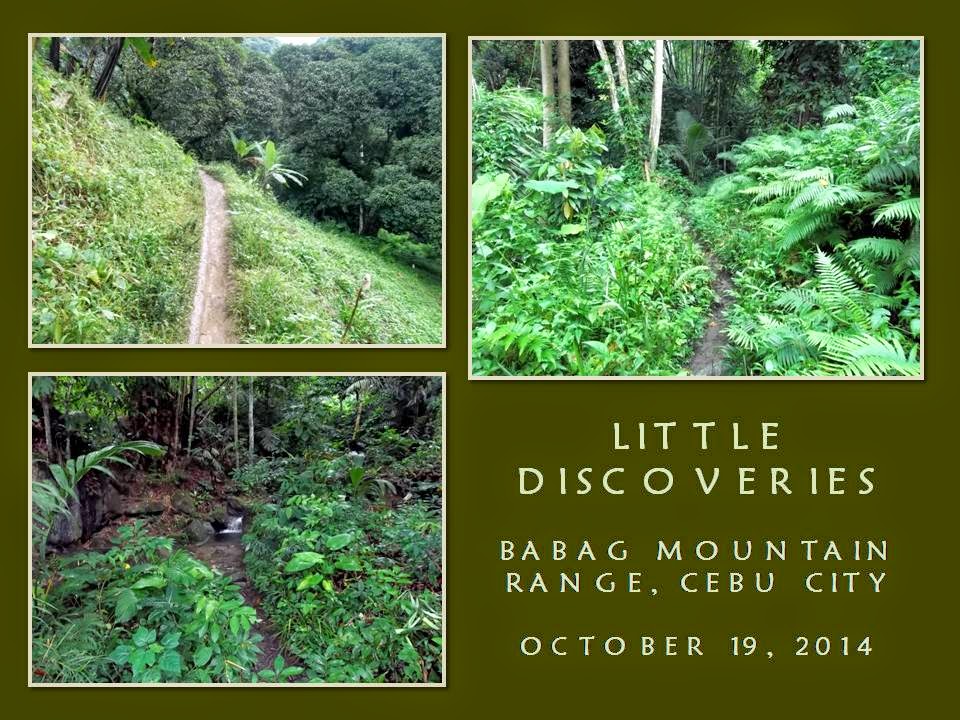
NAPO TO BABAG TALES LXXXIV: Revelation
THE
MOUNTAINS ARE SHROUDED with fogs as wisps of lower clouds are
hovering over its valleys. On the place where I stood, on the
concrete parking area of the Our Lady of Guadalupe Parish, is wet.
Today, October 19, 2014, is another Sunday where we at Camp Red
Bushcraft and Suvival Guild gets to enjoy our dirt time. It is a
time for me to discuss to people about Blend, Adapt and Improvise,
which is really part of my e-Book project, ETHICAL BUSHCRAFT.
I
believed it had rained hard in the early morning but I had not felt
it in my home at MJ Cuenco Avenue for it was dry. Rain had been felt
most here in Guadalupe. Much more so at the Babag Mountain Range.
Ernie Salomon, Nelson Orozco, Boy Olmedo, Jonathan Apurado, Justin
Apurado, Marisol Lepon and Mark Lepon begins to appear by ones and by
twos at the assembly place. When we had secured the food
ingredients, we leave at 07:30.
The
motorcycle-for-hire drivers converging at the back of the church are
beginning to be an annoying lot. I see many new faces and they begin
to exact higher fares from us. They probably had assumed that we are
new to the place and that we do not know the standard fare that
locals pay. I do not trust these new faces nor would I place my life
in their hands as a passenger. I think they need a good night’s
sleep. We rode instead whom we know.
By
the time we cross the foot bridge of Napo, the Sapangdaku Creek is
robust and clear. I never saw her so sparkling and so alive. Her
swirling currents are music to my ears. It is good to listen to her
watery melodies. Meanwhile, the trail is wet and very muddy. I am
leading. I study the path and choose which way to walk on. I do not
want to inconvenience locals with our passing on a route that they
had been using for commerce and for their day-to-day chores. I want
to leave it as it is.
I
shun the trail, once in a while, and pass by alternate routes when I
think it is so idiotic to walk there. I do not subscribe to that
insipid notion of walking single file on a trail even if it is
muddy. I liked to think a lot when I am walking. I am no
zombie. I absorb the essence of the place and becomes one with it.
It is like entering into your own house and notice things disturbed
by another. It is like enjoying the comfort afforded only by a home.
I
am always at home among the mountains. My visits here are not
superficial nor urged by peers or to be seen in Facebook. Although I
post my photos in that social networking site, but it is always five
months too late. All Sundays of the month are almost spent in the
outdoors to the consternation of the wife. My kids do not mind.
They would rather see a healthy dad that do not watch over their
backs all the time than one who loved to boss around on a couch.
There
is a slight powdery shower but it will be gone for long and then
return again. My pace is fast and I leave full shoe prints on the
surface. I cannot do about it for now. It will deteriorate when the
soil will melt before rain or another pair of shoes will walk over
it. To be honest, I cannot identify my own shoe print. I walk back
a few steps to take a picture of it to remind me that it is mine.
We
reach Lower Kahugan Spring and we take a rest. I fill up my empty
water bottle. I take my first sip of water. Two old locals
entertained us with their tales. It is good to know them and to be
treated as a local. Appreciate it very much. The sky turned dark.
I heard a low growl of thunder. Perhaps, another promise of rain.
Then, without warning, the sky cleared. Sunlight.
The
Kahugan Trail is wet. It is gradually ascending. I look back. The
rest are up to the test. No one is lagging behind. We pass by a
father and son clearing a path of vegetation. That path goes down to
the Busay Lut-od Waterfalls. The splashes of water dropping from a
height made a loud noise. Three waterfalls make the narrow valley
shudder with resonance. The chapel is now near and soon we will get
our rest. At 08:45, we got that.
Dark
clouds appear again with low rumbles of thunder. The powdery light
rain fell from the sky, cooling down the earth. Slowly, with great
care, we go down a brook and into a small mountain community. Few
people are around. We follow the trail down into a forest and then
to the Upper Sapangdaku Creek. The route goes up into a ridge which
I thought would never end. It did end on the last house owned by
Vicente Bonghanoy.
He
is around and we are quite glad we could take a rest and prepare our
meal here. First things first, coffee. Oh coffee, where art thou?
I retrieve a pot while Ernie and Jonathan produce alcohol burners and
cups to boil water pronto. The rest take a seat to take a good
breather. It is good to just sit still and scrutinize the texture of
your blade. The knife is the lifeblood that stirs Camp Red people to
go outdoors.
Tough
men that I knew of in my younger years carry knives. Local men,
women and children alike, as they had been and as now, carry bolos.
They are not confined to just here but everywhere in the country.
Blades are extensionS of the hands to be used as a tool. Without
such instruments, tasks would be downright difficult to accomplish
with just teeth and fingernails. Bushcraft is a lawful activity. It
uses knives just like farmers, veterinarians, butchers, foresters and
hunters do. Do not ask me next time why I carry blades.
When
coffee is ready, I take two cups. Old men deserve a lot of coffee.
It helps to keep in stride with younger legs. It is the best
companion of free-spirited men. Nelson, Justin and Mark forage dry,
but rare, firewood. Ernie, Jonathan and Boy are in the kitchen
preparing the ingredients for our meal. There is water piped from a
spring some distance away where Vicente went to fix the line. The
blades begins to appear. It slices meat and vegetables; split
bamboos; chops firewood; or simply as star attraction of a story.
Such
men of Camp Red are like that. They are proud of their blades. To
them it is an emblem of their being non-conformist. A badge to
segregate real men from sheep or walking meat. Our ladies too. They
open carry knives just like their men do. Bushcraft is where you see
and test yourself in a real world. We do not go against the
environment, like most people do with their expensive gears, but be
one with it with less and yet find comfort in it.
By
11:30, the meal is served. Pork sinigang (a tamarind-based
soup), swamp radish salad, fried anchovies, chicken flakes with
sliced carrots, and raw cucumber in vinegar are the viands. A kilo
of milled corn replaces rice as our staple. We start lunch right
after the prayer for meals. Hot food just off the fire are wonderful
to eat. Camp Red do not teach their people to rely on pre-cooked
meals, canned goods and MREs or cooking with MSG and other artificial
flavourings. We dine with real food and it is always a feast.
When
everyone had settled, I start the lecture. The pioneers of outdoors
recreation had coined the ageless outdoor creed of “Leave
nothing but footprints...” when too many people begun to
discover the outdoors. Reckless enjoyment of the outdoors led to
degradation of campsites and streams, which also led to injuries and
fatalities. It is just difficult to manage and contain people
visiting the outdoors and the natural parks.
Later,
the Leave No Trace was adopted by park managers to make people
understand better the impact of man on a fragile environment. It is
a set of guiding principles which were designed for temperate areas,
mountain environments and deserts. The tropics has a different
environment but it is better, just as well, if local mountaineers,
backpackers, hikers and cavers learn and understand LNT because they
tend to visit the mountains in large numbers which is just too much
an impact for different ecologies to recover.
Bushcraft
activities do not visit high places like mainstream outdoorsmen do
but would prefer places below the treeline. Bushcraft people in
other countries find LNT very impractical, cumbersome and quite
amusing. Here in Cebu, LNT is just a reference in hindsight but we
have a set of values so different from that which we had started to
adopt. It is the simple principle of Blend, Adapt and Improvise.
Before
knowing this bushcraft principle, it is best that our mindsets, which
had been conditioned through many years of Western-style education
and thought processes learned in university classrooms and corporate
environments, be adjusted back to our roots. Back to the days when
life was simple with the feet so close to the earth. Back to the
days when the cooking fire was fire from firewood. Back to the days
when earth and heaven and you were one.
Under
the principle of BLEND, is a set of guideposts to teach you how not
to stand out of your environment. It starts from the clothes you
wear and the gears you have, the odor you carry, shiny objects to
hide, enjoying the silence, choosing trails and places to walk for
your own safety and security. Blend is just an antithesis to being
gregarious, colorful and unknowing. It is taking a step ahead from
an unexpected threat which usually come against soft targets like
visiting hikers.
ADAPT
is the principle by which you take Blend to a higher level. It
simply is bringing yourself to be one with the surroundings and to
minimize your presence. It describes how to choose a campsite and
your shelter, using the wind and the light to your advantage,
choosing the best firewood and the size of your fire and to use
natural camouflaging against observation and discovery. Security and
safety are taken into great consideration here.
The
last is IMPROVISE. Since bushcraft is a cerebral activity, this
principle teaches you to think, assess and make use of nature to your
advantage. It may be studying a trail, ensuring other sources of
water, making tools from nature and from things which few thought
could be possible, using nature to work for you, carrying it light,
and learn stealth. This last principle is for the serious
outdoorsmen who takes good care of their back trail.
I
know that Blend, Adapt and Improvise place a lot of people
off-tangent because it simply goes against the grain of conventional
thinking that influences how people should enjoy the outdoors, as in
a Western model, and to the way how you choose your clothes and
gears, which actually are outcomes of a capitalist market. Blend,
Adapt and Improvise creates a level field for everybody
regardless of your economic status and makes your outdoors pursuits
less complicated.
When
I had finished with my discussion, a quick blade porn followed. We
give thanks to Vicente for his generosity with regards to the use of
his place, of his water and of his stock of firewood that were made
to cook our food. We left him our unused sachets of coffee and
whatever food ingredients that were not used during cooking. We
foraged half-dry wood and place it underneath the crawl space of his
house as our replacement for the burnt-out firewood which he says as
unnecessary.
But
there is one thing that had been bothering me for the past many
months. It is the place were he sourced his water. To recall, I had
been dying to look for a water source near to that hidden meadow I
discovered more than a year ago so it could possibly host a future
Philippine Independence Bushcraft Camp. He revealed it to me and
point me to a hidden route. As if that is not enough, he also
revealed to me a route that would take us direct to Napo once we
climb up Tagaytay Ridge.
We
leave at 13:00 and start for the water source first. It is on the
west of us, following the horizontal contour until we reach a pillar
of two old hardwood trees, the name of which I cannot determine since
the leaves are located 60 feet above us. I cannot believe that such
huge trees had survived the onslaught of homesteading, farm clearings
and a small charcoal industry. This marks the path to a small
mountain brook. I smiled at what I saw.
I
cross the small stream and walk to an elevated ground. I see a
petrol barrel converted into a water tank. It is full of water,
filled by a natural spring channeled by a bamboo trough. The drips
are slow and I hope the volume would not change if there is heavy
rain or drought. I leave the water source but my mind goes back to
the brook. If I could follow it upstream, perhaps, I would find its
source, but that would be on another exploration, don’t you think?
We
all go back to the main trail and begins to negotiate the route
towards the ridge. Above it is Manggapares Trail. The part of the
trail had been widened into a dirt road during the start of
construction of the steel power pylons in 2012 which connect first
from Bocawe. This road had reverted back as a trail as vegetation
began to claim back what was theirs. We go down the ridge passing by
the fifth, fourth, third and second towers in succession.
This
hidden trail that I had been eyeing to explore for a long time is the
same trail that Vicente had revealed to me just an hour ago. I let
everyone know that we are now in exploration mode so they could
prepare themselves of the unexpected. This was like the Manggapares
Trail I saw over a year ago when it was not subjected yet to a
tree-cutting frenzy. It is so beautiful and so serene. It exudes a
mystery all its own.
But
this is really part of Manggapares Trail, I now realized, for it
tiptoed on the same back of this ridge called Tagaytay. It connects
from Babag Ridge, 700 meters or so high, down to the river crossing
of Napo, about 180 meters above sea level. This WAS the trail that
an earlier generation of hikers walked and climbed on the way to
Mount Babag. This is an old trail that I have even passed once in
the early ‘90s while I was with my former club.
There
are no branch of trail but I found one going left but that would be
on another time, perhaps. I found a low knoll on the right that
looked like a good covered campsite. It is wide with a faint trail
that has lost its luster due to non-use. I walk on the main path
which suddenly dip at a steep angle. Walking is now controlled, one
step at a time, until I see a farm. I see black PVC pipes and water.
They must have water source somewhere near.
We
pass by abandoned houses but their doors and windows are open. I see
a woman doing laundry but her back is facing us, a group of old folks
talking did not notice us and then I step on familiar ground. On my
right is the bridge of Napo. I just explored the last half of
Manggapares Trail and I am tempted to keep this route to myself and
for Camp Red.
But,
no, this should be shared. This is perfect training ground for our
local fitness buffs gearing to snare honors in national and
international competitions. The trail runners would be happy to try
this route. As for me, I just keep on exploring, opening up many
secrets, and entrenching the whole mountain range as a redoubt when
SHTF comes.
Document
done in LibreOffice 3.3 Writer
Posted by
PinoyApache
at
10:00
0
comments
Labels: Camp Red, Cebu City, exploration, Manggapares Trail, Tagaytay Ridge
Subscribe to:
Posts (Atom)




