THIS
WOULD BE THE last Sunday of training for the intrepid individuals who
will compose the Exploration Team of Segment III of the Cebu
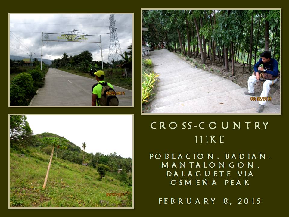
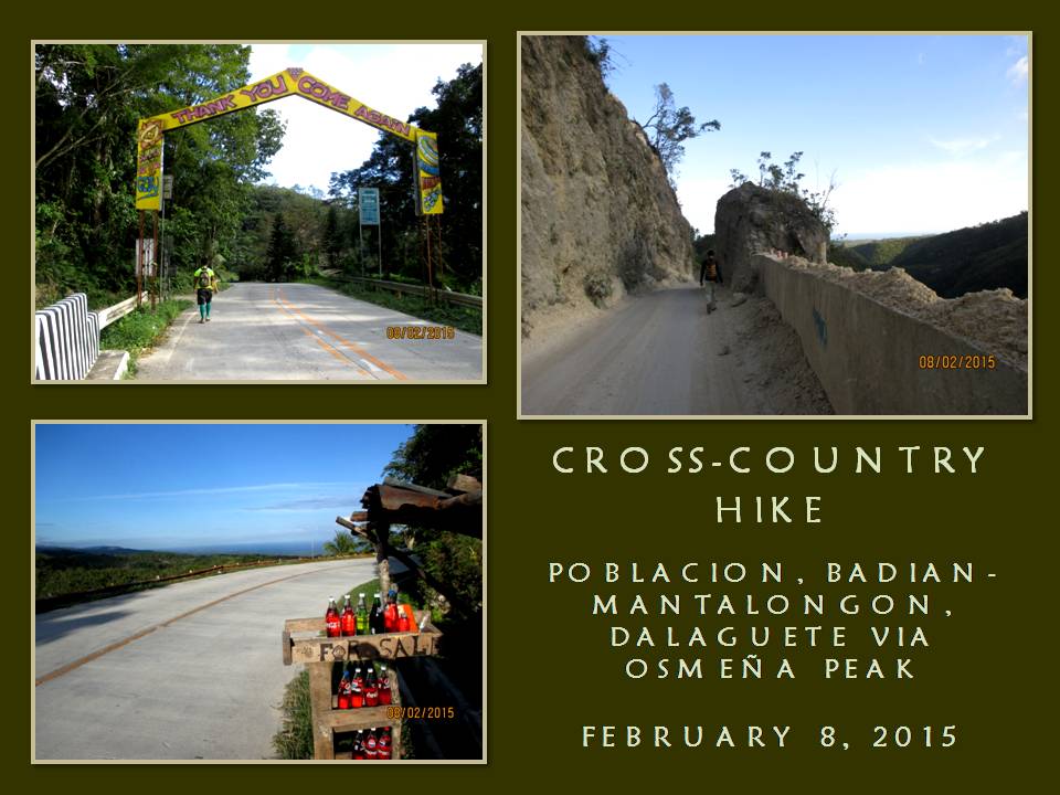
Highlands Trail Project. Today, February 8, 2015, we will do a
coast-to-coast hike and climb from the Municipality of Badian to the
Municipality of Dalaguete with Osmeña Peak as the highlight of the
route. It is 34 kilometers long according to a road marker on the
junction of the highway in Badian.
We
will be on Survival Hike Training. We will just subsist on bread and
water. We will have to forego again lunch in between Point A and
Point B, unlike that which I used to do with my other activities.
During Segment III, time would be of essence since we would have to
cover a lot of ground under daylight hours and we could have that
deserved meal only during dinner and breakfast. We will also train
on speed and endurance and, for me, getting used to the load I will
carry during Segment III.
I
am the project director of the Cebu Highlands Trail Project since
this is my brainchild. It is a personal undertaking that is
supported by both the Camp Red Bushcraft and Survival Guild and the
Mountain Climbers Alliance of the Philippines. Sponsors who had
contributed equipment and other logistics for this project are
Silangan Outdoor Equipment, Mr. Jonathan Blanes, Mr. Glen Domingo,
Mr. Aljew Frasco, Mr. Glen Pestaño, Titay’s Lilo-an Rosquillos and
Tactical Security Agency.
I
am also the team leader and navigator of the Exploration Team. The
team is composed of Jonathan Apurado and Jovahn Ybañez with Justin
Apurado as reserve. They are all here for today’s activity and
they will face and brave the yet untried but intimidating route with
me. It had rained when I am about to leave my house 03:00 and I
liked the omen I received. I walk from home to the direction of the
Cebu South Bus Terminal and take a short nap.
The
bus leave Cebu City for Badian at 05:30. We cannot be at Badian at
07:00 since I miscalculated the departure time and I have to make do
with a 08:00 arrival. We reach Badian at 08:15 and we start our foot
journey at 08:35 after some personal necessities. We walk on the
road for the village of Basak, which we reach at 09:40. At Basak,
the trailhead to Southern Cebu Mountain Range is found and I retrieve
my AJF Gahum knife and open carry it. Jonathan and Justin do
likewise with their knives.
The
weather is cloudy since we left the national highway and it augured
well to our cause. I am most worried with the 10 kilo load in my
Silangan Predator Z bag because I might bog down when the route would
get difficult in very warm temperature. I follow the trail from
memory over rocky terrain and small farms. We reach a small
community of Malagaring and eat our first pieces of bread and drink
water. It is good to take a rest, but not for long.
We
meet the first party of overnight visitors of Osmeña Peak. They are
poor creatures utilizing minors to carry the loads for them. Not a
good idea. I decide to shift to a different route down a small
valley which I have had the lust to explore. This is the best moment
to undertake that and the best moment as well to evade the Malagaring
Trail which would be crowded by the same people we had met earlier.

The
path is good but there is less forest cover. It is used for farming.
The route is also used by charcoal gatherers. Here and there and
everywhere are spots of ground used in charcoal making and, on three
occasions, smoke emit from mounds of earth indicating charcoal in the
making. A very light shower fall from the skies and make limestones
slippery. I have developed trust on my 5.11 Tactical Series Shoes
and I am not worried.
The
only worry from this pair is that the energy caused by the pounding
of feet on ground are not absorbed well by the rubber soles but
transferred directly instead to the feet soles as what happened the
last time when we were on another training from Lutopan, Toledo City
over the middle spine of Cebu and down the road to South Poblacion,
San Fernando. My feet soles were in great pain after that and a skin
on the tip of my left heel burst.
Today,
I added rubber insoles to my shoes and added another layer of thin
socks next to my skin apart from the Kailas hike socks I preferred
using. The trail ascends in easy gradual stages but when the sun is
out I begin to feel my energy sapping. We stop to rest near a
smoking charcoal mound and eat our second pieces of bread and drink
water. It is good to just sit and recover your breathing.
We
continue on and the trail begins to go steep and pass by farms of
taro and walls of limestone so close together. I see a lot of caves
here and I like caves but not to the extent of using it as a venue
for commercial and leisurely activities. This route is so “lonely”
but I like it the way it is. It suits well to my interest of
bushcraft and survival. I see water seep down from the rock wall and
channeled to a plastic container with bamboo troughs.
We
climb up to through many saddles and I now begin to feel fatigued.
It begins to get worse when the sun comes out. From afar, I see a
small community. It would be good to take rest there and ask for
directions. I noticed that the farther we take the explored route,
the farther we are from the village of Patong and of Osmeña Peak. I
happily remove my backpack when we reach one house. We eat our third
pieces of our bread and drink more water.

We
ask of their coconuts and happily disgorge it of its precious liquid.
I feel the energy coming back and I stare back at the steep trail
that a local pointed to me that would lead me to Patong. It is very
intimidating but I have to try. My stomach is full and it would add
to the weight. Slowly, I ascend the path which leads to a high
saddle and arrive at the top without stopping. We are now behind
schedule when I followed the route in that small “lonely” valley
but, nevertheless, we have to be at Patong and analyze our chances.
We
reach Patong and take the opportunity of dousing thirsty throats with
cold soft drinks. I believe we lost about two hours exploring a
place and recovering my blunder. It is 13:00 now and I calculate in
my mind the possible time we would be at the peak. I would like to
be there by 14:00 so I could communicate with Chad Bacolod by radio
using an assigned frequency. Chad is a member of the team as Base
Support. He does not go with us but updates us of weather at
assigned hours. Likewise, we update him of our progress.
Osmeña
Peak (1,015 MASL) would be the last obstacle to overcome and it
divides Badian from Dalaguete and, slowly, we begin our ascent. For
some time, fogs would hug us then the sun blast us and then it go
cloudy and sunny again. We reach the peak at 13:58 with a good
clearing. Remnants of weekend visitors are enjoying the view that
OPeak offer. I shake hands with Jovahn, Jonathan and Justin to
congratulate them for climbing OPeak the hard way. I use the radio
on the assigned frequencies and inform Chad of our position.
We
go down the peak for the village of Mantalongon, Dalaguete through
the old route. A lot of houses had sprouted on the upper valley that
disoriented me during the last few recent times I was here but I am
reunited today through the effort of Jovahn. He lead us through a
trail that cuts across the wide Mantalongon Valley instead of
following the meandering road which cut short our travel time. We
reach the village at 15:18 and douse our thirst with cold drinks
along with eating the fourth pieces of our bread.
From
here, it is all the way down the coast of Dalaguete. It is all
concrete except at a part where there is an ongoing road clearing. I
never liked concrete pavements because it is not kind to the feet,
especially when it goes downhill. It is still a long way to go and
it is now 13:30 and then I chance upon a road marker after hiking
half a kilometer. It says we are still 12 kilometers away!

My
worst fears are relived. Now, as I steadily walked down the road, I
could now feel excruciating pain under my feet. Worse, the rubber
insoles do not work well outside my hike socks and liner socks do not
work well inside on the same socks. My feet feels like it is
floating inside their shoes and my toes bump against the insides.
When my toes curl to lessen pain the collision brought, it puts
pressure on the upper part of the toes, where the the thin socks
fills the creases and gaps and rubs the skin.
I
transfer to the part of the road where there is dirt or where there
are grasses. The reprieve is only temporary until you step on a
small pebble and you wince in pain and it slows my walk. I need to
be on the coastal highway before 19:00 and resting is out of my
thoughts. I did not blink at pain but my eyes betray. The concrete
markers says 10 kilometers...9...8... Each time I see one, it gives
me hope, but the farther I walk, the pain becomes great.
7...6...5...,
I could see the coast now and I overtake Jonathan and Justin take
rest. Adding to my misery is the weight of the backpack which starts
to dig deep on the flesh of my shoulders. I just transfer the bag –
and the weight – infront. Meanwhile, motorcycles whizz by with
many people on board unable to comprehend our activity. Sometimes,
the drivers offer us rides for free but we softly decline.
Farther
ahead and beyond my sight is Jovahn. Four kilometers to go and I
could achieve my goal in a few hours, with or without all these pain.
Then comes 3...2...and I could see the grade of the road more to my
liking now but, still, I choose the greener sidewalks and trot slow
until I see the last of the marker which says it is the last
kilometer. I reach the junction at 18:10, just as Jovahn had
predicted we would, and seconds after me are Jonathan and Justin.
We
had just accomplished our last training session in preparation for
Segment III, which we will undertake on February 19-22 from
Mantalongon, Barili to Mantalongon, Dalaguete over the middle
mountain ranges and, I fully believe, we are ready for that
challenge. We also had just accomplished the first-ever reverse
cross-island hike in contemporary times from Badian to Dalaguete in
under 10 hours despite being delayed.
Our
hike was done by traditional means, although we may have achieved
this rare distinction, but it was just a means to a bigger picture.
The Exploration Team’s focus is on Segment III and this achievement
was done only for the fun of it. It was sweet for Jonathan and
Jovahn for they had not ascended Osmeña Peak from a reverse route
and then doing the long extra distances but it was most sweet for
Justin for it is his first. At his young age, he had already
accomplished much today what most of us have done at a later age.
Nevertheless,
we celebrate our coup by finishing the last pieces of bread before
limping to the bus stop across the road. As I have said before in a
previous article, that finding a half-empty bus to ride is much
easier here than on the other side which the majority of weekend
hikers go. The first bus arrive with many vacant seats to choose
from and I sit nearest to the door and enjoyed the stress-free ride.
Document
done in LibreOffice 3.3 Writer