DAY
TWENTY-FOUR ::::: WHEN I ARRIVED HERE YESTERDAY, I felt it was the sweetest
moment of the Thruhike. I have walked over the last and the most difficult
physical obstacle of the Cebu Highlands Trail – the Doce Cuartos Mountain Range
in Tabogon. Here in Malingin, Bogo City, the high-octane stress and dread of
the past 23 days are now beginning to lose its hold on me. There are now just
four days left to finish this journey. I drank a warm Swiss Miss in a metal
saucer to celebrate this milestone today, February 11, 2017.
In
a little while, Day Twenty-four will roll towards another sunset. While I am
beginning to feel light on both load and emotions, the idea of walking on the
plains of Bogo City and Medellin is not a walk in the park either, especially
on the latter. We will be treading mostly on a national highway that is
straight as an arrow on some stretches which are almost devoid of shade. I gave
up my breakfast of Knorr soup and rice after three spoonfuls and accept the
parmesan cheese and wheat bread that were offered by Markus Immer.

Markus,
friend and benefactor and staunch supporter of the Thruhike, had
extraordinarily delivered our supplies earlier than what was agreed at five
different occasions. Not because he is Swiss, and the Swiss are very exacting
when it comes to time, but because “he always has five minutes more time than
the next guy”. That is his maxim and that is why he is extremely reliable. But
on those five occasions, I beat him by an average of 20 minutes. I have my
reasons why I arrived earlier than the supply run. One of these is that I
planned this Thruhike as if I am engaging in a war campaign!
It
is his wish and personal request to join me and Jonathaniel Apurado for the
last stretch of the northern leg. He will have that slot and he will celebrate
with us when we reach the end of this long journey on the northernmost point of
Cebu, a handful of days from now. Still walking with us is Leomil Pino, who had
been tagging for the past two days. But another fresh set of legs, Glyn
Formentera, will be along for the dayhike just like he did on Day Five of the
southern leg.
The
Hon. Marilyn Calidguid and his councilman son, Darwin, both of Malingin
village, sent us off at 08:00. Weather is warm and sunny. Not a good
combination on the plains. We stop to honor the flag when the national anthem
was sung at the Malingin Elementary School. Today, we will follow the old
railway from here to Don Pedro Rodriguez, Bogo City. The paths are still there
but the sleepers, the stays and the iron rails are no more. The path is now
dirt which pass by fields planted with sugar cane on both sides.
This
old railway was very relevant and useful during the years when sugar prices
were booming in the ‘50s and the ‘60s, even up to the early ‘70s. This was the
main artery that fueled the economy of the sugar producing towns of Bogo,
Medellin, Daanbantayan, San Remigio, Tabogon and Borbon. The engines with their
wagons brought the canes from the fields to the lone processing plant in
Medellin, converted to molasses and were exported.

It
is now a ghost of its old self. The skeletons now adorned somebody’s lawn like
I saw in Malingin. But in the USA, they converted old and condemned rail lines
into trails for tourism. One particular spot is the Katy Trail, named after the
Missouri-Kansas-Texas Railroad which stopped operation in 1986, is very popular
for biking, hiking and handicapped-use rails-to-trails project. It is 300
kilometers long. How I wished Bogo City and Medellin sees the wisdom of this
purpose and develop it for leisure outdoor tourism.
The
fields are still planted with sugar canes with contract farmers doing the
backbreaking work of planting, weeding, watering and harvesting. Part of the
trail is planted with corn and the path goes through among stalks. A remnant of
the old railway, stone buttresses that support a missing bridge over a small
stream, remained. The former railroad are presently used to accommodate farm
machinery and trucks. It is a good place to hike. There is abundant breeze
coming from the north and the air is mild.
The
old railroad goes its way through the plains and it intersects, for a time, a
line of steel towers bringing in electricity from Leyte to power Cebu’s
ravenous industries. We passed by the new administrative capital of Bogo City
and I believed they are developing and leasing these lands for commerce and
industry. Ever since it became a city in 2002, it begun to allocate land to
accommodate its expected expansion. This small city has so much land area and
many unused spaces. It has its own wharf but is also accessible to another
bigger port in nearby San Remigio.
Unfortunately,
somebody squatted on the right-of-way of the old railroad that would have
brought us direct to the national highway, now known as the Central Philippines
Nautical Highway. We have to detour to a small path to this highway in Don
Pedro Rodriguez. Two hundred meters away is a crossroad where there is a very
popular restaurant. We stop by here at 09:40 to rest from the unrelenting rays
of the sun and rehydrate on cold beverages. Since I had a light breakfast, I
have to open up one of my Fitbars for insurance.
After
ten minutes, we are on our way again. I sent a text message to the Medellin
Police Station to let them know of our passage through their area. The torment
of the long walk along the concrete-topped and shadeless highway begins. At
10:05, we reach the Dayhagon Bridge. Underneath it is the Dayhagon Canal which
separates Bogo City from Medellin. I have walked this less-known man-made canal
last April 29, 2015, during low tide, from Hagnaya Port, San Remigio to
Polambato Port, Bogo City, a distance of 11 kilometers. It was the stuff of
adventures for I was alone and it was well-documented.

The
sun was really unrelenting. Imagine a highway where there are no shades? What
were planted on both sides are bougainvilleas, as unwelcoming as the highway to
foot traffic with its thorns. There used to be trees here but Typhoon Yolanda
(Haiyan) made short work of it. The highway danced and shimmered from the heat
waves as if you are walking on a desert. Only fools like us walk this very long
stretch at this time of day. By 12:30, we arrive at an oasis-like setting on
the village of Curva, Medellin for our noonbreak. It is another crossroad with
a bakery and lots of cold beverages. Light meals of bread, Nutribar and a
capsule of Herbalife natural raw Guarana as supplement.
I
studied my maps of the surrounding areas. These are mere reproductions that I
screen printed from the Project Noah website, now mothballed, enlarged to fit
in short-sized bond papers and protected inside my Sea Line map case. I have to
improvise because government maps are utterly outdated. These can be oriented
with a compass like you are using a real map. I am not going to take the old
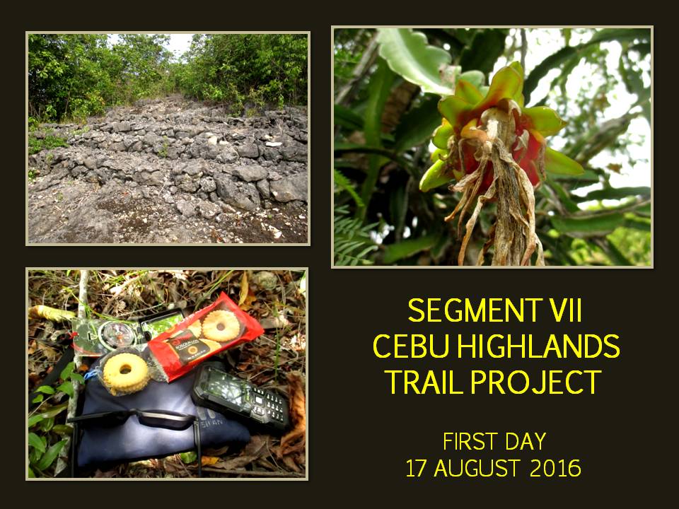
route which I used during the Segment VII Exploration Hike last August 2016. I
aim to walk up the Panugnawan Hills and cross the wide valley to Bakhawan,
Daanbantayan.
After
an hour, we resumed our journey. We take the middle road. It goes up its way
dictated by the heights of the Panugnawan Hills. At least, here, there are
shades. Pressed from behind by Leomil and Glyn, I increased the pace. I do not
know how I got a lot of power but, I believed, the daily intake of
multivitamins and Guarana extract have made its effect on my performance. I
have never felt something like this before because I have never tried one.
Since it was provided to me and Jon by Markus on one set and by Mirasol Lepon
of Herbalife on the other, I decide to make the most of it.
As
I walked the whole stretch of the Panugnawan Hills, I scanned paths that go
down that wide valley. I studied the terrain well and waited for the right
moment. When I reach a chapel and a dirt road beside it, I have to decide at
that instant else it would be another story. Making the right decisions when
doing terrain analysis on an exploration that doubled as a Thruhike is very
important. You just have one chance and there are no alternatives. It is a make
or break affair. I scan the farthest reaches of this valley and something
inside of me favored this path. We walk down the wide valley.
The
dirt road weave its way among fields devoted for sugar canes and dotted with
coconuts planted along the edges. Some fields are bare, some are full and
healthy, while some are littered with dried leaves and shrivelled trunks. There
is a community halfway and someone said we are in the village of Dalingding
Sur, Medellin. This primitive road goes up and sugar canes are now tall and
healthy, depriving my field of vision. Worse, paths crossing each other are now
common. Would I go down right, go up on my left or should I go straight ahead?
I
was right all the time with my choices. I came upon a hump and I saw another
valley. I realized I am standing above the Dalingding Hills, a low range of
mountains that run between Caputatan Norte, Medellin to Dalingding,
Daanbantayan and parallels the Panugnawan Hills. Across me are the familiar
hills which I have once passed last year going to the north of Cebu. Behind it
would be Bakhawan and safe refuge.

For
another hour we navigate another valley planted with the same sugar canes and
finally arrive at a road corner located on a mountain pass of the Pangadlawan
Hills. This road goes to a national highway by the coastline. We are now in
Daanbantayan. Another hour more and we will be knocking on the doors of our
host, Bakhawan Beach Home. My muscles are aching. My bones are creaking. My
soles begins to go tender. The dirt road is rocky but we will have rest at the
end of this.
We
overtook two locals who I thought were men. Both of them were carrying bundles
of long firewood above their heads and they were women. One is middle aged and
the other must be sixty. My God, they were strong! I offered to carry their
firewood for them but they declined. Their husbands are working in Metro Cebu
and goes home every weekend. They are left to fend their children for the rest
of the week and gathering firewood is one of the tasks to survive day in and
day out. When they were done with that, they went back to carry another set of
firewood!
When
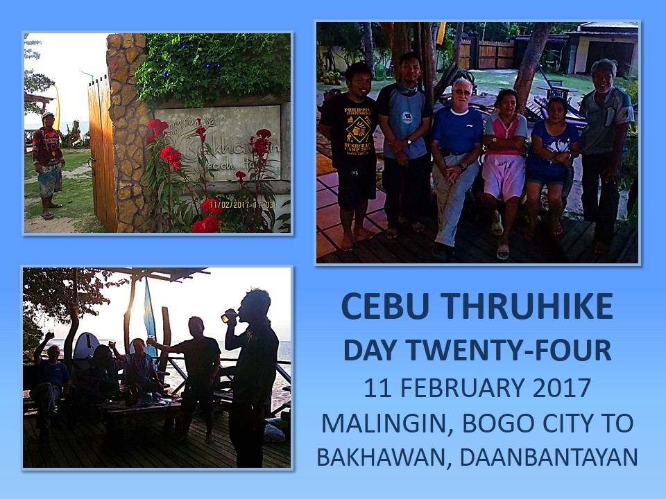
I arrive at the gate of Bakhawan Beach Home at 16:50, Doming the caretaker was
already expecting us, smiling. I shook his hands and we all entered the
spacious beach resort which is composed of two structures: Balay No. 1
and Balay No. 2. Lani Perez, the proprietress, assigned the second home
to us. She is a long-time friend and is a supporter of my Thruhike as well as
my exploration of the Cebu Highlands Trail which I completed last November. She
also hosted my Exploration Team when we passed by here in August 2016.
I
slumped on a wooden divan and closed my eyes after a tiring hike. Everybody
were relieved. Doming had already cooled a case of one-liter bottles of beer in
the ref. I was so thirsty that beer tastes like water and two bottles
disappeared fast. I just sat there and enjoying the rest as the sun sets beyond
the horizon. Oh, one more task to make. I sent a text message to the
Daanbantayan Police Station to inform them that we are now in Bakhawan. I got a
prompt reply. Only a few police stations reply. Most of them never ever cared
or that their numbers are dead.
The
Hon. Lucia Eleptica of the village of Bakhawan came when she heard news of our
coming. We were welcomed to stay at Bakhawan and she promised a free-rein
chicken for our dinner. It was the best that she could offer since we were
already taken cared of inside the Bakhawan Beach Home. I gave my sincerest
thanks to her and we are again left to the soothing sounds of the waves amidst
the soft scarlet hues that colored the skies as the fiery orb goes its way
westward.
We
will have guests coming and they are all from the Camp Red Bushcraft and
Survival Guild, a club that I founded. They arrived at 18:30 and they are
Ronald Abella and his son, Christian Jacob, and the couple Mark and Mirasol
Lepon. I am expecting another guest, a common friend between Lani and me – Bebut
Estillore. He came at around 19:30 together with Lani. With everyone present, a
grand dinner, courtesy of Bakhawan Beach Home, entice everyone to sit around
the long table that Lani had acquired from the long houses of Papua New Guinea.
I
checked in early and claimed the second room of Balay No. 2 to myself.
The soft bed is good for two people and the extra space allowed me more room to
roll from side to side unhindered. The sea is at low tide so I have no other
recourse to freshen up except in the bathroom. The cold water trickling down
from the overhead shower gave a wonderful feeling. It soothed worn out nerves
that have been forged for the last 24 days by heat, dust, grime, cold, rain,
thirst, hunger and heavy loads. After almost a half hour under the shower, the
soft bed simply whisked me to Lady Starlight.
Distance
Walked: 27.69 kilometers
Elevation
Gained: 110 meters and a low of 3 meters
DAY
TWENTY-FIVE ::::: THE ECSTASY OF A GOOD NIGHT’S sleep on a soft bed and knowing
that you would do nothing gruelling for today is a heavenly feeling. And what
good fortune and timely occasion when you have the place all to yourself – by
the beach. The soothing sound of waves roll into your consciousness as your
nerves get smoothed by the unending flow of cool breeze under a shade. The
Thruhike is not all sun and grime, it deserves a break and Bakhawan Beach Home
is the perfect place to be in for that affair.
I
woke up at 07:00 and found the balcony abandoned. Last night’s party left an
almost-full bottle of local brandy, empty bottles, empty cups and cups with
stagnant brandy, peanuts and empty saucers, Nalgene bottles, LED lights, knives
and bags. The two divans are all occupied and I see a hammock, back almost
kissing the floor. I see a white head jutting out from a sleeping bag laid on
the floor. The sea have receded far and exposed the tidal flats. From a
distance, a small yellow boat is floating offshore. Today is February 12, 2017
and this day is reserved for rest and recreation.

Slowly,
some absent occupants of Balay No. 2 begins to rise from their warm
beds. Jonathaniel Apurado and Markus Immer come to life. Then a couple of guys
with reddish zombie eyes stirred. Ah, the party people. Leomil Pino and Glyn
Formentera, two of my guests who walked with us yesterday, shook off their
sleepy heads and starts to get busy doing nothing. The tidal flats got their
attention. Lani Perez, the owner of Bakhawan Beach Home was already up. She is
busy talking to Doming, the beach caretaker. I smell food! Bebut Estillore
joins us.
Bebut,
my tormentor and drinking buddy of 20 plus years ago. He laughs his patented
laugh which sounds like a hyena smelling something to eat. The laughter, it
gets on your nerves when you are at the losing end of a friendly repartee. That
is Bebut and he is one of my best friends and he is the godfather of my
youngest son. We are kumpare but we do not call each other that. We call
each other “Magua”, the anti-hero of the Last of the Mohicans. He
brought special ground coffee from Bukidnon and, oh God, it tastes and smells
heavenly!
More
party people, Ronald Abella and Mark Lepon, joined their brethren on the wet
sand. Mirasol, the better half of Mark, and Christian Jacob Abella, were the
last to rise. No, they were not part of the night revelers. They are normal
people who observe normal sleeping hours like me, Jon and Markus. Slowly the
surf begins to reach back towards the beach. High tide would be at 16:29. I
keep track of these little things which are found on my itinerary. Slowly, the
long table gets filled with seafood galore. Fish soup, grilled squid and dried
fish, and complemented with sunny side up fried egg.

I
opt to have that Bukidnon coffee again after the meal. It is nice to just sit
down and talk with Bebut, Lani and Markus slurping warm coffee with the cool
breeze blowing. Slowly the small yellow boat approached the shore. Doming
carried an empty pail to meet the two fishermen. The boat is half-carried and
half-dragged up the sand into drier land. The three men slowly removed the net
from the boat’s hold and dragged its end six meters away to be cleaned of debris,
weeds and catch. Lani, Bebut and Markus joined Doming and the fishermen, then
the rest of the guys offered their hands for the harvest.
The
collective effort produced a half-filled bucket of fish, crabs, shrimps, squids
and edible kelp. The sight of the catch is enough to send my gastric juices
boiling. Unknown to us, the sea crawled slowly up the shore. Even though the
sea level will reach its highest at four, I decide to take a bath on the open
sea. I waded offshore for about 200 meters before I reached chest level. Fifty
meters away are the reefs that clashed with the white capped surf. Swimming in
ideal conditions of a warm day and crystal-clear water where you could see
bottom. The tides begun its work clearly where I frolicked as the current sweep
floating debris northward out of the Tañon Strait.
The
warmth of the sun on my shoulders and the warmth of the water below me is a
good combination of a well-appreciated idea of relaxation. It is therapeutic
even. Floating on the surface removes that everyday presence of gravity. I
think I have stayed long enough which is just about fair. I waded back to shore
where waterline are at a level of a few inches higher than when I did an hour
ago. Time to hit the shower to remove the salt from my hide and my elastic
undershorts. Then the call to meals. Wow!
After
the sumptuous lunch, the unfinished bottle of brandy became the object of
desire. Packs of peanuts and fried corn are mixed in the fray. The party
continues and laughter and jokes put the company fixed on the table on the view
deck. The hours became a blur of creeping shadows that expose and hide all that
were hidden and bare. Most of the guys took to the call of the risen tide but I
have been there a few hours ago and the invite of a cool room is much desired.
The soft cool bed under the beat of an old ceiling fan pushed me to dreamland.

When
I regained awareness, the day have reached its moment when it gave in to the
law of nature. Sunset is but a half hour away and the banter of the company I
left for the comforts of an afternoon nap transforms into a melancholic and
subdued silence. Everyone knows that we would all part on the first hours of
daylight and those that would be left could have wished they have free time to
walk with us for the rest of the Thruhike. Dinner comes and the voices goes up
in a high crescendo once again but not like before.
There
are cold bottles of beer but the eagerness of turning it upside down empty are
not there anymore. It is a silent gathering, almost strange, and the silence
seems to strangle the words from flowing out. I have a long day ahead of me and
I turn in early inside the same bed I slept on. The worrying are no longer
there but the early signs of rapture starts to boil inside of me. This kept me
from drowsing for two hours or more. It is the same as those of anxiety moments
that appeared prematurely hours ahead. There is the toilet to flush what it
impose on the body though so, Good night.
Distance
Walked: 0.0 kilometer
Elevation
Gained: 3 meters and a low of 0 meter
Document
done in LibreOffice 5.2 Writer