Showing posts with label cross-country hike. Show all posts
Monday, April 10, 2017
A MAN-SIZED HIKE THAT FAILED
I AM TAKING ANOTHER SHOT OF MOUNT SAMBORYO today – December 11, 2016. I almost went over its top last January in my quest to find another and much-better route for Segment I-A of the Cebu Highlands Trail when I met a local who directed me instead to Cabatbatan and cold refreshments. I was utterly dehydrated then and was following the trail to the peak when that chance encounter convinced me to backtrack and savor that cold drink.
It mystifies me of seeing that mysterious peak everyday from the vantage of my window in downtown Cebu City. It mystifies me remembering the strange reaction of locals whom I talked to when I was going there alone. Perhaps, there may have had been bad memories? I just want to go over what is beyond it. It is part of my beloved Babag Mountain Range which I know so well and exploring beyond Samboryo would be an opportunity to expand my playground.
My plan today is to start from Lutopan, Toledo City and do a cross-country walk to Guadalupe, Cebu City just like the last two episodes I did in January. But, this time, I would climb Mt. Samboryo and find a route to Tagaytay Ridge and go straight down to Napo. I want to evade the road from Cabatbatan to Pamutan Junction and then to the Sapangdaku Spillway. Roads are torture to the soles of feet and shoes going downhill and melt a hiker’s resolve upon facing endless rises.
This is an activity for the Camp Red Bushcraft and Survival Guild and they came to the 7Eleven outlet across the Cebu South Bus Terminal. Arriving one after the other are Jonathaniel, Justin, Locel, Glynn, Christian, Eli, Abigail, Ariel and Mark with three guests from a freelance outdoors group called BAKTAS. We left the terminal after getting in a Lutopan-bound bus, which I know would be crawling on the highway picking up passengers.
We arrived there at exactly 08:00 and proceed to Camp 7, Minglanilla on board motorcycles for hire after procuring foods that are quick to cook. We must be at Guadalupe in under twelve hours and we have a long way to go, part of it, unfamiliar ground. Being caught at dusk at these places is my main concern. This is an exploration hike after all and maybe this might be a good opportunity to change my already-altered Segment I-A Route of the Cebu Highlands Trail, which project I wrapped up last November 3.
The day is warm but there is cloud cover from time to time. We need to be at Buot-Taup, a rural village of Cebu City located along the Bonbon River, before noon to compensate for the slow bus and so we quickened our pace without stopping until I noticed that our party becomes so stretched out that I could not see the status of some of the guys beyond my view. We rest by a small stream for about five minutes before setting out again.
We arrive at Buot-Taup at 10:40 and the guys deserve their rest under the shade and cold drinks from a store. Across us is Mt. Samboryo. I know how to go there but how I would navigate to Napo via Tagaytay Ridge is a question that is still left hanging. This is my expertise, so to speak, engaging on blank spaces and I am really good at it. The Bonbon River is wide but a hanging bridge, made of steel, spanned river bank to another 120 meters away.
We cross this bridge at 11:10 and it rocked and yawed at the cadence of our feet and shift of weights. We all travelled light for we are in a day hike only. Despite that, some have shelters and hammocks if Doc Murphy decides to rap our heads. For assurance, four of us carried VHF radios since the four are ham radio operators. By my experience, cellular signals always fail and always short on places where it is most needed. For this reason, radios are standard equipment in all Camp Red activities.
After 30 minutes of ascent under the brunt of a noontime sun, we took rest at a place where there is a water source. Here, we retrieved our alcohol burners and start to boil water for coffee and instant noodles. There is a mango tree giving a wide shade and branches to hang three hammocks. Five burners worked simultaneously providing us warm beverage and warm nutrition. A boom box sound off rock music from someone else’s phone by Bluetooth. The guys were all in high spirits.
By 13:00, we are now ready to scale the peak and continue on our cross-country hike. We pass by a farm and reach a ridge. This trail we follow goes down to Cabatbatan but another trail goes up to Mt. Samboryo. The path is a bit steep and we topped it at 13:35 nevertheless. Beyond it are more mountains and more ridges and a free-reined water buffalo with its young are blocking a trail at where it is most tight!
For some reason, I decide to follow a path but it starts to become difficult to read some signs so I stop and reorient my location with the button compass of my Advanced Fire Starter Pro. Somewhere where the needle point north would be Mount Babag. I cannot see it but I can see a ridge across us and it goes north like. I turn back and go down a saddle and up that ridge and I soon found a good trail. So good that I begun to sense adrenaline pumping my legs.
It is a beaten trail. It traverses on a knife edge-like ridge where, if not for the thick vegetation, that interesting feature can be appreciated very well. The edge is so narrow and steep on both sides but even on the surface where feet tread on. From a distance of ten meters, I see a Philippine bronzeback on a branch that crossed the path. I approached it near enough to catch it unawares and a good shot with my old and dependable Canon IXUS. It melted away to the forest once it notices me.
The ridge joined into a wide meadow that gave a view below of the upper Bonbon River Valley and the twin peaks of distant Pung-ol and Sibugay while on the right of me are higher ridgelines that hosts an impenetrable forest of trees and shrubs. The trail follow north in between meadow and high ridge and we came upon a lonely sight of a small house in the middle of the empty vastness of this unknown part of the Babag Mountain Range. On one window are three small girls looking at our drab outfits.
I feel pity at the children’s remoteness from the nearest community and school which would likely be either at Cabatbatan or Bokawe or down to Buot-Taup and they are deprived of even the most simple happiness that most children take for granted like electricity, running water and decent food. I decide to stop and asked from our party if they have extra food to spare for the small girls. These girls should enjoy the spirit of Christmas and they get to have that at my insistence.
We pass by a farm and I see something colorful and unnatural moving within the forested trail. Then a chance meeting of fellow hikers. The group belonged to the Sugbo Outdoor Club and it is lead by its president, Jude Morales. I have heard a few years ago that the people from SUOC have hiked these parts. They had not expected me and my party to stray here and were surprised at our appearance. Smiles and greetings made this lonely enclave festive for a while.
They go on their way to Camp 4 in Talisay City while we go on our way to Napo. It is 14:30 and a lot of daylight to spare. It was easy to follow the path of where they passed for they left a lot of footprints on soft earth and, I presume, on even hard surface. I followed a trail which had smudges on its surface. I quickened the pace for the path is so beaten and well used that I believed I am on the right path. We pass by a couple of rockslides blocking some of the way and a stream going berserk some few days ago.
We reach a lone house and I picked out a ribbon of concrete down a far valley and then it began to sink in me that I was following the wrong way based on my wrong assumptions of trail prints. I was about to go down to Bokawe. We strayed for 40 minutes on a trail gently going downhill and logic would dictate that it would take us another 50-55 minutes to get back to where we were when I started this mistake. We do not have that luxury of time and so I decided to double the effort and we made it back in 20 minutes!
By now it was already 16:00 and long shadows obliterate the path of any natural light that might help me reading tracks from a host of different trails. Which one? A surge of hope appeared when I saw week-old wheel ruts from off-road motorcycles. You know how I hate these guys running their dirt bikes on pristine forest trails but, today, I thank them for being here last week. It helped me navigate on this unknown stretch. We just left the last house and, in these last hours of daylight, your presence is not so welcoming.
The wheel ruts disappear for a time and found again until it is difficult to assess it in near darkness. The LED torches do not help either while in the hands of everyone. It destroys your natural night vision and gets you distracted. I got my orientation back using the button compass and look for those elusive wheel ruts at dusk. Cold wind begins to claim the ridgetops and on every exposed places where there are no trees. Trails crossed each other and I do not want to make a mistake again.
I come upon a small pond with a tree beside it. Fingers of light probed on the tree and around it completely missing something that moved just a couple of meters infront of me. The thing just ducked the probe lights and looked from side to side, completely ignoring my presence, and stepped into the shelter of the tree trunk. It was dark and hairy and it walked on two legs instead of four. My mind begins to work like a computer retrieving images from memory and begun to reject that do not fit.
First thing that came into my mind was the image of a palm civet which are common here. Belonging to the lemur family, no palm civet walked erect on two hind legs. Next thing is the monkey. Although almost of the same size and posture as that of an alpha male but our monkeys here have tails. The thing has no tail and there are no other monkeys here except the Philippine macaque. Surely it was not wildlife and I begun to entertain of a creature which is popular in folk tales – the wood imp or what we locals heard as the “tambaloslos”.
I was just amused at its human-like reaction to evade light and quite amazed that this creature failed to notice me. It did not move fast but was in a motion akin to tiptoeing. I retrieve my own LED and approach the back of the tree and it just disappeared. Could I have just been imagining things? No I was not. I did not feel something weird about that chance encounter. I do not entertain such superstitious thoughts even though I had encountered many in different forms and circumstance nor I am inclined to believe those “third eye” power.
What I see is bound only for the scientific parcel of my mind to digest on and if ever it spills over to fantasy, well, I am a creature of my own Christian faith. My God is greater than all these creatures of the dark. So I dismissed it outright and pushed on down the trail. I walked and studied the trail in darkness, lighted by swarming and moving beams of light, and at the same time, in the back of my mind, I kept remembering the imp’s human-like character. It begun to fog as the temperature went down by a degree.
Annoying sounds from competing videoke machines, carried by the breeze from a distant Bonbon River Valley, begins to get on my nerves, slowly disorienting me. I was now almost at the bottom of a steep ravine following a trail that somehow was impossible for a rider on a motorcycle to get out of. There was no other way this time except to backtrack. I was not exhausted but I can feel its telltale signs that I am but a few minutes to it which is safe for me but I cannot know the physical conditions right now of those who are with me, especially the guests.
We need to go back to where we were near Bokawe. When I got out of that steep ravine, I start to assess our situation. We do not have food and that is a fact. Another fact is that the guys have day jobs even though they are prepared to bivouac for the night. Eli has a GPS and it shows our location to that of Mt. Babag and it looks easy on that small monitor but quite difficult to accomplish in darkness if we intend to push on our original plan of reaching Napo. It is now 19:00 and an hour of walk to Bokawe would be safe enough to accomplish.
I designate Jon to lead while I decide to stay at the back. Too much of thinking to find the right path and adapting to the glare of LED lights have left my brain slightly exhausted and I need to rest from those. We went over humps and hills and one guest begun to experience cramps. We have to rest to make the injured recover before pushing onward. It was while going down a trail that I begin to notice that we were going the wrong way. The injured guy seems to notice that too. We have to backtrack again with long rests to give a break to the injured.
Then we have to stop and take a much longer break. At this juncture, I announced to everyone what I saw a few hours ago. They were astonished and almost in panicky mode. It is 20:30 and we had been walking in circles. They believed we were hexed and this can be upturned by wearing our clothes inside out which would increase their fear and make me a laughing stock instead for believing such things. I need to break this impasse by remaining calm. I would outsmart this creature by using instead a female member to lead us out of it. I did not even have to explain long but the reluctant girls bravely obeyed this task and we were able to find the true path back to Bokawe which we reach at 21:30.
Everyone, except I, were physically exhausted, not because they were walking for more than twelve hours, a good part of that in darkness, but because they were playing to the whims of their mind and unknowingly released adrenaline for no apparent reason except by their fear of the unknown. I have come to understand such fears long ago and I have developed the inner strength to tame my mind. My mind though was tired from the thinking and so was exceptionally alert for the good part of the day.
We took that opportunity of rest at Bokawe by indulging ourselves to the simple joys of cold soda drinks, replenishing lost electrolytes. Here, where we were in a secluded valley and surrounded by peaks, we were able to send text messages and propagate VHF radio signals which failed us all the time while we were on those high places between Mt. Samboryo and Mt. Babag. A lot of us do not want to walk anymore which helped to my cause for it prevented injuries and we stayed until our rescue transport came at ten to eleven.
Document done in LibreOffice 5.2 Writer
Posted by
PinoyApache
at
21:25
0
comments
Labels: Camp Red, Cebu, Cebu City, cross-country hike, Minglanilla, Mount Samboryo
Thursday, December 1, 2016
MAN-SIZED HIKE XXII: Ilihan to Lake Lanao
I
HAVE ACHIEVED SEVENTY-FIVE PERCENT of the CEBU HIGHLANDS TRAIL
PROJECT after I have walked and finished Segment VI. Segment VI is
the one I explored last February 22-25, 2016, starting from Caurasan,
Carmen to Ilihan, Tabogon in four days and three nights and on a
distance of 56.17 kilometers. I have accumulated a total mileage of
289.16 kilometers since day one of the CEBU HIGHLANDS TRAIL PROJECT
and this would increase very soon.
Today,
August 17, 2016, I would start from where I left off the last time,
which is from Ilihan, and hopefully, finish Segment VII on August 21
at Cebu’s northernmost end, which is at Bulalaqui Point,
Daanbantayan. This will be the longest yet at five days and four
nights and has a rough length of 65-70 kilometers. To recall,
Segment VII had been denied me one time last March when the heat of
the election campaign period and of El Niño forbid me to go on after
I floundered in Mabuli, Tabogon on the first day due to scarcity of
water.
The
CEBU HIGHLANDS TRAIL PROJECT was, at first, a personal undertaking
which first has its beginnings with a dayhike with friends from
Lutopan, Toledo City to Guadalupe, Cebu City in February 2011. It
metamorphosed into a longer multi-day hike from Lutopan to Mantayupan
Falls, Barili in March 2012 which I designated as Segment II. In
October 2013, I completed Segment I with a cross-country hike from
Mount Manunggal, Balamban to Guadalupe.
I
would have finished the CEBU HIGHLANDS TRAIL PROJECT in two years
were it not that I was holding a vital position in the company where
I worked. If I would have to realize the CEBU HIGHLANDS TRAIL
PROJECT in 2015, I would have to sacrifice my comfort zone and put
all my energies into it. At that time, it was impossible and letting
go of my day job would put me and my family in dire straits. So it
goes that 2012, 2013 and 2014 passed by with just one or without any
exploration hikes.
Realizing
the immensity of this endeavour, I decide to form an Exploration Team
(Eagle One) and a Base Support Team (Eagle Base) dedicated for the
CEBU HIGHLANDS TRAIL PROJECT starting in 2015 so I could finish it
before 2017. I took the XTeam to stressful and difficult day treks,
without meals in between, during trainings in traditional navigation.
Together with the Base Support Team, I taught them the basics of map
reading, putting more emphasis on the more practical military
methods.
I
have picked my team carefully, after careful considerations of their
capability, initiative and ability to accomplish the functions
assigned for them like Jose Neo and Chad Bacolod of Eagle Base.
Endurance and stability under pressure will be the hallmarks of Eagle
One and these are composed of Jonathaniel Apurado, Justin Apurado,
Jovahn Ybañez and the new member, Fritz Bustamante. I am the Team
Leader, Navigator, Security Officer and Project Director all rolled
into one.
I
cannot accomplish this project without the logistics and the funds.
Answering to my call for support in whatever form it may be,
individuals, here and abroad, and businesses responded. Notable
among them are Titay’s Liloan Rosquillos and Native Delicacies,
Alvin John Osmeña, GV Hotel Philippines, Silangan Outdoor Equipment,
Jonathan Blanes, Glen Domingo, Alan Poole, Jose Neo, Tactical
Security Agency, App Ops Philippines, Lester Padriga, Harold Butanas,
Lavilles of Australia, Bakhawan Beach Home, Glenn Pestaño, Amaya
Montecalvo and Markus Immer.
The
following also provided the CEBU HIGHLANDS TRAIL PROJECT, in one way
or another, services and goods and acknowledgments which are valuable
in accomplishing our goals like Drinox’s Kitchen, the Quijano
Family, Melo Sanchez, Jeremiah Dayto, Matthew de Leon, Mountain
Stories Blog, Warrior Pilgrimage Blog, Ham Radio Cebu, the Mountain
Climbers Alliance of the Philippines, the Camp Red Bushcraft and
Survival Guild, PAC Gear, and the Philippine Mountaineering Blog.
That
2015 produced amazing results which led to the explorations of both
Segment III and Segment V and, partly, of Segment IV. Segment III
was finished in just three days, instead of four days, in February.
The route was Mantalongon, Barili to Mantalongon, Dalaguete. On the
other hand, Segment V ran from Mantalongon, Dalaguete to Upper
Beceril, Boljoon but the XTeam decide to walk the extra mile to
Poblacion, Boljoon. It was done in two days, instead of three, last
May.
The
extremely-warm conditions of a queer climatic phenomenon in October
caused by forest fires in Indonesia slowed down the XTeam and caused
them to abort their Segment IV hike at Danasan, Danao City after four
days but not after hiking the “no man’s land” coming from Gaas,
Balamban. However, Eagle One returned in January 2016 to finish
Segment IV, starting from Cambubho, Danao City and ending it, after
two days, in another “no man’s land”, to Caurasan, Carmen.
After
that, was Segment VI, and, now, this – Segment VII. Composing
Eagle One are me, Jonathaniel, Justin and Fritz with Jose Neo at
Eagle Base. Eagle One is equipped with dark sunglasses provided by
Zue Fashion. Described below are the highlights, weather and other
bits of information of the whole itinerary of Segment VII, which was
aborted on the last hours of the fourth day:
SEGMENT
VII, CEBU HIGHLANDS TRAIL PROJECT
ILIHAN,
TABOGON TO LAKE LANAO, DAANBANTAYAN
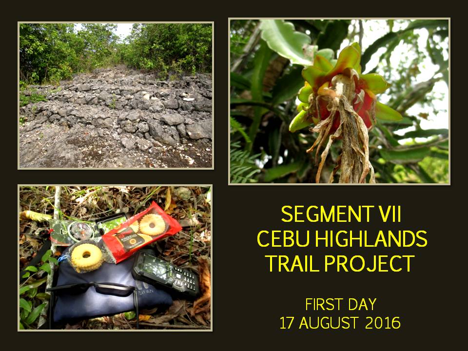
FIRST
DAY
AUGUST
17, 2016
04:30
– Leave Cebu North Bus Terminal, Mandaue City for Ilihan, Tabogon
by bus.
06:45
– Arrive Ilihan. Courtesy call on peace officer, recording our
presence and purpose.
07:00
– Leave Ilihan for Labangon, Tabogon. Pace: Moderate to fast.
Weather: Warm with cloudy skies.
08:15
– Arrive Labangon. Courtesy call on village head.
08:30
– Leave Labangon for the “Unnamed and Unmarked” Mountain Range. Pace: Slow. Weather: Very warm and sunny.
09:40
– Rest and rehydrate on unnamed peak, elevation unknown. Decides
to name this peak as Mount Lo-ong, in reference to its proximity to
a small community of same name. Old path vanished due to thick
vegetation.
09:55
– Proceed exploration. Pace: Slow. Weather: Extremely warm and
sunny.
10:43
– Rest and rehydrate on another unnamed peak, elevation unknown.
Decides to name this peak as Mount Lutaw, in reference to its
proximity to a small community of same name. Rock surface bounced
off heat to us. Found a blooming wild dragonfruit cactus.
Collected four specimen samples. Took naps under the shade after a
snack of rosquillos and dried fruits.
12:00
– Proceed exploration. Pace: Slow. Weather: Extremely warm and
sunny.
13:00
– Rest and rehydrate at a rare habitation. Found trail to here
after many tries. Local named Enteng, very helpful. Jonathaniel,
Justin and Fritz proceed downhill to fetch water at a small
community of Timbangan.
13:35
– Proceed exploration. Pace: Slow. Weather: Extremely warm and
sunny.
14:50
– Arrive at area of sinkholes and abandoned phosphate mines. Thick
vegetation cover many sinkholes. Two big sinkholes recently caved
in. Dangerous to explore. This is the place referred to by the
locals as the Doce Cuartos, a cavern system of twelve chambers.
Looking for paths on this trackless wilderness for the other side of
the limestone cliffs.
15:35
– Rest and rehydrate after path finding.
15:45
– Proceed exploration. Pace: Slow. Weather: Very warm with sparse
clouds.
16:00
– Rest and rehydrate on top of peak with a covered sinkhole. A
small flat ground is encircled by a rim of dwarf forest and
limestone rising ten feet above us.
16:15
– Proceed exploration after finding a notch on the rim. Pace:
Slow. Weather: Very warm and sunny with clouds.
16:20
– Propagated VHF signal on top of the highest limestone cliff using
a Cignus V85 portable radio with stock antenna at 5 watts power to a
repeater tower of Ham Radio Cebu located in the Babag Mountain
Range, Cebu City, 89+ kilometers away. Communicated successfully
with amateur station 4F7MHZ.
16:25
– Hereby named the unmarked and unnamed mountain range, not found
in any old or current maps, as the Doce Cuartos Mountain Range, in
reference to the cavern system of same name which is the most known
feature.
16:30
– Proceed exploration and to find a suitable campsite. Stopped
along they way to drink water of an unopened coconut found on the
ground. Pace: Slow to moderate. Weather: Warm and cloudy.
17:30
– Halt the day’s activity at a covered saddle. Set up hammocks
and shelters and produce campfire to smoke away mosquitoes.
Countless cave bats stream out of underground habitats. Limit water
use for drinking and cooking only. Dinner is crab meat soup, rice
and egg-chorizo omelet. Enjoyed coffee afterwards.
19:00
– Taps.
Distance
Covered: 9.1 Kilometers.
SECOND
DAY
AUGUST
18, 2016
06:00
– Wake up call. Start cooking fires. Breakfast is seaweed soup,
rice and boiled eggs with coffee. Water supply very low. Campsite
is among Leichardt pine trees which attract pollinators and a
strange hummingbird.
07:55
– Break camp. Proceed exploration for a route to find a community
or a habitation. Pace: Slow. Weather: Extremely warm and sunny.
Trackless wilderness, talus rocks, tight valleys and low hills.
Conserve energy by following cleavage among hills and long rests
under the shade. Forage wild papayas for fluid and electrolytes.
11:00
– Rest and rehydrate on last drops of water. Took naps under the
shade after snacks of energy bar and dried fruits.
12:30
– Proceed exploration for a community or a habitation. Pace: Slow.
Weather: Extremely warm and sunny.
13:00
– Arrive at small community of Tindog Bato. Rest and rehydrate
with water, soda drinks and iced water.
14:00
– Leave for Manlagtang, Tabogon. Pace: Moderate. Weather: Very
warm and sunny.
14:30
– Arrive Manlagtang. Rest and rehydrate.
15:15
– Leave Manlagtang for Guadalupe, Bogo City by bus to make up time
when I found we were navigating off-course by forty degrees due to
the passage afforded by tight valleys.
15:50
– Arrive Guadalupe and proceed to walk a route towards the Hagnaya
Port Road found in Dakit, Bogo City.
17:00
– Arrive highway. Took early dinner at a small eatery.
17:30
– Leave highway for Malingin, Bogo City.
18:00
– Arrive Malingin. Courtesy call on village officials. Set up
hammocks and shelters. Enjoyed coffee.
21:00
– Taps.
Distance
Covered: 13.6 Kilometers.
THIRD
DAY
AUGUST
19, 2016
06:00
– Wake up call. Start cooking fires.
08:00
– Leave Manlagtang for Don Pedro Rodriguez, Bogo City. Pace: Fast.
Weather: Warm with sparse clouds. Followed a route of an old and
abandoned railroad line. Foraged sweetsops along the way.
10:30
– Arrive Don Pedro Rodriguez. Rest and rehydrate.
10:40
– Leave Don Pedro Rodriguez for Curva, Medellin. Pace: Fast.
Weather: Very warm and sunny.
12:15
– Cross Dayhagon Canal Bridge. Rest and rehydrate.
12:25
– Proceed hike. Pace: Fast. Weather: Extremely warm and sunny.
14:05
– Arrive Curva. Rest and rehydrate. Feet soles suffered from
walking along treeless and shadeless sidewalks of the highway in
Medellin. Prepared late lunch.
14:45
– Leave Curva for Poblacion, Medellin. Pace: Fast. Weather: Very
warm with sparse clouds.
16:50
– Arrive Poblacion. Rest and rehydrate.
17:15
– Leave Poblacion for Bakhawan, Daanbantayan by bus to make up time
for my lapse in identifying and finding a suitable direct route to
there. (The next morning, I found it.)
17:30
– Arrive Bakhawan Beach Home. Rest and rehydrate. Start cooking
fires in makeshift kitchen. Dinner is vegetable in coconut-milk
soup and milled corn. First bath after three days. Bakhawan Beach
Home is a sponsor of the CEBU HIGHLANDS TRAIL PROJECT.
22:00
– Taps.
Distance
Covered: 30.4 Kilometers.
FOURTH
DAY
AUGUST
20, 2016
06:00
– Wake up call. The proprietress, Lani Perez, and her staff at
Bakhawan Beach Home hosted a breakfast for the XTeam. Food consists
of dried fish, organically-grown vegetables, rice and fruit with
coffee.
09:05
– Leave Bakhawan Beach Home for Dalingding Hills, Daanbantayan.
Pace: Moderate to fast. Weather: Warm with cloudy skies.
11:30
– Arrive at Dalingding Hills. Rest and rehydrate.
11:45
– Leave Dalingding Hills for Libertad, Daanbantayan. Pace: Fast.
Weather: Mild and rainy.
12:25
– Arrive Libertad. Rest and rehydrate.
12:40
– Leave Libertad for Lake Lanao, Daanbantayan. Pace: Moderate.
Weather: Very warm and sunny.
15:20
– Arrive Lake Lanao. Water shrunk to just a small pond. Most of
the lake had been converted into rice fields.
15:30
- Proceed for the village of Lanao. Pace: Slow. Weather: Warm and
cloudy.
16:20
- Arrive Lanao. Rest and rehydrate.
16:30
– Elements of Daanbantayan Police Station arrived to respond to an
“Armed Person Alarm” which turned out to be the XTeam. XTeam
decides to go with the police peacefully, without any protest, so
our presence would be recorded officially.
17:30
– I decide to abort the exploration, to include the final 7
kilometers or so for tomorrow, for the safety of the XTeam.
18:00
– Leave Daanbantayan for Mandaue City by bus.
22:30
– Arrive Cebu North Bus Terminal, Mandaue City. Terminate
exploration.
Distance
Covered: 18.12 Kilometers.
TOTAL
DISTANCE COVERED: 69.89 Kilometers
One
of the biggest obstacles to the CEBU HIGHLANDS TRAIL PROJECT is local
cooperation or acceptance. Their life-long habits and beliefs,
shaped by their isolation to modernization and urban fads (hiking,
exploration), placed us in extreme disadvantage. I may have the
documents to show the legality of our presence and activity but,
still, we are viewed with suspicion. On our side, we interpret it as
either indifference, arrogance or ignorance and it is most dangerous
when strong spirits are mixed or there is too much politics in a
place.
Next
are government bureaucrats who are tasked to act on my request
contained in my letters addressed to the office of the Provincial
Governor and of the Cebu Provincial Police Office. Their ineptness
and lack of initiatives have caused me dismay for they failed to
disseminate the information contained in my letters that could have
explained everything even before I was at these places like
Daanbantayan. This is but routine and demands less work and I cannot
understand why it cannot be done?
Difficult
terrain is nothing, but when an uncooperative weather condition is
blended into the fray, it would really really be difficult, like on
my first day in an earlier attempt, and on the first and second days,
on an unnamed and unmarked mountain range bounded by the villages of
Labangon, Mabuli, Manlagtang and Somosa, all in Tabogon. There is no
known water source on the range and whatever it had would have
immediately wither under the onslaught of warm weather. That
condition will bring down your water supply.
There
were three highlights in the exploration for the route of Segment
VII. First was the exploration of almost the whole mountain range,
previously unmarked and unnamed in any map. Nobody goes there except
of a few intrepid wood gatherers. It is an uninviting terrain of
loose rocks, bare and sharp, which host a forest of unwieldy and
spiny bushes and have no known water sources. It is my honor and
privilege then to bestow it with a name that is just as enigmatic:
Doce Cuartos Mountain Range.
Next
is the rediscovery of a long-forgotten relic of an earlier era which
was the route of a railroad line that serviced the sugar cane
plantations of Bogo City to its destination to a sugar refinery in
Medellin. Its presence in old maps gave me the more reason to
include this in the route of Segment VII. The route goes straight
and seamless until a big house blocked its route in Don Pedro
Rodriguez, Bogo City. It would be wise for the city and the Province
of Cebu to preserve this old railroad route as a Cebuano heritage.
Last
is our privilege to be hosted by Bakhawan Beach Home. It is not
everyday that we can enjoy amenities of an exclusive resort yet it is
just fortunate that Bakhawan Beach Home is one of our sponsors. The
XTeam are used to hard and uncomfortable campsites on all our
exploration hikes but the soft beds under the warmth of a roof in
close proximity to the lulling sound of surf on shore are just
heavenly. It is then my pleasure to thank Ms. Lani Perez and her
staff for the warm reception and accommodation given to Eagle One.
After
I have parted from my employer in the last days of 2015, I was
determined to finish the CEBU HIGHLANDS PROJECT before 2017. I
trained with the XTeam when we have no exploration schedule to keep
us fit. I refined and re-routed Segment I, especially the
Lutopan-Guadalupe route, when the thought of a future dam
construction occurred to me, which would surely bury the old route
under a man-made lake.
I
have, segment by segment, reached the threshold of completing the
CEBU HIGHLANDS TRAIL PROJECT. Although I have aborted Segment VII, I
have covered enough ground to consider it a success. The last
stretch of untouched territory to Bulalaqui Point is just about seven
kilometers long. A mere day hike. An “icing in the cake” when
its time to be walked will come. Eagle One have accumulated, after
the last segment, 355.33 Kilometers or Eighty-Seven Percent of the
CEBU HIGHLANDS TRAIL PROJECT.
Document
done in LibreOffice 5.2 Writer
Posted by
PinoyApache
at
08:30
0
comments
Labels: Bakhawan Beach Home, Bogo City, Cebu, Cebu Highlands Trail, cross-country hike, Daanbantayan, Doce Cuartos Range, exploration, Medellin, Tabogon
Subscribe to:
Posts (Atom)