Showing posts with label Tabogon. Show all posts
Thursday, September 14, 2017
THE THRUHIKE JOURNAL: Days 22 and 23 (Labangon to Malingin)
DAY
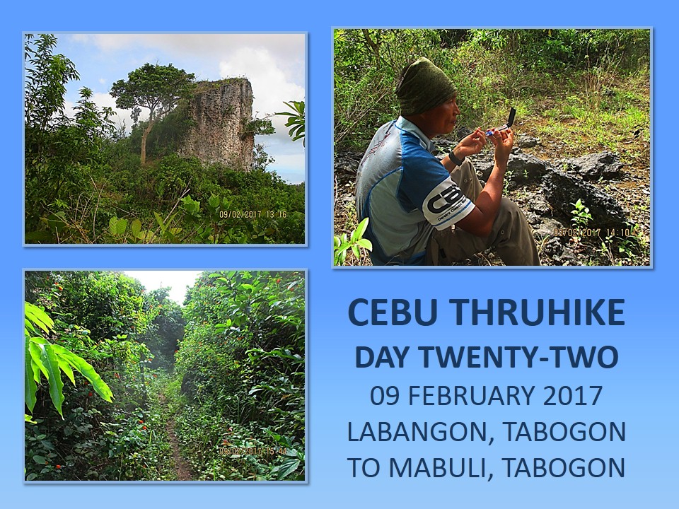
TWENTY-TWO ::::: THE COPS FROM THE Tabogon Police Station have left. We appreciate very much of their presence last
night watching over us. We were able to thank them. Today, is February 9, 2017
and this will be Day Twenty-two of the Thruhike. We just had a breakfast of
bitter gourd mixed with egg, rice, coffee and bread. We have another fresh
supply brought by the supply team yesterday.
Leomil
Pino would be joining with me and Jonathaniel Apurado today as a guest hiker.
He chose the most difficult time over the most brutal route. He would be with
us for as long as his time allowed him to. What he would worry is just today
and tomorrow because he is on his own where food is concerned. After this, food
could be had along the way because it would all be lowlands and highways.
The
supply team brought my Jack Wolfskin trail shoes yesterday and it shall be
tested against the unforgiving terrain of the Doce Cuartos Mountain Range. I
changed into a clean pair of Lorpen hiking socks that were provided by Viajero
Outdoor Centre at a special price. I also changed into a clean pair of Accel
elastic undershorts. I carried all my dirty socks and undershorts with me
north, as well as the everyday sleepwear – a cotton t-shirt and a long-sleeved
PDRRMO jersey.
After
drinking in capsules of Enervon Multivitamin and Herbalife Natural Raw Guarana
and an amount of Yakult Cultured Milk, I gave my thanks and appreciation to
Hon. Leonilo Peligrin and wife of Labangon, Tabogon. I left a loaf of Park N Go
bread and their baked products as my appreciation. Breathing on air near the
national highways gave me opportunities of good cellular phone signals and
allowed me to update the Thruhike to my sponsors, family, followers and friends
in a social networking site.
The
Lenovo A7000 smart phone floated out unsent photos of ten days while the Cherry
Mobile U2 basic phone tackled text messages. After that, I switched off power
on the Lenovo to save the battery for more picture taking up ahead for it
devours battery life quickly. It was cold last night even though we were in
lower elevations but I had a good night’s sleep. I am ready today for the
hardships ahead. We left Labangon at 07:40 which is not good. Forty minutes of
delay is a big difference.
The
Doce Cuartos Mountain Range is the last obstacle and is also the most
challenging. Rising to not more than 270 meters and a length of about 4-5
kilometers, it is partly wilderness. Few locals go there as there are almost no
trails and there are no known water sources. There is a forest of stunted trees
which just barely grew above your head. It is made of limestone, with loose
outer surface and treacherous sinkholes. Less foliage contribute exposure to
the sun while rocky surfaces bounce off heat.
I
had tried exploring this twice during the Segment VII Exploration Hike last
April 2016 where I did a solo and again in August 2016 with four others. The
first time was almost a success but lack of water and suspicious locals forced
me to abort it. I followed my route on the second attempt but I lost the trail,
going in circles until I found it, then I let another from my team to find a
route during the most trying times which led us farther away from engaging on a
northerly direction.
This
time we followed a wide trail until we reach an open well. Across us is a trail
to the southern part of this mountain range. We hiked slowly, conserving energy
as much as possible for it would be extremely warm up there even when there is
a very generous presence of breeze. The route I chose is the same as the last
two episode. When the trail disappeared, I embarked on guessworks, to determine
where the rest of the trail would be?
I
had learned from the last time and able to distinguish some familiar features.
I did a lot of trial and error of possible routes and followed a few ghost
trails until I found a real trail. When you are into that, you do not
compromise your companions to hardships. They stay in one place while you do
the reconnaissance yourself. Besides, it is easier and faster if you do it
alone instead of a line of people going back and forth all the time.
I
found the small patch of corn field. Someone comes here all the time. That
someone may have a source of water nearby or he depends on rain. There is a
wild dragonfruit growing near and I cut four members to propagate it or maybe
borrow my idea of “pepper diplomacy” which I used to great efficacy during the
southern leg of the Cebu Highlands Trail. How did it get there? Anyway, I
discovered that this small field is watered through a ditch which came from a
natural drainage during rain and rainwater stayed for a while here.
First
time I was here, I came from a trail from below. These last two were from a
trail from above which, in my first visit, I used in leaving from here. I need
to explore more of this place. It may have another trail. I got to exert more
effort. I found it finally. I followed this. It afford me a good view of the
sugar cane fields in between Ilihan and Labangon. I passed by a hole on the
ground where there was water recently. The trail led me to a thin copse of
mahogany trees. My older route passes by this place and it goes to a small
house.
I
had befriended the occupant. His name is Vicente. Today, I have real gifts for
him aside from a combination of numbers for a numbers game. He is here
gathering charcoal. The place has shade. Perfect for a noon break. It is still
11:08 but it is so warm. I opened my High Sierra Titan bag and dug my hand at
its deepest quarters, producing a box of ten Marlboro packs. Vicente was
smiling now and I thought I heard an old woman from inside the house. I added
two packs of Knorr instant soup, 200 grams of rice, a loaf of bread and baked
products. We lunched on Fitbars and stayed until 12:00.
I
followed the trail uphill into a forest of stunted hardwood. The vegetation
changed as we penetrate its most remote parts. Trees were now tall with bi-is
palms growing among them. Some parts had been cleared for firewood and I see
many abandoned holes that were used to make charcoals. The trail goes down and
I know where it goes so I tried again the trail that branched off it. This was
the ones I used during my two visits here and it would lead me to a place where
there are gaping sinkholes and where there is a standing rock called Tindog
Bato. From a gap on a rock, I finally glimpsed the sea to the east.
The
trail disappears because it was overgrown by grassland. I would not chance
clearing a path here. It is too dangerous. There may be more sinkholes. Tremors
and aftershocks caused edges of some sinkholes to collapse and enlarge. The
last trail that I followed passed in between two sinkholes and it just stayed
at the edge of a cliff. I consult my clock, it is 14:00. Too few daylight hours
left. We stopped and rest for a while and thought out another strategy. The
warmth, the thirst and the fatigue factor are just too much.
We
would follow the route I took the last time. I will go down and look for that
dry watercourse. I will travel down following the contour, gently and slowly.
The vegetation is so thick, made up of thin wiry vines running everywhere,
elongated branches trying to reach for sunlight, shrubs and palm leaves. There
are trees and thick branches but it is best that I move like water instead of
acting like an irresistible force slashing indiscriminately on anything that
blocked.
I
forgot to bring out my Camp Red Limited Edition Balaraw during the lull and it
was so cumbersome to unload and load my heavy backpack. I need not waste
strength to untangle myself. I borrowed instead Leomil’s Seseblade NCO knife. I
do not need a big blade to work my way through this jungle tangle. The very
light Seseblade is enough and I do not have to use brute strength. All I have
to do is flick a wrist and – voila – I am moving forward. It was hard going but
it would be harder still heaving a bigger knife and getting entangled. This is
no cinema. This is the real world.
I
found the dry watercourse. The last time, we followed it downstream, blinded by
the rush of adrenaline. Today, I will follow it upstream, just like the ones I
have wanted last time, but I will be facing an obstacle of chest-high grasses.
You cannot slash it with a knife, you have to part a path through it with a
stick. I cut a slender branch for this purpose. I need to make a lot of noise
with the stick to scare away what is hiding beneath. Good thing we do not have
big cats here else we are meat salad.
As
I navigate through all these unwelcoming territory, my eyes cast left and right
for any signs of a way out of these suffocating place. I must have walked
slowly and surely for about 800 meters when I caught something that elicited me
approval. A trail. I transferred to there. Leomil was in a state of semi-shock
and speechless while Jon already on the brink of exhaustion. It was very humid
and draining. The air was thick. Breathing took an effort. Resting above the
grassland valley gave us more room to recover strength.
We
go up and up into a high valley. I could see from a gap the reservoir tanks of
Libjo, Tabogon. It was one of my reference points and it showed we had not
travelled far although I thought we did a lot of walking. The gap offered a way
out of the Doce Cuartos Mountain Range for there is a trail. I opt for another
branch that goes into uncharted territory for me. I had spied an abandoned hut
last time and I aim to reach that today before dusk sets in.
I
found the hut and there is a tinaja just near it. There is water. I even
scared a rail which had been quenching its thirst from there. The trail passed
beside the natural reservoir and goes up to a ridge. I followed it to a rocky
promontory where there are steps hacked on the rocks. Beyond it is a small
plateau and is the jewel this mountain range have kept hidden from me for some
time. The place is flat but it is ringed by hardwood trees. Unfortunately,
locals are starting to deforest it. We will set up camp here for it is now
16:00.
The
hammocks are strung up between trees along with their overhead canopies.
Firewood are plenty and we will have a small campfire after supper. Jon and
Leomil have recovered and are now laughing as they gave life to the three
alcohol burners. Water is boiled and I deserve a cup of coffee. We have enough
water for dinner and breakfast plus a small washing for the pots in between. I
think we would be left a liter of water tomorrow to share among us. Let
tomorrow worry itself then.
We
got a nice meal of thick Japanese spicy noodles, rice, plus pork and beans. The
full moon hung over the sky casting an eerie glow over the rugged landscape
below. Leomil has his MP3 music going. The spirits of the mountain have favored
us today and showed me to this place. Warm breeze from the sea blew over the
fire that flickered and danced, enjoying its existence with its earliest companions,
who fed it with more fuel. I felt like being transported to a place when the
earth was still young.
Distance
Walked: 4.35 kilometers
Elevation
Gained: 254 meters and a low of 106 meters
DAY
TWENTY-THREE ::::: I EXPERIENCED THE BEST sleep ever last night even if I was
partly exposed. The combination of a cool night, warm breeze from the sea, well
fed, silver light from a full moon and that floating feeling of a hammock could
best any night spent in a 5-star hotel on any day. Unfortunately that beautiful
feeling do not last with the approach of daylight. A sea of clouds enveloped
the lower places blocking the sun.
Today,
is February 10, 2017 and it is the birthday of Mrs. PinoyApache. I reached for
my Cherry Mobile U2 basic phone and sent out a birthday greetings to her. She
has been very worried about me, especially when she saw photos I posted with
blistered feet and blackened shoulders during the southern leg of the Thruhike.
She has to accept my stubbornness. She thought I am half-mad for engaging in an
activity where I am not paid.
I
woke up late but Jonathaniel Apurado and Leomil Pino were still in their dreamy
moments. I noticed Leomil sleeping on his ground sheet. Did he not slept in his
hammock last night? I noticed his hammock opened up at the bottom and it had
dumped him to the ground. It had a torn fabric. Anyway the perfect condition
last night placed him in a good advantage as if he was sleeping in a hammock.
The
fire had burned to ashes. There is still heat as I placed a hand inches above
it. A live ember. I gathered the unburnt ends over the small ember and, moments
later, smoke appeared. Oh sweet woodsmoke. Even the mountain spirits loved it.
I filled a pot with water just enough for me. With my Trangia, I flicked a
lighter and blue flame shoots up from its small reservoir. Smell of coffee and
woodsmoke go together.
Leomil
and Jon woke up. Either the smoke or my noise or the light piercing the eyelids
may have something have to do with that. Jon, still sitting on his hammock,
fried the rice from last night and fried also the thin slices of Bilbao
chorizo. The smell of a different food other than the Knorr soups shook my
appetite alive. We eat our breakfast and left little to throw away. We could
not spare water for washing and we hoped we have that on Day Twenty-three of
the Cebu Highlands Trail.
We
break camp at 08:30 and go down the mountain. We passed by the hut of yesterday
and saw a trail that goes down. We met a local. We talked about the abandoned
hut. It is an urban legend. The previous occupant had been possessed by an
unnatural power. He had the power to walk on the tops of coconuts and bamboos.
He could slip in and out unseen even when he was cornered in several police
dragnets. He was impervious to bullets but died when his underling stabbed him
on account of loot spoils.
That
was why there was something in that campsite of ours last night. I just ignored
it but it was there, watching us. It could have played a prank on Leomil. But I
was sleeping with my Camp Red Special Edition Balaraw and I can not miss at
close distance. Anyway, the trail goes down into dangerous places as it pass by
deep sinkholes. Staying late at dusk on the trails here is not advisable. I
trust my Jack Wolfskin shoes but, even so, we were careful.
We
touched bottom and there are trails everywhere. Took out my Suuntu M30 compass
and followed one trail that goes north. There is a stream that divides us from
the rest of the field. Beyond us is a field of sugar canes. Where we were are
meadows. We followed the path that goes on its wavy progress, passing by
marshland, forest, crossing streams, until we have to stop at the edge of a
community to gather our breathing.
I
got the feeling that I am going to the village of Mabuli, Tabogon. I sent a
text message to the Tabogon Police Station to inform them that we are now
approaching that place. I simply had an unpleasant experience here last April
2016, during the first day of the Segment VII Exploration Hike. I was alone
then. I was not welcomed to stay in their village when I did a courtesy call.
They were concerned of their safety. What could one man, burdened with a heavy
bag and almost died of thirst, do to their peace and order?
I
was suspected by local officials as someone working for an opposing political
party even when I have a letter received by the Office of the Governor and
another from the Cebu Police Provincial Office. That is the problem with
half-literate people is they do not understand what is stated in the paper.
People from the municipal mayor’s office arrived to interrogate me but found
nothing wrong. They called the police to escort me out of this place for my
safety. That was the time I aborted my exploration.
I
am going back to Mabuli. There is the small store where I took refreshment and
there is the public school. I see their village hall as we walked on the dirt
road. This village is a beautiful place but the more I am out of here, the
better. The people are just too suspicious, even now. I have been into the most
notorious places of the CHT but I was not subjected to disgrace and distrust. I
would not have come down here again where it not for water. I simply do not
want a hiker passing by here in the future. I may have to refine the route of
Segment VII later.
This
village is simply big. I thought I have gone past Mabuli after walking for two
hours and crossing two streams where I thought it as boundary with Bogo City.
But when I met a local and asked, they would say I am still in Mabuli. This
stretch would have been perfect as it is all trail. I cast a glance at giant
power pylons crossing my path and I remembered that these are omnipresent in
Bogo City. I met another local and I got an answer that satisfied my wish. I am
in Bogo City. At that moment, I sent a text message to the Bogo City Police
Station informing them of our presence and our Thruhike.
The
trail could not go past anymore on our northerly progress as fields are now
fenced. Private lands. We followed a miserable looking dirt road that exits to
the national highway, which was known in the old days as the Cebu Hagnaya Road
but is now part of the Central Philippines Nautical Highway. We walked beside
the pavement amidst the blur of buses and cargo trucks. It is warm and sunny and
shades are less when you are on highways. We have to find a place to take a
noon break and a meal.
We
found one at 12:15 in a place somewhere between La Paz and Anonang Norte, Bogo
City. It is a small store but it sells food. The owner is Mercury Las Doce. She
was curious of our big bags and a conversation began. She was amazed at our
journey that started in Liloan, Santander last January 17. Her husband, Martin,
joined her. He, in all his years living in this place have never been to the
Doce Cuartos Mountain Range. Martin gave Jon a machete which are commonly used
to cut sugar canes. Jon, on the other hand, replicates the gesture to Martin
with a Swiss Army Knife Camper.
After
an hour of rest, we continued on. We switched on the other side of the road,
which is now more shady, and passed by La Paz. We walked on and reached the
boundary with Dakit, Bogo City. It is here that we exit from the road and
transfer to a trail that cross 600 meters over an unused lot and it joins with
an unpaved road. It leads to the interior and followed it until we crossed a
slowly disintegrating bridge. We are now in the village Malingin, Bogo City.
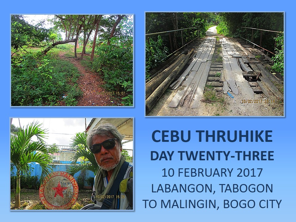
Just 300 meters more and we will arrive at their village hall.
By
15:30, we were now resting at a community stage. We were expected and the
village chair, Hon. Marilyn Calidguid, met us. We were welcomed to use their
new building but we insist to use the stage instead as our sleeping area.
Missing me by 30 minutes, Markus Immer arrived with Glyn Formentera. Markus and
Glyn would stay here and would walk north with us tomorrow. The Toyota Hi-Lux
pickup of Markus would be driven back to Cebu City by his driver.
It
seemed that something was taken off my back. For 23 days, we faced difficult obstacles,
bad weather, sudden and unexpected warmth, suspicious people, slippery trails,
heavy loads, monotonous menu and cold nights. I could not count the nights I
find myself chasing sleep. My appetite was strong but the last five days I
found my breakfast half-consumed where Knorr soup is present. The heat shrivels
the skin. Rain drains down in your socks causing you blisters. Bad shoulder
straps saps the life out of you but the most difficult of all are still people.
Distance
Walked: 13.99 kilometers
Elevation
Gained: 254 meters and a low of 45 meters
Document done in
LibreOffice 5.2 Writer
Posted by
PinoyApache
at
08:30
3
comments
Labels: Bogo City, Cebu, Cebu Highlands Trail, Doce Cuartos Mountain Range, journal, Tabogon, thruhike
Thursday, September 7, 2017
THE THRUHIKE JOURNAL: Day 21 (Bongdo to Labangon)
I
TOOK ANOTHER BATH this morning. It was not that cold last night. Maybe we were
not that high in elevation anymore. I do not have an altimeter and I could not
determine how high was our location here in Bongdo, Borbon. But it was sunny
for the last two days and, despite that, the breeze was cold. The amihan,
the northeast monsoon winds, carried the winter cold of Siberia, Japan and
China to the tropics, where we are 10 degrees above the equator. We also had
the sun slightly at our back even at noontime.
This
would be the last day of my Hi-Tec Lima hiking shoes for the Thruhike. When we
reach Labangon, Tabogon, it would be sent home. It would be replaced by another
pair of Jack Wolfskin shoes, which I used brand new during the southern leg,
and have caused me blisters for there was no time to break it in. I believed
the 11 days I spent walking the Cebu Highlands Trail before it was replaced by
the former is good enough to try it once more. Tomorrow hosts the final and
most terrible obstacle of the Thruhike.
The
bath last night and today, February 8, 2017, have freshened me and have washed
away dust, grime and that manly odor. It also gave me a clear mind. That helped
when I had another breakfast of instant Knorr soup and rice, which I find so
monotonous and devoid anymore of appeal. But there is coffee to keep me alive.
As always, the capsules of Enervon multivitamins and Herbalife natural raw
Guarana and, of course, Yakult cultured milk are consumed before we step out
into the great outdoors and Day Twenty-one.
I
have washed last night my Silangan hiking pants and the official CHT jersey
made by Silangan Outdoor Equipment, my outfitter. It stayed odorless just the
same as if it were not laundered. What it removed were tiny salt crystals,
dust, debris and pollen. Nevertheless, the notion of having clean apparels gave
you a peace of mind. I will still wear my Fila socks and SNS elastic
undershorts for the last time today. Tomorrow will be a hard day and I hope the
supply team arrive later this afternoon along with Jack Wolfskin.
We
left the village of Bongdo at 07:30, after thanking the Hon. Abdias Retuerto
and the village secretary. I know the route to the next village where we will
cross another municipality. We follow an unpaved road, stopping for a while to
talk to a good furniture maker who specialized in bamboo material. We walk on
and stop by a small stream where there is a small bridge. We are now between
the boundary of Borbon and Tabuelan.
It
is a very lonely place. By the time we left the last house thirty minutes ago,
we did not encounter people. We continue on and follow our route but someone
whistling was coming towards us. He got startled when he saw us. We gave
greetings but the guy acted queerly. I gestured to Jonathaniel Apurado and he
understood. This early morning, the green things were greener, the air clearer
and the birds sang to their joyous abandonment. The weather is mild with breeze
blowing cool. It would have been perfect for the local guy except for our unsought presence.
As
I reach a landmark, I scan the landscape and found what I was looking for. It
is a trail. How did I know there was a trail? Been here done that, but how did
I found that out before? Simple. Terrain analysis. When I explored this place a
year ago, I found the rough road was going west but my direction was to the
north, so it was not difficult. Just scan your right side if you happen to walk
west and it would reveal itself. Of course, you need to have good observation
skills. Common sense will teach you that.
The
trail followed the hills gently up and worked its way along contours, crossing
a wide cleft and then up another gentle slope until I saw a roof of a hut.
Familiarity breeds happiness. We are now approaching the village of
Kanluhangon, Tabuelan. I have also nurtured friendship with their village
chair, Hon. Felix Rondina, so I sent a text message to the Tabuelan Police
Station to inform them of our presence in their area and our Thruhike.
We
arrived at the village at 09:00 and began the routine of paying courtesy call
to an official. There was a group of residents sitting under a waiting shed and
they were waiting for someone. They spotted me but their body language told me
a reaction that could only be borne by either excitement or by confusion. There
was something in the air. Was it my appearance? I am now bearded and tanned
with white tousles of hair. My clothes are partly wet with sweat and one of my
shoes was smiling. I looked like a hobo.
One
of them approached me suspiciously and asked if we were the ones they were
expecting. No, I says. We are just passing through. Are we hikers? Yes, we were
hiking since January 17 from Santander and going to Daanbantayan. Then there
was joy and laughter in everyone as they poured out of the waiting shed. They
did not expect us so soon. We were supposed to be expected for lunch and they
were having a meeting on what food to offer us.
My
happiness got replaced with sadness as I learned that Felix had passed recently
from a motorcycle accident at Liloan. He was another able public servant and
was also the head of the Tabuelan Disaster Risk Reduction Management Office,
just like the late Dante Limana of the village of Tabili, for Catmon. I met
both at a search and rescue conference in Cebu City last July 2016. Their
presence would have ensured safe passage for hikers after this Thruhike is
over.
We
stayed and talked with the residents. Three live fowls arrive with their owners
while a fire is started at the back of the health center. I get to know Felix’s
widow, Lendy, herself a village councilor. We were warmly entertained and
offered native delicacies. During a lull, I tried the weighing scale. I could
not believe I weigh close to 86 kilos. Was the scale defective? It had been a
long time I weighed like this. I stopped standing on one when I failed to bring
my weight below 98 kilos.
We
eat lunch together with the residents of Kanluhangon. I took several servings
even though that, in less than thirty minutes, we would be hitting the trail
again, this time, with bloated stomachs. I eat to my hearts content. The food
was heartily offered and there was sincerity in their voices. I wished
policemen from Tabuelan would join us in this feast. They were also expected. I
explained to the residents that we have a schedule to pursue and people to meet
at 16:00. It is very important that I arrive there first.
At
11:45, we left Kanluhangon after giving our sincerest thanks and our
appreciation. We walked on a paved road that became unpaved when it joined
another one. Under the heat of the noontime sun, we persevered and reach a
paved road. This road goes to coastline Tabuelan and the other end to Tabogon.
We followed the one going east but made a left turn at a corner, entering the
village of Calambua, San Remigio. It was breezy yet, despite it, the sun burned
above and the pavement bounced off glare. Sent a text message to the San
Remigio Police Station informing them of our passage.
The
road offered few shades except by coconuts. To the right of me is a rolling
valley of grassland and sugar canes. I looked for the trail, found it, and
began crossing this wide valley. It is better hiking here and the trails are
much kind to the feet soles. We cross a small bridge and, guided by the sight
of the national highway far away, we choose our route. We did not follow the
path taken during the Segment VI Exploration Hike last year. Instead we took a
northeasterly direction.
We
crossed a stream and climbed up a dirt road, crossed another bridge, go back to
the same road. We passed by a private cemetery and continue on until we reach
the St. Martin de Porres Parish. We are now in Ilihan, Tabogon and a few meters
from us is the national highway. It is 13:55 and we have so much time. We can
take a half hour of rest and still be at Labangon, Tabogon before 16:00. Our
supply team would be expected on that hour and I am competing with a Swiss guy,
who are known to observe prompt time. After all, they made famous the Swiss
watch.
Markus
Immer would be driving the supply team in his Toyota Hi-Lux pickup. On the last
three rendezvous, I arrived early before him and on this fourth supply run, I
would keep that record intact. He would always arrive before time but I beat
him all the time. We start for Labangon at 14:20, after crossing the highway. I
sent another text message for the Tabogon Police Station so they would expect
also of our presence. The asphalted road wove among sugar cane fields and then
I saw this ragged monolith from afar. The Doce Cuartos Mountain Range is the
last and the most difficult obstacle of the Thruhike.
I
shivered at its sight because I could not shake off the trauma of my two
failures there in April and August last year. This small mountain range is my
Moby Dick and I am Captain Ahab trying to tame her. I would try her again
tomorrow. Most of it are unexplored. It has only a very few trails and there is
no known water source. Forest cover are stunted, exposing your head to heat
exposure. It is made of limestone and the surface are made of loose rocks. One
mistake and you are done.
A
sign says we are now in Labangon. We crossed a bridge and found the village
head at his home at 15:30. I made a courtesy call on the Hon. Leonilo Peligrin
and asked permission to stay and sleep for the night. He welcomed our presence.
At 15:45, Markus and company arrived. With him were Justin Abella, Leomil Pino
and Jenmar de Leon and our fresh supply of food and fuel. Part of that are
bread from our valued sponsor Park N Go Bakeshop, courtesy of Randy Salazar.
A
police patrol from the Tabogon Police Station arrived at 17:30 to check on us.
They informed us that they were sent to secure our presence and that they would
also stay overnight. Very much appreciate that. After supper, Markus, Jenmar
and Justin left. Leomil would stay with us and would hike with us tomorrow and
try to experience this terribly dour mountain range. We three tried to fit in
the limited space of the hut. The night is silently eerie but we have guardian
angels tonight.
Distance
Walked: 14.97 kilometers
Elevation
Gained: 212 meters and a low of 89 meters
Document
done in LibreOffice 5.2 Writer
Posted by
PinoyApache
at
09:30
2
comments
Labels: Borbon, Cebu, Cebu Highlands Trail, journal, San Remigio, Tabogon, Tabuelan, thruhike
Thursday, December 1, 2016
MAN-SIZED HIKE XXII: Ilihan to Lake Lanao
I
HAVE ACHIEVED SEVENTY-FIVE PERCENT of the CEBU HIGHLANDS TRAIL
PROJECT after I have walked and finished Segment VI. Segment VI is
the one I explored last February 22-25, 2016, starting from Caurasan,
Carmen to Ilihan, Tabogon in four days and three nights and on a
distance of 56.17 kilometers. I have accumulated a total mileage of
289.16 kilometers since day one of the CEBU HIGHLANDS TRAIL PROJECT
and this would increase very soon.
Today,
August 17, 2016, I would start from where I left off the last time,
which is from Ilihan, and hopefully, finish Segment VII on August 21
at Cebu’s northernmost end, which is at Bulalaqui Point,
Daanbantayan. This will be the longest yet at five days and four
nights and has a rough length of 65-70 kilometers. To recall,
Segment VII had been denied me one time last March when the heat of
the election campaign period and of El Niño forbid me to go on after
I floundered in Mabuli, Tabogon on the first day due to scarcity of
water.
The
CEBU HIGHLANDS TRAIL PROJECT was, at first, a personal undertaking
which first has its beginnings with a dayhike with friends from
Lutopan, Toledo City to Guadalupe, Cebu City in February 2011. It
metamorphosed into a longer multi-day hike from Lutopan to Mantayupan
Falls, Barili in March 2012 which I designated as Segment II. In
October 2013, I completed Segment I with a cross-country hike from
Mount Manunggal, Balamban to Guadalupe.
I
would have finished the CEBU HIGHLANDS TRAIL PROJECT in two years
were it not that I was holding a vital position in the company where
I worked. If I would have to realize the CEBU HIGHLANDS TRAIL
PROJECT in 2015, I would have to sacrifice my comfort zone and put
all my energies into it. At that time, it was impossible and letting
go of my day job would put me and my family in dire straits. So it
goes that 2012, 2013 and 2014 passed by with just one or without any
exploration hikes.
Realizing
the immensity of this endeavour, I decide to form an Exploration Team
(Eagle One) and a Base Support Team (Eagle Base) dedicated for the
CEBU HIGHLANDS TRAIL PROJECT starting in 2015 so I could finish it
before 2017. I took the XTeam to stressful and difficult day treks,
without meals in between, during trainings in traditional navigation.
Together with the Base Support Team, I taught them the basics of map
reading, putting more emphasis on the more practical military
methods.
I
have picked my team carefully, after careful considerations of their
capability, initiative and ability to accomplish the functions
assigned for them like Jose Neo and Chad Bacolod of Eagle Base.
Endurance and stability under pressure will be the hallmarks of Eagle
One and these are composed of Jonathaniel Apurado, Justin Apurado,
Jovahn Ybañez and the new member, Fritz Bustamante. I am the Team
Leader, Navigator, Security Officer and Project Director all rolled
into one.
I
cannot accomplish this project without the logistics and the funds.
Answering to my call for support in whatever form it may be,
individuals, here and abroad, and businesses responded. Notable
among them are Titay’s Liloan Rosquillos and Native Delicacies,
Alvin John Osmeña, GV Hotel Philippines, Silangan Outdoor Equipment,
Jonathan Blanes, Glen Domingo, Alan Poole, Jose Neo, Tactical
Security Agency, App Ops Philippines, Lester Padriga, Harold Butanas,
Lavilles of Australia, Bakhawan Beach Home, Glenn Pestaño, Amaya
Montecalvo and Markus Immer.
The
following also provided the CEBU HIGHLANDS TRAIL PROJECT, in one way
or another, services and goods and acknowledgments which are valuable
in accomplishing our goals like Drinox’s Kitchen, the Quijano
Family, Melo Sanchez, Jeremiah Dayto, Matthew de Leon, Mountain
Stories Blog, Warrior Pilgrimage Blog, Ham Radio Cebu, the Mountain
Climbers Alliance of the Philippines, the Camp Red Bushcraft and
Survival Guild, PAC Gear, and the Philippine Mountaineering Blog.
That
2015 produced amazing results which led to the explorations of both
Segment III and Segment V and, partly, of Segment IV. Segment III
was finished in just three days, instead of four days, in February.
The route was Mantalongon, Barili to Mantalongon, Dalaguete. On the
other hand, Segment V ran from Mantalongon, Dalaguete to Upper
Beceril, Boljoon but the XTeam decide to walk the extra mile to
Poblacion, Boljoon. It was done in two days, instead of three, last
May.
The
extremely-warm conditions of a queer climatic phenomenon in October
caused by forest fires in Indonesia slowed down the XTeam and caused
them to abort their Segment IV hike at Danasan, Danao City after four
days but not after hiking the “no man’s land” coming from Gaas,
Balamban. However, Eagle One returned in January 2016 to finish
Segment IV, starting from Cambubho, Danao City and ending it, after
two days, in another “no man’s land”, to Caurasan, Carmen.
After
that, was Segment VI, and, now, this – Segment VII. Composing
Eagle One are me, Jonathaniel, Justin and Fritz with Jose Neo at
Eagle Base. Eagle One is equipped with dark sunglasses provided by
Zue Fashion. Described below are the highlights, weather and other
bits of information of the whole itinerary of Segment VII, which was
aborted on the last hours of the fourth day:
SEGMENT
VII, CEBU HIGHLANDS TRAIL PROJECT
ILIHAN,
TABOGON TO LAKE LANAO, DAANBANTAYAN
FIRST
DAY
AUGUST
17, 2016
04:30
– Leave Cebu North Bus Terminal, Mandaue City for Ilihan, Tabogon
by bus.
06:45
– Arrive Ilihan. Courtesy call on peace officer, recording our
presence and purpose.
07:00
– Leave Ilihan for Labangon, Tabogon. Pace: Moderate to fast.
Weather: Warm with cloudy skies.
08:15
– Arrive Labangon. Courtesy call on village head.
08:30
– Leave Labangon for the “Unnamed and Unmarked” Mountain Range. Pace: Slow. Weather: Very warm and sunny.
09:40
– Rest and rehydrate on unnamed peak, elevation unknown. Decides
to name this peak as Mount Lo-ong, in reference to its proximity to
a small community of same name. Old path vanished due to thick
vegetation.
09:55
– Proceed exploration. Pace: Slow. Weather: Extremely warm and
sunny.
10:43
– Rest and rehydrate on another unnamed peak, elevation unknown.
Decides to name this peak as Mount Lutaw, in reference to its
proximity to a small community of same name. Rock surface bounced
off heat to us. Found a blooming wild dragonfruit cactus.
Collected four specimen samples. Took naps under the shade after a
snack of rosquillos and dried fruits.
12:00
– Proceed exploration. Pace: Slow. Weather: Extremely warm and
sunny.
13:00
– Rest and rehydrate at a rare habitation. Found trail to here
after many tries. Local named Enteng, very helpful. Jonathaniel,
Justin and Fritz proceed downhill to fetch water at a small
community of Timbangan.
13:35
– Proceed exploration. Pace: Slow. Weather: Extremely warm and
sunny.
14:50
– Arrive at area of sinkholes and abandoned phosphate mines. Thick
vegetation cover many sinkholes. Two big sinkholes recently caved
in. Dangerous to explore. This is the place referred to by the
locals as the Doce Cuartos, a cavern system of twelve chambers.
Looking for paths on this trackless wilderness for the other side of
the limestone cliffs.
15:35
– Rest and rehydrate after path finding.
15:45
– Proceed exploration. Pace: Slow. Weather: Very warm with sparse
clouds.
16:00
– Rest and rehydrate on top of peak with a covered sinkhole. A
small flat ground is encircled by a rim of dwarf forest and
limestone rising ten feet above us.
16:15
– Proceed exploration after finding a notch on the rim. Pace:
Slow. Weather: Very warm and sunny with clouds.
16:20
– Propagated VHF signal on top of the highest limestone cliff using
a Cignus V85 portable radio with stock antenna at 5 watts power to a
repeater tower of Ham Radio Cebu located in the Babag Mountain
Range, Cebu City, 89+ kilometers away. Communicated successfully
with amateur station 4F7MHZ.
16:25
– Hereby named the unmarked and unnamed mountain range, not found
in any old or current maps, as the Doce Cuartos Mountain Range, in
reference to the cavern system of same name which is the most known
feature.
16:30
– Proceed exploration and to find a suitable campsite. Stopped
along they way to drink water of an unopened coconut found on the
ground. Pace: Slow to moderate. Weather: Warm and cloudy.
17:30
– Halt the day’s activity at a covered saddle. Set up hammocks
and shelters and produce campfire to smoke away mosquitoes.
Countless cave bats stream out of underground habitats. Limit water
use for drinking and cooking only. Dinner is crab meat soup, rice
and egg-chorizo omelet. Enjoyed coffee afterwards.
19:00
– Taps.
Distance
Covered: 9.1 Kilometers.
SECOND
DAY
AUGUST
18, 2016
06:00
– Wake up call. Start cooking fires. Breakfast is seaweed soup,
rice and boiled eggs with coffee. Water supply very low. Campsite
is among Leichardt pine trees which attract pollinators and a
strange hummingbird.
07:55
– Break camp. Proceed exploration for a route to find a community
or a habitation. Pace: Slow. Weather: Extremely warm and sunny.
Trackless wilderness, talus rocks, tight valleys and low hills.
Conserve energy by following cleavage among hills and long rests
under the shade. Forage wild papayas for fluid and electrolytes.
11:00
– Rest and rehydrate on last drops of water. Took naps under the
shade after snacks of energy bar and dried fruits.
12:30
– Proceed exploration for a community or a habitation. Pace: Slow.
Weather: Extremely warm and sunny.
13:00
– Arrive at small community of Tindog Bato. Rest and rehydrate
with water, soda drinks and iced water.
14:00
– Leave for Manlagtang, Tabogon. Pace: Moderate. Weather: Very
warm and sunny.
14:30
– Arrive Manlagtang. Rest and rehydrate.
15:15
– Leave Manlagtang for Guadalupe, Bogo City by bus to make up time
when I found we were navigating off-course by forty degrees due to
the passage afforded by tight valleys.
15:50
– Arrive Guadalupe and proceed to walk a route towards the Hagnaya
Port Road found in Dakit, Bogo City.
17:00
– Arrive highway. Took early dinner at a small eatery.
17:30
– Leave highway for Malingin, Bogo City.
18:00
– Arrive Malingin. Courtesy call on village officials. Set up
hammocks and shelters. Enjoyed coffee.
21:00
– Taps.
Distance
Covered: 13.6 Kilometers.
THIRD
DAY
AUGUST
19, 2016
06:00
– Wake up call. Start cooking fires.
08:00
– Leave Manlagtang for Don Pedro Rodriguez, Bogo City. Pace: Fast.
Weather: Warm with sparse clouds. Followed a route of an old and
abandoned railroad line. Foraged sweetsops along the way.
10:30
– Arrive Don Pedro Rodriguez. Rest and rehydrate.
10:40
– Leave Don Pedro Rodriguez for Curva, Medellin. Pace: Fast.
Weather: Very warm and sunny.
12:15
– Cross Dayhagon Canal Bridge. Rest and rehydrate.
12:25
– Proceed hike. Pace: Fast. Weather: Extremely warm and sunny.
14:05
– Arrive Curva. Rest and rehydrate. Feet soles suffered from
walking along treeless and shadeless sidewalks of the highway in
Medellin. Prepared late lunch.
14:45
– Leave Curva for Poblacion, Medellin. Pace: Fast. Weather: Very
warm with sparse clouds.
16:50
– Arrive Poblacion. Rest and rehydrate.
17:15
– Leave Poblacion for Bakhawan, Daanbantayan by bus to make up time
for my lapse in identifying and finding a suitable direct route to
there. (The next morning, I found it.)
17:30
– Arrive Bakhawan Beach Home. Rest and rehydrate. Start cooking
fires in makeshift kitchen. Dinner is vegetable in coconut-milk
soup and milled corn. First bath after three days. Bakhawan Beach
Home is a sponsor of the CEBU HIGHLANDS TRAIL PROJECT.
22:00
– Taps.
Distance
Covered: 30.4 Kilometers.
FOURTH
DAY
AUGUST
20, 2016
06:00
– Wake up call. The proprietress, Lani Perez, and her staff at
Bakhawan Beach Home hosted a breakfast for the XTeam. Food consists
of dried fish, organically-grown vegetables, rice and fruit with
coffee.
09:05
– Leave Bakhawan Beach Home for Dalingding Hills, Daanbantayan.
Pace: Moderate to fast. Weather: Warm with cloudy skies.
11:30
– Arrive at Dalingding Hills. Rest and rehydrate.
11:45
– Leave Dalingding Hills for Libertad, Daanbantayan. Pace: Fast.
Weather: Mild and rainy.
12:25
– Arrive Libertad. Rest and rehydrate.
12:40
– Leave Libertad for Lake Lanao, Daanbantayan. Pace: Moderate.
Weather: Very warm and sunny.
15:20
– Arrive Lake Lanao. Water shrunk to just a small pond. Most of
the lake had been converted into rice fields.
15:30
- Proceed for the village of Lanao. Pace: Slow. Weather: Warm and
cloudy.
16:20
- Arrive Lanao. Rest and rehydrate.
16:30
– Elements of Daanbantayan Police Station arrived to respond to an
“Armed Person Alarm” which turned out to be the XTeam. XTeam
decides to go with the police peacefully, without any protest, so
our presence would be recorded officially.
17:30
– I decide to abort the exploration, to include the final 7
kilometers or so for tomorrow, for the safety of the XTeam.
18:00
– Leave Daanbantayan for Mandaue City by bus.
22:30
– Arrive Cebu North Bus Terminal, Mandaue City. Terminate
exploration.
Distance
Covered: 18.12 Kilometers.
TOTAL
DISTANCE COVERED: 69.89 Kilometers
One
of the biggest obstacles to the CEBU HIGHLANDS TRAIL PROJECT is local
cooperation or acceptance. Their life-long habits and beliefs,
shaped by their isolation to modernization and urban fads (hiking,
exploration), placed us in extreme disadvantage. I may have the
documents to show the legality of our presence and activity but,
still, we are viewed with suspicion. On our side, we interpret it as
either indifference, arrogance or ignorance and it is most dangerous
when strong spirits are mixed or there is too much politics in a
place.
Next
are government bureaucrats who are tasked to act on my request
contained in my letters addressed to the office of the Provincial
Governor and of the Cebu Provincial Police Office. Their ineptness
and lack of initiatives have caused me dismay for they failed to
disseminate the information contained in my letters that could have
explained everything even before I was at these places like
Daanbantayan. This is but routine and demands less work and I cannot
understand why it cannot be done?
Difficult
terrain is nothing, but when an uncooperative weather condition is
blended into the fray, it would really really be difficult, like on
my first day in an earlier attempt, and on the first and second days,
on an unnamed and unmarked mountain range bounded by the villages of
Labangon, Mabuli, Manlagtang and Somosa, all in Tabogon. There is no
known water source on the range and whatever it had would have
immediately wither under the onslaught of warm weather. That
condition will bring down your water supply.
There
were three highlights in the exploration for the route of Segment
VII. First was the exploration of almost the whole mountain range,
previously unmarked and unnamed in any map. Nobody goes there except
of a few intrepid wood gatherers. It is an uninviting terrain of
loose rocks, bare and sharp, which host a forest of unwieldy and
spiny bushes and have no known water sources. It is my honor and
privilege then to bestow it with a name that is just as enigmatic:
Doce Cuartos Mountain Range.
Next
is the rediscovery of a long-forgotten relic of an earlier era which
was the route of a railroad line that serviced the sugar cane
plantations of Bogo City to its destination to a sugar refinery in
Medellin. Its presence in old maps gave me the more reason to
include this in the route of Segment VII. The route goes straight
and seamless until a big house blocked its route in Don Pedro
Rodriguez, Bogo City. It would be wise for the city and the Province
of Cebu to preserve this old railroad route as a Cebuano heritage.
Last
is our privilege to be hosted by Bakhawan Beach Home. It is not
everyday that we can enjoy amenities of an exclusive resort yet it is
just fortunate that Bakhawan Beach Home is one of our sponsors. The
XTeam are used to hard and uncomfortable campsites on all our
exploration hikes but the soft beds under the warmth of a roof in
close proximity to the lulling sound of surf on shore are just
heavenly. It is then my pleasure to thank Ms. Lani Perez and her
staff for the warm reception and accommodation given to Eagle One.
After
I have parted from my employer in the last days of 2015, I was
determined to finish the CEBU HIGHLANDS PROJECT before 2017. I
trained with the XTeam when we have no exploration schedule to keep
us fit. I refined and re-routed Segment I, especially the
Lutopan-Guadalupe route, when the thought of a future dam
construction occurred to me, which would surely bury the old route
under a man-made lake.
I
have, segment by segment, reached the threshold of completing the
CEBU HIGHLANDS TRAIL PROJECT. Although I have aborted Segment VII, I
have covered enough ground to consider it a success. The last
stretch of untouched territory to Bulalaqui Point is just about seven
kilometers long. A mere day hike. An “icing in the cake” when
its time to be walked will come. Eagle One have accumulated, after
the last segment, 355.33 Kilometers or Eighty-Seven Percent of the
CEBU HIGHLANDS TRAIL PROJECT.
Document
done in LibreOffice 5.2 Writer
Posted by
PinoyApache
at
08:30
0
comments
Labels: Bakhawan Beach Home, Bogo City, Cebu, Cebu Highlands Trail, cross-country hike, Daanbantayan, Doce Cuartos Range, exploration, Medellin, Tabogon
Friday, July 1, 2011
NIGHT TRIP FOR BANTAYAN ISLAND
I HAVE NEVER BEEN to Bantayan Island. But I'm going to change all that tomorrow, January 4, 2011. I will cross the Bantayan Channel come rain or shine. I leave Mandaue City at 9:50 PM. Eddie Alberca is with me and he will drive the Suzuki Every 220 for me. Our first destination would be Bogo and I'm sure the multicab will run like a rocket tonight.
“...rain or shine.”
I begin to ponder on the possibility of crossing to Bantayan when I pass by the seaside road approaching Mitsumi in Danao City. The crests of endless waves are bedecked with white foam and the seas are really really rough tonight. The cold front from the north brought forth icy winds and agonizingly-slow constant drizzle. It had been like that since New Year's Day and I was drenched to the toes, one time, when I climbed Mount Babag on January 2. Raining the whole day making trails slippery and soft and, yes, the cold wind.
Eddie made good work of the multicab running at 100 Kph as the Cebu North Road is almost abandoned. Blame that to the weather. Okay, we will sleep tonight at Bogo and I bring with me my sleeping bag and other little comforts inside my Habagat Viajero. I wear a windbreaker and tune the built-in MP3 of my Nokia 2700 to entertain us during our travel.
After an hour, we were now in Maca-as, Catmon, still a lot of dark kilometers of highway to cover. After a while, stars begin to appear in the moonless sky as the multicab fly by past hilly Eme, Sogod. They were so clear and the timing of the song “Underneath the Milky Way” by The Church playing on my MP3 is most appropriate.
At twenty minutes before midnight, we reach our billeting place in Bogo. We buy local brandy and mixed it with soda energy drink to celebrate an early arrival and sleep could come later. The first boat trip to Bantayan from Hagnaya Wharf in San Remigio is at 5:00 AM, so I set my alarm to 3:30 AM. It was the time when I lay for just a few seconds that my alarm screamed its existence. Shucks! I shut-off the alarm and resume my sleep when Eddie shook me later. 4:30 AM!
Eddie stepped on the gas for Hagnaya and I saw him holding back vomit and sweating cold. Poor Eddie! On the other hand, it serves him right. We arrive fifteen minutes later. At Hagnaya, we leave the 'cab on paid parking and slurped hot coffee. We fear that all boat trips would be cancelled by the Coast Guard as what happened to the 5:00 AM schedule adding us to an increasing number of dismayed passengers.
We persevered and we found ourselves sitting inside the upper cabin of M/V Island Ferry V and the small launch leave the mainland at 6:30 AM. After channeling through Hagnaya Bay, the boat got itself tossed and bounced on open sea. The boat shuddered five times hit by the huge waves and, once, empty air pass below keel. Eddie could not hold it any longer and disappeared aft and released his troubles to the sea. Meanwhile, I prepare myself for my own bouncy ordeal.
After an hour-and-a-half, the ferry settled on the wharf of Santa Fe and we rush out to look for transpo to Bantayan town. My whole body is in great quivers and carry a big-sized chunk of headache that I don't get to appreciate the first-time-visitor-scenes unfolding before me. I need a breakfast. Badly! We look something fishy and soupy and search for it in and around the public market and found one near the beach.
We opted for danggit1 soup and linarang pagi2 plus two servings each of milled corn. After that, my intestines got itself sorted right and I'm back to normal and carry out the business of why I am here. I pass by the edifice of the coral-stoned Saint Paul Catholic church and take two hurried shots. So, this is the only parish in the world that could celebrate fiesta on a Good Friday.
For just a little over two hours we are on our way again to Santa Fe and there are a lot of passengers queuing for a boat back to the mainland. The boat we rode in coming over here just left and we settled in a bigger M/V Super Shuttle Ferry 23. This one is much better and much roomier. I enjoyed the trip seating on my plastic bucket seat. The tossing subsided as the boat enter Hagnaya Bay and it is already 2:30 PM when it toss out the mooring lines.
We have to proceed to Bogo and, then, to Tabogon after Hagnaya and too little time left. Eddie and I decide to forget lunch for a while and hurriedly retrieve the multicab from its parking bay and speed to Bogo. We arrive at quarter to three and proceed with our work. It is already 3:30 PM when we leave Bogo for Tabogon taking a left turn where an ancient acacia stood. This particular road is the only stretch of Cebu that I have not been into, to include the town of Tabogon.
It is raining again and the multicab negotiate the asphalt highway fairly. It is a good road and it run in bends and loops and the scene remind me of rural areas I've seen in the early '80s. I begin to love this stretch especially at the part in Kal-anan. By 4:30 PM, we were already on the steps of our last stop and, after this, I could have that lunch. Maybe but where? Porquois pas?
As me and Eddie again take to the road, I notice a very long and high concrete fence under construction. This is in Tagnucan, Tabogon. I can't understand a single individual or family snaring the long strip of seashore for almost three kilometers just to themselves to the exclusion and detriment of the original residents and fishermen thus denying them access to the sea where they depend their livelihood on. What brazen display of GREED! And I just lost my appetite.
We pass by Borbon. I see many concrete fences here just like the ones I passed by in Tabogon. One prominent family even emblazoned their commercial emblem on the gate. I have no beef about all these fencing and securing properties. They could do that on mountaintops to give them more privacy just like Hitler did in Berchtesgaden. Why along the sea? To cavort and giggle on beaches while a thousand hungry stomachs misses a free opportunity of meal when they find their access to the sea barred? That's just isn't morally right, paesano.
At 6:00 PM I finally have my late late lunch in Bawo, Sogod. This time, I eat long green peppers, my favorite, which this commodity I found wanting during a very filling breakfast in Bantayan. After the meal, we go directly to Mandaue and arrive at 7:50 AM. I still feel the rocking of the boat in my system and those ugly fences are difficult to erase from my mind.
Document done in OpenOffice 2.1 Writer
1Rabbit fish.
2Tamarind-based soup of manta ray.
Posted by
PinoyApache
at
22:30
0
comments
Labels: Bantayan Island, Bogo, Cebu, commentary, food, Tabogon, travel
Subscribe to:
Posts (Atom)