Showing posts with label trailcraft. Show all posts

Wednesday, March 16, 2022

2022-011 | FINDING "FORRESTER"

OUTDOORS COMMON SENSE TIPS: When you have 50 sets of hiking shoes using the same trail, you need to isolate, at least one print of a certain shoe, so you could have an idea where the owner is going.

I just love this moment. Keeps your mind sharp.


First seen in Facebook

November 18, 2018

=> => => o0o <= <= <=


GENUINE OUTDOORSMANSHIP IS A collection of skills, crafts and common sense that may bring about a semblance of understanding nature better but it demands more than a thousand days and nights outdoors. A big chunk of that is learning for more knowledge which he or she initiate on their own lonesome self. 

The true gentleman or lady of the outdoors spends most of his/her time alone. He or she prefers no distractions so he/she could focus on all the skills and knowledge that was fed into him/her through the years and apply it where it is most applicable. One of the skills which gave him/her sheer satisfaction is tracking. It is a special skill that cannot be learned overnight or a decade of watching YouTube.

Tracking is neither good nor bad but it is as old as time. Tracking demands space, time and isolation. Tracking is very discriminating. The tracker disregards the rest when he/she finds what he/she is looking for and hugged that trace until the very end. On a well-trodden trail or on a well-paved path it is a nightmare but patience and common sense would win him/her over. 

Tracking both human and wildlife is easiest in the dead of winter or where there is still snow; on muddy places or on moist patches of dirt; on hardened crust of silt above a sandy floor like deserts and dry riverbeds; and on very tight places. Tracking the most deceptive wildlife is easier than trailing a human who thinks. 

One of the best cerebral exercise is to identify a footprint from a set of 25-50 footprints passing on a very well-used trail on a weekend. Isolate this imprint and familiarize the lugs and identify the make. Remember, one single print could have many owners. Measure the length with a stick as well as its width. Notice the depth of the print which would give you an idea as either a male or a female. Then the depth might also tell you of the load the owner carried.

Measure the stride if you can see another same print ahead which could tell you further if the owner is indeed male or female. The length of stride could also tell you more about the height of the owner and the pace he or she exacts. It would not be easy to spot a clean print with so many people using the same trail which could easily contaminate your specimen.  

When you do catch up with the hikers, make a comparison with each individual you see. Use the “theory of deduction” to save time until you believed your “quarry” is found. Looks could be deceiving. Be very sure since that specimen print you zeroed could have many owners. When you found correctly what you have been trailing for so long, relish on your success and reward yourself with an ice-cold bottle of beer!  

Anybody can be an outdoorsman and it is not a big thing but the there is an invisible line that defines a true gentleman or the lady of the outdoors from a somebody. The latter has their own set of culture, dress code and crowd while the former does not care, yet they would know those of his or her kind upon first impression and of those who could never be his/her own. 

=> => => o0o <= <= <=


WARRIOR PILGRIMAGE BLOG, personified by this writer, is synonymous with the Outdoors, since Bushcraft and Survival is its niche. Safety and Security are its bedrock when it ventured into organizing outdoor events that involved people as in adventure/pilgrimage guideships and seminars; and explorations and expeditions. 

Through tutorship, experience, folk knowledge and good old common sense, this writer was able to collect useful information which he is currently documenting in a book titled, ETHICAL BUSHCRAFT. He shares some of this information and knowledge in his training sessions; in his social-media account; and in this blog.


Wednesday, July 1, 2015

NAPO TO BABAG LXXXV: A Tracking Lecture and a Try on Retro

THE GUYS ARE TALKING about a retro outdoors activity and, for that matter, I came to the assembly area in Guadalupe today, November 9, 2014, in my most retro-iffic attire. I wore faded jeans, a Ralph Lauren blue plaid shirt, a Henschel leather brimmed hat, a leather belt and my Lifeguard USA rucksack. I make it sure that I have the William Rodgers bush knife with me as well as my good old tomahawk.

Not all were doing a retro though and they looked so corporate. They did not live up to the spirit of the Camp Red Bushcraft and Survival Guild and refused to be unconventional. On the other hand, the couple Mark and Marisol Lepon, not yet full-pledged members, were in their ‘70s inspired clothes and old-school bags. Glenn PestaƱo arrived like John Rambo. He is wearing faded jeans tucked into combat boots, a Vietnam-era jacket and a Ray-Ban Aviator glasses.

We leave Guadalupe at 07:30 after procuring the ingredients for our noon-time meal on the mountains. A full kilo of chicken meat and some ingredients were provided by Jerome Tibon, who graciously declined to join our activity because it is his daughter’s birthday. We wished him and his daughter well and gave thanks for sharing his “party food”. Completing the cast are corporate-looking people like Jhurds Neo, Nelson Orozco, Ernie Salomon and Dominik Sepe with a guest.

It is a cool morning. The northeast monsoon winds bring a semblance of the cooler air from the north temperate zone. No massive clouds appeared but just wisps of it which float like stretched cottonballs. We will aim for the Roble homestead and I walk slow. I am wearing jeans and it would not be good to develop a rash on the inner thighs. I am also thinking of the guys who had the same attire as me.


The trail is hard-packed now, as rains had not been consistent for the last week but the river is laughing like a care-free damsel. I checked everything on the trail, the details on the ground, the sounds of the periphery, people, activities, birds and insects, vegetation and, of course, my backtrail. Although my pace is deliberately slow, I did not stop to rest. When I do stop, it was to accommodate the locals the priority of using their routes, but it was just a few seconds.

We cross again the Sapangdaku Creek and I finally stopped to fill my empty water bottle and to wait for the last man, which that honor belonged to Glenn. Glenn, although interested to spend a lot of time at the outdoors, but his body does not think so. He is overweight, lacks the flexibility and his stamina is suspect. I let him be for this occasion for the environment that we are trudging on to is controlled to our liking and familiarity.

When all are counted in, we take on the ascending trail of the eastern ridge of the Babag Mountain Ridge. Although the sun is making its presence felt, the tree cover deny a lot of it to tire me out and the rest. We take it slow, afraid to tear our aging jeans. On a few occasions, I had to shoulder a knee, high enough, so a foot could have a hold on a waist-high step of a path. As I watch my backtrail, people disappear from my view except Marisol.

I reach the Roble homestead at 09:50 and would have been glad of the benches under the cool shades when I noticed a local youth sitting on one of the bench with an agitated Tonia Roble attending to the boy. I see a 4-inch cut on his scalp. The wound shows a glimpse of his skull and I regret this day that I did not bring my trauma kit with me. Nevertheless, I asked the details of the accident so I could ascertain the extent of his injury. The boy is in a terrible state of shock.

I wait for the others. Five minutes later, Nelson and Dominik arrived. Nelson has a semblance of his first-aid kit with him. Our presence somewhat assured the boy of his present plight. To him we are HELP. Immediately, Dominik cleaned the skin around the wound with betadine and place a gauze pad on the wound. A roll of bandage is wrapped around the boy’s head and secured with adhesive strips. I request Jhurds to contact JB Albano and Eli Bryn Tambiga, both registered nurses with Camp Red.

A bandanna is added by Dominik over the boy’s head to protect the wound from direct sunlight. I immediately advised the boy’s father to get him down to Guadalupe. I asked Manwel Roble to accompany them. I get to talk to JB over the phone and requested him also to meet Manwel and the wounded boy in Guadalupe and facilitate him to a government hospital. I also asked Eli to coordinate with JB, just in case, when the hospital would need blood. Eli is with the Red Cross. Jhurds and I provide a little cash for his immediate need.

Finally, Manwel and the boy’s father got their acts together and walk the injured boy down the trail. It would not be easy, but I hope they could make the journey easier by catching a rare motorcycle on a trail. Slowly, I get the chicken meat from my bag and pass it in the care of Ernie. I get my set of blackened pots and make it ready for cooking. Somebody just said “coffee”, so I get my William Rodgers knife and walk up the trail to forage sticks for a tripod and some dry twigs to start a fire.

Jhurds set up the fireplace and the tripod while I break the twigs into very fine kindling. He gave the honor to Mark of starting the fire with a ferro rod. I provide him with a dry Spanish moss as tinder. The moss caught a spark and it begins to smoke. Mark blow it alive but wrong arrangement of firewood and kindling caused the small flame to die. Mark rearrange the fireplace and starts again with jute fiber. This time there is no stopping the fire. A pot of water is hanged from the tripod.

Nelson begins to chop a piece of log. My William Rodgers splits firewood, too big for its design, but it had accomplished it well. It is just a matter of using the head to get it done along with a generous amount of strength. Bushcraft is never for the corporate kind because it uses hard labor which caused the callousing of the hands which I have had since the time I get to learn how to use a knife on wood and that was some 40 years back.

There were lots of instant coffee, the 3-in-1 kind, and it matters very much to a thirsty individual tormented by the sun and by an unconventional location. Ernie begins to sautee garlic and onion on another fireplace and the familiar sweet aroma hanged in the air where it teases our stomachs to squirm against the brain. The brain ignores it as the tasks need immediate attention except for Glenn. He goes hungry and finding none to eat he burrows into his own world and starts sewing his rucksack.

A group of five hikers – three male and two female – arrived and sat on the farthest bench underneath the mango tree. Tonia provided them green coconuts. They take rest before engaging again the trail to Mount Babag. A group of another three male and three female hikers arrived and the first group left so the newcomers could occupy the bench. An all-women group arrived after them and the earlier one shared the bench with them. They are in their own company while we have ours to enjoy to ourselves. They ate on their prepared meals and they enjoyed the green coconuts.


When Ernie finished with the chicken curry, he begins to work on the Bicol express, a local dish using great quantities of pepper washed with coconut milk. Two pots are hanged over the fire for the rice. After Nelson fried dried anchovies, the meal is set under a hut. Jhurds lead the prayer before meals and everyone take a shot of heaven. Hot meals are always superb and who does not want their food hot, huh? More refills and the curry is decimated. We keep some of the Bicol express for the Roble family.

When all have settled, I begin the lecture on Trailcraft. This is something you do when you are on a trail. It could be walking techniques, places to rest, navigation, trail signs and trailsigns, observation, stalking, plant ID and tracking. But, today, I will talk about Basic Tracking Theories. I learned a little about tracking because I had a wise teacher. That was when I was six until I am nine. Learning tracking is an evolving process and cannot be learned in a day or a week or months. It takes years of your whole adult life.

I tried to think, at first, the ways which my grandfather had taught me, but it is quite cumbersome to teach it to others who do not possess the mindsets of an indigene and I clamber up the Internet hoping I could get a conventional source that suits well with their being city-bred. I used some ideas by John Hurth, from his e-book titled Combat Tracking. It is a good book, but being a book and without a teacher to interpret and guide you, it will just remain a book or a fiction novel even.

Before I start, I remind everyone that you cannot absorb tracking if your mindset is very conventional, a mindset that had been conditioned since your learning age up to present by conventional education, where thought processes are nurtured inside university classrooms and in corporate environments. What you retrieve from your memory is very crucial later on as you progress to develop your tracking skills. This is not taught in classrooms but it is learned by switching on nature to work for you.

First things first, light is very essential. You do not look for tracks in the dark but in daytime. There are certain hours of the day that a footprint or a mere blemish on a ground is very visible. You have to understand the tale of the shadows. The longer the shadows, the better the visibility. If you are in dim-light conditions like a thick stand of forest or jungle, you may use a flashlight. A mirror or a light-colored cloth will also suffice for it will bounce off light onto a suspected sign.

When looking for signs, you start at places where a footprint would likely be seen like muddy spots, soft patches of ground, slopes, streams, sandy areas, dusty roads and on tight places where movement is channelled. Signs could also mean man-made materials left behind or disturbance of everything where a quarry would likely pass. A quarry could either be human or an animal.

According to John Hurth, you should check for ground indicators. Regularity is one. These are impressions not found in nature. A print of a shoe or a perfect hole made by a cane stands out. Flattening is next. It creates a contrast with the surroundings. A foot creates this during a walk as well as the buttocks when someone is squatting. Then you have transferring. The walking sometimes transfers one material from one place onto another which makes it odd like a splash of water on a dry boulder or mud on a sandbar.

Color change is another. You create a difference in color or texture from the rest of the surroundings especially when you trudge on grassy areas. Next is disturbance. Passage causes alteration, movement or re-arrangement of objects from its natural state. These are prevalent on small stones, blades of grass and low-crawling vines. Then last is litter. These are items that are left intentionally or unintentionally.

As there are ground indicators, there are also aerial indicators. These are objects disturbed by a quarry above the height of the ankle. These might be leaves, branches, trunks, vines, boulders or cobwebs. Then there are body discharge which humans usually leave like sweat, blood, saliva, urine and feces. If it is an animal, you might add fur, scales and musk. Non-visual indicators are felt by the senses of hearing and smell. The ears detect unnatural sound while the nose home in on familiar odors.

Signs and footprints never last. It is subject to contamination by other humans and by animals. It is subject to aging and erosion by weather. It is subject to breakdown by bacteria where body discharge are concerned. Certain kinds of terrain like rocks and road pavements are not receptive to prints. Aerial signs do not last when rains come. It is up to the aptitude and observation skills of the tracker when signs are subjected to the above processes and how he may catch his quarry with less indicators.

My last part is how to determine the age of the signs. I cannot tell them how for it is a long process starting from tender age up to present but I could show them where to start. At your backyard, prepare a square meter each of clay, soft loam, grassy loam, sandy loam and sand and place a low fence around them to prevent contamination by rodents and pets. For each type of soil place all prints of your threaded shoe, your plain sandal and your bare foot.

Scatter among them shreds of newspaper and toilet paper, shreds of regular and thin plastic bags, empty sardine and corned beef cans with morsels still adhering to it, cooked and uncooked rice, pieces of bread, vegetables, empty and half-full water bottles, urine, feces/stool, saliva, hair, cigarettes, matchsticks, green twigs, folded and unfolded green and dry leaves, aspirin tablets, bandages with and without blood, empty ammo, etc.


Watch the transformation of all footprints and litter after 30, 60 and 120 seconds. Make notes and take pictures from four angles and make an album. Repeat after 5, 10, 30, 45, 60 and 90 minutes. Make notes, take pictures. Again after 2, 5, 9, 12, 24, 36, 48 and 60 hours. Make notes, take pictures. Do it again after 3, 5, 7, 10, 15, 20, 30, 45, 60, 90, 180 and 365 days. Make the same notes and take the same pictures. Study all the specimens, your notes and pictures and keep it to memory or you may reproduce a miniature and carry it as a kit.

We left the Roble homestead at 14:45 after a retro blade porn. As we go along the way, I showed them how a pair of shoes could cause discoloration on a carpet of ground-hugging weed. Likewise, the flaking of bark from a tree trunk caused by hand. You cannot see it at your usual angle and distance. You cannot even see it by using your familiar conventional mindset. You should pay attention to every detail; to objects not in their natural state or harmony like you normally notice of your things inside of your own room.

The trail back to Napo is hard-packed and there are a few spots where I could leave shoe prints. I leave two prints on two different spots with one spot marked by a banana peeling. I did not tell the others of that but I am hoping that they had shelved off their corporate mindsets and learned a little about the lecture. At the end of the day I asked them about my prints. Nobody noticed except one. They were all busy talking on the trail and they were all males. I am not surprised.

= = = = = = = = =
Postscript: The injured boy was brought to the Cebu City Medical Center after JB Albano had given him a shot of anti-tetanus. His wound was stitched and dressed, given antibiotics and pain killers and is now recuperating.


Document done in LibreOffice 4.3 Writer


Sunday, May 24, 2015

BIRD WATCHING AND MORE

A COMPANY-SPONSORED OUTING is always an essential part in developing and strengthening the camaraderie of its employees. Not only that, it helps to release work-related stress among its employees, especially if it is done outdoors like beaches and mountain resorts. It might integrate team-building seminars but it is much better if the employees are free to do their own thing absent of the shackles of its corporate masters.

Nature heals. I am a believer of that and I, a weekend outdoorsman, have regularly felt nature’s power over an individual. The mountains, the trees, the rivers, the birds, the sands, the seas, the air and everything in it conspire in that healing process. All are part of one large organism called Mother Earth. It breathes. It throbs with life. It worships the one true Creator – the God of Zion, of Islam, of Christians, of Buddhists, of Hindus, and of the many divergent indigenous people.

Today, October 4, 2014, I am in a private resort owned by a retired general in Matutinao, Badian, Cebu. I am with twelve of my officemates of Tactical Security Agency for a company outing. The resort is on the vicinity of the mouth of the Matutinao River. I have the option to bathe in either sea or river or brackish water; lukewarm or cold. It is raining and the tide is low. Not a fine moment to cavort with nature yet.


The travel from Mandaue City in the early morning had been smooth, the weather cloudy. Two vehicles are used: the Toyota Hilux and a Suzuki Scrum. I am riding the latter. After a stop-over at Carcar to load our order of roasted pork (Local name: inasal), we proceed to Badian via Barili. It starts to rain lightly when we arrive at Matutinao at 10:15 and I begun to chop half of the the roasted pork into small pieces with my Trailhawk Cleaver while the place is still peaceful.

The rest begins to fill up the closed cottages and cook rice in electric cooker and by firewood. The Toyota arrived at 11:00 and they had bought pork meat and fresh fish at Moalboal to back up our roasted pork. Since all were hungry, we decide to start our late brunch on the inasal leaving the meat and the fish uncooked and condemned as fodder for supper instead. The inasal is limitless and filled up everyone quickly, this despite the absence of condiments.

The first of the many bottles of brandy is opened but some of us preferred coconut wine (tuba) which had been offered for sale along the road. I very well know (and trusted) that this variety of local wines sold in southern towns are pure and freshly harvested from its source. One of us quickly dispatch a local to procure three gallons. On the other hand, two of my officemates with the Toyota was sent forth to look for a videoke machine for rent as our form of entertainment.


When the tuba came, I relish at its sweetness and declined, time and time again, the glasses of brandy which came my way. Everybody sang to their heart’s content while I enjoyed the company of funny tales and non-work-related conversations. Although it is raining lightly, it had not dampened our spirits and some even went out to the beach and took a bath in the middle of the afternoon.

I opt to stay dry and when the sky cleared at 16:00, I slowly set up my Silangan “stealth” hammock between two trunks of Gmelina trees with a matching Apexus taffeta sheet as an overhead shelter which is secured to the ground with cords and wooden stakes. Glass after glass of the organic wine had left me drowsy and tipsy and I walked to the lounge chairs placed on the beachfront. The sounds of the onrushing waves have soothed my mind and I lose awareness.


I woke up in darkness. It is 20:30 and the singing voice behind the microphone of the videoke showed signs that it had a drink too many. Only a few had stayed awake although it is still not late. I join the small company and eat a full dinner. The fish had been cooked on charcoal while the rest had been prepared raw with vinegar (kinilaw). The pork meat had also been cooked the same way with the fish but it is chopped in cubes. The inasal are plenty while some are cooked with vinegar (paksiw).

I washed again my food with the local wine until I am alone with the videoke machine. The last of my awake officemates turned in at 23:00 and I am now the sole steward of the microphone. Eventually, I got tired of singing and programmed the songs instead with MP3 versions and toned down the volume. I choose soothing songs relevant to this late hour. A hundred songs which, I believed, would last through dawn. I slept at last on my hammock at 02:15.


I woke up at 07:30 the following day, October 5. The water had risen and everyone are on the water. Ate my breakfast of soup from freshly-caught fish alone and washed it with local wine again when I noticed two new gallons are on the table. Some of the guys left the water to steel themselves with either tuba or brandy and picked food to chew about. Conversations opened up complemented with hearty laughs. The high tide had beckoned me to take a swim and I left the group for the beach.

I crossed the river mouth going across to a gravelly beach where some mangroves grew. I walked on the beach past the back of a public school and into an old Malabar almond tree (magtalisay). I touched the lower trunk. This is where the heat bounced off from my small campfire on the night of April 23, 2009 and the very place where I sang the songs that my late grandfather had taught me. That night, I was transformed from a leisure hiker into a more useful outdoorsman. Before leaving, I gave thanks to the tree.

I walked near a sandbar protruding out to the sea. I sat on the pebbly bottom with the rest of my body above the surface. I just sat motionless, enjoying the sun at my back, the waves lapping at my knees and on my tummy. A small fish dart between my legs and swam to the shore’s edge. I followed it with my eyes but lost it. I changed to a prone position and slowly crawled towards the sandbar, just enough to keep my chin above water.


I saw a bird on the sandbar. It stared at me and so I froze. I am about eight meters away from the bird. For about 30 seconds, the bird observed me until it sees me harmless and decides to hop and walk around the sandbar looking for something on the ground. It had a long beak, so it must be a marine bird but it is small with short legs. The wings, tail and head are dark while its undersides are light colored. My memory about this bird begins to work and, I think, this is a common kingfisher (tikarol).

It feeds on something from the ground. It hopped and ran all around the small confines of the sandbar. The sunlight caught a flash of its food at its beak from my low angle of sight. It must have plenty of food on that small island as it peck again and again from something moving on the ground, its tail wagging up and down, a sure sign that it is a happy and contented bird until an unexpected arrival of another bird on a nearby mangrove tree caused it to shriek and dragged a wing on the ground as if shielding from an attacker.

The new arrival – a gray wagtail (bangkiyod) – just watched the kingfisher from below its perch. It then flew away. It may have planned to fed on the same food as that of the kingfisher’s but being late at the party caused it to look for another place to feed itself. I am interested with the kingfisher’s diet and I am also interested to read its track on that small sandbar, especially at that spot where it was spooked and had almost gone to flight.


I have enough of bird watching and I will invade the sandbar for study. Before I went, I take note of the most prominent trees in the vicinity. One is a tall mangrove about 15 meters away and another is a leafy Malabar almond tree across the estuary. These are the most likely trees that a bird would fly to should it be threatened by my presence. The kingfisher chose the Malabar almond tree but it skimmed the water’s surface first before changing angle in a wide arc to the safety of the leaves.

With the sun across me, it was not difficult to find the food that the kingfisher had fed itself to contentment. These are arthropods (hipan-hipan) and it begins to populate the drier ground of the sandbar after being displaced by the approach of tide. Their silvery backs flashed in the glorious sunlight but I cannot find the tracks of the kingfisher, especially at the spot where it dragged its wings. The sandbar is not made of pure sand but just a hump of small pebbles mixed with a bit of grainy sand.

Failing that, I walked to the mangrove tree where the gray wagtail perched. I saw the broken branch where it stood for a moment. The outer end showed signs of use and smoothed than the rest of the branch. I looked for a similar branch and I also found where a bird would always perch. I smiled contentedly of these small discoveries. People do not take notice of these things, of slight differences, of reading nature from its palm up.


With a wet hand, I touch a leaf of the mangrove, leaving a wet imprint of my thumb. Similarly, with a wet forearm, I brushed another leaf with it. The wet imprints caused by my hairy forearms on a leaf adhered. I observed my actions on both leaves for 15 seconds, then 30 seconds and then for a minute. The moisture evaporated but the imprints remained. I went back to the sandbar to look for the tracks. I studied it more closely, lying prone at lower angles, but found no traces. Disappointed, I go back to the leaves.

After five minutes, the imprints on the leaves stayed. At a different angle of light it cannot be seen but when you shift at another angle, it is very visible. Satisfied with my study, I cross the estuary back to the resort. I believed I need more drinks and more food to keep my brain working in order to answer the mystery of the kingfisher. The current on the river mouth can be seen by the eyes. The differing temperatures between salty and fresh water can be felt by skin. I swam from halfway to the shore.

After more than an hour, I go back to the sandbar. I finally found the spot where the kingfisher was antagonized by the presence of another bird. Its wings dragged small pebbles loose and the claws scratched the gravelly sand caused by shifting of its weight. I am able to read this only when seen from a new angle and it had given me a sort of a personal victory. Aside that, I saw a recent foot print of a man, at least of size 8. Invisible on a semi-hard surface unless you see it with a different set of eyes.

I walked to the mangroves. My imprints on the leaves stayed. Subtle things can never be noticed by ordinary people and be seen with an ordinary frame of mind. Even with me, trained in the woods at an early age (although for a short time only), there still are things that I cannot catch attention immediately. It slips from my grasp – my memory – and I could not imagine I sometimes walked like a sheep. So unknowing like the rest. So innocent. So full of meat.

I cross once again the river and touched base on shore. My officemates are preparing our lunch and of leaving. Some of them dress up, packing things, running over again in their minds details that might had been overlooked. I take it slow so I would not be distracted by my ongoing connection with nature. I talked to them of the plants when they asked for a name and I loved to share what I learned.

The rest of the morning dragged by until lunch came. We said thanks to our graceful host and leave something for their caretaker’s upkeep. The two vehicles slowly retrace the path to the highway. On convoy, going to Alegria, we returned the videoke machine and made a detour back to Badian. At Barili, rain overtook us. It is a slow ride, visibility impaired by rain on an accident-prone highway bound for Carcar.

Rain stopped at San Fernando but it returned at full intensity in Minglanilla. A flooded highway along Linao gripped traffic to a standstill. Vehicle and motorcycle engines conked out causing more problems to traffic. We decide to park our vehicles at KIA Motors Service Center while the floodwaters are still high and the rain unforgiving. After 90 minutes, the floods subside and traffic begins to flow. We reach Mandaue City at 16:30. I did not stay long. I have a long way to go on a motorcycle under overcast clouds which still pour wispy drops of rain.

That opportunity to wind myself (or perhaps, for my office mates too) closer to nature had opened up windows of some unused knowledge that I had learned so long ago into practice. I was like a child again, reminiscing of lessons taught to me. This time I had retrieved this aspect and it will be used and, ultimately, shared to a few useful outdoorsmen. Because of a company-sponsored outing done without the shackles of its corporate masters.

Document done in LibreOffice 3.3 Writer


Tuesday, May 19, 2015

NAPO TO BABAG TALES LXXXIII: A Birthday, a Feast and Lots of Footprints

I WENT AS FAST AS I could to Guadalupe today, September 29, 2014. It is now 10:15 and quite late for a morning walk from Napo to the Roble homestead. No, it would not be a walk but a race against noon. I would not have been here were it not for a special occasion of which I am invited. Today is the birthday of Fele Roble, Manwel’s father.

Already hours ahead of me are Boy Toledo and Jhurds Neo. Both had sent me SMS yesterday of their availability for today. I believe more are going there. Anyway, I had taken a light breakfast near the Ayala flyover more than an hour ago after a rare Sunday inspection on my wards at the Pag-IBIG Fund Corporate Tower in the Cebu Business Park.


When I reached Napo, I put on my Chipaway Cutlery Bowie Knife, intending to open carry it to the Roble homestead. I drape my meshed shawl on my neck to shield me later from the onslaughts of the sun, which is nearing its zenith as well as its intensity. The Sapangdaku Creek is full and its water swirled and laughed at the bounty heaped by many days of rain in the valleys and hills of the Babag Mountain Range.

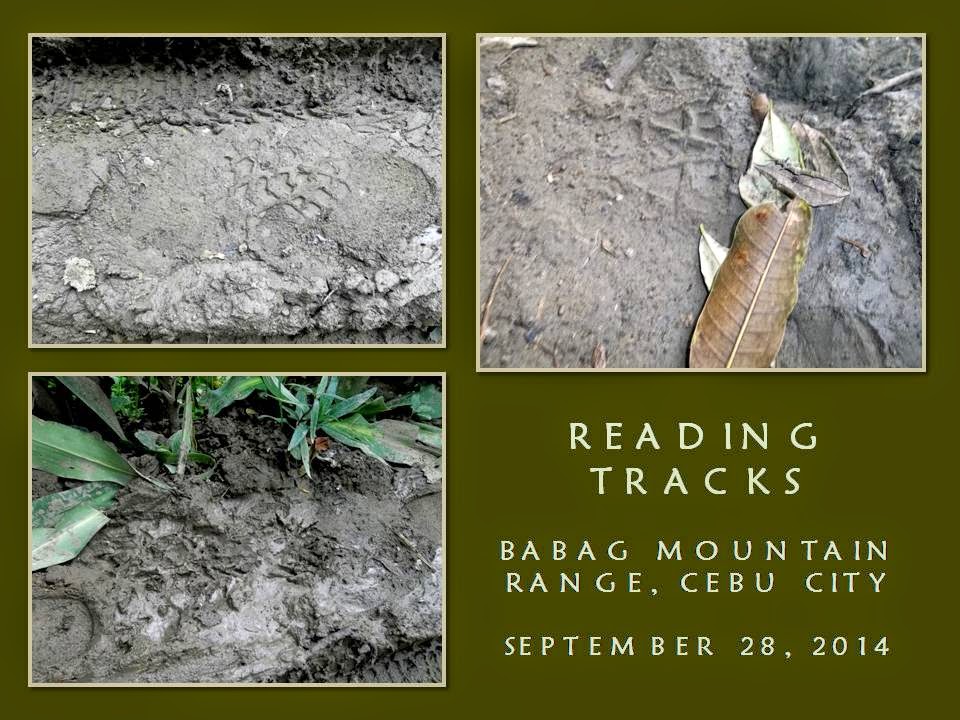
The ground is wet, parts of it muddy. In fact, a lot of soles are printed on trail surfaces. Leaving a shoe print is not wrong nor it violates a Leave No Trace Principle but, here at the Camp Red Bushcraft and Survival Guild, we take it to a higher level. Leaving a print on a wet ground is like leaving a thumbprint on glass; more of like introducing your personality to another person. What you leave behind could tell about you which you had never known yet.


I have something in mind today. I would take photographs of as many footprints as my camera battery would allow me and make a database about it. From there, I would let people guess and choose from the album of prints for a particular picture of a rubber sole. They would also guess the foot size, gender, build and other details like what caused a shoe to dig deep into the ground? They would have to create a story basing on the set of tracks they see.

I am not frustrated of my insane pursuit as the ground gave me many shoe prints to photograph which even a blind man could follow easily in the dark. My eyes were focused on the trail, especially at its wettest and muddiest part where I get to “know” of a lot of clumsy individuals. Most just superimposed their tracks of another while some make a half circle trying to evade the mud – too late and too soon.


As I was doing that a lone hiker joined me on the trail. He could either be amused at my activity or was just ashamed to ask. I do not know since he is behind me. When you do not ask, you would never elicit an answer from me, otherwise, do not wait for that chance wherein you would have to pay me to get one. Nevertheless, he enjoyed my tales of the outdoors and the special and uncanny features of the places where we passed.

We reach Lower Kahugan Spring and we take a short rest while waiting for my bottle to get filled by the natural spring. We resumed our walk and I follow a new route which had recently been opened to the mountain folks but only a few outsiders had known. On it are more shoe prints but, at least, these belonged to friends. Nature had worked in my favor of this so-called deduction process.

The heavy 5.11 Tactical Pants I wear today becomes a drag as the terrain gradient begins to demand more effort of self to attain progress. The bottles of vodka and lime juice inside the Silangan Predator Z backpack also begins to be felt on my shoulders. This business of hiking mountainous terrain could never be understood by sedentary urban folks yet, here I am, always complaining against myself why I am doing this, promising (and breaking), time and time again, never to engage on this again.


It never was easy to fool a person but I seemed to be enjoying this on myself. The brunt of the sun added to this stalemate of a promise and a renege but I am already on a spot called the “point of no return”. The wristwatch, an instrument that promotes the Western idea of time, begins to grab me by the neck and imposes on me to make more effort. I have to be there not later than noon because I had promised myself so.

At precisely 12:00, I reach the Roble homestead but my struggle to be here in so short a time had taken the fight out of me. I sat on the bamboo bench, catching wind, ignoring an invite of a sumptuous meal. Too soon. Too soon. Everybody had already settled on the blank spaces in between, especially Jhurds, Dominik Sepe, Mark Lepon and Maricel, who found a spot at a mango tree on a platform built above the ground.


Boy T, Boy Olmedo, Ernie Salomon and Ramon Corro are on the visitor’s shed, already in the middle of a round of the first bottle of local brandy. I ignore these spectacles and concentrate to listen instead to my body talking. When I have settled, I begin to take fill my plate with milled corn, goat stew (calderetta), free-rein chicken (estofado) and diced pork (menudo). The food are meant for everybody. It is celebration time.

After I had taken my fill of the feast, I join the group on the visitor’s shed. Boy T is on a debate against the rest, defending his privilege to enjoy the outdoors with a little mix of liquor but the rest found on the other part of the shed are against it. I added my voice to defend Boy T but the rest, in jest, rebuke Boy T with a “board resolution” passed by the “Board of Directors” disallowing him to enjoy this privilege. I could only shake my head and smiled in agreement.

After I had disentangled myself from the raucous crowd in the shed, I make busy with my camera again taking photographs of rubber soles to add to my database album. From these soles, I would challenge my adherents to identify the footprints in which it was made. Well, that is advanced trailcraft for you and it would certainly add to your knowledge and, perhaps, you might even use this skill in another situation. Who knows?

Anyway, by 14:30, we leave the Roble homestead. Boy T cut short his drinking binge in accord with the “board resolution” and everybody is happy. Laughing. Sweat begins to bleed from our skin as the afternoon sun creates a very humid condition. We arrive at Napo at 15:15 and wait for our ride back to Guadalupe. We got that and continue our celebration at Boy T’s favorite watering hole in M. Velez Street.


Document done in LibreOffice 3.3 Writer

Tuesday, May 5, 2015

BUSHCRAFT BUHISAN XXIX: The Last Visit

TROPICAL STORM LUIS is hitting landfall today, September 14, 2014, in Luzon, and it had brought great volumes of rain for the past days here in Cebu. It had rained at dawn and I do not mind if it will also rain on my scheduled activity this early morning. I am at Tisa eating bread with coffee and I wait for Bogs Belga, Dominik Sepe and Mark Lepon to arrive. All came early. Very good!

When we had secured ingredients for our noontime meal, we left Katipunan Street and proceed to Riva Ridge Subdivision where there is a road that led to the trailhead of Freedom Trail. Freedom Trail is the route which I had pioneered in 2009 that traverse Tisa Hills, Banawa Hills, some fringes of the Buhisan Watershed Area, Baksan, Arcos Hills, Sapangdaku with terminus at Mount Babag. It was used during Freedom Climb 2009 and again in FC 2010.


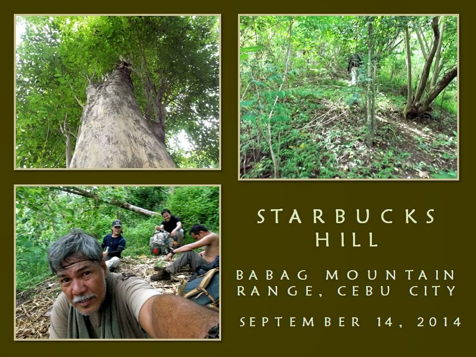
I had last used this route in April 2011 (BUSHCRAFT BUHISAN 7: Training the Pulag-bound) during an endurance training for members of Tribu Dumagsa Mountaineers who were preparing for a climb to Mount Pulag. In that hike, we passed by Kilat Spring and Starbucks Hill, before finishing it at Napo. Today, I will follow that route and, hopefully, scale again the fabled Starbucks Hill.

We reach the trailhead. The ground is wet, dews adhered to the blades of strikingly-green green grasses. Overhead are rainclouds while a strong breeze blew in from the southwest. Rain is ominous but I do not mind. In fact, I welcome it. I reach a sentry post and I retrieve my Chipaway Cutlery Bowie knife from my Silangan Predator Z bag so I could open carry it below my waist.

When you are with a Camp Red Bushcraft and Survival Guild activity you can relish that freedom of carrying a knife openly. It is a privilege that might had been denied to you when you are with another set of people but, here in Camp Red, we ensure you that you will enjoy that right. Along the way you will learn what is the wisdom behind the carrying of knives. For that matter, outdoorsmen of tougher character begins to seek our company.

When we had crossed a cleavage, I begin a practical lecture about tracking while walking along the trail. Since we are on hard ground, tracks are invisible and impossible to read but by touching the surfaces of stones, you will know if people pass by here recently or not. There are two different techniques for that: one for the dry season and another one for a rainy day.


I intentionally brought them to a different trail and, forced to find the correct trail, we took an animal trail, hoping we could find a perfect footprint, which we did, on a farm. Seeing a deep imprint, I touched the ground if it is soft or hard. When I found that it is neither, I explained to them about the gender of the foot that made it; the rough estimate of time that the footprint was made; approximate build and height of the owner; and the possibility that the owner is carrying a heavy load or not.

We cross an open field until we come upon Freedom Trail again. Rainclouds are a blessing when taking this trail since it is really warm and sunny here. Then I thought of the many who have planned an activity for today at any place outdoors but decided not to push through because of Typhoon Luis, of this inclement weather, of muddy trails and of getting wet. I sneered at that attitude. Most of these people loved to use the word “adventure”.

I reach the mango tree on a high saddle and I shift to Kilat Trail. I will again be reunited with the natural spring of Kilat. I found this place while hiking and exploring alone in September 2010. Although locals visit here often to source their water needs, it was unknown to conventional hikers until I brought a few here but these returned and brought more of their kind. The natural spring gave them an option to rehydrate and replenish.


Water poured out of the ground when lightning struck the place many years ago. A burnt stump of an antipolo tree (sp. Artocarpus blancoi L.) stands as a mute reminder while a fig tree growing over the hole nurture its sweetness. Today, I met a man while going down there. We exchanged conversations and I was alarmed when he told me that people from the nearby abomination called Monterazzas de Cebu, conducted a survey there.

That could only mean that they aimed to claim the rest of the Banawa Hills and deny people access to Kilat Spring or, for that matter, claim Kilat Spring for themselves. Behind their palaces and mansions is a watershed area that had provided drinking water to the poorest quarters of Metro Cebu. The government should know that developments adjacent to watersheds are regulated, even prohibited, depending upon its vulnerability. I believed I smelled dead rats somewhere in the offices of the DENR and the Cebu City Government.

I reach Kilat Spring and I see people washing their clothes while the children help their parents with the laundry. I gave away my sweet buns to the children while we stayed for a while to boil water for coffee. Dom and I forage dry firewood and natural tinder, which are rare because everything is wet. It does not matter but we have to try and we did make a small fire just enough to boil water good for four people.

Satisfied with our coffee and after filling up our extra bottles, we left the place going by way to the Portal. The trail is excellent and it is thick with vegetation. Beside the trail is a path hacked for a tree planting project. Each stick marks where a young tree is planted. I reach a point on the trail that I came to get lost often. Today I know where I am going. The sticks told me so. Easy!

When I got past that, I pass by the section where upland marsh palms (saksak) grew abundantly. The palms are flowering and in bloom and nobody had harnessed their saps, which would usually pour out from a flower petiole when cut, that can be used as a strong drink (tapuy) or into vinegar. It only shows that some essential primitive-living skills are not anymore available to the present generation. Why not do the harvesting myself? Hmm...why not?


When we reach the Portal, we rest. It is 10:30. I am eyeing Lensa Trail today and it would lead me to Starbucks Hill. I hope. Last time, after I scaled the small peak (BUSHCRAFT BUHISAN 12: Circles), I got lost when I followed a wrong ridge for an exit route and dumped me and the rest instead on a small but suffocatingly-hot valley. Ultimately, I was able to extricate my companions from that place by following a set of scant tracks on a trail-less terrain. That was in April 2012.

Abundance of rain for several months have thickened the vegetation and the trail looks gloomy. I do not fear snakes for snakes are lazy creatures themselves during a cold rainy day. My worry is the soft ground and the harmful plants that grow along the route. The ground is almost covered by thick bushes and long grasses now and I have to pay attention closely of deceiving paths that led you to nowhere but disappointments.

I do not want to waste time going back and forth borne out of overconfidence and reading the wrong path. I need to be sure where I am going. Somewhere along the path is a small palm that marked a fork of a trail. The left branch would lead to Banica Creek while the other would follow the contour of the terrain. I would make it sure that I will not miss the plant. I follow the right route going into a very long bend until I see a mango tree.

Mango trees are quite rare in Buhisan, especially at its wildest parts. We may have to stay here for a while since it is already 11:00, just about right to prepare a meal. Underneath is a rare clearing and almost flat. It had been visited recently by people. I retrieve the pork, my AJF Folding Trivet and my sooth-blackened pots from my bag. Dominik and I forage again dry firewood. We got only a few dry ones.

Dominik begins to slice the pork with his Hemvarnet knife. Bogs and Mark helped him by slicing the other ingredients with their Mora and Seseblades, respectively. I explore the place and some bushes had recently been cut. I secured three long sticks and a vine and brought it back to the resting place. Dom had already started a fire. A pot is placed over the fire iron. It will be used to cook braised pork.


I prop a tripod over it where the bigger pot containing rice would be hanged beside the first. Only one fire will cook our food inside the two pots simultaneously since we do not have plenty of dry firewood. One pot is placed directly above the flame while the heat carried by the breeze will do the cooking of the second pot that is hanged. Bushcraft is like that. Full of improvisations. Quick to adapt to any situation.

We had our lunch at 12:30. Bogs had added a dish of sliced raw cucumber in vinegar to the fray. It is a simple meal. The braised pork is excellently prepared. I believed we had taken many refills that the bottoms of the pots are scraped clean. We have extra water to clean the pots and to boil some for tea. We revived the fire and burn small scraps of garbage and, when finished with that, we thoroughly put it out.

After repacking our things, we resume at 13:20. The trail really is difficult to follow since the time we left the Portal hours ago. It is now covered with so much vegetation. I arrive at another trail fork. One goes down while the other goes up. I remembered I had taken an ascending trail and so I took this trail. A small snake instantly move away upon noticing my presence. I advised everyone to be a alert.

It is a long ascent and I could not believe, after that, I come upon a house with barking dogs. It is not supposed be there or I may have missed a trail again. I see clusters of houses below us and I take a trail instead leading to a nearby ridge. That ridge is good and well covered. One could camp here without being noticed and would have been a perfect place were it not for the nearness of houses. The trail ended abruptly. I look for other paths but found none so I go back to the lone house and then down to the community.

It is a very secluded community and it is the first time I have visited this place. I asked a man for the name of this place and he said it belonged to Baksan. He pointed me to a route going to the road but I have other things in mind. I need to visit again Starbucks Hill and I asked instead another route to the Buhisan, apart from the route that we had just came from. He pointed a path. I gave thanks and we are still in the game.

When I arrive at the branch of a trail, I followed it and it goes on a long stretch of soft ground. I remembered this route now. It pass by a huge rosewood tree, standing straight to the sky, and everyone are amazed when all see it. The soft ground gave us difficult footing. We rely on our hands, grabbing at anything to keep our balance and to keep us from slipping down. We pass by a patch of broken rocks. Loosening one might trigger the whole hillside to slide down so we chose where we step.

It is silent save for the singing of the cicadas. It never rained but drops of moisture from leaves fall from time to time. Our clothes are wet because of that. The path is wet. The ground gave in to weight. It is a very tiring walk. Mark found a rusting empty shell of a Garand rifle and kept it as a souvenir. We persevered until we reach a ridge. The ridge goes down to a saddle. I stood looking at the familiar back of another ridge – Starbucks Hill.


The rest are exhausted and all sat on dead poles like I did. Infront of them is the fabled peak! It is still 14:30. Is this really Starbucks Hill? Dominik, who was in that hike of April 2011 (BUSHCRAFT BUHISAN 7: Training the Pulag-bound), remembered. I do not know, but there is something amiss. I looked around the saddle, at the tamarind trees and at the peak. There is something that I have noticed as odd but I cannot recall what is that.

Anyway, I urge the rest to move because, after that, it would all be ridges that end near a road. I had never expected that there is now a well-used trail leading to the peak nor I had expected to move easily upward. This is something new on Starbucks Hill. I reach the top in less time than I had expected it to be. The breeze is always cool here. It cooled my superheated body and so for the rest.

I need to find that huge tamarind tree where the “coffee bar” is located. When I had visited here the first time (BEBUT’S TRAIL 5: Starbucks Point), I was with Ernie Salomon, Boy Toledo and Glenn Domingo. We brewed coffee here – under that big tamarind tree – and that is why this place is called Starbucks Hill. It is a special place. A good place to rest from the noontime sun for breeze coming in from the sea are plentiful here.

I am very careful now, intending not to be misled just like the last time. My mind says “RIGHT” all the time, always keeping to the rightmost path if ever there are trail forks. I saw none, much more so the “coffee bar”. Strange. I am now following a descending trail and re-tracing it back to the ridge is now daunting since I covered a lot of ground already. I looked for signs. Somebody just left a bundle of freshly-cut fish-tail palm leaves.

I see black seeds of a zingiber plant on the ground. It is not scattered but grouped like a mound. A Malayan palm civet left it long ago as its dropping but it is now very dry and very light. I thought I heard a rustling of dry leaves on the ground. Might be the rest of the guys coming down after me. As I walk down a few meters, something moved far from my right and it created a lot of ruckus. A sizable snake is fleeing away in a frenzy.

The path I took led me to a stream. It is Lensa Creek all right. The one that supplies water to the catchment basin and then to the dam of Buhisan. We have walked very far and I cannot explain why I am again dumped on another exit. I will have to follow the course of the creek upstream instead, intending to reach Camp Damazo thence to Lanipao and Napo, but it is still a long way. It is now 15:15 and too few hours of daylight. Then I saw a shoeprint on a sandbar.

The shoe is threaded. This is interesting. I called everyone to study the print and asked of their opinions. Dom says it is a hiking shoe and it is going upstream. Very well. Let us see if the rest of the tracks just ahead weave a different tale. A woman may have left this considering that it is a narrow shoe and small. About size 7. We found the same tracks but I found one unusual print. The heel dug in deep. It is made by a rubber boot. It is not made by a hiker but by a local and it has a dog for its companion.

While doing all this walking on the streambed, I chose to step on boulders. When we walk on forested ground, I chose the stones and roots instead of stepping on the wet path. I deliberately show them my walking habits even to the extent of going back to a shoeprint I intentionally left and wiping it away. This is done to leave no trace of my passing and from being observed by another person. It is not related to the Leave No Trace, but a skill taught to me by grandpa when I was a kid. Ages before LNT was born.

The stream gave in to forest then stream again. Another set of shoeprints – I mean, bootprints – are discovered by us. It goes downstream. Why? Because a pebble was dislodged from its hole when the foot stepped above it and moved an inch downstream. It belonged to a man. Why? Because it is size 9 and the imprint is deeper than the first set of tracks we saw. Up ahead, I saw the twin logs and I am near. We walk on until we reach Creek Bravo.

Mark and Bogs are now suffering from cramps. Walking on a streambed is very taxing and would stretch some of your leg muscles because you will be using a different set of muscle tissues that is different from those you normally use on a trail. Camp Damazo is on a high ground and it would be difficult for them. We may have to rest more often and they would have to rehydrate more often. It is a slow process going to Camp Damazo and daylight is losing its brightness.

We reach Camp Damazo. We rest again. It is 16:15. Just a little more and we will be on Baksan Road. I walked with Bogs while Dominik accompanied Mark. Our distances lengthened. I reach the road at 17:00 and waited for Dominik and Mark. They came at 17:20. The trail to Lanipao is now easy as it is all downhill. We use LED torches when darkness overtook us. We took cold refreshments at Lanipao at 18:30.

Our last engagement is Napo. We reach it at 19:00. Motorcycles-for-hire whisk us one by one to Guadalupe. Lessons were learned during the hike and these hardy individuals that I am with had came out of that difficulties smarter and better. For me, it was my last tryst into Starbucks Hill by way of Lensa Trail. From hereon, it shall be a “Holy Grail” to any bushman worth his salt who seeks it.

Note: For a purpose, I never document some of my routes with GPS or given grid coordinates and, lacking that, it ups the ante for adventure.


Document done in LibreOffice 3.3 Writer
Some photos courtesy of Mark Lepon