Thursday, May 16, 2013
NAPO TO BABAG TALES LIX: Reunion With an Old Trail
I
NEED TO KEEP FIT before I will embark Segment III of the Cebu
Highlands Trail Project come May. There is a new route within the
Babag Mountain Range which I have discovered last January and would
be adequate to fulfill as a training ground and I may have to do some
exploring to reach a ridge which was denied to me that time.
So,
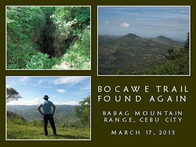
on March 17, 2013, I went to Guadalupe Church to wait for Ernie
Salomon and a couple of guys for this but only Ernie is present and,
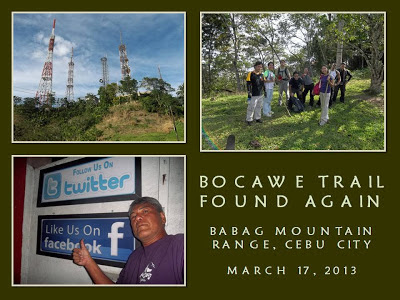
later, Mr. Bogs. Eli Bryn Tambiga appeared with five others. They
were supposed to climb Mount Babag but Eli Bryn thinks he could bring
satisfaction to his group by joining us.
After
securing our food provisions, we leave for Napo at 8:10 AM. We cross
Sapangdaku Creek and walk the trail towards the trailhead for this
new route. Last time, I descend from Bocawe but, this time, I will
do the reverse under the heat of summer. This trail goes up to
Tagaytay which is a long ridge. A beautiful trail is found on its
back but, sadly, a dirt road has been opened to accommodate heavy
equipment for a series of power pylons under construction.
I
do not know the physical condition of Eli Bryn’s guests, especially
the three women, but I am consoled, by the fact, that all are
registered nurses volunteering with the local chapter of the
Philippine National Red Cross. My main concern is drinking water for
the group and there is no water source here except at the place of
Julio Caburnay three kilometers away with which place we will
prepare, cook and eat our lunch.
I
go slow when one of the nurses almost fainted. I need to use
available shades in between as resting places. The length of stay
would depend on the distance between shaded areas. The ridge is not
populated and there are no houses but there are mango, jackfruit,
soursop, pomelo, tamarind and lime trees. A lot of these bear ripe
fruit but we only take lime and a couple of pomelo.
The
sun deliver its brunt along the bare places where the dirt road
start. A bulldozer is parked precariously along the edge of a big
hole. Although it provide a little shade, I advise my people to stay
away from it else ground underneath it had lost its integrity and
might collapse due to weight. Rays of the sun bounced off the dirt
road and the rests are longer.
We
found an open shed for the absent construction workers and I decide
we make coffee to pep up our sagging spirit. The cool bamboo
flooring is a welcome respite and I come to know better the rest of
the party. Two of them are recent participants of an international
offroad triathlon in Liloan and that is why they have been
unaffected. Nearby is Liboron Trail that I used last time but I
remove that idea as it is quite dangerous for inexperienced hikers.
After
the coffee break we need to overcome the last rise instead and see
what is on the other side. We reach it in about five minutes and Eli
Bryn take a reading from his altimeter at 600 meters. The dirt road
wind its way down and join the Bocawe-Cabatbatan Road but following
it meant that I have to say goodbye to an exploration. Across me is
a high peak and looks formidable in the middle of the day. I heave a
sigh of good relief in finding no trail going up. Good riddance!
I
found a path at the right and it goes down, maybe, to that dangerous
trail which does not endear well to me at this time. I may have to
find another route that would go around this peak so I follow the
edge of a small gully and I found a rarely used trail which is now
covered with grass. It goes around the hill and out into a wide
meadow. The path disappears but I can understand now the gist of the
path’s direction as it goes straight into a barbed-wire fence.
I
squeeze into and in between the loose strands of the fence and I am
on the other side. Meanwhile, the others wait until I give them a
signal to come over. The other side of the fence is thickly wooded
with dense underbrush. My senses peak up to watch out for snakes and
toxic plants. This is is what I loved most – to read signs among
thick bushes and recover long-lost trails. I wind among vegetation
and intentionally step on the trunk of a small stinging tree to keep
it out of the way.
The
ghost trail goes down into another meadow and another low hill stare
across me. I saw a small saddle on the right and I walk towards it
for I know saddles are natural passes. When I’m done, I see the
part of Liboron Trail where it is not yet dangerous to tread and go
the other way towards Julio’s place which we reach at 12:00 noon.
Everyone needs a full drink of water, some shade, hot food and a good
rest.
I
softly retire after I have prepared and cooked milled corn. Ernie
take over and dispatch all food ingredients under his multi-tool
knife. Others help in the slicing of spices and vegetables as I just
listen to their conversations not far away with closed eyes and
unknowingly invite an unwelcome company of pesky black ants that make
my nap a come-and-go affair.
A
spoon is rapped on a cup signalling that food is cooked and ready for
the taking. I glance at my watch and it is 1:45 PM so I look for my
stainless steel cup and wooden spoon. Food cooked are chicken
sinigang, garbanzo beans and “shrimp paste special”. Ernie
prepared a dessert of raw cucumber and tomato. I prefer just chicken
soup with two refills before adding milled corn for my third refill
and some slices of cucumber.
Feeling
rejuvenated, I need to leave for Babag Ridge in the quickest time
possible as we have a few daylight hours left. Julio’s nephew give
me directions to reach the ridge by an ascending trail. We leave at
2:30 PM and the heat of the day is not felt here as cool breeze from
the sea are abundant at the higher level. I reach the edge of this
trail and it connect to another, much older, trail on the top of the
ridge itself. The altimeter said that we are now at 700 meters.
But
there is something familiar with this trail. I try to reorient my
memory with this trail and I begin to realize that this is the same
trail that I used as a training ground in 1993 and 1994. I would
start solo then from Buhisan with a fully weighted Habagat Venado
II and walk the whole day toward Upper Busay. Later, I did trail
running here. This is the same trail that I had been looking for a
long time when I returned hiking in 2008 after I have stopped
climbing mountains in the late ‘90s.
It
is like a homecoming. A reunion. The trail have now become wild as
was the last time I saw it. Vegetation have claimed the spaces and I
have never seen rattan palm trunks as thick as a man’s arm growing
here. Back then it was wider, wide enough for a mountain bike to
pass but this is better this way. I would rather have shoe prints
leaving mark on this ground than the rut of wheels.
I
follow the trail to Mt. Babag and I see the familiar view on the
other side of the mountain range that you don’t normally see
approaching from Napo. I have a good vantage point of the wide
Bonbon River Valley from here and, across, are Sinsin Ridge and the
Central Cebu Mountain Range. Rising north of Bonbon are the twin
peaks of Mount Pung-ol and Mount Sibugay, the latter being
erroneously referred to as either “Sirao Peak” or “Mount
Kang-irag”.
Too
many fences along this ridge have disoriented me no end and leave me
fatigued in mind and body, especially when finding a route. Because
of these fences some parts of the original trail have vanished or
were diverted and becomes unfamiliar to me. This is aggravated by,
the fact, that there are no water sources here. We reach the
shoulder of Mt. Babag at 4:00 PM and make no time for rest as our
urge for water plunge us to reach the Upper Kahugan Spring.
When
I reach the watering spot, the piping system had been dislodged and
the spring water from the ground is exposed to foreign matter and so
I skip it hoping to obtain drinking water at the Roble homestead
instead. I meet six climbers along the East Ridge Pass and they are
going to Babag Ridge until I reach the house at 4:45 PM. I wait for
the others to come but it would be a while because the trail is
bleached hot by the sun and the soil is loose making descent quite a
trouble.
When
all have arrived, we said goodbye to the Roble family and leave at
5:30 PM for Napo by way of Kahugan Trail. Nightfall overtake me at
Lower Kahugan Spring and one of the female nurses is having trouble
walking so I lend her my LED torch to aid her. I follow her until I
reach Napo at almost 7:00 PM. I wait for the others and dispatch
them all back to Guadalupe before I leave myself.
It
was a perfect day of toiling and training to make myself fit. It was
originally a solo affair but I decide to include all comers. All are
safe, did not suffer injuries and are satisfied of being at places in
a series of “firsts”. Lastly, I have finally found my old trail
which I thought had been converted into another road. It still
exists and is untamed. Now I know the mountain range much better
now.
Document
done in LibreOffice 3.3 Writer
Posted by
PinoyApache
at
17:08
![]()
Labels: Bocawe Trail, Cebu City, exploration, Mount Babag, Tagaytay Trail, training
Subscribe to:
Post Comments (Atom)


2 comments:
SIR, ask lang ko if ok ra magtrek without a guide in mt. babag.. thanks :)
Pwede ra Ma'am Flor. If gusto ka ug guide, please feel free to contact Manwel Roble at 09322968646. He is a local mountain resident and he is 15 years old. Whatever fee you would give him would surely help him in his studies.
~PinoyApache
Post a Comment