THIS
PASSION BY TEAM Adrenaline Romance of walking the entire length of Cebu, in
sub-segments, following in the wake of my epic Thruhike, which I did in 29 days
of January and February 2017, have set them afire. They had crossed over the
halfway mark of the Cebu Highlands Trail by finishing Segment V last May 24-25,
2019 and accumulated a thought-provoking 230.08 kilometers.
That
is already a bragging right in itself that is very difficult to equal by even accomplished
hikers, much more so, by their fellow bloggers. Gian Carlo and Sheila Mei, to
include their friend Apol, are in a different level right now and I could feel
the electricity running in their veins. They have adapted very well to the
rigors of the CHT and developed that certain toughness of the mind that I had
so recognized during my explorations of the routes.
I
was awakened by Gian Carlo calling me on an early morning of June 29, 2019. He,
Sheila Mei and Apol were already in the Cebu North Bus Terminal. It was a shock
for me since I always come first and, there, my client took the place of my
alarm which I set at 04:00. Daylight already carved the dawn sky! How could
that be? I take pride of always being the first to arrive. This time I was very
sloppy.
Anyway,
I arrived blushing at 05:35 to the trio and offered my profound excuses.
Without waiting for them to decide what would be next, I went straight to a
waiting bus that would take us to Carmen. We arrived there at 07:30 and found a
small eatery in the public market to take breakfast. We also bought extra food
for our lunch which our itinerary says 12:00 at Agsuwao, Catmon.
We
hired motorcycles to bring us up to Caurasan, Carmen, which travel took more
than an hour and, instantly, I set about my usual courtesy calls. The village
officials expected our coming and it took just a few minutes. Then I proceed to
the military detachment nearby and jotted the names of Sheila, Gian Carlo, Apol
and mine. The military wished us well and would be monitoring our progress.
We
left Caurasan at 09:20, by way of an unpaved road which were lined with flowering
indigenous trees of all shapes and sizes. The rugged road becomes half-concrete
prevalent on most found on most mountain villages of Cebu. It is just a set of
narrow concrete ribbons that could accommodate one set of four wheels one way
or a couple of motorcycles each going the other way.
I
walked point retrieving information from memory. The entirety of the CHT was
never created with the efficiency of a radionavigation system, which could have
produced waypoints, but by the quirks of traditional navigation. It was these
invisible routes that my memory tracked feverishly, sometimes placing a stress
on my brain, leaving me mentally exhausted at times.
When
I walked, I watched out for the familiar. If I had some doubts, then I would
consult the general directions of my compass. Since we were walking north, then
north shall be the judge, come what may. My compass, an analog Suuntu A30 – now
paired by a digital Casio Protrek sportswatch which I just used recently – had
never let me down.
Sometimes,
I would rely with common sense where terrain is concerned. I would never choose
a path that goes down, to my false security and comfort. On this moment, you
would be tempted to the drift of just going down and, by that time, too much
ground had been covered to offset an error. I would opt for higher ground
instead and abandon it when the terrain rolled in my favor.
I
saw a trail that branched out of this road and I followed it uphill. At first I
was in doubt but when it passes by a community, I began to like it since it
looked familiar. I began to like it more when the trail went around the back of
Mount Kapayas, whose peak is but a short detour for us if we choose to visit
it. I was now in my groove and sniffed the path like a bloodhound.
This
trail passed by swidden farms among forests and over beautiful meadows with
coconut trees that afford limited views of a remote valley which places I would
not want to be lost in. As I mentioned earlier, the drift of travel would
somehow lull you into complacency until such time that you discover you are way
off your general direction by several kilometers that rectifying it would need
a lot of effort and energy.
Both
Segment IV and VI, thirty-five and twenty years ago, was a mass base of a
political organization that was engaged in an armed struggle against the
military and the overthrow of the government. Because of its remoteness, dotted
with thick forests and so many hiding places, these places created a reputation
of its own. It became “no man’s land” to the detriment of the residents.
While
I recognized its latent risks, I came with good intentions. These beautiful
places cannot just live forever in their past. My introduction of adventure
tourism through the CHT, carefully whetted to only a few hikers as possible, is
meant to open up opportunities for these communities which difficulties caused
by hostilities and distrust have left them with little or no options.
Since
we had been walking for an hour, I picked a spot for rest, known by the locals
as Lantawan, where there is an abandoned shelter littered by broken shells of
cooked egg. It offered an unobstructed view of a valley and the hills across
which belonged to the municipality of Tuburan. We stayed here for fifteen
minutes and just enjoyed the landscape.
We
pursued the path once more with vigor, the trail now hugging the steep bulwarks
of Mt. Kapayas. For once, it crossed over a steep farm and went down from a
ridge grown with mahogany trees. Before me are two paths whose left fork I took
during the seventeenth day of my thruhike in February 2017 which could have led
me farther away from a path I fixed in my memory until a guardian angel led me
to the right trail.
This
time, I fixed it permanently. I took the right. The trail still hugged the
steep mountain but, no sooner, I espied a concrete path up ahead complete with
steel railings. Concrete pavements meant that motorcycles could now penetrate
these once remote parts and that is good even when outdoor purists disdained
the sight of it. It does not matter to me since it is made for walking just the
same.
I
was happy at this path concreting project. Imagine the many years the residents
have suffered from neglect of the government and the difficulties brought on by
a foreign ideology upon their communities? The sight of this path, from the
side of an adventure guide who relied on his memory for navigation, is
heavenly! Even if it goes up for around 400 meters!
We
arrived on a small plateau where there is a small community. I followed the
trail until we arrived at the house where I last slept in during my epic
thruhike. It belonged to the former village chief of Bongyas, Catmon, Mr. Soping
Branzuela. I gave him a certificate and left a loaf of bread as my appreciation
for his kindness and hospitality. Bread is something of a luxury in these
places.
Since
it is already 11:15, we decided to enjoy fifteen minute rest. Once done, we
followed a trail down to the village center. I was expecting millet grown on
their farms but I was in the wrong season. Only here and in a few adjoining
villages where millet is grown. What was grown instead were corn. We arrived at
the village center at 12:00 and decided to spend noonbreak here with cold soda
drinks.
At
exactly 13:15, we resumed our foot journey. There is another road with a set of
two narrow concrete pavements. It goes and it wind among farms, grassy meadows
and more beautiful landscapes. While it was warm at that hour, breeze were
plentiful and helped to our cause. There was not much traffic on the road
except for a few motorcycles.
At
a spot where there is a beautiful small valley, I point to Team Adrenaline
Romance the peak of Mt. Kapayas and its neighbor, Torre Peak, from a far
distance. They were amazed at the progress we made for just half a day. Sooner,
or tomorrow, this mountain would just be a speck just like the last time we saw
it from Balamban.
We
followed this half-paved road in the village of Agsuwao until it became
unpaved, then full concrete for a time and then asphalt that is in need of new topping.
A big concrete tablet showed that we are now in the village of Tabili, Catmon,
but it would still be a long way to our campsite. At 16:00, we arrived at the
home of the late village head, Mr. Danny Demana. His father-in-law replaced him
and we were expected.
I
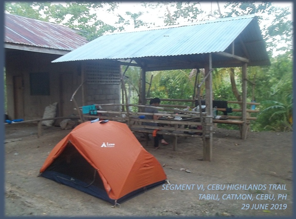
slept here twice: During the route exploration of Segment VI in February 2016,
the time I befriended Mr. Demana, and Day 18 of my thruhike. We occupied the
space at the back where there was a nursery, a shed and an outhouse. Both Apol
and I claimed the shed with its four posts for our hammocks while Sheila Mei
and Gian Carlo pitched their tent on open ground.
Team
Adrenaline Romance surprised me with a new aluminum pot. They were amused at
the pot I brought last time in Bangkito, Tuburan during Segment IV. It had a
hole which made the cooking of rice a lengthy task. This time, rice should be
cooked effortlessly; which it did with my Trangia alcohol burner; causing thin
streaks of soot to mark its bottom.
During
this time, we enjoyed tea served in small a ceramic kettle and cups which I
carried. After supper, we hit the deck at 19:30. It rained hard that night. The
roof above me had a leak and one line of drop fell on me. I had to shift
position so water would not hit me dead center. I refused to let the rain steal
away my sleep and sleep I had after a few wet moments of discomfort.
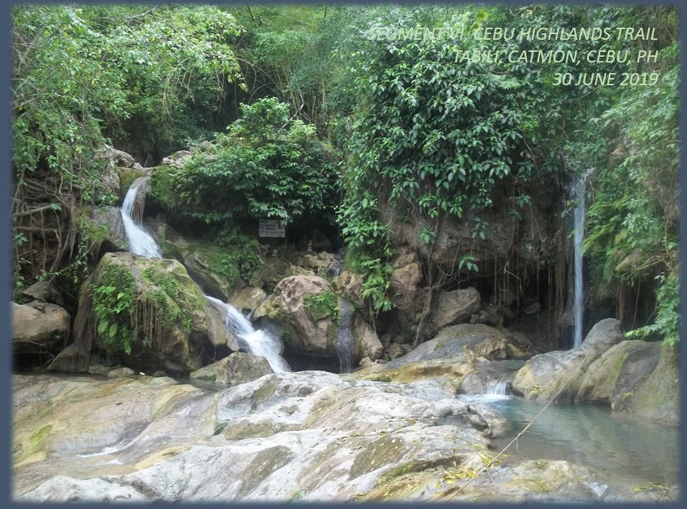
We
woke up early at 05:30 of September 30, 2019 and prepared ourselves an attire
for swimming. We visited the Tinubdan Waterfalls of Tabili, Catmon guided by the
teenaged son of the late Mr. Demana. We hopped on motorcycles for a short trip
to the trailhead and walked a short path to the bathing area. This has gained
popularity since it was featured in social media by vloggers.
After
an hour enjoying the coolness of an early morning bath in Tinubdan Waterfalls,
we returned to our campsite and prepared breakfast. After another round of tea
in style, we broke camp. By 08:00, we gave thanks to our host and proceed to a
stream that separates Catmon from Sogod. The stream is called Bawo Creek. The
day is cloudy but humid owing to last night’s rain.
After
a half hour of asphalt road, we took an unpaved road and, up to a certain
point, we took a trail that led us to the stream. It is a beautiful countryside
with orchards dotting the landscape. The water was not high and we crossed it
without having to remove shoes and socks. There were dry parts necessitating
just a little effort to leap over.
I
followed a path through head-high cornstalks until such time we were in open
places. I looked back from where we came from and it was a beautiful sight.
Farther away, Mt. Kapayas reduced in size to bigger than a speck and Team
Adrenaline Romance could still not believe that they placed so much distance
from it in a day. The trail has to climb over a ridge that now belonged to
Sogod.
Huffing
and puffing, we made it to the ridge. It was as if we climbed a mountain but
this was no mountain. It was a plateau of small Chocolate Hills-like mounds,
which were farmed by locals in delicate terraces. We were in the village of
Cabalawan, Sogod. Further ahead is the village center and the road. We followed
this dirt road and turned left on another dirt road at the first corner.
The
road went straight to a large hill planted with mangoes but bent to the left
and then to the right until we arrived at a bridge. Beyond this bridge was a
trail that traversed over farms and orchards and communities until we arrived
at an unnamed creek which I believed to be that of Putat River which spews out
its contents to the Tañon Strait.
We
crossed the stream without too much effort and crossed another tributary and we
followed another trail that led us to an asphalt pavement. Finding a store, we
decided to stop for noonbreak since it was already 11:15. The owner welcomed us
and we were allowed to cook rice, boil water for coffee, sit in the shade and
use the bathroom.
We
left at 12:30 after paying for what we consumed and our profound thanks for the
hospitality. The road was abandoned at this hour, the nearby Mangadlaw
Elementary School is devoid of children and teachers since it was a Sunday. The
road was lined by several communities and solitary houses. By 13:30, we took a
courtesy call on the village of Cabangahan, Sogod, scribbling our names on
their visitor’s log.
We
resumed our walk on a beautiful stretch of road which has limestone forests on
both sides and tell-tale signs of karst cave formations. This was an enjoyable
walk because, somewhere up ahead, lay the village of Bagakay, Sogod and their
well-kept secret, the Dau Cave, named after a large dau tree (English: Pacific walnut) growing near its entrance.
We
arrived there at 14:15 and made a courtesy call. The accommodating village
official offered to guide us to Dau Cave and they have taken considerable
effort to clear the vegetation at its approach. After the brief excursion, I
retrieved a certificate and bestowed it to the village of Bagakay in
appreciation for their assistance in completing the CHT and the success of the
Thruhike.
We
bade goodbye at 15:00 and proceed to walk the last kilometers of our journey.
Our destination is the village of Mohon, Sogod. On that place is a highway that
traversed northern Cebu from Borbon to Tabuelan. We need to be there before
dusk and hopefully catch a bus to Mandaue City.
Everyone
were suffering from fatigue; walking for hours even though we have enough rest;
and completely hydrated. The feet soles were complaining and during this
stretch we rest when we could. Although the day’s warmth was decreasing at that
hour, aided by shades of trees and hills, we were sweating very much. At 16:30,
exactly on the itinerary, we arrived at the road corner.
This
was just the first half of Segment VI and Team Adrenaline Romance chalked up an
additional 32.3 kilometers on their mileage, and upped their total to 262.11
kilometers. There was no rush and we made it exactly at what was stated in our
itinerary, except on the first day where we did not make it to Agsuwao, Catmon
for our noonbreak. This was an exception for I was late at the meetup area.
Please
stay tuned for more adventures of Team Adrenaline Romance in the next month as
they try to complete Segment VI by trailing this blogger to Ilihan, Tabogon.
How many kilometers would they add to their current total? Expect you to follow
their campaign and read Adrenaline
Adventure Hike: Segment VI-B. Make your presence felt by giving a comment.
Thank you!