
DAY TWO ::::: THE STRONG WINDS HAVE
MELLOWED down while the monotonous tap-tap of the rain on my canopy have lulled
me to laziness. It should be a cold morning but I am surprisingly warm. The
Therm-a-Rest insulated foam pad which was provided by Michael Schwarz for the
Thruhike have given me strange comfort which I have had not experienced
before. Indeed, I had a good night’s
sleep free of worries but I have to rise from the comfortable capsule of my
hammock.
I was amazed at our coverage of Day
One. We were not supposed to be camping
here at Monteverde, Samboan yesterday but somewhere down short of here. The first day adrenaline spurt might have to
do with that. Or that I intend to change
the itinerary. It is the latter but
adrenaline and, perhaps, capsules of multivitamins and Guarana may have
helped. Here, we have a good water
source and a perfect ground to set up hammocks and shelters.
It is 06:15 and I need to boil
water for coffee. Suddenly, my hands are
afire. Ants, known locally as “hakot”,
have invaded the nooks and crannies of my backpack where I stashed my rice and
everywhere on the ground and then my feet got stung and it was all over me
quick. They were working all night while
I had that hangtime. They were also on
my Park N Go bread. I gyrated to a
tuneless dance and dragged my bag far, slapped it hard and shook off the tiny
army.

I did have that coffee while
watching over my Trangia alcohol burner doing its work on rice. Jonathaniel Apurado, my buddy of this
Thruhike, is cooking Knorr soup on his alcohol burner. You might wonder how much food we carried for
this journey? We carried food good for
five days only, intending to replenish our supply at Mantalongon, Dalaguete on
Day Five, which would be on January 21, 2017.
We each carried a half kilo of rice, repacked in five plastic tubes weighing 100 grams each, and three packs each of Knorr flavored soups and another three
for Korean spicy noodles. Actually, I
carried more for insurance if ever Murphy’s Law imposes its will on the
Thruhike.
The warm Knorr soup mixed with warm
rice on a cold morning is wonderful. My
food plan are soup for breakfasts, baked goods and energy bars for lunch and
spicy noodles for dinners. When we get a
chance to pass by markets, we will change our diets but, basing on my food
plan, this would be rare and few. By
now, you would get the idea of our eating habits for a month. You know, planning the Thruhike is not
easy. You will have to study your
itinerary long and hard before making it final, careful enough not to
overestimate nor underestimate the distances between places found in maps. When you have the itinerary, planning your
meals are next.
The good thing about my itinerary
is I could change it if I wished it. I
can enjoy this privilege because I have explored these places in segments. Days One, Two, Three and Four are part of
Segment VIII which I had passed by last September 2016 but we did that starting
from Upper Beceril, Boljoon going down to Liloan, Santander and this Thruhike
is going on a reverse, which is kind of tricky on your planned pace because it
is uphill. But Day One was spectacular
because I changed it.
We leave the campsite at 08:15 just
in time when curious locals visited us.
The wind began to pick up its strength and rain lashed at us but we
still retained good manners to accommodate their questions and it turned out
well and good. One of those who came is
Dominador Rodriguez, and we met him last time when we passed by here. We followed him as we continue on our journey
today, January 18. Before I reached the
boundary of Oslob, I informed their police station about our presence and our
activity. I might not get that chance
for I know cellular phone signals ahead are absent.
I do not feel tired nor I feel
muscle pains from the labors of a forced march yesterday. The amount of time walking among mountains
done every Sunday for eight years have done wonders for my body and I have
adapted well. If this is to be a gauge
then the Thruhike is good as done! I
have trained myself well even before this epiphany happened in 2011 but the
greatest transformation is my mindset. I
might be older but I am better than when I was an invincible adventurer of the
‘80s and the ‘90s.
The trail passed by a well but we
have already secured water. We reach a
paved road. This same road goes down to
Tumalog waterfall and to the coasts of Oslob but the one we are following is
the unfinished Trans-Axial Highway which goes uphill. The scenery begins to change when you are on
higher elevations. Valleys, farms,
verdant hills, rocky cliffs and solitary huts dot the countrysides. A Brahminy kite flew from behind me to the
right and I take it as a good omen. I
tried hard to capture it with my camera but another one caught my attention as
it called me with its shrill whistle.
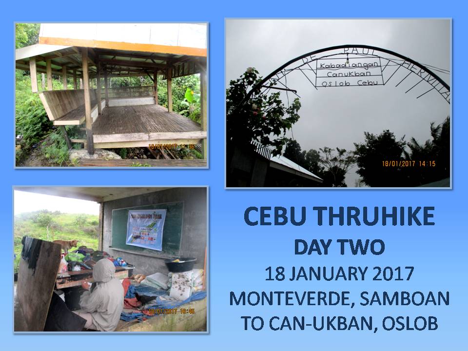
For the moment, there is no other
way to walk here but I see some shortcuts where it would bypass the pavements
and it goes through forest trails.
Actually, you would not know these until you see a long bend or a
hairpin turn and then you decide to explore a path which puts you on places
where you most wanted it to be. It goes
perfectly well on three of such places because I was certain it would. We reach Cañang, Oslob at 10:15 and rest at
its barangay hall to talk to a local.
Although the building gave us warmth and protection from the rain and
cold, we need to continue our walk and so have to leave this friendly
village.
The same road goes into more scenic
scenery of long deep valleys on either side, choked with trees and approached
by a series of low hills, farms and verdant meadows, landscapes which you would
not know existed in Cebu. The same
Brahminy kites that I saw a couple of hours ago appeared. By now, the weather turned mild with bit of
sunshine. We came upon a waiting shed at
11:25, at a place called Mohon, already part of Can-ukban, Oslob and we stopped
for noonbreak.
Since we were on higher ground, I
decide to test the Versa 2-Way VHF radio on selected frequencies for Cebu City,
Alcoy, Dalaguete and Argao. Both Jon and
I possessed amateur radio station licenses, being members of Ham Radio
Cebu. Cloudy weather, distance and
mountains forbid me to come in contact with these repeater stations. The rest is a good thing for it made me
appreciate this structure at closer range than the last time I passed by here.
Well rested, we leave Mohon at
13:00 in a cloud of light showers. The concrete road is in good condition as it
weave its way among hills and pocket forests which, to my mind, contain an
enormous number of avian species. From a
distance, you will see this same road climbing up through more elevations and
it would probably deter you when you walk it in another time. The wet weather brought by a Low Pressure
Area might have helped us in overcoming this obstacle but you will feel the
cold as you go higher.
We arrived too early at the place
where we are supposed to spend our second night, at 14:10, but it is pointless
to go on under this uncooperative weather to seek shelter on another
place. We will just have to take
advantage of the friendship we made with a couple who owned a concrete house
which is located just across the Vincent de Paul Hermitage. It is convenient for us to honor the
itinerary this time, just in time to see Miguel Aniñon grind ears of corn with
a millstone, which I caught in video.
We spend the rest of the day
unloading our things to dry it out, together with our bags. The hammocks were dry and that is the most
important thing. We do not have to worry
about the rain since we tied it on the concrete posts of an unfinished concrete
structure where there is a roof, although without walls, and owned by the
Aniñon Family. The location of their
house, together with the hermitage, are located on top of a peak and we are,
nevertheless, exposed to the spray of raindrops and cold wind. That night, strong gusts and heavy downpour
brought by the storm pelted our camp.
Distance Walked: 10.37 kilometers
Elevation Gained: 754 meters from a
low of 538 meters
DAY THREE ::::: THE COLD CREPT INTO
MY SIDES where the Therm-a-Rest had not clasped me as it gave way to weight of
body inside a hammock which had become soggy from the intermittent spray of
moisture. It was like that for the rest
of the night and, here, early in the morning of January 19, I begun to wiggle
out of my discomfort zone. Jon had
already started cooking the rice and boiled water for coffee on our alcohol
burners. The skies were still in a dour
mood and it was raining. The things that
we dried yesterday, remained moist.
Fr. Carlo Curacot of the Vincent de
Paul Hermitage came to pay us a visit after breakfast and asked of how are we
doing? After a while, he sent us warm
buttered pancakes and, finishing it, we set out on our journey to the
north. The ground was wet and slippery
but we decide to go against common sense by taking a steep shortcut downhill to
evade a long bend of concrete road. We realized it was difficult to stay erect
following this trail, more like a suicide mission, but we survived this
unscathed.

An unpaved road is nice but trails
are better. Only, the trails to our next
destination are in short supply. When
there is a shortcut, we took it and, most often, it is so muddy and
slippery. We stop by a small house with
so many family members at 09:50 on a boundary between Oslob and Ginatilan. A matriarch, Damiana Cariño, 72 years old and
bent to so much time working in the fields, talked about her predicament of
never receiving cash allocated to senior citizens from both towns. We advised her to focus on the town where she
is registered as a voter. That is where
most local funding is based on, of small towns where politics are so divisive.
Another shortcut brought us to
another stretch of unpaved road and a welcome sign says Manlum, Oslob and
another says Cansaloay, Oslob. Up ahead
would be a shallow well fed by a natural spring. It is a small marshy place and is one of the
headwaters of the Laguinsan River which wind its way to the coasts of
Oslob. A trail goes up to a bald hill
which goes up and up. The rains had not
abated, winds picked up strength as we gained elevation. Fogs obliterate the landscape, making
navigation a patchwork of guesses and tells.
Most of the time, I am caught
off-balance by the force of the wind.
The Therm-a-Rest is slung across my shoulder to the front of my body and
is the object of so much wind resistance so I have to clip it lee of the wind
with my left arm. Mt. Bandera would just
be around there beyond my vision obscured by fogs. As I go further, terrain which lay invisible
begun to show its earthly appearance, blurry humps at first then in great
details.
Now I am on the hump that is Mt.
Bandera and we stop for a while to send out another propagation test to a
repeater station of Ham Radio Cebu, found in the Babag Mountain Range of Cebu
City, a distance of about 118-120 kilometers.
I am testing a Versa Duo VHF Radio, with stock antenna and 5 watts
power. The first stream of
communications was received by station DY7EYN at 11:00 but was interrupted by
bad weather and cut short. The second
one at 11:30 went out seamlessly and acknowledged by station 4F7MHZ.
Satisfied by the results of the
worthiness of the Versa Duo in extreme weather conditions, we go down the trail
towards Tigib Spring, another source of the Laguinsan River. We arrive at 12:10 and enjoy our 50 minutes
of noonbreak under the onslaught of streaming winds and whipping rain. We munch on energy bar, biscuits, bread and
mixed trail food. I foraged ripe guavas
and sliced it in halves with my Buck Classic 112 knife.
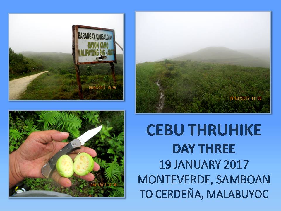
At exactly 13:00, we followed the
trail that would join with an unpaved road, which would become one with a paved
one, recently concreted. This road goes
on lazily uphill, twisting and bending forever towards the sky, passing by
either at Malabuyoc or at Boljoon, again and again. The good thing is the rain had abated for a while
and there are no fogs to block your view ahead although the wind still ruled
the higher elevations, especially at the most exposed areas. At this stage, I informed both the Malabuyoc
Police Station and the Boljoon Police Station of our presence in their area.
At a point where it is most
elevated, the road begins to twist and bend downward. Heavy rains have clogged up ditches with silt
and pebbles, on some points, carrying whole culverts down the mountainside. Landslides threaten a house below while
cracks on elevated ground above roads is something you would not want to happen
where people pass. I have not seen one
vehicle, not even the omnipresent motorcycles-for-hire. But there is life here. A boy rode the back of his carabao while a
noisy party of intoxicated locals just came out from a house where there is a
feast of some sort.
Schoolchildren walked their way
home from school and some of them run at the sight of us. Stories of child snatchers pervade everywhere
and we fit the description of big bags to stuff children inside. Cannot blame them for these places are indeed
lonely which a newly-opened road could not change immediately. In time, maybe they will get used to the
sight of a backpacker. I hope so. The Thruhike opens you to different local
cultures and different people who harbor different beliefs and, most of them,
are talkative enough to tickle you with their simplicity.
By now, the road is eerily empty
and silent. I found a copse of mahogany
trees which I have eyed before as a perfect camping site for hammocks. It is now 15:30 and I do not know if we would
get another opportunity to find a good place like this to camp up ahead. This is perfect, although it is just ten
meters away from the road. It is
slightly elevated, since we are at the shoulders of Mount Ablayan, and trees
are growing near each other that could hide several shelters. I got a light gray taffeta sheet and Jon has
a brown laminated nylon sheet. Both are
of neutral colors and we are good in stealth camping.
Immediately, I tied the
partly-moist hammock to separate trees to wick away moisture while I fixed over
it my wet taffeta shelter. Then I
removed all the things inside the bag to let it all dry, carefully storing the
food cache above the ground. I fixed the
drip lines at each end of the hammock in the event rain will come. Set up my Trangia alcohol burner at a spot
where I could comfortably sit, scratched the small ferro rod of an Advanced Pro
Fire Starter over the alcohol fumes and a fire erupted. So began my coffee moments.
I cooked the rice and then my first
supply of spicy Korean noodles. Jon
seems satisfied with his shelter but there is something different in him
today. He looks fatigued. Maybe the weight he carried. His bag is bigger than mine. We both expect an expedition type of activity
but I carried things that are necessary even though some have redundancy in
functions. I even left my metal cup,
preferring to savor coffee from the extra lid of my smallest pot. The only extra luggage I have is a selfie
stick.
But there is also something
different with my feet today. I felt a
soreness at each base of my big toes.
Walking with wet unbroken shoes and new socks since Day One might have rubbed
the skin of the big toes. The pair of
Jack Wolfskin fits just right but it would have been better if I broke it down
for a few days before engaging on the Thruhike.
Same with the Lorpen cotton socks which were provided by Viajero Outdoor
Centre at a special price. We are still
on the third day and I do not want some things putting a monkey wrench on the
Thruhike.
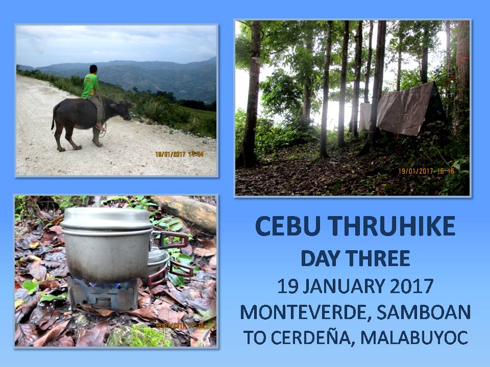
In my mind’s blueprint, I would use
the same socks and undershorts for four days and will change to new ones only
on the fifth day and the eighth day afterward for this southern leg. The Silangan Outdoor Equipment hiking pants
and shirt would be worn without spares for the whole of the Thruhike. I could only wash it, perhaps, in places
where there is an abundant supply of water but that is just about it. I cannot assure myself if I could take a bath
nor brush my teeth. I hanged my moist
jersey, hike pants and wet socks for drying.
Despite our efforts to camp
stealthily, I noticed schoolchildren running so fast on the road when they
passed by near our campsite and then sneak a glance at our direction. They have developed keen eyesight even at
hours where everything stood gray and they could distinguish something that is
not right. I may fool a mainstream hiker
but I cannot fool a mountain youth. I
toast my coffee lid, for want of a cup, to them. There is light rain yet we enjoyed supper at
18:00, while there is still light. Rain
and wind lashed back its fury during the middle of the night but I am warm even
half naked.
Distance Walked: 11.94 kilometers
Elevation Gained: 839 meters from a
low of 359 meters
Document done in LibreOffice
5.2 Writer





