WHEN
SOMEBODY IS SENDING you a long text message, you read it whole and do
not jump to conclusions. Do not assume you know the full context of
the message. If you do, you suffer inconveniences as well as
admitting that you are yourself stupid, with which word, in my own
case, I am fond of labelling at less-imaginative people. Oh, stupid
me.
That
happened for today, August 15, 2015. It is a Saturday and I am
supposed to be in the office working my butt for my bosses. I
requested to be absent from work at the last minute because I thought
this is the day that I am going to guide biology students to the
village of Sapangdaku. The biology class would pay me and it would
compensate much my absence. However, they reminded me TODAY that it
would be tomorrow!
I
am alone at the parking lot of the Our Lady of Guadalupe Parish. It
is 09:30 and I am in the middle of my boo-boo. I am thinking of how
I would spend the day instead. Going home is out of the topic. I am
at the gateway to the Babag Mountain Range and the mountains are
calling. I decide to do a solo hike instead to kill time. I shoot a
message to Ernie Salomon that today's activity is postponed.
I
am not carrying my usual items because the excursion with the biology
students assures me that I do not have to cook food. They would
carry pre-cooked food. Anyway, I decide to make today a training
activity for myself in preparation for a series of bushcraft camps at
the end of this month at Lilo-an, then probably in Luzon in September
and back again to Cebu in October and November.
What
I really worry about is the Segment IV of the Cebu Highlands Trail
Project come October. It is a long hike that will start from Mount
Manunggal over the rugged spine of the mid-north area to Carmen. I
need a lot of second wind to develop and, for that matter, the third
and fourth winds, if there would be such. Today would be a good
opportunity to engage in a survival hike.
When
I finished filling up my Nalgene from an automatic water dispenser,
Ernie arrived. He did not receive my message I sent a few minutes
ago. Oh well, I told him of my boo-boo and I have to postpone the
activity with the biology students because of their inavailability.
He decides to go with me, after all, the mountain trails are near.
He needs to train himself too because he had not been to the
mountains for sometime now.
Okay,
I buy five bread, four mooncakes and two sachets of 3-in-1 coffee.
There will be no cooking except boiling of water for coffee.
Fortunately, I have brought my Trangia alcohol burner with its
collapsible stand that is designed as a wind screen but I have no
alcohol. Ernie has. We are good to go now and I choose Bebut's
Trail because it is near and I am planning to visit again the fabled
Starbucks Hill.
It
is now 10:00 as I lead up the high steps of a concrete stair that
will also lead to the lowest ridge of the Guadalupe Hills. It is
very humid. There is mild sunlight and there is a promise of rain.
Clouds begin to block the heat and it is a good moment at this
tormentable hour to walk this bald hill which I had named as
“Heartbreak Ridge” for it caused heartbreak to a lot of people.
I
rest under the shade of a Jamaica cherry tree (Local name: aratiles,
mansanitas) and I place my AJF Gahum knife on my belt and an
olive-green meshed shawl on my head. Camera on the ready, I stalk
the path leading to the power pylon, the tunnel vent, the small farm
and beyond the ridge. The ground is wet since it rained early
morning with dews on the leaves.
The
rains had fattened the vegetation and stimulates growth of rare
plants like the elephant foot yam (pongapong) and the pepper
vine (buyo). Ernie is fascinated with my knowledge on plants
and he wanted me to find him purslane (olasiman) so he could
plant it in his small garden. I tried but I cannot find one which
left me wondering why since it is very common like a weed.
We
reach the place which I called as the Portal, which is really what
the locals called in its vernacular version - “ang Pultahan”.
For more than one hour we walked without stopping although we walked
at a normal pace. At the Portal we rehydrate and eat a mooncake
each. We engage a passing old couple with two empty 5-gallon bottles
to a conversation. They are going to Kilat Spring. I gave them date
seeds hoping they have better green thumbs than me.
I
look at the path going to Starbucks Hill and it is overgrown with
thick vegetation. According to the couple nobody goes that path
anymore. My audacious outlook melted when they said that and my
earlier plan to whack bushes got scuttled. I settled for an
alternative. There is still the only path of the seven found at the
Portal that I have had not walked. This trail goes up into an
unknown peak.
Once
I settled my backpack on my shoulders, there is no stopping. Ernie
follow behind me, adrenaline rising and ready for another opportunity
to explore places. Much of these hidden small places are now known
because of my daring and my drive to quench my adventurous spirit.
Nobody goes to these places because nobody wants to. Most outdoors
people do not have the penchant to search because they do not know
how. They like easy ones.
The
path is steep and slippery. Blame that to my now toothless 5.11
expedition shoes made worse by rain falling down and getting soaked
right up to my skin. The path disappears but I know where it goes
and it led to a small cassava farm. Who would have thought people
would plant something here unless there is a house nearby. More
walking led me to loose earth being dug up. I thought it at first as
another charcoal-making devise but I am wrong. It came from a hole
in the ground. Treasure hunters?
It
is deep enough but what could be hidden there? There is a horizontal
shaft but I have no appetite to find ghosts in tight places. There
must be somebody or some nearby house to engage in this earth-moving
stuff. I look at the other side of the path – it is well used. I
follow it and it goes upward until I reach the peak. There is a
cairn but behind it is an even bigger hole. This is big. What could
goad some people to dig big holes above a peak? I take a pinch of
earth dug from the hole and it says nothing. Not even a hint of
copper or iron. Yamashita again? Come on, give me a break!
We
rest here for a while and analyze everything. If it is an enlarged
cave then there must be something down there. There could be people
hiding from sunlight, I mean from the law. It could be a “safe
house”. I do not want to poke my nose on other people's business
just as long as they leave mine. I am alright with that. Somehow, I
have to continue my exploration of this route. A slight shower
begins to pour and that spurred me to move on.
It
is a well-used route. Meaning, people that worked on the small
cassava field or of the enlargement works on the two tunnels came
from here or passed by this stretch. Then a house. The same house
which I passed by on September 14, 2014 (BUSHCRAFT BUHISAN 29: The
Last Visit) during my relentless pursuit of re-discovering
Starbucks Hill. I am perplexed at this discovery of the same house.
Good thing it is occupied this time and I have answers to my
questions.
One
of the answers lead me to decide to cut this nascent exploration
short, which means, we have to go down the hill, pass by a community
and take the road back to Guadalupe. We reach the road alright but
we have to take shelter at an abandoned structure to sit out the
heavy rain and lightning that was now hurled from the skies. It is
12:30 and it might do us good to make hot coffee and eat the rest of
our bread. Kids came and we parted most of the bread to them. I
believe they needed it more than we do.
We
continue on our way down when
the lightning stopped
to the creek spillway and reach Guadalupe at 14:00. My feet are now
beginning to complain of the 5.11 shoes that I have been so proud to
own and use in
most of my adventure time starting January. It had seen good days
even in such a short time but it has to remain with me until such
time that
I have not found the means for its replacement or its “retirement”.
But
the meat of the day's disappointment was really the boo-boo I made.
MY
BODY IS NOT working at its best, yet I have given my word.
Regardless, I have to honor a walk in the woods today, June 28, 2015.
This is the first hike that I would take after two Sundays where I
gave myself a break. I needed to be back to the mountains right
after convening the fifth edition of the Philippine Independence
Bushcraft Camp that was hosted by the Municipality of Lilo-an, Cebu.
I
wake up at exactly 05:00 and begin the process of transferring the
things that I had arranged so well inside the Lifeguard USA rucksack
into the bigger Silangan Predator Z tactical bag. I start to sweat
as I was doing this although the morning is cooler than I had
expected because of the early rain. Having settled that after almost
an hour, I switch to the bathroom.
It
was a quick shower and, I noticed, I am still sweating.
Nevertheless, I change to my outdoor apparels and off I go into the
street. I arrive at Guadalupe and I am glad to see familiar faces.
They are all from the Camp Red Bushcraft and Survival Guild and four
of them had just finished the PIBC. It is a good opportunity for the
two of the four to see the environment reserved for bushcraft. The
real world, I mean.
I
also happen to see two new faces and three minors. My mind begins to
calculate the risks of the route in relation to a child's view. It
would be a long walk though but warmth would be out of the equation.
I may have to slow my pace then and talk a lot of things that may
catch interest to a child. It is a good idea to expose children more
often in the woodlands instead of being wired to an electrical
outlet.
The
first route will be Bebut's Trail. We climb up a series of high
steps to get there until we are onto a ridge that cant upwards
towards Banawa Hills. This meant we have to pass by that dreadful
“Heartbreak Ridge”, which is not dreadful at this moment since it
is going to rain. I hear whispers of thunder from somewhere beyond
the horizon and I see rain falling hard on Bohol Strait. It is very
far but the southwest winds (Local name: habagat) is pushing
it nearer to where I stood.
We
walk past the power pylon and take a rest at the tunnel vent
constructed by the Japanese during World War II. Those that visit
here the first time wondered at the tunnel's presence and asked about
its length. It is a piece of history and I hope that this
abomination called Monterazzas de Cebu would not touch this place
like those they recently done on the adjoining hills.
The
steady climbing towards the crest of the hill gave in to the steady
downhill into woodland which the first-timers have not thought of as
existing. Everybody, especially the kids, are sweating hard. Along
the way, I show different plants that are edible and those that are
harmful and gave meaning of why they joined. The density of greens
and the number of trees overwhelmed the young ones.
We
stop by a small community to study the hosting of an outreach event.
After ten minutes of talking with the locals, we proceed on to the
road at Baksan. The road, which links the village of Sapangdaku to
the villages of Pamutan, To-ong and Buhisan, is now concrete. We go
up the road and somewhere up ahead we will bury into the forest
again. The second route would be Lensa Trail.
The
trail is good and a better improvement than the last time I was here,
which was last March. That time, it was very warm and the vegetation
had wilted but I did it twice. We follow a small stream, which turn
out to be Creek Alpha. It now has running water and it leads to the
old Camp Damazo, the site of the first PIBC. It starts to rain but
not that strong. I guess the kids needs to rest and we stop to
prepare our meal.
Rain
had soaked dry wood and tinder. Finding dry ones under this
condition is quite tricky but the guys know where to find dry ones.
They learned that by joining the PIBC. Ernie Salomon, the veteran
camp cook, takes charge of the cooking. He asks people help and,
instantly, all lend their hands to assist him. A smoky fire begins
to appear while the food ingredients are getting processed for
cooking.
Another
set of guys begin digging a waterhole. It is dug on the stream bed.
The water go foggy but, in a little while, it will go clear. I line
the insides with pebbles. We will use the water later on for
washing. Meanwhile, boiled water is now ready for coffee. I get my
cup and proceed on to enjoy my coffee. Coffee never tastes better to
a man deprived of the urban comforts than in the outdoors. I wonder
why coffee companies do not exploit outdoor conditions in their
commercials? I am willing to model for them. Ha!
A
tripod is raised and a pot is hanged over the fire. Rice.
Conversations echo along the small stream as Ernie begins the
preparations of making spring rolls. Cooking oil are extensively
used to cook the rolls. Rain continues and people shield the cooking
and the fire with banana leaves. Jhurds Neo, forage small stems of
crawling bamboos (bokawe) and used these as skewers for sliced
pork. I believe there will be pork barbecue. The sweet aroma of
fatty oil teased my nostrils as it touched ember.
The
light rain causes much difficulty on the cooking. A tarpaulin
shelter is rigged to keep the young ones from the rain. By 14:00,
lunch is now ready. Fried spring rolls and pork barbecue are doubly
tasty when you eat it two hours after twelve noon. All partake of
the meal evenly. The children eat silently as the light rain numbed
the conversations to the background. It is typical jungle condition
made bearable by a good hot meal.
Slowly,
we clean up the place after packing all the gears that had been used.
We left the water hole as it is. I pick up my water bottle half
immersed in the stream. Water inside gets cooled and I drink some of
it before stowing it back to my rucksack. We will take the rest of
Lensa Trail and leave the old Camp Damazo. I lead them to this nice
path that had not been seen by people outside of my sphere. But I
doubt that.
A
lot of people read this blog. They would love to be in my shoes.
Who would not? I gave people inspiration by writing many articles
where the readers felt as if they were the ones engaging on these
activities themselves that I regularly wrote about. It wakes up the
adventurers and the explorers in them that they have thought long ago
that they are not capable of. I use my blog to compel people to
visit the mountains, make children happy, initiate charity and incite
locals to protect their environment.
However,
as much as I would like people to engage in the trails and places
that I always talked about, there are a few places that I wished they
would not try to visit. One such place is the one I called as “the
last wild place”. It has a name but I rather not mention it so
people would not go in there and hurt themselves or despoil its
environment, whichever. It does not mean that I do not trust your
education and your morals. It is just not meant for recreation and I
rather it stays that way.
We
reach Creek Bravo and we rest. The boy and the two girls are
affected by the rain and the humidity. The trail would be ascending
after here. I will have to go slow and engage them in conversations
to distract their feeling of discomforts. My conversations would
always touch on the plants and the most common birdcalls. When we
reach the top of a ridge, we rest. The kids are winded, tired and
seemed to want this activity over quickly.
We
follow the thickly-forested ridge to a hill and then another ridge to
a much-wider hill. Camp Damazo at last! Of course, I did not tell
the guests that it is. To those who started their love for
bushcraft, like Jhurds and Dominik Sepe in 2012, it is always a sweet
homecoming. Found this place in 2010, on the heels of a forced march
to civilization after a day of exploration where I was to choose four
trails running on four directions. I choose east...and here.
We
rest here, sitting where it is inviting to our flesh. Someone brings
out his alcohol stove and paired it with a pot of water.
Aha...coffee break! The magnet of interest has overtaken me and I
make ready my stainless-steel cup. The rain had ceased but it
invites live mosquitoes in its wake. One guy burns dry twigs and
smoke begins to chase mosquitoes away. For a good thirty minutes, we
just sat and talked and enjoyed our coffee.
Then
it is time to move. The kids had recovered slightly but there is
still a steep route that we need to climb at after crossing a small
stream. It is not that hard anymore for the kids for others carried
their things. All they do is to make sure that they do not slip. I
did. My 5.11 Tactical shoes had already seen the start of its ending
in a near future. I try to make do by timing my steps slowly on
surfaces which I think are slippery.
We
reach the road and the kids heave a sigh of relief. So it may be for
others that I have not had the opportunity to observe. Well, the
path across me is all downhill and so easy. Just make sure you do
not get chased by dogs since there are settlements along the way. It
is now 17:30 and Lanipao is just beyond.
MAP
READING IS a rather technical subject with understanding influenced
greatly by the magnetic needle of a compass and by your
interpretation of your surroundings into your map. I learned the
basics of map reading while with the Boy Scout movement in the ‘70s
under the tutelage of the best scoutmaster in the country - the late
Sergio Damazo Jr.; and progress into a much better navigator while in
Tanay, Rizal in the late ‘80s.
This
year – 2012 – is my first time to teach map reading to a group of
people and I thought it easy but it is not. It’s different when
you are the recipient of knowledge instead of the one giving it. All
my life had been used to receiving such valued instructions and I am
very grateful for all my very patient teachers. I am not trained to
be a teacher but, this time, I have to start acting like one --- even
for free!
I
did my first lecture about map reading on March 18, 2012 and nine
individuals from the different outdoors groups came. I held my
morning activity indoors at one of the abandoned buildings of the
Department of Agriculture compound in M. Velez Street, Guadalupe,
Cebu City. The afternoon segment was dedicated to the practicals at
the hills above Guadalupe and Banawa. Critique and review came
afterwards.
Aiming
to improve my manner of instructions, I scheduled another session for
April 29 at the same locations and I may have to accompany the
participants, especially during the actual part, so all could fully
absorb and understand the mechanics of reading a map in harmony with
the compass. Three participants of the previous class availed of
this free lecture while two first-timers join the rest.
I
start the instructions at 7:30 AM inside the room where a bare wall
with light blue paint became an improvised blackboard. Unhinged
doors propped up with wood crates were used as benches, improving the
classroom situation in a more relaxed manner. As usual, I have my
set of maps that will be used as instructional aids, my chalks, my
lecture handouts and photocopies of the city map under section
3721-I.
The
first order of lecture touched on the basic information found in the
topographic map and the rudiments of using a compass. Succeeding
instructions proceeded with how to use the grid lines; how to place
and identify land shapes into the locations found on a map; how to
orient the map with the compass; how to get a bearing and how to
interpret these bearings into your grid coordinates.
The
instructions move surprisingly very fast that, at 9:30 AM, it is over
for the indoor lecture. I doubt it very much that I have mastered
the art of teaching map reading to others but it is just simply that
I have a present set of students who absorb all what I taught like
water on sponge. I could not be more happy than to end this in
lesser time than what I have expected.
So,
we leave the DA Compound for the direction of Guadalupe church. We
may have to eat a meal – a brunch – to better prepare us for the
difficult part of the activity. By 10:30 AM, we start to head for
The Portal, by way of Bebut’s Trail. Along the way, we may also
have to tackle Heartbreak Ridge on a hot almost-noontime sun.
Walking up a hill with a map and compass presents a good combination
of brawn and brain exercise.
The
sun – the tormentor at Heartbreak Ridge – gave us a wide berth
and did not show face until we reach the treeline. In between, the
boys tried their best sighting azimuths on reference points and
drawing straight lines or the back azimuths on their test maps. One
such bearing was taken at the very place where there is a tunnel
vent. Participants are forbidden to use GPS.
Everybody
are instructed to locate three positions using the resection or
triangulation method; one location using a modified resection method;
and another location using dead reckoning. The last task requires
self to develop the skill to analyze and find your own position when
you run out of reference points to sight upon. All were up to the
challenge and manage to finish an imaginary short orienteering course
in less time.
We
leave The Portal at 12:30 noon bound for a small community where
there is a native version of a gazebo with a good supply of water.
One participant carried a camp stove, fuel and cook set. I remember
us buying sachets of instant coffee from a store and so we boil water
for that. After the coffee break, the participants took readings of
our present location as a bonus. It seems to me that they are hard
to stop when they start on to something.
We
leave the place at 1:30 PM, the participants fully assured that they
have complied with my map reading requirements. There is one more
task to do and it will commence an hour from now. We walk down the
road from Baksan to Sapangdaku crossing by a river spillway then on
to Guadalupe.
We
transfer to the Red Hours Convenience Store in M. Velez Street, just
across the old DA Compound, where I conduct critique and review of
the participants’ test maps over glasses of ice-cold beer. Over
these same glasses, I teach them how to plot and connect each
position and how to read their grid coordinates. At the end of the
day, my Grassroots Bushcraft Teaching Series about Map Reading
navigate itself to good waters.
NEED
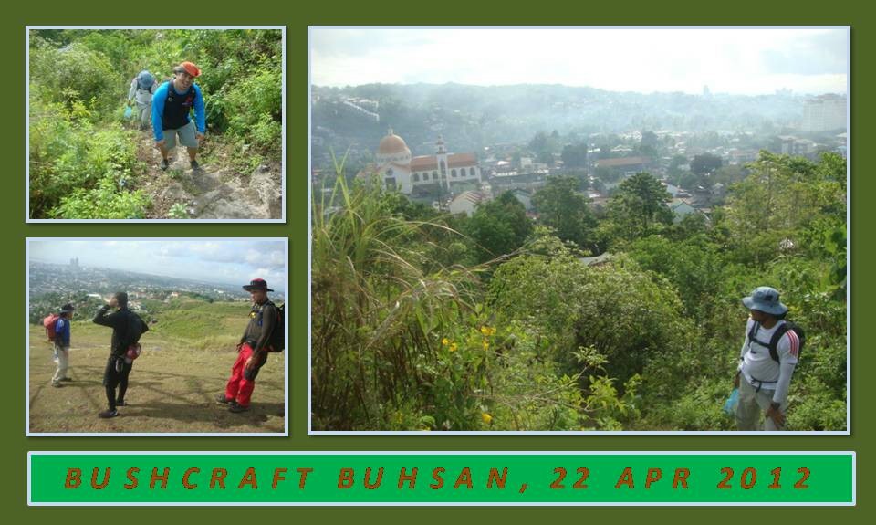
TO GO OUT to the wilderness of Buhisan and Baksan today, April 22,
2012. Camp Red needs also to exercise their domain of bushcraft and
survival by going on a foraging hike and doing a campsite location
and development. Got new guys with me, as well as old reliables
Silver Cue and Jhurds Neo.
Need
to teach the new bushmen traditional land navigation today. I am
going to re-visit my jungle wonderland and I am going to take
Dominikus Sepe, Glenn Abapo and Mr. Bogs in there. My first target
would be the place called The Portal. It had rained hard during dawn
and it made the ground wet. Such downpour in summer are rare and it
makes my foraging of dry fire tinder rarer still. So collecting dry
things are out of the question.
We
start from the south gate of Guadalupe church at 7:10 AM. I could
feel the draining heat of the sun at this early hour of the day at
Heartbreak Ridge. I could only imagine what the others might have
felt at this deceptive stretch. It is a gentle slope of 30-degrees
or more yet devoid of any vegetation. In summer, it is brown like
cocoa and dotted with black patches of burnt out grass.
We
walk over the highest hump of this serpentine-looking range of hills
scarred by a high-end housing project on the east that do more bad
than good to the lowland residents of Cebu City. Beyond that ugly
earth-moving activity and unseen from the urban areas are lush
vegetation that provide food and livelihood to the poor mountain
folks and thick stands of timber that is home to birds and other
living creatures.
This
private-capital urban-development project is dangerously close to the
Buhisan Watershed Area and, someday in less than twenty years, I
believe that more developments will intrude into lands classified as
timberland and where my only jungle wonderland in the city is found.
Along the route, I stop by to pick up leaves and buds from wild basil
that I may need later to season our noontime meal.
Once
I reach the enclave of trees, I could feel my energy returning. My
steaming body gets cooled and the silence is so soothing to the
spirit even when it is pierced by the constant chirping of birds. I
follow the path that I called Bebut’s Trail. The star apple tree I
photographed intentionally burned at its lower trunk by an unknown
firewood gatherer sometime in May 2010 to hasten its death have
finally succumbed. The limbs were now missing and only the dry trunk
remained and will soon be firewood.
Up
ahead, some person cut two big branches of an ancient tamarind tree.
Nearby is a charcoal pit where all the missing branches are found and
charred black. Summer heat always put a strain on farms and produce
and complicates a farmer’s livelihood where, most likely, he is
bound to cut trees to feed his family. I pass by a Spanish plum tree
and a copse of breadfruit trees and all are left untouched.
I
reach The Portal at 8:30 AM. This is a hub of seven trails and I let
everyone take rest and drink their water. After a short briefing, I
follow the rest of Bebut’s Trail. It is over a year since the last
time I passed by this path. I believe the previous year have
deposited a lot of rainwater as the greens have not wilted yet as
this is in the middle of summer although this season is one of the
hottest I have felt.
My
long absence from this part of the trail have taken a toll on me as I
miss the branch of the path that I usually take. I make a detour
when I notice I followed a different route and retrace myself back.
I looked for the stunted palm tree on the left that marked the branch
but it had grown long stems which I failed to notice. When I do
found the true path I estimate I have already wasted about ten
minutes of reconnoitering and of doubling back and forth. It would
have been longer if I have a larger party with me.
The
day turns hot and I’m sweating hard as well; my mind working
full-time to analyze, guess and second-guess this trail that have
become elusive to my eyes and feet. I am tired and I miss again the
route when I pass by an unfamiliar landmark and I have to stop and
recover my wits. I have heard of a sinkhole in Baksan but I have not
seen it until I became stupid.
I
found the sinkhole and it is dangerously so close along the path. It
has a squarish hole of about five feet by five feet and is quite deep
that I could not clearly see the bottom for fear of falling into it.
I see plastic and rubbish snagged among exposed roots of trees that
found its way into the sinkhole’s mouth. I shiver at the thought
of someone walking this part of the path in the dark.
I
take another trail hoping to make a circle and I assumed it did when
I reach another route crossing mine. I follow this trail until
persistence brought me to the second Portal at 9:20 AM but I just
lost fifteen minutes. Found deep in the forest, it is another hub of
six trails marked by three boulders. The presence of a tamarind tree
gives me assurance that it is a path that forest residents regularly
use when they go to Buhisan to forage and hunt. We use the shade and
the good ground clearing to rest and rehydrate.
I
found the trail behind the boulders and start to follow it when I
encountered another snag. The route seems to have been obscured now
by thick vegetation and I go back again to where I came from so I
could study the reference points and recollect hard. I lost another
ten minutes here trying to discern the route and I found it passing
by a decaying and stunted giant ipil tree and amongst spotted-leaf
agave plants.
The
grade of the path ascends onto a saddle and then follow the contours
of the mountain range, crossing several ravines, and it climb again
into another saddle and I stop to recover my breathing. Infront of
me is Starbucks Hill. I will climb it and make my coffee there.
This hill is sort of a fable among those whom have not gone with me
on my sorties here and all of my companions will, finally, have the
chance to scale her.
Thick
vegetation choked the lower ramparts but I go around it and squeeze
myself in between small clearings which I assume is a trail. My
judgment got better of me as I reach the crown and I am rewarded with
a cool breeze. Starbucks Hill is in the middle of a natural wind
channel as it is in between Mount Lanipao and Baksan Hills. Behind
Starbucks is a ridge that goes straight into Lanipao.
I
follow that ridge so I could make coffee at the “coffee bar” - a
small clearing underneath a huge tamarind tree. Since vegetation
have obscured so much of the trail, I , again, failed to follow the
true path. I am tired of making circles and retracing my route until
I pass by a knife-edged ridge and this is most scary. I just leave
it at that - following the wrong way - until I stop at a very small
valley at 11:30 AM.
Below
the shade of a teak tree, we claim a spot for rest. I am thirsty but
I control myself to drink indiscriminately as I need the rest of my
water for cooking and washing. I am just bringing one liter of water
and I have only consumed less than a tenth of that in four hours of
laborious hiking. I am the best in the field when talking about
water discipline and I intend to keep it that way no matter how
tempting.
I
boil water for coffee first to pep up our sagging stamina. I intend
to drink stronger coffee before proceeding with the business of
preparing our meal for lunch. Silver helped me with the preparation
of the mixed vegetables while I concentrated on the milled corn.
Meanwhile, Mr. Bogs produce some commercial pre-cooked food in
pouches which we heated.
It
is a respectable meal, and hot, and everyone take several servings of
milled corn and the viands. After the meal, we rest a few minutes
more to nurse back our strength which is more than enough. This
small valley leads to a dry watercourse which goes down into heavy
jungle and, probably, a stream. Lack of breeze make this place oven
hot.
We
leave at 1:30 PM. I follow a faint trail into a knoll. Behind the
knoll, the path becomes just a smudge on the ground that goes into an
almost-impenetrable vegetation. The footprints are devoid of
thread-like patterns describing that the man, whomever he may be, is
wearing rubber flip-flops. It follows a steep hill until I see a lot
of footprints everywhere going in circles.
I
follow a path that trod into difficult terrain and I am getting
confused until Silver gets my attention when he saw animal snares
just above of the very place where the footprints are going in
circles. I see four animal snares and, between them, are barriers.
The snare maker intends to catch his prey by channeling it into the
snares.
Two
meters away are two holes on the ground whose mouths showed signs of
use. What’s inside of those holes could either be the home of
monitor lizards, pythons, forest rodents or palm civets. I pass by
slowly across the snares, taking careful steps not to disturb the
triggers or the limb spring.
There
is another faint path going up and it connects to a discernible
trail. I need to gain height and I follow the ascending route into a
hill where a slight break from the forest offered me a view to
observe landmarks or the very form of the land contours. Onward is
more of high ground which might lead me back to Baksan but I noticed
a branch of a trail which I just passed by a few minutes back that
goes down into something familiar or some kind of terrain with
similar vegetation.
I
gambled on this trail and it lead to a stream which I crossed and
re-crossed and landed on Camp Damazo, the site of last year’s
Philippine Independence Bushcraft Camp (PIBC). After a delay of two
hours, I begin to start my search for another camp site for this
year’s PIBC. The day is late and I may have to discard campsite
development and stocking of firewood.
Crossing
another stream, I follow Lensa Trail uphill and found my new Camp
Damazo. The place is thick with straight-growing trees offering good
camp ground in between these. This is the best site and very far
from any riparian area and is abundant of firewood and tinder. I am
elated to have come across this place after seeing old remains of
fire on the ground on two sites. Further up ahead is a spring that
may supply the drinking needs of PIBC participants.
After
trekking for an hour, we reach the edge of the Baksan Forest Reserve.
There is a road going up to Pamutan or going down to Sapangdaku but
I prefer to follow across the trail to Lanipao Rainforest Resort.
This is mango country and I could see all the mango trees blossoming
with flowers. I spotted also star apple trees bearing fruits but
they were too high and with great effort we were able to bring down
one fruit which is very sweet.
Going
down further and further, we reach the resort. There are many guests
and we continue on a road to a store beside a dirt volleyball court.
The owner sells cold soda drinks but I prefer beer. After finishing
three big bottles of that, we push on for Napo and reach it at about
4:30 PM. We take a ride on motorcycles-for-hire for Guadalupe and
transfer to Red Hours where our post-activity discussions were set in
motion.
The
day is complete with the location of the new Camp Damazo and I may
need to explore further the areas around the site. I will need to
develop the periphery of the camp like the location of the latrines
and the campfire area and stock it of firewood and water. The
concrete preparation of PIBC MMXII goes on full steam with this
activity.
I HAVE BEEN LUSTILY eyeing the trail that lead down into the Buhisan Watershed Area everytime I passed by the Portal on my way to Napo. This trail came into my attention when I discovered a route starting from Guadalupe to Napo in Sapangdaku, all in Cebu City, during an exploration last January 10, 2010 which gave birth to Bebut's Trail.
And so, on May 2, 2010, I gathered enough courage to penetrate the thick jungle that have been acting like a wall to my camera's view finder screen. Ernie Salomon, a fellow bushcrafter, begged to come with me and I welcomed his company and expertise in the bush, as well. We both meet at the front parking lot of the Our Lady of Guadalupe de Cebu Parish at seven in the morning and took breakfast at the back of the church.
Afterwards, I bought pork meat, soy sauce, spice and 25 pesos worth of bread. I have with me two almost-empty butane cans for my stove, ¾ kilo of milled corn, chart and compass, extra shirt, lighter and safety matches, stainless-steel drinking cup and cooking pot, spoon-fork-knife set and my tomahawk. We will cook lunch in the watershed, God willing.
We tried a new route for the Guadalupe Hills which start from across the churchyard and hoping it will be a better route. It is a good route than the old one after all so, goodbye there “heartbreak ridge”. I passed by the tunnel area and parted the bread for the family of Ricky Flores. Ricky's wife could not hide her satisfaction as a meal for the children just dropped from out of nowhere. Sure, it is good for the heart to share something for those who have less in life.
We arrived at the Portal at nine and I checked my things in my day pack for the little details that I might have missed and, finding none, we went down into the jungle, with me in the lead. The route went down straight crossing into several dry water courses that will come alive during a rain. The ground was dry and leaves crackled as we stepped over it. I saw the remains of what used to be an animal trap and I warned Ernie to be careful else he will be caught into a live one.
I followed the trail bending and winding its way into the jungle and I saw several disturbances like an unearthed pebble caused by a shoe, broken twigs, leaves out of shape and lots of shoe prints on the earth. Possibly, there may have been people passing here recently in the opposite direction coming from below us and they have grabbed onto the branches and leaves for support.
I crossed over a dry brook where the trail pass by a large tree and crossed another dry brook and down into a place where two creeks meet, a place where there is a large rock where another large piece of it split years ago causing a concave depression on to the one left standing. It is a perfect bushcraft lab good for one. Water could be sourced from the dry creeks once it is filled during the rainy season. I know there are hibernating catfish and fresh-water shrimps from below the creek bed waiting for just the right time to surface.
A dry brook from across the large split rock fall four feet into the bigger creek causing a slight hole into where the water will fall and it is there where I will catch my food. It is a natural hole that will become a small pool populated soon by shrimps and land crabs and will attract predators like monitor lizards, pythons and palm civets.
In the meantime, the trail ended onto this place and I have to follow the dry creek downstream as my only option and it is not a pleasant idea walking along a creek or a stream bed. Meanwhile, my eyes scanned the green curtains on both sides for a break where there might be a hidden trail somewhere but I failed to find one and I have to contend myself as a walking “target” for imaginary bushwhackers.
Finally, I found a trail but it is a short one and ended into another place where two dry creeks converge into a bigger stream. Damn! Another stream bed to walk on and I saw two small stones piled over a rock to mark a route. Hmmm. Somebody or some people were here and, judging from the fresh tracks they left along the trail awhile ago, it must be one to two days old.
I walked on and found another trail above the creek and it followed the stream like a bee to a pollen until we reached a flat and wide expanse of land where head-high shrubs and tall trees grow. Here I could see the blue sky in a wide arc especially in the wide stream bed. The hair at the back of my neck stood as I feel someone is watching over us. This is a bird-hunting area. I just hope that this somebody is not looking at me in the cross-hairs of his scope.
I immediately leave the exposed area to a covered terrain and rested for a while and talked to Ernie about the possibility of getting hit by a crossfire from a hunting rifle if, and when, we walked into a sighted target or prey from far beyond. I remembered two guys in two separate incidents got hit camping near the dam site of the Buhisan Watershed Area in the '90s and after that people began to evade Buhisan for fear of getting shot.
I also remembered one night in 1993 when I was camping alone near the dam site, two people with a fire torch were looking for something in the forest. It dawned on me, at that time, that I was the one they were looking for, for they were looking at the place where a person last saw me unpacking my things from my backpack. Fortunately for me, I decided at the last instant to sleep on a hammock instead of inside a comfortable tent. I hitched my hammock up high in a large acacia tree and secured all my things above the ground, thus leaving no trace of my presence.
Buhisan is a dangerous place and is a safe haven to people running from the law. Although there is a law against bird hunting, nobody is enforcing it here. Worse, there are no forest wardens to look after the trees that are slowly being cut in the fringes and in the catchment basin itself. Buhisan is a man-made forest designed to support a watershed so it could provide drinking water for Cebu City residents in the 1920s until today although it could only provide a little over 15% of piped water to the present population.
In a while, I saw two men with hunting rifles moving about in the distance. Analyzing at the unknown hazards, we decided to camp out in the middle of the basin and prepared our lunch as it is already 11:30 AM. I unpacked my pork meat, milled corn, cooking pot and camping stove and heated water for the grain while Ernie sliced the onions, garlic and the pork into small cubes and marinated it in soy sauce and lime. I stood guard and practiced throwing my tomahawk on to a tree trunk.
At 15 past twelve noon, we ate lunch and finished off the last of the meals. We were that hungry! Ernie hinted how he missed a cold bottle of orange soda. Now, that makes two of us very thirsty. It is steaming hot in here and I decided to look for a huge shade where I could cool down and take a brief siesta.
I lay in the ground and listened to the earth throb with life. Above me, a cacophony of bird sounds lend a playful note to my ears and I feel drowsy and was about to wink an eye when I heard distant voices coming from the dam site. I saw another group of three men, each with scoped hunting rifles, going on their way to the catchment basin. They talked briefly with Ernie as they passed by and they were unaware of my presence for I was perfectly hidden even from Ernie himself.
We decided to leave the basin at 2:00 PM and cut short our exploration by going to the dam area where the trees and the ground are more tame and more familiar. I picked up three cut pieces of straight branches that were left in the ground by a wood gatherer. They make good material for my arrows that I will manufacture soon. The man-made lake is dry and devoid of life. When it is full, it is a large pond full of mudfish, tortoise, toads, frogs and fresh-water crabs.
We walked at the fringes of the lake and into the old man-made forest of mahogany, acacia and sargo seiz trees whose spaces among them have been hastily patched up by thorny rattan palms - the only plant strong enough to resist the unkind leaves of the mahogany tree. Saw a family of four eating a late lunch in the coolest shade of the forest before we meet again another group of three men armed with sets of rifle and scope and I thought I recognized the leader as someone who have had brushes with the law in the past.
We got out of the watershed and walked a little over the concrete road when a vacant motorcycle-for-hire offered us a seat which we gladly took and I thought again of that cold orange soda suggested by Ernie a long ways ago. It has become a realistic target.
CONCLUSION:
THE BUHISAN WATERSHED AREA is a protected zone under the protection of the Cebu Landscape Protection Act of 2008 authored by Honorable Eduardo Gullas of the First District of Cebu Province. Even so, people refused to observe a clear respect to the laws of the land and to the authorities through willful destruction of trees and wildlife feigning no other means of income and ignorance as a reason.
Granting by that premise, the Department of Environment and Natural Resources (DENR) in cooperation with the Metropolitan Cebu Water District (MCWD) should fork out funds to secure the watershed area from questionable intrusions and visitations with sturdy fences and patrolled now and then by armed forest guards to discourage the wanton felling and desecration of trees, the possession of hunting rifles within and the use of these weapons to hunt and kill birds and wildlife.
While it is not yet in the drawing board and, while the watershed is not off-limits yet to hikers and weekend campers, I think those that frequent the place should police their own ranks and limit the participation to not more than five persons so as to remove the disturbance made by the impact of hiking boots treading everywhere and to diminish the impact of introducing human wastes into the very ground where a part of Cebu's population source their drinking water.
Also, it is advised that visitors should wear bright and visible-colored clothing for easy recognizance by a hunter lying in wait from afar to preclude of being shot accidentally. It is always a risk when entering the watershed and the entering party should see to it that they make known their presence and they expect such risks.
IT IS THE MIDDLE of summer, April 18, 2010. The hillsides are brown and the creeks are dry. Camp Red, meanwhile, is in training mode. The mainstays – Boy Toledo, Ernie Salomon and I – are towing a trio of bushcrafter wanna-bes – Niño Dizon, Dave Uy and Brady Betonio. Tailing along is Wil Davies (aka Jungle Wil) of Jungle Wild Adventures.
The route is Bebut's Trail, a beautiful trail that I have discovered on January 10, 2010 that is perfect for bushcraft and survival activities. Along the route is a war-era tunnel, copses of fruit-bearing and softwood trees that grow along the edges of the Buhisan watershed and the Baksan forest reserve, a peak, a saddle, ridges and down into dried-up creeks that ends at Napo.
We took lunch beside a waterhole of the now-dry Sapangdaku River and the new guys listened earnestly to Jungle Wil, Boy T and Ernie about some bushcraft tips, use of camping equipment and food preparation. After the meal, everybody showed their blades for posterity.
Below are some of the images done in collage to illustrate the flow of the activity:
Finally, Jungle Wil bequeathed his large stainless-steel cup to Camp Red with a simple ceremony. The cup have been to so many campsites like the Himalayas, Patagonia, the Pyrenees, the Mojave Desert, the Appalachians and to so many crags in the UK, the Grand Canyon, the Rockies and in China before making Cebu its final home. Well, Camp Red is proud and honored to keep this “sacred” cup.
Document done in OpenOffice 2.1 Writer
Photo collage done in JPEG-converted MS Powerpoint 2007
FOLLOWING UP ON my February 28, 2010 complete exploration of the last stretch of Bebut's Trail, a route which start from the back of the Our Lady of Guadalupe de Cebu Parish that I discovered on January 10, I brought Boy Toledo, Ernie Salomon and Glen Domingo on May 21 to assess for themselves the condition of the route.
Glen D brought with him his coffee maker and we brewed coffee in a small upland community where we rested. It was black coffee and no sugar. Nevertheless, it pepped up the small party to tackle this route with more enthusiasm even under the extremely-hot summer morning.
We climbed an unnamed peak that gets in our way and Glen D suggested that it be named Starbucks Point, purely by accident and not through an unsolicited endorsement of a product. The rest of the story is told in ten collage of images:
...is about tropical bushcraft and survival and adventure travel. It will be a support hub for the outdoor activities of Camp Red Bushcraft and Survival Guild and the main bulletin for my own adventures. It is my conduit to promote bushcraft and survival in Cebu and the rest of the Philippine islands and will be the umbrella name that I will use when I conduct seminars and outdoor events.
Should you be interested to learn bushcraft & survival, or willing to join my adventures, please, feel free to email me at pinoyapache (at) yahoo (dot) com or contact me at +63 935 860 1460.
Three-day camping and skills learning workshop designed for outdoors people, responders, field workers, as part of extracurricular school programs, for the military and the police, character building for youths and for every other citizen.
BASIC TROPICAL BUSHCRAFT COURSE
Three-day camping and skills learning workshop designed for outdoors people who choose bushcraft and survival as a lifestyle.
URBAN SUBURBAN SURVIVAL BASICS
Two-day indoors seminar designed for urban survival enthusiasts, preppers, homesteaders, the military and the police, and situationally-active people with a few practical exercises.
CEBU HIGHLANDS TRAIL
Guided walk limited only to segment hiking with duration of 2 to 6 days. There are eight segments in the CHT. Hiking through the CHT can be arranged by extraordinary considerations.
CAMINO DE SANTIAGO OF CEBU, PHILIPPINES
Guided walk applicable for the 10-day Camino from Badian to Compostela; the 5-day Camino from Sogod to Compostela; and the 2-day Camino in Liloan-Compostela.
GUIDESHIPS & ADVENTURE TRAVEL
Guided hikes on popular and remote destinations within the island of Cebu and its satellite islands.
SPEAKING ENGAGEMENTS
Accepts invitations to speak before schools, organizations, clubs, events and companies on topics related and limited to my outdoors lifestyle and experiences.
PRODUCT TESTS & REVIEWS
Send me your products and goods for field tests in all my activities and events and get a review in return. I am also open for product ambassadorship and willing to grace events.
EXPLORATIONS & EXPEDITIONS
Would accept and assist to help organize, identify and guide through areas for scientific studies, school activities, sporting events and company ventures. Would also accept to finding routes over mountains for certain organizations.
Warrior Bulletin
CHRISTMAS UNITED 11
Balamban, Cebu
January 21-22, 2023.
SEGMENT 2, CEBU HIGHLANDS TRAIL
Toledo City to Barili, Cebu, PH
February 4-5, 2023.
BASIC WILDERNESS SURVIVAL COURSE
Bukidnon, PH
February 2023.
EVENT SECURITY MANAGEMENT
Cebu City, PH
March 6-10, 2023.
SEGMENT 3A, CEBU HIGHLANDS TRAIL
Barili to Argao, Cebu, PH
March 11-12, 2023.
SEGMENT 3B, CEBU HIGHLANDS TRAIL
Argao to Dalaguete, Cebu, PH
March 25-26, 2023.
PHILIPPINE INDEPENDENCE BUSHCRAFT CAMP
Liloan, Cebu, PH
June 10-12, 2023.
Google Search
Top 40 Bushcraft Blog
The only Filipino, Asian or blogger from a third world country to be in the list.
Badge of Recognition - FINALIST
Sports and Recreation, Bloggys 2015 Philippine Blogging Awards