Showing posts with label Freedom Trail. Show all posts

Tuesday, September 1, 2015

NAPO TO BABAG TALES LC: The Team Finals

FROM NINE PEOPLE WHOM I had invited to join my selection in establishing a team to explore the route for Segment III of my Cebu Highlands Trail Project, five made themselves available for the challenge last January 4, 2015. It was a tryout of sort and I was considering the five to be on the team, in one way or another, but I need only two slots.

It was a moderate route that tackled Tagaytay Ridge head on from Sapangdaku Creek and then taking a long loop, tiptoeing over Babag Ridge and down again to Sapangdaku Creek until we ended the day at the trailhead in Napo. The rain that had caused trails to go muddy, soft and slippery, made it more hard. All persevered and made my selection for the team difficult and complicated.

Today, January 11, 2015, however, will be different. I would be expecting four of the five to be at the meeting place in Tisa. The fifth candidate would be in a foot race and would not be available at Tisa but I considered the absence justifiable. On the other hand, only two candidates physically came. Well and good! That would make my selection easier now. Even before this day’s hike would commence, the two had comfortably snared the slots. Congratulations! Although, it would still be the manner of how both will finish this hike.


So, after a light breakfast at Mang Tinapay, we leave Tisa at 07:00 for the trailhead over Riva Ridge Subdivision. We will be following the complete route of Freedom Trail, a route that I had last walked on June 11, 2010. I do not know if some stretches of the route are still existing but I do know that this is the mother of all travails that I had concocted on the Babag Mountain Range.

Fortunately, the climate played into my expectations. There is a thick cloud blocking the rays of the sun as I gaze from the trail on Tisa Hills. At this hour, the sun will start to scorch you senseless on the bare slopes. It was smooth sailing for us that I have given in to the temptation of exploring another route that would bring me closer to Kilat Spring.

My 5.11 Tactical Series Shoes played true to its billing and had never given me problems on water-polished limestones which my other shoes had. I cross a cleavage and go on up Banawa Hills, passing by parched farms and stopping to examine a small chapel with a small statue of the Holy Child. The ground underneath a mango tree is swept clean, indicating that there is a thriving community on these forgotten places.

In a week, the whole of Cebu will celebrate the feast of the Señor Santo Niño de Cebu and the chapel is being readied as well and, I believe, the common people living here would celebrate with the rest. Their faith keeps them going and they persevered on these unkind slopes but it is their home and that is where they get their strength to survive. I am just amazed at these poor simple folks, toiling under the sun on soil as hard as rocks.

We move on and cross another cleavage into a rare flat land that is home to stunted rows of horseradish. Grassland pitas (Local name: maya) swarm the air when it notice our presence. I enjoyed the spectacle that I kept them flying with a loud clap of the hands. I pursue Freedom Trail into the higher elevations and then I switch to a path that led to Kilat Spring.

I meet an old woman with a bundle of long sticks above her head. I presume, she came from Buhisan and she carried that uphill for, maybe, about 30 minutes. Oh God, she is strong but coughing bouts showed weakness in her health. Tears well on my eyes that she still had to do this labor so late at her age when she is supposed to be resting and taken cared of by her relatives. I know that life is sometimes unfair but God will never turn a blind eye on her. I am sure of that.

I walk on and somewhat assured that I would be walking down the lee side of Banawa Hills. The natural spring is devoid of people. We took the occasion to fill our bottles full with its pure water. After that, we proceed for the Portal at 09:00 and, I believe, it would be a short walk to there. By 09:30, we are passing by the place, intending to reach our next stop in another 30 minutes.

I reach Baksan Road and walk the concrete pavement uphill in warm sunshine. I need to reach a forgotten trailhead at 10:00 and I am beginning to doubt it because of my sudden exposure to sunrays which slowly demoralizes me. But, as I was recovering from the heat under a mango shade, the clouds again interfered. I hasten my pace and reach the trailhead.

I finally sat down on a knee-high concrete that marked the presence of a drainage culvert underneath and the trail just across. We took the opportunity to munch on a piece of bread. Yes, we are training in survival hiking. We will not cook a meal like I used to do with the rest of the Camp Red Bushcraft and Survival Guild because, during Segment III, daylight hours would be precious and we need to cover a lot of ground.


I am applying to the candidates what I had experimented many times: bread and water. One bread if bloated with water afterwards, would give you enough energy for a good two hours to tackle difficult terrain. For moderate terrain, about 3-4 hours. This is the first of our rest stops. I had bought six cinnamon bread and I eat only one. Sweet, yes, and overindulgence of which would not be good for your health but I need glucose to give me that energy boost.

I face the path that lead to Arcos Ridge with dread because I do not know anymore the condition of the trail. I discovered this trail in 2009 and incorporated this into that Freedom Trail that I had talked about. I notice smoke ahead – charcoal makers! Walking on slowly, I see a man helped by his two little kids arranging wood in a hole. They did not notice my coming and were startled by my presence. To diffuse their anxiety, I gave six little cupcakes to the two children and I am rewarded with smiles.

We proceed on and I face now a wall of thick vegetation where, before, was a path with strips of little corn plots beside it. Arcos Ridge is a thin piece of ground that starts from Baksan going down into Napo. About a kilometer long, more or less. It is very steep on the whole side facing the Sapangdaku Creek and on some sides towards a part of the Lanipao Valley.

I always open carry a big knife in all my outdoor pursuits and, today, the AJF Gahum heavy-duty knife claimed that honor of worthiness. I hacked a path through thickets and vines which hinder our passage. I did not do this blindly because you would veer away from your intended route. I checked out the landmarks to guide my progress else I would fall on those steep slopes. This is traditional land navigation at its best and I was slashing for about 40 minutes.


The work with the knife would have tire me out were it not for the cloudy skies shutting away the sun. I got a firm hold of the path I made and I am rewarded with the first of the several tamarind trees which I remembered shaded me during my previous visits here. The trees became my guide posts until the first signs of a trail appeared as the terrain cant down. It is steep but it is the trail. Slowly and methodically, I reach Arcos Creek. It will drain into the bigger Sapangdaku Creek somewhere near Napo.

I cross the Sapangdaku and intentionally immerse my shoes in the water to get rid of the caked mud which it got during last week’s initial training. Then I climb over the riverbank and into the campus of the Napo Elementary School. It is 11:30 and we buy cold soda drinks to pair it with our bread. I eat two pieces. I begin to feel better now but, I think, we need to spend a brief but well-deserved siesta in the school.

By 13:00, we continue on. After crossing a footbridge, we follow the trail to Lower Kahugan Spring, reach it after 30 minutes, and then refilled my bottle. I look at the skies and it begins to darken. Rain is threatening our hike. I pushed myself harder because of that when I made my move towards the Roble homestead and suffered for it by resting often on the trail.

At 14:30, I reach the house. I could not believe it that I am able to reach it in less than 30 minutes. Probably some 25-26 minutes because we rested at the natural spring for a refill and lots of breathers for me. The fastest I did was 28 minutes but it was done downhill! I take a seat on the bamboo bench and close my eyes to keep my body still for it was shaking like an overworked engine.

I plead from Fele Roble three pieces of green coconuts for the three of us. I drank the refreshing liquid of the fruit and opened it with the AJF Gahum to retrieve the meat with one hand for my nourishment because I needed it most for the hardest part of the journey. For insurance, I eat my fourth bread and washed it with water. It is still a long way and a lot of it are uphill.

I walk slowly, not forcing this time, even though I am pressured by time. I rest to take breathers when I need to and I could not count of how many times. It was torture and I begin to entertain thoughts to end this hike if I reach Mount Babag and hire a motorcycle to whisk me down to JY Square and sanity. To reach the topmost ridge, 45 minutes is unrealistic although I have done it long ago.


This time it is different. It brings back memories of that 2010 Freedom Climb starting on the same place at Tisa. I was carrying a big Habagat Venado II then, which contained all the items of my house. This time I am carrying a smaller Silangan Predator Z that contained the things that I would need during Segment III. By 15:30, I reach Babag Ridge. I blinked at the feat I just made. I think I am crazy and I need a break!

I would have taken a shortcut on the shoulder of Mt. Babag but it had been smothered by a construction work. I may be crazy but crazier still are people who bulldozed mountains when they begin to think a piece of the mountain as their property. This land belongs to the government and is considered timberland. The most you could do is just possess a title declaration or a timber lease agreement but you could not develop and construct a permanent structure on it. Period!

I walk on and grumble on the way until I reach a small store. We stop to buy cold softdrinks and eat our bread. (I ate my fifth.) I am refreshed and I now believe that I could finish this circuit and begins to disregard that exit plan to JY Square. For almost an hour we walk the road until I reach the trailhead of the No-Santol-Tree Trail which would lead me to Kalunasan.

Thank God, this is all downhill. The bad news is it is already late afternoon and soon it will be dark. The trail had improved a bit, I suppose. The last time I passed by here was on the dawn of Black Saturday 2013. It is also very slippery here but my new shoes keep my footing stable. This is really a good pair. I make good progress and come upon familiar landmarks which says I am in the right way.

As I was traversing the rest of the trail, I am tempted to explore a trail that Ernie Salomon had wanted to try. I begin to follow that path but, contrary to what Ernie had believed, it went instead to the direction of Napo. I looked for an alternative route to find a short cut that would intersect back to my own NST Trail. It goes down to a flower farm and then a dead end. I saw a glimpse of a path far down and I studied the terrain carefully.

I thought I saw an easy way to get there but I misjudge it. It was not easy but I chose a Hail Mary chance and it brought me to a steep gully. Debris are choking it but you have to be careful where you step. The rocks are slippery since it is wet but you have no choice but down. It is already gloomy as the last hours of the day are sinking. Going down I see bamboos and bamboos meant people. People always gather bamboos for housing materials.


My hunch was correct. Bamboo poles were harvested recently and left all around. I used the long poles as a bridge to transfer to another spot. I crawled, balanced, slid and even squeezed painfully my holy balls to initiate a good progress. I finally found the headwaters of Lahug Creek by accident and this is no mean feat in an unholy hour. The waters are clear but I remembered the flower farms were using pesticides. Blue traces stuck on their leaves.

The light of the setting day is getting dimmer now but I am walking downstream over boulders and then I saw a path going up. This is the trail I saw earlier from the flower farm, I reckon, and my heart beats faster with excitement and so are the footsteps behind me. We ready our LED lights but we did not use it. In the dim light the path is very clear like a ribbon of creamed coffee. I use this opportunity for night navigation training instead for the duo.

We reach Kalunasan Road at 18:00 and there is nothing more to do but eat my sixth bread and walk its long length to Guadalupe. We arrive at 19:15 and conclude our journey at Bikeyard Coffee where Aljew Frasco, Bona Canga and Christopher Maru joined us. The remaining two candidates with me are now officially part of the Segment III Exploration Team, along with another, who excused himself because of a commitment, and two others as Base Support Crew.

That was a blockbuster of a route and it was long and hard. We all deserve the slots for we persevered and survived on bread, water, coconut and soda drinks. This was just the start. We will be doing this same routine for four days of February as we walk Segment III and – soon - from Segment IV to Segment VIII. The Cebu Highlands Trail is a demanding route and no one had taken it yet but me and my team are undaunted. I will walk into the sunset with my team and we will leave a legacy.


Document done LibreOffice 3.3 Writer

Tuesday, May 5, 2015

BUSHCRAFT BUHISAN XXIX: The Last Visit

TROPICAL STORM LUIS is hitting landfall today, September 14, 2014, in Luzon, and it had brought great volumes of rain for the past days here in Cebu. It had rained at dawn and I do not mind if it will also rain on my scheduled activity this early morning. I am at Tisa eating bread with coffee and I wait for Bogs Belga, Dominik Sepe and Mark Lepon to arrive. All came early. Very good!

When we had secured ingredients for our noontime meal, we left Katipunan Street and proceed to Riva Ridge Subdivision where there is a road that led to the trailhead of Freedom Trail. Freedom Trail is the route which I had pioneered in 2009 that traverse Tisa Hills, Banawa Hills, some fringes of the Buhisan Watershed Area, Baksan, Arcos Hills, Sapangdaku with terminus at Mount Babag. It was used during Freedom Climb 2009 and again in FC 2010.


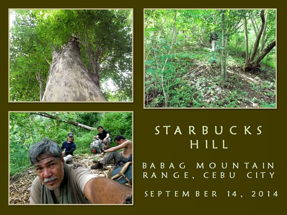
I had last used this route in April 2011 (BUSHCRAFT BUHISAN 7: Training the Pulag-bound) during an endurance training for members of Tribu Dumagsa Mountaineers who were preparing for a climb to Mount Pulag. In that hike, we passed by Kilat Spring and Starbucks Hill, before finishing it at Napo. Today, I will follow that route and, hopefully, scale again the fabled Starbucks Hill.

We reach the trailhead. The ground is wet, dews adhered to the blades of strikingly-green green grasses. Overhead are rainclouds while a strong breeze blew in from the southwest. Rain is ominous but I do not mind. In fact, I welcome it. I reach a sentry post and I retrieve my Chipaway Cutlery Bowie knife from my Silangan Predator Z bag so I could open carry it below my waist.

When you are with a Camp Red Bushcraft and Survival Guild activity you can relish that freedom of carrying a knife openly. It is a privilege that might had been denied to you when you are with another set of people but, here in Camp Red, we ensure you that you will enjoy that right. Along the way you will learn what is the wisdom behind the carrying of knives. For that matter, outdoorsmen of tougher character begins to seek our company.

When we had crossed a cleavage, I begin a practical lecture about tracking while walking along the trail. Since we are on hard ground, tracks are invisible and impossible to read but by touching the surfaces of stones, you will know if people pass by here recently or not. There are two different techniques for that: one for the dry season and another one for a rainy day.


I intentionally brought them to a different trail and, forced to find the correct trail, we took an animal trail, hoping we could find a perfect footprint, which we did, on a farm. Seeing a deep imprint, I touched the ground if it is soft or hard. When I found that it is neither, I explained to them about the gender of the foot that made it; the rough estimate of time that the footprint was made; approximate build and height of the owner; and the possibility that the owner is carrying a heavy load or not.

We cross an open field until we come upon Freedom Trail again. Rainclouds are a blessing when taking this trail since it is really warm and sunny here. Then I thought of the many who have planned an activity for today at any place outdoors but decided not to push through because of Typhoon Luis, of this inclement weather, of muddy trails and of getting wet. I sneered at that attitude. Most of these people loved to use the word “adventure”.

I reach the mango tree on a high saddle and I shift to Kilat Trail. I will again be reunited with the natural spring of Kilat. I found this place while hiking and exploring alone in September 2010. Although locals visit here often to source their water needs, it was unknown to conventional hikers until I brought a few here but these returned and brought more of their kind. The natural spring gave them an option to rehydrate and replenish.


Water poured out of the ground when lightning struck the place many years ago. A burnt stump of an antipolo tree (sp. Artocarpus blancoi L.) stands as a mute reminder while a fig tree growing over the hole nurture its sweetness. Today, I met a man while going down there. We exchanged conversations and I was alarmed when he told me that people from the nearby abomination called Monterazzas de Cebu, conducted a survey there.

That could only mean that they aimed to claim the rest of the Banawa Hills and deny people access to Kilat Spring or, for that matter, claim Kilat Spring for themselves. Behind their palaces and mansions is a watershed area that had provided drinking water to the poorest quarters of Metro Cebu. The government should know that developments adjacent to watersheds are regulated, even prohibited, depending upon its vulnerability. I believed I smelled dead rats somewhere in the offices of the DENR and the Cebu City Government.

I reach Kilat Spring and I see people washing their clothes while the children help their parents with the laundry. I gave away my sweet buns to the children while we stayed for a while to boil water for coffee. Dom and I forage dry firewood and natural tinder, which are rare because everything is wet. It does not matter but we have to try and we did make a small fire just enough to boil water good for four people.

Satisfied with our coffee and after filling up our extra bottles, we left the place going by way to the Portal. The trail is excellent and it is thick with vegetation. Beside the trail is a path hacked for a tree planting project. Each stick marks where a young tree is planted. I reach a point on the trail that I came to get lost often. Today I know where I am going. The sticks told me so. Easy!

When I got past that, I pass by the section where upland marsh palms (saksak) grew abundantly. The palms are flowering and in bloom and nobody had harnessed their saps, which would usually pour out from a flower petiole when cut, that can be used as a strong drink (tapuy) or into vinegar. It only shows that some essential primitive-living skills are not anymore available to the present generation. Why not do the harvesting myself? Hmm...why not?


When we reach the Portal, we rest. It is 10:30. I am eyeing Lensa Trail today and it would lead me to Starbucks Hill. I hope. Last time, after I scaled the small peak (BUSHCRAFT BUHISAN 12: Circles), I got lost when I followed a wrong ridge for an exit route and dumped me and the rest instead on a small but suffocatingly-hot valley. Ultimately, I was able to extricate my companions from that place by following a set of scant tracks on a trail-less terrain. That was in April 2012.

Abundance of rain for several months have thickened the vegetation and the trail looks gloomy. I do not fear snakes for snakes are lazy creatures themselves during a cold rainy day. My worry is the soft ground and the harmful plants that grow along the route. The ground is almost covered by thick bushes and long grasses now and I have to pay attention closely of deceiving paths that led you to nowhere but disappointments.

I do not want to waste time going back and forth borne out of overconfidence and reading the wrong path. I need to be sure where I am going. Somewhere along the path is a small palm that marked a fork of a trail. The left branch would lead to Banica Creek while the other would follow the contour of the terrain. I would make it sure that I will not miss the plant. I follow the right route going into a very long bend until I see a mango tree.

Mango trees are quite rare in Buhisan, especially at its wildest parts. We may have to stay here for a while since it is already 11:00, just about right to prepare a meal. Underneath is a rare clearing and almost flat. It had been visited recently by people. I retrieve the pork, my AJF Folding Trivet and my sooth-blackened pots from my bag. Dominik and I forage again dry firewood. We got only a few dry ones.

Dominik begins to slice the pork with his Hemvarnet knife. Bogs and Mark helped him by slicing the other ingredients with their Mora and Seseblades, respectively. I explore the place and some bushes had recently been cut. I secured three long sticks and a vine and brought it back to the resting place. Dom had already started a fire. A pot is placed over the fire iron. It will be used to cook braised pork.


I prop a tripod over it where the bigger pot containing rice would be hanged beside the first. Only one fire will cook our food inside the two pots simultaneously since we do not have plenty of dry firewood. One pot is placed directly above the flame while the heat carried by the breeze will do the cooking of the second pot that is hanged. Bushcraft is like that. Full of improvisations. Quick to adapt to any situation.

We had our lunch at 12:30. Bogs had added a dish of sliced raw cucumber in vinegar to the fray. It is a simple meal. The braised pork is excellently prepared. I believed we had taken many refills that the bottoms of the pots are scraped clean. We have extra water to clean the pots and to boil some for tea. We revived the fire and burn small scraps of garbage and, when finished with that, we thoroughly put it out.

After repacking our things, we resume at 13:20. The trail really is difficult to follow since the time we left the Portal hours ago. It is now covered with so much vegetation. I arrive at another trail fork. One goes down while the other goes up. I remembered I had taken an ascending trail and so I took this trail. A small snake instantly move away upon noticing my presence. I advised everyone to be a alert.

It is a long ascent and I could not believe, after that, I come upon a house with barking dogs. It is not supposed be there or I may have missed a trail again. I see clusters of houses below us and I take a trail instead leading to a nearby ridge. That ridge is good and well covered. One could camp here without being noticed and would have been a perfect place were it not for the nearness of houses. The trail ended abruptly. I look for other paths but found none so I go back to the lone house and then down to the community.

It is a very secluded community and it is the first time I have visited this place. I asked a man for the name of this place and he said it belonged to Baksan. He pointed me to a route going to the road but I have other things in mind. I need to visit again Starbucks Hill and I asked instead another route to the Buhisan, apart from the route that we had just came from. He pointed a path. I gave thanks and we are still in the game.

When I arrive at the branch of a trail, I followed it and it goes on a long stretch of soft ground. I remembered this route now. It pass by a huge rosewood tree, standing straight to the sky, and everyone are amazed when all see it. The soft ground gave us difficult footing. We rely on our hands, grabbing at anything to keep our balance and to keep us from slipping down. We pass by a patch of broken rocks. Loosening one might trigger the whole hillside to slide down so we chose where we step.

It is silent save for the singing of the cicadas. It never rained but drops of moisture from leaves fall from time to time. Our clothes are wet because of that. The path is wet. The ground gave in to weight. It is a very tiring walk. Mark found a rusting empty shell of a Garand rifle and kept it as a souvenir. We persevered until we reach a ridge. The ridge goes down to a saddle. I stood looking at the familiar back of another ridge – Starbucks Hill.


The rest are exhausted and all sat on dead poles like I did. Infront of them is the fabled peak! It is still 14:30. Is this really Starbucks Hill? Dominik, who was in that hike of April 2011 (BUSHCRAFT BUHISAN 7: Training the Pulag-bound), remembered. I do not know, but there is something amiss. I looked around the saddle, at the tamarind trees and at the peak. There is something that I have noticed as odd but I cannot recall what is that.

Anyway, I urge the rest to move because, after that, it would all be ridges that end near a road. I had never expected that there is now a well-used trail leading to the peak nor I had expected to move easily upward. This is something new on Starbucks Hill. I reach the top in less time than I had expected it to be. The breeze is always cool here. It cooled my superheated body and so for the rest.

I need to find that huge tamarind tree where the “coffee bar” is located. When I had visited here the first time (BEBUT’S TRAIL 5: Starbucks Point), I was with Ernie Salomon, Boy Toledo and Glenn Domingo. We brewed coffee here – under that big tamarind tree – and that is why this place is called Starbucks Hill. It is a special place. A good place to rest from the noontime sun for breeze coming in from the sea are plentiful here.

I am very careful now, intending not to be misled just like the last time. My mind says “RIGHT” all the time, always keeping to the rightmost path if ever there are trail forks. I saw none, much more so the “coffee bar”. Strange. I am now following a descending trail and re-tracing it back to the ridge is now daunting since I covered a lot of ground already. I looked for signs. Somebody just left a bundle of freshly-cut fish-tail palm leaves.

I see black seeds of a zingiber plant on the ground. It is not scattered but grouped like a mound. A Malayan palm civet left it long ago as its dropping but it is now very dry and very light. I thought I heard a rustling of dry leaves on the ground. Might be the rest of the guys coming down after me. As I walk down a few meters, something moved far from my right and it created a lot of ruckus. A sizable snake is fleeing away in a frenzy.

The path I took led me to a stream. It is Lensa Creek all right. The one that supplies water to the catchment basin and then to the dam of Buhisan. We have walked very far and I cannot explain why I am again dumped on another exit. I will have to follow the course of the creek upstream instead, intending to reach Camp Damazo thence to Lanipao and Napo, but it is still a long way. It is now 15:15 and too few hours of daylight. Then I saw a shoeprint on a sandbar.

The shoe is threaded. This is interesting. I called everyone to study the print and asked of their opinions. Dom says it is a hiking shoe and it is going upstream. Very well. Let us see if the rest of the tracks just ahead weave a different tale. A woman may have left this considering that it is a narrow shoe and small. About size 7. We found the same tracks but I found one unusual print. The heel dug in deep. It is made by a rubber boot. It is not made by a hiker but by a local and it has a dog for its companion.

While doing all this walking on the streambed, I chose to step on boulders. When we walk on forested ground, I chose the stones and roots instead of stepping on the wet path. I deliberately show them my walking habits even to the extent of going back to a shoeprint I intentionally left and wiping it away. This is done to leave no trace of my passing and from being observed by another person. It is not related to the Leave No Trace, but a skill taught to me by grandpa when I was a kid. Ages before LNT was born.

The stream gave in to forest then stream again. Another set of shoeprints – I mean, bootprints – are discovered by us. It goes downstream. Why? Because a pebble was dislodged from its hole when the foot stepped above it and moved an inch downstream. It belonged to a man. Why? Because it is size 9 and the imprint is deeper than the first set of tracks we saw. Up ahead, I saw the twin logs and I am near. We walk on until we reach Creek Bravo.

Mark and Bogs are now suffering from cramps. Walking on a streambed is very taxing and would stretch some of your leg muscles because you will be using a different set of muscle tissues that is different from those you normally use on a trail. Camp Damazo is on a high ground and it would be difficult for them. We may have to rest more often and they would have to rehydrate more often. It is a slow process going to Camp Damazo and daylight is losing its brightness.

We reach Camp Damazo. We rest again. It is 16:15. Just a little more and we will be on Baksan Road. I walked with Bogs while Dominik accompanied Mark. Our distances lengthened. I reach the road at 17:00 and waited for Dominik and Mark. They came at 17:20. The trail to Lanipao is now easy as it is all downhill. We use LED torches when darkness overtook us. We took cold refreshments at Lanipao at 18:30.

Our last engagement is Napo. We reach it at 19:00. Motorcycles-for-hire whisk us one by one to Guadalupe. Lessons were learned during the hike and these hardy individuals that I am with had came out of that difficulties smarter and better. For me, it was my last tryst into Starbucks Hill by way of Lensa Trail. From hereon, it shall be a “Holy Grail” to any bushman worth his salt who seeks it.

Note: For a purpose, I never document some of my routes with GPS or given grid coordinates and, lacking that, it ups the ante for adventure.


Document done in LibreOffice 3.3 Writer
Some photos courtesy of Mark Lepon

Monday, November 1, 2010

FREEDOM CLIMB 2010

I AM THE FIRST to arrive at the meeting place in Tisa, Cebu City in the very early morning of June 12, 2010. Today is Philippine Independence Day and I aim to refresh my love of country by participating in the 2nd Freedom Climb on one of the two designated campsites in the Babag Mountain Range. Sixty-five summits will be climbed all over the country and around the world where there are Filipino patriots.

The EWIT Mountaineers will be at the vanguard of the most number of participants on a campsite above the former Swiss Chalet restaurant. They will start at noon from Napo in Sapangdaku. Other groups will tackle the route from Kalunasan and converge with the main group. Others still, will walk on the Babag Ridge Road from Upper Busay to this site.

Camp Red, on the other hand, chose to make this event meaningful by starting at Katipunan Street and camp on another designated campsite at Manwel's Peak, a knoll 150 meters away from Mount Babag which is the highest point of Cebu City at 752 meters above sea level. I am with Camp Red – a bushcraft and survival group.

Rounding up the rest of Camp Red is Boy Toledo, Ernie Salomon and newbie Marco Albeza. Going along with us is the couple Randell and Marjorie Savior and Glenn Tampos - all of Tribu Dumagsa and special guest Wil Davies (aka Jungle Wil) of Jungle Wild Adventure Tours. We will follow the route specially designed for this occasion – the Freedom Trail.

This is the second straight year that this route will be used for this event. Last year Boy T and Ernie successfully led the Cebu Mountaineering Society (CeMS) in the 1st Freedom Climb and camped at Manwel's Peak at a pace of thirteen-and-a-half hours under a showery weather.

Freedom Trail starts from Katipunan in Tisa and climb over Tisa Hills and Banawa Hills then it goes inside the edges of the Buhisan watershed and the Baksan teak forest, then crossing a road into Arcos Hills and goes down into Lanipao Creek where it joins the Sapangdaku River and then Napo. From there, it follows the Sapangdaku up river and climb any of the routes to Babag Ridge.

Our small group left at six in the morning after a quick breakfast. Ernie took the lead while I act as rear guard. We reach the bare Banawa Hills at an early hour and it is a welcome thought. Walking here beyond seven in the morning is torture. We pass by a couple of small huts and all took the opportunity to rest amongst a shade of aratele trees.

I carried for the last time my 80-liter Habagat Venado II. I could feel the backpack creak and grunt as it secured all my necessities for this traverse trek over some of the most gruelling trails in Cebu City. It is heavy but I can manage very well the climbing. I worry about how my knees will fare during a long downhill stretch.

Bushcraft is about observation and adapting and more on skills while mountaineering is more about mileage and altitude. I can do both. Showed Jungle Wil an improvised bat catcher made of bamboo frame and thorns called kaguingking. He thought it at first as a TV antenna. It sure looks like one from a distance until you go closer.

We walk along the edges of the watershed and took a short respite in Puertahan Uno. We did another short rest in Puertahan Dos after an hour of walking, Boy T lay on the ground exhausted while I decide to sit down for the first time. An hour-and-a-half to go and we will have lunch.

We climb Starbucks Point and make coffee in a shady clump of big tamarind trees. A flat rock served as table and we eat whatever snacks we brought. Marco shared his sticky rice (puto maya) and I consumed one and it made his pack lighter. For the first time, we felt the coolness of the breeze here and it is generously given by nature.

Refreshed, it is time to move once again and cross the Baksan-Pamutan road into a saddle between Mount Lanipao and Arcos Hills. We followed the route downhill into Lanipao Creek and arrived at our designated lunch area at exactly twelve noon beside a water hole in Sapangdaku River.

Instantly, Boy T retrieved his fresh seaweeds from his pack and prepared it while Ernie cooked pork sinigang and sauteed dried fish in tomato sauce. Marco and I tended the cooking of the milled corn in three small pots while Jungle Wil did the entertaining stuff. All the while Randell, Marjorie and Glenn watched the flurry of activity by our tight group.

After 45 minutes, it is time for lunch. The guests retrieved their packed lunch and shared it with the rest of the party. Tribu Dumagsa couldn't believe that we do cooking on the trail as they were used to carrying a prepared meal and eat it cold on the trail. Camp Red ensures everyone that all are comfortable as possible by eating food just off the fire.

We left at 1:30 PM for Napo and cross the Sapangdaku into a route that follow the snaking river uptrail. Going along with us are five rifle-carrying men. They are going to Kahugan to hunt birds, reptiles and small mammals and they wear long pair of blue jeans and heavy jackets. I envy them but I prefer to catch my prey with deadfall traps and snares.

We arrived at the foot of the Kahugan Trail at 2:15 PM and we overtook the first contingent of the EWIT Mountaineers led by Ariel Montuerto. I refilled my bottle from a natural spring and another party from EWIT arrived with Eric Rio at the forefront. Then came another led by Paulo Tallo. They are all friends and these young people are so dedicated with their hobby, the environment and the impoverished children of the mountains. They are kindred spirit and they are special.

We leave the now populated place and start the climb for the Roble homestead where, I know, they are preparing green coconuts for this special activity. The Robles lived in between Napo and Mt. Babag and it is a natural resting area for rehydration. We arrived at 3:30 PM and sat on the bamboo benches. Fele Roble have added two more long benches to accommodate more people but, it seems, many will come.

Ching Altar came here in the morning with her office mates and her American boss who have been trying without success to meet me in person after visiting and reading my personal blog. Unfortunately, they move too fast for our party and I missed the opportunity to meet him but they leave a couple of unused coconut meat which I consumed. He, he, freebies!

A little while, Eric's group came and then Ariel's. Fifteen minutes later, Paulo arrived and, I estimate, there were 33 people here including our own. Then more people arrived and we have to leave at 4:30 PM to give room and negotiate the Babag East Ridge Pass while Ariel did the same taking his group into the difficult Ernie's Trail.

I keep an eye on Glenn and Randell on this last stretch as both have been suffering from cramps every now and then. I know how to remedy this by applying pressure on the lower joints and then a massage to keep the blood flowing. Finally, we are over the ridge and walk a couple of hundred meters to our campsite. At 15 before six in the evening I closed the gap and pitched my tent.

In the half-light of dusk, I failed to stop my balled sleeping bag into rolling down the slope at a fast roll going in the direction of a deep ravine. I run after it and, at that time, I run like Usain Bolt but could not keep up with the pace. What is a sleeping bag anyway? At the last moment before it could teether into the ravine a low branch stopped it just enough for me to retrieve it at the last minute. Lucky me!

Exhausted, I lay inside my tent and drowsed awhile until Manwel Roble nudged me. Oh, supper. I must have slept for an hour, I guess. I smiled at Manwel and I went out to eat the meal left for me. Wow! Chopped cabbage in soup and canned tuna. I eat voraciously and consumed all, including sliced bread. Now, where did they get those? Ernie passed me a cup of cold liquid. Beer? Yes!

They must have drunk four-and-a-half big bottles of San Miguel Grande while I was asleep. A green beer case have only one full bottle left and another half-full bottle held by Ernie. The rest were empty. This is Boy T's idea of celebration, I guess. We talked under a starlit sky gazing at the bright metropolis below. After the beer, a tequila bottled appeared courtesy of Tribu Dumagsa.

Jungle Wil told me a tale while he was in a Mexican cantina. An old Mexican said to him that a glass of tequila will wash away dust, a second glass will make you drunk while a third one will make you crazy with sex. We all laughed at this thought and I evaded that third glass. I asked him if the Mexican have any idea about the fourth glass of tequila? Jungle Wil just grinned and I downed the 3rd, 4th, 5th, 6th and 7th glass that came my way.

While we were conversing gleefully, many more parties arrived in the dark going to the direction of the main camp occupied by the EWIT Mountaineers. I counted twenty headlights bobbing on the road. Meandro Abao of EWIT came forward our camp to see if we are alright. He is with Jon Consunji and Vince Delicano of CeMS and they started their hike at five in the afternoon. They will all camp at the main campsite and skip our place.

Many more came and it is already almost ten. Groups like ZETS, YAMOG, YAPAK, BAGTAK came for this event, not to mention other groups whose names escape my memory and the freelancers. I would not be surprised if the participants would swell to over a hundred climbing patriots. As fog began to envelop our small camp, we burrow into our tents and observe taps.

In the morning the big campsite across us are full of tents and they were like a rainbow failing to take off the ground. We cooked breakfast with more of this cabbage soup, noodles and canned tuna with our favorite staple – milled corn. After the meal we broke camp.

I carried a Philippine flag and lashed it at a 3-foot long slender bamboo tube and will be our flag pole. I pierced the earth with Glenn's wooden staff and slid the bamboo pole around it making our flagpole higher. The flag danced in the breeze. I lead the singing of the national anthem – Lupang Hinirang, then the oath of allegiance – Panatang Makabayan. Ariel and Meandro came to represent EWIT and joined in the simple ceremony.

Time to leave the campsite and we go down to where we came from yesterday. Boy T and Jungle Wil opt to stay in Papa Joe's store by the roadside. We leave at nine and arrived in the Roble homestead at 9:45 AM. We took a long rest while waiting for Boy T and Jungle Wil. They arrived thirty minutes later red behind the ears!

We would have moved downhill but Manwel's mother, Antonia, insisted that we stay for a while. She prepared and cooked two free-rein chicken for us. She is celebrating her natal day today. Wow! What a treat! The soup is so delicious, the meat so juicy. Milled corn and rice came with the viand but I chose the part of the milled corn where it kissed the pot's bottom. It goes best with native chicken soup!

After a short rest we bade goodbye to the Roble family. Just a little more downhill and we would be on the river bed. At least it will come close to being flat and it will be kind to my knees. The weight carried by the Venado on my back is multiplied several times with each step taken down ward and it hurt both my knees. Then that should be it. I will hang the Venado for good after this. The last hurrah!

We reached Napo at around two in the afternoon. We let the guests hop on the motorcycles-for-hire first before us. We rendezvoused at Guadalupe and Tribu Dumagsa parted company with us while Jungle Wil took a taxi for his flat. I opted to go home early and rode a public jitney twice. As I arrived home I made it sure that I send a message of thanks to Manwel's mother for her wonderful meal.

EPILOGUE:

MEANDRO ABAO notified me a week later that there were One Hundred Ten (110) people who participated in the 2nd Freedom Climb in the Babag Mountain Range and I'm sure the organizers – Filipino Mountaineers, Inc. - welcomed this news with such enthusiasm and vigor. I believe a new annal in Philippine mountaineering have arrived.

Document done in OpenOffice 2.1 Writer

Monday, March 1, 2010

FREEDOM TRAIL II: Ultimate Freedom

THE FREEDOM TRAIL is a route that start in Katipunan Street in Tisa and ends at Mount Babag. Both places are historical. Katipunan is named after the independence movement of 1896 which fought against the Spanish colonizers and Mt. Babag is a site of many battles by different generations of Filipino resistance against the Spaniards, the Americans and the Japanese. 


This trail is created and designed for use during the so-called Freedom Climb that coincided with Philippine Independence Day. It is over fifteen kilometers long and passes over many rolling terrain, a forest reserve, ridges, cleaves, small hillside farms and a handful of river crossings.


Actually, two attempts have been made to complete the trail to Napo by Kompas Lakaw Mountaineers with Boy Toledo and Ernie Salomon and both failed. A breakthrough did fell on June 7, 2009 where I led the exploration team. The trail was officially used on June 13, 2009 and the Cebu Mountaineering Society, led by Boy T and Ernie, did the honors of the first club to walk in full length this trail.


On September 13, 2009, Boy T, Ernie and me retraced the Freedom Trail again and below are the images I took:


Photos taken by a Nokia 3650

Document Done in OpenOffice 2.1 Writer

Sunday, November 1, 2009

FREEDOM TRAIL

IT HAD BEEN RAINING when I took a standing breakfast in the early morning of June 7, 2009 at an eatery in Katipunan Street, Tisa, Cebu City. Boy Toledo and Ernie Salomon were with me and they did likewise. At the end of this day, we will be completing the last leg of this “freedom trail” which will be used during the First Philippine Freedom Climb on Philippine Independence Day on June 12.


This is the trail that Boy T and Ernie, together with the group from Kompas Lakaw, are trying to establish starting from Katipunan Street in Tisa to Napo in Sapangdaku on May 30 and June 6. The same trail which ended abruptly at the Baksan Road that this same group followed towards the Sapangdaku spillway; still a far-off distance from Napo over a concrete-and-asphalt road which would take away the spirit of an already fatigued hiker to assault the steep Ernie's Trail to Mt. Babag.

For the Kompas Lakaw people, the newly-discovered trail from Tisa to Baksan meant a piece of the bragging right to claim a niche in the local mountaineering community. For Boy T and Ernie, it meant defeat; especially Boy T, who lamented to me at his home in Lapulapu City in the night of June 6, that they could have explored further the terrain beyond Baksan had some Kompas Lakaw guys been pliant enough to walk the extra mile with them.


Boy T never gave up and convinced me to join him explore further this “lost” trail. He never liked the idea of walking on roads and would rather be inconvenienced walking on trails. I always advocated hiking on pure mountain trails instead of walking on hilly roads and I understood fully well his point. I have confidence on his (and Ernie's) stamina and I believe that both can tackle the long and winding trails of about twenty kilometers distant from Tisa to Mt. Babag. What I am worried of are those that will be coming with them.


At 7:00 AM, under a cold shower of a monsoon rain, we three walked the main street of Riva Ridge Subdivision until we reached the foothills of Tisa Hills, where the rain stopped, assuring us of an all cloudy day. The trail passed nearby Villa Amores and Tisa South Hills Subdivision. The Spanish Riviera-like location of houses of the latter are nicer to behold when seen from a near distance but is in sharp contrast to an adjacent colony of temporary settlers living in their little decrepit huts. The poverty gap is so conspicuous here.


These gentle slopes where short grasses abound offered a good view of the Basak-Pardo-Bulacao corridor. The trail snaked around farms hacked out of hard limestone rocks. Farms whose thin soil ably supported the plants that grew on them. Most of these plants are stunted and bear fruits that are of lesser size than the average produce.


After an hour of steady uphill hike, we crossed over to the Banawa Hills and passed by an electric power pylon and we rested below a lone a coconut tree. From this vantage, we could clearly see from below us the Gochan Hills, the Tanchan Celestial Gardens and the South IT Park in Banawa. This stretch could have been glaring hot at eight in the morning but the early morning rains left a cloudy sky that cooperated well with our trek.


A few houses are located here and what human activity found are confined just to a minimum. Walking further on, we passed by some telltale signs of charcoal-making holes hidden amongst corn and cassava plantations. Passing by the last house, I saw two little girls climbing an arateles tree and enjoying the sweet little round fruits. Here, I left three used text books to the delight of the children.


The route then passed by along a trail planted with gmelina trees. Local inhabitants living in these hills sourced their wood for charcoal here and they only cut at the branches well above the trunks unlike those that I have seen in Sapangdaku and Kalunasan where the charcoal gatherers there wantonly cut the trees at the base of their trunks leaving no chance for the trees to regrow!


Looming across us is the construction site of the Monterazzas de Cebu. Tsk! Tsk! Tsk! Development in the hills should be controlled reasonably and not dictated by greed. It left great ugly gashes upon the hillsides of Banawa Hills and caused mudflow in large volumes down the the foothills that inconvenienced people living near gullies and along dry riverbeds. This “development” is uncomfortably close to the forest reserves of the Buhisan-Toong-Baksan watershed site – a protected area.


From gmelina trees we went into a great forest cradled between the Banawa and Baksan hills and by the Babag Mountain Range. This is second-growth forest; a reforested area. This is my first time to pass by this corridor of well-hidden timberland. The trail is perfect as it is very shaded and it followed the gentle contours of the slopes and ridges. Birds abound in this area. I even saw one wild rooster who flew from one tree branch to another tree branch.


Some stretch of the trail are very treacherous with slippery or loose soil and quite narrow in some parts. Along this newly-found trail are a number of rattan palms growing and claiming its former habitat and many times I would get snagged by its thorny vines. Few people pass by these wooded trail yet some recent human activity left some tree branches and trunks being cut and collected for firewood.


The trail went on its winding route until it reached a place marked by three big boulders marking the convergence of three trails. One trail heading towards Baksan; another trail, I presumed, going to the Buhisan-Toong area; and the other one lead deep into the forest, probably to Pamutan, I think. We followed the northeast trail for Baksan and it led us to solitary mango trees growing along the route until we reached an upland neighborhood in Sitio Calumboyan.


Here and there were playing children and we passed by crumbled old buildings at the back of the Baksan Elementary School and by an open deep well which is a source of potable water for the community. Finally, we three reached the Baksan Road. One part goes downhill to the Sapangdaku spillway; the other part goes up for Pamutan. This is the road that gnawed away the previous group's creativity and endurance. I will not let down Boy T today. I will lead and I will find a way.


I followed the dirt road uphill as my trained eye were now focused for some gaps in the forest that might tell of a trail. Walking on for about a hundred meters, more or less, I saw one such gap, barely discernible even to me. It looked like one of those several dried-out water routes along the road that I passed by but this one is flat and not steep. I decided to investigate and followed this wild trail and it was criss-crossed by naked tree roots whose soil cover were carried by recent run-offs. A recently-felled tree blocked the way, but my persistence took me on the other side and – voila – a trail is officially discovered.


Looking yonder, I could see Mt. Babag and I believed we have found the “lost” trail after squeezing ourselves amongst the thick and leafy branches and twigs of that fallen tree that blocked our path. I took the lead, then Ernie and Boy T followed after me and, after an hour or so of following the serpentine trail, we came upon a tamarind tree. I remembered these tamarind trees were used by the “old ones” in marking the trail in and around the Sapangdaku and Kalunasan areas. Then I saw more of these tamarind trees and I felt sure and safe that these trail will lead me, Boy T and Ernie to Napo.


We went over a long ridge and I saw below us the concrete road of Sapangdaku winding and bending along the route of the Guadalupe-Sapangdaku River like a ribbon. Now, we have found this “lost” trail that Boy T have been yearning to find on two separate occasions and it is not lost anymore and I officially gave it a name – the Freedom Trail – which elicited approving nods from both Boy T and Ernie.


By the way, this newly-discovered trail is a part of the long trail which I am planning to plot and trailblaze, starting from the foothills near the Guadalupe church up to Napo, to skirt away from the concrete-and-asphalt road. My work is half-done and I now just have to worry with the other unexplored half. Anyway, we passed by more of these tamarind trees and came upon a youngster making charcoal. We almost missed the main trail here when we followed the youngster's footprints into a cul-de-sac. We backtracked and found the true trail passing amongst little corn farm plots.


From these wee plantations, we went down and down and came upon a father with his two small daughters resting in a hut. We also rested here and conversed with the man and he directed us to the correct trail for Napo. Thanking him for that needed info I unloaded two used textbooks for his two daughters. They were all smiles as they opened page after page. We bade goodbye to them and went to some more downhill routes and came upon a branch of the Sapangdaku River.


We followed the creek down river until it reached the main waterway and we came upon a group of young boys hunting and fishing catfish and fresh-water crabs. They were armed with rubber-slings with thin little spears and nets and I could see they were enjoying their fishing well with a number of fishes and crabs already tucked inside their little buckets. We followed their direction until we reached Napo and we took our lunch there at thirty past noon.


By 1:30 PM, we were fording the river and we traveled the Napo Main Trail towards another river crossing were we took a brief rest. We took a shortcut bypassing Sitio Busan into Manwel Roble's place where we stayed for just a while upon noticing that nobody's around. Just the same, I left a pack of five wafers for Manwel, Juliet and Jucel.


We left at three and retraced our path back to Napo. From Napo we walked the hard concrete road for Guadalupe and arrived there at 4:15 PM. We celebrated our success in completing the Freedom Trail with a toast of glasses of ice-cold beer at our favorite watering hall in Guadalupe. Through Boy T's persistence and Ernie's insistence, it had shaped the route into a first-class route worthy of a major climb.


Document done in OpenOffice 2.1 Writer.