Showing posts with label Kilat Spring. Show all posts

Saturday, November 26, 2016

BEBUT’S TRAIL XIV: The Italian-Sounding Abomination

WE AT THE CAMP RED BUSHCRAFT and Survival Guild begun to love Baksan when we discovered its secrets that we decide to transfer our “dirt times” there. At Baksan, we do not meet anymore colorful corporate hikers. Of course, they know where it is because it can be searched in Google Earth but going there is still a puzzle for them. Even if they will accidentally find it, they cannot fit in because there is nothing spectacular to talk about.

In the old Roble Homestead, we frequently meet them there. Meetings are mutual and friendly but we know that they talk behind us because we are different. We do not worship Leave No Trace, like they do in such vociferous manners on other people, yet they cannot impose it on us. We have our own set of values when it comes to enjoying the outdoors and LNT is not one of those.

We carry knives and we know most of them cringe at the sight of even the smallest Swiss Army Knife. We regard our knives as mere tools and we know the value of this simple tool in simple outdoor functions or, worse, during SHTF. Our difference from them stood out glaringly with our joyous attachment to our unique tradition of the blade porn. We delight at our “wrong turns” and it is the best thing in the world.


We blend well with the landscape by just being there and not mere passersby. We can sit idly by a campfire and enjoy its companionship of warm food and steaming coffee while some of these colorful hikers would be busy spying on other campers of their misplaced garbage. While some of them pounce people in Facebook by posting pictures that hurt their make-believe LNT sensibilities, we dare them with ours that totally ground against their beliefs.

We are now at Baksan always to save them of their frustrations of seeing us doing many things that ran contrary to their Western-inspired outdoor principles. We regret to inform them that we never camp on bald peaks nor make campfires there. These are the very places we evade for it ran counter to our adherence of Blend, Adapt and Improvise. On the other hand, we do not stay a minute and we had rather be on our way quick.

This day – August 14, 2016 – I am with these crazy bushcrafters. Two male guests came along upon the invite of one. Our plan would be to test the route between Tisa and Kilat Spring for we heard rumors of this greedy Italian-sounding abomination called the Monterazzas de Cebu trying to gobble up the whole of Banawa Hills and part of Tisa Hills, thereby, close access to a valuable water source at Kilat forever.
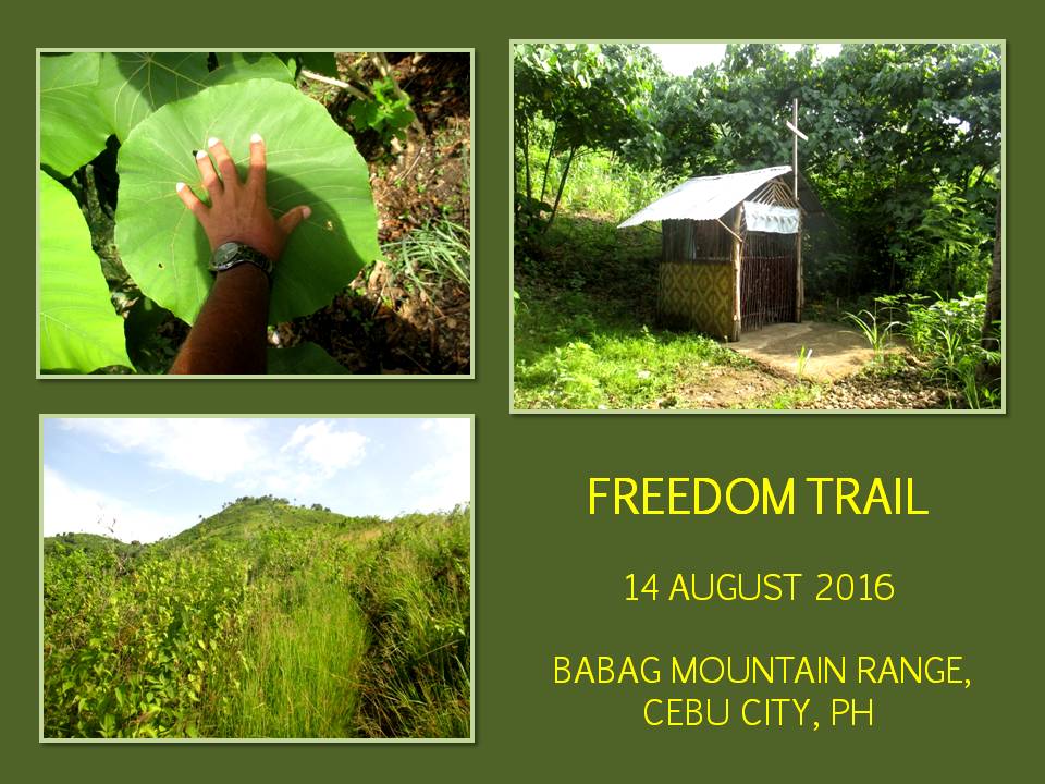


Although it is still 07:30, by my own experience walking both Tisa and Banawa Hills at this hour, it should already be warm. The hills are grassy but devoid of trees. It is rare to find a copse of different trees, most of it among deeper cleaves and on a few ridge tops. A power pylon stood guard on the trail. Its presence a hint that a corridor underneath it and its cables are government property. Why would this Italian-sounding housing development pursue its project?

Behind this low mountain range facing Cebu City is a watershed where Kilat Spring is found and the imaginary boundary is just a couple of steps away. Do not the Metro Cebu Water District find this position irregular? Is it okay to supply water to the metropolitan area whose source partly comes from the Buhisan Watershed Area which is now a close-door neighbor of this Italian-sounding residential area?

Did they check where their drainage flowed this time because there had been silence lately of places which had been inundated with water and mud coming from them in the past? I am just curious because one small stream in the Buhisan showed brown and silty effluents during a downpour. I understand it has been issued an Environment Compliance Certificate by the DENR because you cannot proceed with earth-moving activities without one? Is this ECC acquired with all the proper requirements? Is it above board?


Is it not a part of this Italian-sounding residential area transgressed by a corridor of high-voltage power lines supported by two steel towers on two separate points can be a risk to life and property? Can City Hall just allow and provide them building and land development permits without closely scrutinizing its close location to a watershed and a power corridor? Would City Hall not consider preserving a historical landmark that is now being trampled underneath this Italian-sounding abomination? It is a kilometer-long Japanese tunnel.

I waited for the others as they slowly negotiate the trail. I found a branch of a trail that would lead us to Kilat Spring. I know most of them have exhausted their water bottles but, over that ridge where there is an old mango tree, a path goes down into the Buhisan Watershed Area and abundant water. It did not take long and we reach Kilat Spring. We have all the water in the world. We celebrate by boiling water for coffee.

Water from Kilat Spring, according to an old-timer that I met some years back, burst forth after the ground was hit by lightning. A stump of a burnt tipolo tree is a testament to this incident which happened many many years ago. The water is now caught inside a concrete box and is diverted to the dam structure to serve as water supply for the MCWD engineers while the rest just flows freely thru a tap. Above the spring is a talo-ot tree, which nurtures the fine quality of the spring.

After 45 minutes we proceed to the Portal. We are now traversing thick jungle on a path that had not been used frequently by many people as before. Some parts of the trail are beginning to be overrun by weeds and it came at a point where there is a spot that had, so many times, led me to walk in circles and I am doing it again. I finally caught the true path and it relieved all the stress that I am now beginning to accumulate.


We pass by a forest of mixed sugar palms (Local name: idyok) and upland marsh palms (saksak). There has been an attempt to burn down these and a few of the palms are molested and cut without meaning. How could anyone be so vicious on these palms? I carefully pull the hair-like fibers of a sugar palm and the others did so. We collect this for our fire-making needs as it is a good tinder. I stuffed mine inside a small plastic bag where it will be transferred to my fire kit soon.

We reach the Portal but we continue until we reach Sibalas, the “Navel of Baksan”. There is also a natural spring here which is now housed inside a concrete box. Nearby, is the resting hut of the old steward of the water source and of the big swath of the place itself – Luceno Laborte or Noy Ceno. He is around and Jhurds Neo, the head shed of the Camp Red Bushcraft and Survival Guild, gave him two brand-new stainless-steel cups which elicit a very happy smile from him.

Everybody settled down and proceed to the foraging of dry firewood, which are few. Nevertheless, we have ways to make it fire-ready. The sound of wood being split by knives echoes down to where I sat talking to Noy Ceno and Jhurds. I watch the two guests, both wearing red t-shirts, watching silently the show the guys are now running. It would be their first time to see “dirt time” and they are glued to the spot where they are crouched.


Ernie Salomon, the camp fixer, is busy preparing the food while the rest are keeping him company in the slicing business. Fires are lit on two hearths. A pot for coffee is now above one while another pot of rice claims the other. Ernie’s home-made hobo stove spews out a smoke and a tin cup for coffee is placed over it. I was tired of the hike. Maybe I am just too busy. I was guiding people yesterday. Or maybe I am getting old.

I drank coffee again and I tinker with my Cignus V85 VHF radio. I am able to contact amateur station DV7FAL of Linao, Talisay City from my hidden location in Baksan, bouncing my signal to a steep flank of Banawa Hills which then makes a ping-pong to a repeater in Busay. Ingenious maneuver. When you are into ham radio, you tend to experiment and that is what I just did with an inferior made-in-China equipment. Think of what I could do with a Japan-branded radio?

Immediately after that, I caught the attention and interest of Christopher Ngosiok, Nelson Tan and the two guests about ham radio. We talked about licensing, acquisition of radios, review classes and preparing for that written examination administered by the National Telecommunications Commission. I am a licensed ham operator for three years now and I carry a callsign of DW7EUV. Many of the guys from the Camp Red Bushcraft and Survival Guild are licensed hams.

Radio equipment is always part of mine and someone else’s gear. Radio communications is essential when SHTF sets in. I have personally witnessed cellular signals fail in the aftermath of a 7.2 earthquake in Bohol and in places in the path of Typhoon Haiyan. Only radio signals were able to provide a link between the distressed communities and relief agencies. It happened in 2013 in many places of Bohol, Leyte, Samar and Northern Cebu.


Spoon is rapped on a pot lid, signalling the start of our late lunch. Ernie did wonders with chicken meat with an estofado dish. For a dayhike, we at the Camp Red Bushcraft and Survival Guild are pampered to feast like kings! How could we reduce our weight with food like that? More servings please! We gave a share of the meal to Noy Ceno and his family and our bellies bloat like that of Jhurds’. Hahaha…

When dark clouds begun to appear in the middle of the afternoon, we decide to pack our things back into our bags, including the blackened pots. We will be exiting to Guadalupe this time but, first, we will have to pass Enas. I lost the trail to there and I decide to explore the many strange trails that crisscross Lower Baksan until I call it quits and followed a trail that led to high ground. So familiar. So, Bebut’s Trail it is.

We go down that dreaded place called “Heartbreak Ridge”. We walk on the fringes of that Italian-sounding abomination and I see they are now starting to fence off the poorer quarters. How can you fence off a fault line? It is recently discovered in Buhisan, just at their back. I wished the new homeowners well.


Document done in LibreOffice 5.2 Writer

Tuesday, September 1, 2015

NAPO TO BABAG TALES LC: The Team Finals

FROM NINE PEOPLE WHOM I had invited to join my selection in establishing a team to explore the route for Segment III of my Cebu Highlands Trail Project, five made themselves available for the challenge last January 4, 2015. It was a tryout of sort and I was considering the five to be on the team, in one way or another, but I need only two slots.

It was a moderate route that tackled Tagaytay Ridge head on from Sapangdaku Creek and then taking a long loop, tiptoeing over Babag Ridge and down again to Sapangdaku Creek until we ended the day at the trailhead in Napo. The rain that had caused trails to go muddy, soft and slippery, made it more hard. All persevered and made my selection for the team difficult and complicated.

Today, January 11, 2015, however, will be different. I would be expecting four of the five to be at the meeting place in Tisa. The fifth candidate would be in a foot race and would not be available at Tisa but I considered the absence justifiable. On the other hand, only two candidates physically came. Well and good! That would make my selection easier now. Even before this day’s hike would commence, the two had comfortably snared the slots. Congratulations! Although, it would still be the manner of how both will finish this hike.


So, after a light breakfast at Mang Tinapay, we leave Tisa at 07:00 for the trailhead over Riva Ridge Subdivision. We will be following the complete route of Freedom Trail, a route that I had last walked on June 11, 2010. I do not know if some stretches of the route are still existing but I do know that this is the mother of all travails that I had concocted on the Babag Mountain Range.

Fortunately, the climate played into my expectations. There is a thick cloud blocking the rays of the sun as I gaze from the trail on Tisa Hills. At this hour, the sun will start to scorch you senseless on the bare slopes. It was smooth sailing for us that I have given in to the temptation of exploring another route that would bring me closer to Kilat Spring.

My 5.11 Tactical Series Shoes played true to its billing and had never given me problems on water-polished limestones which my other shoes had. I cross a cleavage and go on up Banawa Hills, passing by parched farms and stopping to examine a small chapel with a small statue of the Holy Child. The ground underneath a mango tree is swept clean, indicating that there is a thriving community on these forgotten places.

In a week, the whole of Cebu will celebrate the feast of the Señor Santo Niño de Cebu and the chapel is being readied as well and, I believe, the common people living here would celebrate with the rest. Their faith keeps them going and they persevered on these unkind slopes but it is their home and that is where they get their strength to survive. I am just amazed at these poor simple folks, toiling under the sun on soil as hard as rocks.

We move on and cross another cleavage into a rare flat land that is home to stunted rows of horseradish. Grassland pitas (Local name: maya) swarm the air when it notice our presence. I enjoyed the spectacle that I kept them flying with a loud clap of the hands. I pursue Freedom Trail into the higher elevations and then I switch to a path that led to Kilat Spring.

I meet an old woman with a bundle of long sticks above her head. I presume, she came from Buhisan and she carried that uphill for, maybe, about 30 minutes. Oh God, she is strong but coughing bouts showed weakness in her health. Tears well on my eyes that she still had to do this labor so late at her age when she is supposed to be resting and taken cared of by her relatives. I know that life is sometimes unfair but God will never turn a blind eye on her. I am sure of that.

I walk on and somewhat assured that I would be walking down the lee side of Banawa Hills. The natural spring is devoid of people. We took the occasion to fill our bottles full with its pure water. After that, we proceed for the Portal at 09:00 and, I believe, it would be a short walk to there. By 09:30, we are passing by the place, intending to reach our next stop in another 30 minutes.

I reach Baksan Road and walk the concrete pavement uphill in warm sunshine. I need to reach a forgotten trailhead at 10:00 and I am beginning to doubt it because of my sudden exposure to sunrays which slowly demoralizes me. But, as I was recovering from the heat under a mango shade, the clouds again interfered. I hasten my pace and reach the trailhead.

I finally sat down on a knee-high concrete that marked the presence of a drainage culvert underneath and the trail just across. We took the opportunity to munch on a piece of bread. Yes, we are training in survival hiking. We will not cook a meal like I used to do with the rest of the Camp Red Bushcraft and Survival Guild because, during Segment III, daylight hours would be precious and we need to cover a lot of ground.


I am applying to the candidates what I had experimented many times: bread and water. One bread if bloated with water afterwards, would give you enough energy for a good two hours to tackle difficult terrain. For moderate terrain, about 3-4 hours. This is the first of our rest stops. I had bought six cinnamon bread and I eat only one. Sweet, yes, and overindulgence of which would not be good for your health but I need glucose to give me that energy boost.

I face the path that lead to Arcos Ridge with dread because I do not know anymore the condition of the trail. I discovered this trail in 2009 and incorporated this into that Freedom Trail that I had talked about. I notice smoke ahead – charcoal makers! Walking on slowly, I see a man helped by his two little kids arranging wood in a hole. They did not notice my coming and were startled by my presence. To diffuse their anxiety, I gave six little cupcakes to the two children and I am rewarded with smiles.

We proceed on and I face now a wall of thick vegetation where, before, was a path with strips of little corn plots beside it. Arcos Ridge is a thin piece of ground that starts from Baksan going down into Napo. About a kilometer long, more or less. It is very steep on the whole side facing the Sapangdaku Creek and on some sides towards a part of the Lanipao Valley.

I always open carry a big knife in all my outdoor pursuits and, today, the AJF Gahum heavy-duty knife claimed that honor of worthiness. I hacked a path through thickets and vines which hinder our passage. I did not do this blindly because you would veer away from your intended route. I checked out the landmarks to guide my progress else I would fall on those steep slopes. This is traditional land navigation at its best and I was slashing for about 40 minutes.


The work with the knife would have tire me out were it not for the cloudy skies shutting away the sun. I got a firm hold of the path I made and I am rewarded with the first of the several tamarind trees which I remembered shaded me during my previous visits here. The trees became my guide posts until the first signs of a trail appeared as the terrain cant down. It is steep but it is the trail. Slowly and methodically, I reach Arcos Creek. It will drain into the bigger Sapangdaku Creek somewhere near Napo.

I cross the Sapangdaku and intentionally immerse my shoes in the water to get rid of the caked mud which it got during last week’s initial training. Then I climb over the riverbank and into the campus of the Napo Elementary School. It is 11:30 and we buy cold soda drinks to pair it with our bread. I eat two pieces. I begin to feel better now but, I think, we need to spend a brief but well-deserved siesta in the school.

By 13:00, we continue on. After crossing a footbridge, we follow the trail to Lower Kahugan Spring, reach it after 30 minutes, and then refilled my bottle. I look at the skies and it begins to darken. Rain is threatening our hike. I pushed myself harder because of that when I made my move towards the Roble homestead and suffered for it by resting often on the trail.

At 14:30, I reach the house. I could not believe it that I am able to reach it in less than 30 minutes. Probably some 25-26 minutes because we rested at the natural spring for a refill and lots of breathers for me. The fastest I did was 28 minutes but it was done downhill! I take a seat on the bamboo bench and close my eyes to keep my body still for it was shaking like an overworked engine.

I plead from Fele Roble three pieces of green coconuts for the three of us. I drank the refreshing liquid of the fruit and opened it with the AJF Gahum to retrieve the meat with one hand for my nourishment because I needed it most for the hardest part of the journey. For insurance, I eat my fourth bread and washed it with water. It is still a long way and a lot of it are uphill.

I walk slowly, not forcing this time, even though I am pressured by time. I rest to take breathers when I need to and I could not count of how many times. It was torture and I begin to entertain thoughts to end this hike if I reach Mount Babag and hire a motorcycle to whisk me down to JY Square and sanity. To reach the topmost ridge, 45 minutes is unrealistic although I have done it long ago.


This time it is different. It brings back memories of that 2010 Freedom Climb starting on the same place at Tisa. I was carrying a big Habagat Venado II then, which contained all the items of my house. This time I am carrying a smaller Silangan Predator Z that contained the things that I would need during Segment III. By 15:30, I reach Babag Ridge. I blinked at the feat I just made. I think I am crazy and I need a break!

I would have taken a shortcut on the shoulder of Mt. Babag but it had been smothered by a construction work. I may be crazy but crazier still are people who bulldozed mountains when they begin to think a piece of the mountain as their property. This land belongs to the government and is considered timberland. The most you could do is just possess a title declaration or a timber lease agreement but you could not develop and construct a permanent structure on it. Period!

I walk on and grumble on the way until I reach a small store. We stop to buy cold softdrinks and eat our bread. (I ate my fifth.) I am refreshed and I now believe that I could finish this circuit and begins to disregard that exit plan to JY Square. For almost an hour we walk the road until I reach the trailhead of the No-Santol-Tree Trail which would lead me to Kalunasan.

Thank God, this is all downhill. The bad news is it is already late afternoon and soon it will be dark. The trail had improved a bit, I suppose. The last time I passed by here was on the dawn of Black Saturday 2013. It is also very slippery here but my new shoes keep my footing stable. This is really a good pair. I make good progress and come upon familiar landmarks which says I am in the right way.

As I was traversing the rest of the trail, I am tempted to explore a trail that Ernie Salomon had wanted to try. I begin to follow that path but, contrary to what Ernie had believed, it went instead to the direction of Napo. I looked for an alternative route to find a short cut that would intersect back to my own NST Trail. It goes down to a flower farm and then a dead end. I saw a glimpse of a path far down and I studied the terrain carefully.

I thought I saw an easy way to get there but I misjudge it. It was not easy but I chose a Hail Mary chance and it brought me to a steep gully. Debris are choking it but you have to be careful where you step. The rocks are slippery since it is wet but you have no choice but down. It is already gloomy as the last hours of the day are sinking. Going down I see bamboos and bamboos meant people. People always gather bamboos for housing materials.


My hunch was correct. Bamboo poles were harvested recently and left all around. I used the long poles as a bridge to transfer to another spot. I crawled, balanced, slid and even squeezed painfully my holy balls to initiate a good progress. I finally found the headwaters of Lahug Creek by accident and this is no mean feat in an unholy hour. The waters are clear but I remembered the flower farms were using pesticides. Blue traces stuck on their leaves.

The light of the setting day is getting dimmer now but I am walking downstream over boulders and then I saw a path going up. This is the trail I saw earlier from the flower farm, I reckon, and my heart beats faster with excitement and so are the footsteps behind me. We ready our LED lights but we did not use it. In the dim light the path is very clear like a ribbon of creamed coffee. I use this opportunity for night navigation training instead for the duo.

We reach Kalunasan Road at 18:00 and there is nothing more to do but eat my sixth bread and walk its long length to Guadalupe. We arrive at 19:15 and conclude our journey at Bikeyard Coffee where Aljew Frasco, Bona Canga and Christopher Maru joined us. The remaining two candidates with me are now officially part of the Segment III Exploration Team, along with another, who excused himself because of a commitment, and two others as Base Support Crew.

That was a blockbuster of a route and it was long and hard. We all deserve the slots for we persevered and survived on bread, water, coconut and soda drinks. This was just the start. We will be doing this same routine for four days of February as we walk Segment III and – soon - from Segment IV to Segment VIII. The Cebu Highlands Trail is a demanding route and no one had taken it yet but me and my team are undaunted. I will walk into the sunset with my team and we will leave a legacy.


Document done LibreOffice 3.3 Writer
