Tuesday, April 25, 2017

MOUNT BOKATOL

I ALWAYS BELIEVED THAT WHEN you show goodwill among our brethren living on the mountains, trails and paths which lay unknown to you for years, would be given to you on a silver platter. You will be surprised because you will not be doing the asking. In fact, the asking will be from them. From them.

You might wonder why I have so much complete mastery and knowledge among our mountain trails here in Cebu? It is this line of thought that I follow. With all sincerity, of course. Since we transferred our May and December outreach events, respectively called Who Put the “N” in Nature and Christmas United, to Baksan in 2015, each year we get to explore a new route.
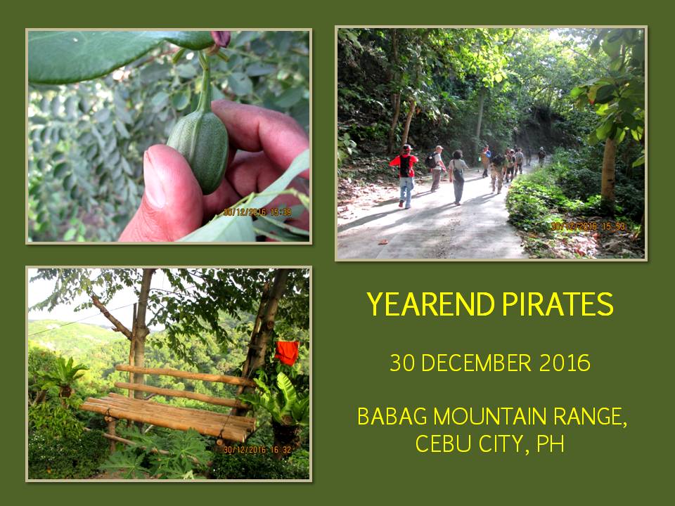
This year, which actually falls on the last days of 2016 – December 30 – I will be again following the wake of a local guide. Coming along is the full force of the Camp Red Bushcraft and Survival Guild. We would not be doing dirt-time this time but just a hike in the woods, an exercise to purge off party fats incurred during the Christmas season.


For me, it is an ongoing preparation for my Thruhike of Cebu which would commence in a fortnight or so. The opportunity of following the guide gives me the luxury of knowing the information about water sources, interesting plants and people, place names and the lore associated with the places we passed by. The same information that I would be doing for myself from no other than me starting January 17.

Right now, I am balancing on a series of boulders along Sapangdaku Creek as ably as my aging knees could accommodate as I try to keep up with the pace of the guide. The guide brought us upstream. People are washing clothes along the stream, some taking a bath. It is so interesting to see rural life this close in a city as big and modern like Metro Manila.

From the streambed we follow retaining walls wide enough to be used as a path by locals and reach the Sapangdaku Spillway. People are washing their motorcycles here and a petroleum tanker crew washed the insides of the big tank, the sludge and hydrocarbon effluents mixing in with the flowing stream towards where people are washing and bathing.


Nobody from the government have thought of watching the streams. Of even placing a simple environmental signage to create awareness among the populace. Cleaning a vehicle, much less, a petroleum tanker is a health hazard to the poor folks who still use the stream for washing and bathing. I have even seen an open well downstream which the folks still used for domestic use.

From the spillway, another problem emerged upstream. Asphalt slabs from a repaved road nearby were dumped along the riverside, constricting the channel and the flow of water. That is dangerous! It would create another water channel when a strong current of flood water cascades down from the mountains and there are a lot of houses infringing on the easements.

It opened my eyes to these problems here. Nobody was thinking. Not even the safety engineers of the construction gang nor the operators of the petroleum tanker nor the barangay officials who are supposed to look over these things. I pity at the standards of our safety education. People should be informed of these lapses in judgment and procedures, committing to that lazy Filipino trait of looking at and doing things as in “Pwede Na”. Good enough. Good gracious!


The broken asphalt pavements became another dry path to navigate the stream and we stop for a while on a local artisan whom I know simply as Paket. Paket is a wood carver and a furniture maker. His carved work, especially blade handles and sheaths are masterpieces which is appreciated in our small bushcraft community. We exposed his craft in Facebook and survivalists in Luzon begins to appreciate his work too and so have given him an extra earning.

Continuing our river walk, we pass by under a bamboo bridge that I had not thought existed. It is private property and we push on until we came upon a part where there is a tiny stream joining the Sapangdaku. The place is called Amia. There is a trail and the guide start to follow it. It is a good trail and only the locals knew of its existence until today. I saw some familiar signs that it had been used before by the “other people”.

We are quite privileged to have been led to this place and we will keep it a secret, hoping it would have a strategic importance to me if ever our country will be invaded by a foreign power. Of course, I have countless other locations, too numerous to mention, which I could convert into redoubts and can be connected with each other by a flexible line of communication. My trysts into the mountains is not just about recreation, it is also planning for the future.


I do not trust a big bully across the sea who keeps on gobbling up islets and rocks and reefs as theirs even though it is within our exclusive economic zone. Then we have a national leadership who seem to acquiesce to these dastardly activities by undoing the efforts of the previous administration before the International Tribunal of the United Nations Convention on the Law of the Sea which favored our claim.

I intend to use these places when SHTF comes and I intend to resist invasions from there. I do not see a soul. Not yet. Maybe during the season of ripe mangoes and star apples. Moving up the trail, I see an abandoned camp. It belonged to mango sprayers. Mangoes in Cebu are sprayed regularly with chemicals to induce it to flower and bear fruit beyond the natural cycle of only once a year. They do it thrice and thrice the gain. Greed!

Over the years bottles and plastic packaging of chemicals are littered everywhere together with discarded rubber hose and empty plastic drums. A cheap laminated nylon sheet houses a crude shelter while another sheet is converted into a water reservoir filled with water from a small stream that is tapped through a PVC hose. I am tempted to burn the whole place but I would not compromise my guide’s goodwill. And I intend to go back.


I checked my temper but I took pictures. A lot of people surely would not like what I saw if ever I post this in a social network site. Maybe an environmental watchdog or NGO would notify concerned government agencies when they see these photos. Maybe not. But in Facebook, attention comes in short notice by the act of fingers doing the talking. Almost everybody has an Android phone and the dance of fingers on glass is swift and loud.

That done, we proceed. We pass by what seemed to be an abandoned hut but dogs barked at some distance and came hurrying to our location. A little later, the owner talked to our guide. Later, beyond hearing distance, the guide warned us that the man is suspected to be a witch. At this knowledge, the pace quickened.

We arrive at a spot where a motocross event was held last month. It is a good place for picnics since it has benches and net hammocks and kind of breezy. It has a good view of the city and has lots of shades. We are now on the other side of the mountain. This can be accessed from Baksan Road and a path had been widened to allow motorcycles here. This is perfect place to rest long and cook our meal.


Everyone retrieved their cook pots, the food ingredients and their prized knives. After dumping the ingredients and my blackened pots, I left them for awhile to have a look of the whole place. I found a bench under a wide shade and enjoyed the view of the metropolis, the harbor and the islands. There is a good supply of breeze and, instantly, I forgot everything. I could not resist Ms. Slumber.

At the sound of approaching footsteps, I awakened. I napped for about fifteen minutes and that is well. I rejoined the group and they were in the middle of their coffee time. A pot is instantly refilled with water and boiled. I waited for my own coffee time but, when it do came, I had it one after the other. Stories and laughter filled the ridgetop masking hungry stomachs whose owners took a lot of quick glances on the hearth.

In meals done by the Camp Red Bushcraft and Survival Guild, it is never a boring moment. It is always warm, cooked in real fires, and it is always a feast no matter if it is done on a beautiful day or under the onslaught of storms. There is the main dish of mixed-vegetable soup and pork liver estofado and the side dish of fried anchovies and raw cucumbers in vinegar with either plain rice or milled corn to pair those. And it is 13:15, perfect time to tease gastric juices.

After 15 minutes, I open coconuts with my AJF Gahum heavy-duty knife for beverage and desserts with its meat. Feeling refreshed and knowing that we must continue our journey, we cemented our moment here with our good old tradition of the blade porn. A decaying log becomes a spiny caterpillar with all those knife points pierced on its surface standing up. I am just amazed at how such a small activity could start a lively conversation all its own.

We begin packing and everyone are ready to walk once more and fulfill that chance to climb Mount Bokatol. This peak is a solitary one and no one except the locals visit the montain. It is steep on all sides but there used to be a trail according to the guide. We left this nice place and follow a trail that goes through a forested part where there are more mango trees, a concentration of grapefruit and star apple trees.

Then we came upon a patch of horse radish planted in straight lines. We have to weave among the trunks and branches on sloping terrain, afraid to disarrange a tangle of small leaves. The invisible path goes down a steep slope where there are no handholds except maybe some slender cassava trunks. The guide was walking it straight down. I find it hard to keep pace even if I am agile enough but I worry those who are not used to this kind of terrain.

We reach a saddle and Mt. Bokatol would be somewhere over the top but the path is strewn with thick vegetation and it is straight up. The ground is loose but we have handholds to halt our downward slide. A long vine becomes a lifeline of would-be Tarzans, sturdy enough to hold the weight of a man as heavy as my own. By 15:10, everyone have scaled the peak.

On any topographical map of Cebu City, it is measured at 301 meters, almost a thousand feet. Half-buried is an old concrete marker and there is a new one, as tall as a man, painted with yellow bands. On the side where we came from are a teeming ecosystem of jungle tangle and, on the other side of the tall marker, is a man-made forest of Burma teak, dead and silent.

Remembering the guide’s tale that it was used by the Americans as a machinegun pillbox, I looked for traces of it. A hole on the ground confirms my find. It was changed in size by “treasure hunters”, hoping to find that elusive Yamashita loot. On the government side of the peak is a trail going down to who knows where. We go down it and the ground is more loose in the absence of grass. Forests planted with exotic trees do not permit healthy diversity and it is bald forever under its branches.

I saw traces of recent motorcycle activity here. Somebody was trying to climb Mt. Bokatol using this route and failed. He could not get past another hole on the ground where a step-like two-meter high ground divides the rest of the trail. On foot it was easy to navigate because you can hold on to the trunks for balance. I go down another saddle and it looked familiar.

On this saddle lay the trail to a steep ridge running perpendicular to the Sapangdaku Creek and the Guadalupe-Kalunasan Circumferential Road which goes all the way to Napo. I found this place in 2009 and have used the trails here during some weekends, the last itme in January 2015. This used to be thickly forested but now only Burma teaks remain standing. A path gently goes to Baksan Road and we made our exit, going all the way to the Sapangdaku Spillway and, lastly, Guadalupe.

Document done LibreOffice 5.2 Writer

Monday, April 17, 2017

BUSHCRAFT BUHISAN XLIII: Man on Fire

I AM AFIRE.  LAST WEEKEND’S debacle in the mountains does not alter my mood and my mind today, December 18, 2016.  I have something big to accomplish next month and I do not have that much time to prepare.  A month could barely move mountains unless San Miguel Brewery or Lucio Tan would dip their fingers into my affair.  I am prepared for rejections though when expectations turn into empty air.

I have declined many offers to earn an income since the start of December for my mind is focused only on one thing – The Thruhike.  With or without those big names, I will have my Thruhike and I have a promise to deliver to my first set of sponsors, who expressed their profound support with funds and them nice things.  I could not ask for less at the moment and while I am at it, I have to develop my stamina and my mindset to keep my end of the bargain.

It is so hard on me.  I could feel the pressure weighing down on my resolve since I had already set a date of January 17, 2017 as the start of the Thruhike.  I could not back down from it.  And it is now about to be less than a month away.  It would have been easier if I do not do the planning and just be a follower.  But when you are the instigator of such things, the task is horrendous and of almost epic proportions since you would be treading on grounds that have not been tried before.

The Thruhike is not a walk to climb a peak which, by usual practice here in the Philippines, takes about two to seven days, usually starting at trailheads that has elevations of 200 meters and up.  The whole island of Cebu, at its backside, is difficult terrain, starting from sea level extending to at least 400+ kilometers of mountain trails and roads and I have programmed to hike it at 27 to 32 days with extra three days safety margin.  Besides that, it is not a guided hike.  It is navigational savvy at its best.


Of course, my closest of friends knows what I am doing and my capability of accomplishing this Thruhike right from the start up to its endmost might be mind-boggling but all know I could achieve this.  But there may have been skeptics among them.  But that is alright.  I know some people would open their purses right at the last minute and I am prepared to do the things in between like more time in the outdoors and before the altar of my faith.

I have even purchased a new pair of running shoes taken from donations for training.  I do not use it for running but for personal errands where running is out of the equation.  The walking is enough and I do not have to exaggerate it in speed so I could have that fastest best.  I take care of my joints and tendons and I have my own discriminatory reasons not to behave in such reckless abandonment. 

Today at Guadalupe, we are but few.  It would just be a leisurely hike, just enough to sharpen the mind and to get the hang out of what nature could offer to the senses.  Coming with me is Jonathaniel Apurado, Ernie Salomon, Richie Quijano and Glyn Formentera.  This is my ideal size of crowd for a dayhike.  I do not like boisterous company and I do not like people talking on the trail.  They could have that in places of rest though.


We are going to Camp Damazo today to seek the pleasures of its existence.  No it is not high and mighty stuff.  It is drab and jungle and teeming with creeping devils.  We will be walking straight to it with the church parking ground as the trailhead.  We know how to go there and we kept it within our own circle which, in this case, is that ugly stalking tiger called the Camp Red Bushcraft and Survival Guild.  Yeah, we are ugly to mainstream gadflies and we do not conform to their borrowed ideology.

It had been raining early in the morning and it is good to see the verdant grass growing thick and healthy on that totally bare backside of a hill that I am fond of calling as the “heartbreak ridge”, for the very reason that it had denied a good number of people to give up climbing it and almost claimed the same numbers that barely survived.  It is just a low hill and I do not know why it is unkind to people?

If you are not likely be a victim of this heartbreaking episode, you are bound to see a different angle of the city and you begin to like it but we have to move on higher ground to the refuge of shades offered by a forest of fruit trees, hardwood and shrubs which you cannot see from anywhere down the curbs or even thought it existed this close to urban living.  So save that exhilarating feeling on your SD card.


The ground is wet and, as expected, a myriad of different birds tries to choke your eardrums with their beautiful melodies.  This part, that I named as Bebut’s Trail, is heaven for anyone who have been stressed out in drab office work.  It is shady and, when the season is right, you could practically pluck star apples, Spanish plums or currants from fruit-heavy branches.

The trail goes horseshoe like, passing by a place called the Portal before ending at Baksan Road.  You just walk a few meters up the road before engaging again another trail called the Lensa Trail.  It is all downhill and goes through a man-made forest of Burma teak.  It is eerie and silent in here as birds and flying insects do not make this exotic forest their habitat.  Only a few people go here like local wood gatherers and us.

The playgrounds chosen by the Camp Red Bushcraft and Survival Guild are different from those chosen by the mainstream outdoors crowd.  We prefer our camp under the protection of trees and we liked it anonymous.  Of course, we have to chose earth colors for our canopies and our clothes to achieve that effect.  Camping on peaks and on places where the crowds are, are taboo for us.  Our minds do not simply work that way, child like.


A stream crosses my path.  It is brisk and milky and birds seem to delight at that spot where native plants thrived.  Yeah, it rained some hours ago and I have not seen Creek Alpha like this.  We follow its course downhill where another trail welcomed us.  We cross the same stream and hiked onto dry ground for the rest of the day.  The path took on another half circle midway between mountain top and another stream.

I showed the guys of the honey oozing down a trunk of a Burma teak.  Like I said before in another article, it is unusual for insects, much less a stingless bee colony, to roost in exotic trees.  But here it is, defying instinct for survival.  It is evolution at work.  We cross Creek Bravo and the forest here seems more alive with busy insects zooming here and there while birds make their presence felt with their staccato of melodies.

Lensa Trail climb up a ridge over what seems to be a very beautiful forest that became a tangle of jungles when we reach Camp Damazo.  This is our camp and everything comes to a standstill.  We each brought firewood and tinder from the lower trails and, in a moment, we would have wood fire, a kind of fire disdained by the mainstream, whose beliefs follow that foreign ideology they hold so dear which, ironically, allows one.

First things first – coffee!  I brought my Swiss Army emergency burner with me and coffee came in short time with fire coming from small branches.  Not bad for a piece of can.  This is a gift from my Swiss friend and we we here last November 26.  Proof of that is that I saw and retrieved the dismountable pot holders of his Kelly Kettle.  We simply overlooked it and thought we stowed it back to the burner set.  Hahaha…there it is.

Ernie begins to ask of the food ingredients which we carried separately as Camp Damazo starts to transform into his kitchen without walls.  Overhead is a dour sky but we do not want to be caught unprepared and so erected a cheap plaid nylon sheet above the hearth.  Cords were in short supply but we have nature to provide us with something to stretch the canopy.  Jon helped Ernie with the cooking while Richie and Glyn break the twigs into small pieces.

With the way the day behaved, it would be an enjoyable one as eyes are on the black pot.  The same pot that had served me and my brethren well since the Philippine Independence Bushcraft Camp of 2012.  It had survived the punishing interludes of Scotchbrites and sand and it is an icon in itself, a testament to the frugality and practicality of bushcraft.  Everything we do and use are of the old world tradition and flashy gears used by the mainstream crowd does not find an instant fan from among us.


By popular demand, we are dining again a dish of pork liver estofado with a side dish of sliced cucumber and tomato in vinegar.  Everyone ate in silence, savoring the warm food in warm humid jungle.  The food is good and it even tastes better here.  Ernie does it with a flair all the time.  This is his specialty – cooking – as well as his tinkering and inventing gadgets from scratch.  I watch him all the time and tease him until he polishes his cooking to perfection.

We stay for a while to recover from the shock of a full meal.  Stories, yarns and jokes crawled out naturally caused by the effects of a fully-satisfied stomach.  Washed pots and utensils are dried for a while as the owners claimed the eternal silence of the hills as theirs, for the moment, and felt free to do as they please with laughter and jolly voices echoing among this forested enclave.

At 14:30, we leave our beloved Camp Damazo.  We halt for a while at Caramon Spring to drink then we continue to cross a couple of streams and climb up another peak whose one trail led us to Baksan Road.  We cross this road into another trail that goes down a fertile valley and into Lanipao.  The rest of the way, we walk on the road to Napo.  Then a motorcycle is a good option to complete our day’s journey as it brought us back to Guadalupe.

It was an easy day yet worth more than the time when I raced with another on a high peak in another place and time faraway.  There was no adrenaline rush and that feeling of invincibility you normally feel when on a high place becomes so alien and distant, replaced by a subtle appreciation of life and the natural world.  I am on fire and the things I do in my present life would help and guide me in my quest to tame that wild spirit from within.  The Thruhike will be my statement in my life should I succeed.

Document done in LibreOffice 5.2 Writer

Monday, April 10, 2017

A MAN-SIZED HIKE THAT FAILED

I AM TAKING ANOTHER SHOT OF MOUNT SAMBORYO today – December 11, 2016.  I almost went over its top last January in my quest to find another and much-better route for Segment I-A of the Cebu Highlands Trail when I met a local who directed me instead to Cabatbatan and cold refreshments.  I was utterly dehydrated then and was following the trail to the peak when that chance encounter convinced me to backtrack and savor that cold drink.

It mystifies me of seeing that mysterious peak everyday from the vantage of my window in downtown Cebu City.  It mystifies me remembering the strange reaction of locals whom I talked to when I was going there alone.  Perhaps, there may have had been bad memories?  I just want to go over what is beyond it.  It is part of my beloved Babag Mountain Range which I know so well and exploring beyond Samboryo would be an opportunity to expand my playground.

My plan today is to start from Lutopan, Toledo City and do a cross-country walk to Guadalupe, Cebu City just like the last two episodes I did in January.  But, this time, I would climb Mt. Samboryo and find a route to Tagaytay Ridge and go straight down to Napo.  I want to evade the road from Cabatbatan to Pamutan Junction and then to the Sapangdaku Spillway.  Roads are torture to the soles of feet and shoes going downhill and melt a hiker’s resolve upon facing endless rises.

This is an activity for the Camp Red Bushcraft and Survival Guild and they came to the 7Eleven outlet across the Cebu South Bus Terminal.  Arriving one after the other are Jonathaniel, Justin, Locel, Glynn, Christian, Eli, Abigail, Ariel and Mark with three guests from a freelance outdoors group called BAKTAS.  We left the terminal after getting in a Lutopan-bound bus, which I know would be crawling on the highway picking up passengers.


We arrived there at exactly 08:00 and proceed to Camp 7, Minglanilla on board motorcycles for hire after procuring foods that are quick to cook.  We must be at Guadalupe in under twelve hours and we have a long way to go, part of it, unfamiliar ground.  Being caught at dusk at these places is my main concern.  This is an exploration hike after all and maybe this might be a good opportunity to change my already-altered Segment I-A Route of the Cebu Highlands Trail, which project I wrapped up last November 3.

The day is warm but there is cloud cover from time to time.  We need to be at Buot-Taup, a rural village of Cebu City located along the Bonbon River, before noon to compensate for the slow bus and so we quickened our pace without stopping until I noticed that our party becomes so stretched out that I could not see the status of some of the guys beyond my view.  We rest by a small stream for about five minutes before setting out again.

We arrive at Buot-Taup at 10:40 and the guys deserve their rest under the shade and cold drinks from a store.  Across us is Mt. Samboryo.  I know how to go there but how I would navigate to Napo via Tagaytay Ridge is a question that is still left hanging.  This is my expertise, so to speak, engaging on blank spaces and I am really good at it.  The Bonbon River is wide but a hanging bridge, made of steel, spanned river bank to another 120 meters away.

We cross this bridge at 11:10 and it rocked and yawed at the cadence of our feet and shift of weights.  We all travelled light for we are in a day hike only.  Despite that, some have shelters and hammocks if Doc Murphy decides to rap our heads.  For assurance, four of us carried VHF radios since the four are ham radio operators.  By my experience, cellular signals always fail and always short on places where it is most needed.  For this reason, radios are standard equipment in all Camp Red activities.

After 30 minutes of ascent under the brunt of a noontime sun, we took rest at a place where there is a water source.  Here, we retrieved our alcohol burners and start to boil water for coffee and instant noodles.  There is a mango tree giving a wide shade and branches to hang three hammocks.  Five burners worked simultaneously providing us warm beverage and warm nutrition.  A boom box sound off rock music from someone else’s phone by Bluetooth.  The guys were all in high spirits.


By 13:00, we are now ready to scale the peak and continue on our cross-country hike.  We pass by a farm and reach a ridge.  This trail we follow goes down to Cabatbatan but another trail goes up to Mt. Samboryo.  The path is a bit steep and we topped it at 13:35 nevertheless.  Beyond it are more mountains and more ridges and a free-reined water buffalo with its young are blocking a trail at where it is most tight!

For some reason, I decide to follow a path but it starts to become difficult to read some signs so I stop and reorient my location with the button compass of my Advanced Fire Starter Pro.  Somewhere where the needle point north would be Mount Babag.  I cannot see it but I can see a ridge across us and it goes north like.  I turn back and go down a saddle and up that ridge and I soon found a good trail.  So good that I begun to sense adrenaline pumping my legs.

It is a beaten trail.  It traverses on a knife edge-like ridge where, if not for the thick vegetation, that interesting feature can be appreciated very well.  The edge is so narrow and steep on both sides but even on the surface where feet tread on.  From a distance of ten meters, I see a Philippine bronzeback on a branch that crossed the path.  I approached it near enough to catch it unawares and a good shot with my old and dependable Canon IXUS.  It melted away to the forest once it notices me.

The ridge joined into a wide meadow that gave a view below of the upper Bonbon River Valley and the twin peaks of distant Pung-ol and Sibugay while on the right of me are higher ridgelines that hosts an impenetrable forest of trees and shrubs.  The trail follow north in between meadow and high ridge and we came upon a lonely sight of a small house in the middle of the empty vastness of this unknown part of the Babag Mountain Range.  On one window are three small girls looking at our drab outfits.

I feel pity at the children’s remoteness from the nearest community and school which would likely be either at Cabatbatan or Bokawe or down to Buot-Taup and they are deprived of even the most simple happiness that most children take for granted like electricity, running water and decent food.  I decide to stop and asked from our party if they have extra food to spare for the small girls.  These girls should enjoy the spirit of Christmas and they get to have that at my insistence.

We pass by a farm and I see something colorful and unnatural moving within the forested trail.  Then a chance meeting of fellow hikers.  The group belonged to the Sugbo Outdoor Club and it is lead by its president, Jude Morales.  I have heard a few years ago that the people from SUOC have hiked these parts.  They had not expected me and my party to stray here and were surprised at our appearance.  Smiles and greetings made this lonely enclave festive for a while.


They go on their way to Camp 4 in Talisay City while we go on our way to Napo.  It is 14:30 and a lot of daylight to spare.  It was easy to follow the path of where they passed for they left a lot of footprints on soft earth and, I presume, on even hard surface.  I followed a trail which had smudges on its surface.  I quickened the pace for the path is so beaten and well used that I believed I am on the right path.  We pass by a couple of rockslides blocking some of the way and a stream going berserk some few days ago.

We reach a lone house and I picked out a ribbon of concrete down a far valley and then it began to sink in me that I was following the wrong way based on my wrong assumptions of trail prints.  I was about to go down to Bokawe.  We strayed for 40 minutes on a trail gently going downhill and logic would dictate that it would take us another 50-55 minutes to get back to where we were when I started this mistake.  We do not have that luxury of time and so I decided to double the effort and we made it back in 20 minutes!

By now it was already 16:00 and long shadows obliterate the path of any natural light that might help me reading tracks from a host of different trails.  Which one?  A surge of hope appeared when I saw week-old wheel ruts from off-road motorcycles.  You know how I hate these guys running their dirt bikes on pristine forest trails but, today, I thank them for being here last week.  It helped me navigate on this unknown stretch.  We just left the last house and, in these last hours of daylight, your presence is not so welcoming.

The wheel ruts disappear for a time and found again until it is difficult to assess it in near darkness.  The LED torches do not help either while in the hands of everyone.  It destroys your natural night vision and gets you distracted.  I got my orientation back using the button compass and look for those elusive wheel ruts at dusk.  Cold wind begins to claim the ridgetops and on every exposed places where there are no trees.  Trails crossed each other and I do not want to make a mistake again.

I come upon a small pond with a tree beside it.  Fingers of light probed on the tree and around it completely missing something that moved just a couple of meters infront of me.  The thing just ducked the probe lights and looked from side to side, completely ignoring my presence, and stepped into the shelter of the tree trunk.  It was dark and hairy and it walked on two legs instead of four.  My mind begins to work like a computer retrieving images from memory and begun to reject that do not fit.

First thing that came into my mind was the image of a palm civet which are common here.  Belonging to the lemur family, no palm civet walked erect on two hind legs.  Next thing is the monkey.  Although almost of the same size and posture as that of an alpha male but our monkeys here have tails.  The thing has no tail and there are no other monkeys here except the Philippine macaque.  Surely it was not wildlife and I begun to entertain of a creature which is popular in folk tales – the wood imp or what we locals heard as the “tambaloslos”.


I was just amused at its human-like reaction to evade light and quite amazed that this creature failed to notice me.  It did not move fast but was in a motion akin to tiptoeing.  I retrieve my own LED and approach the back of the tree and it just disappeared.  Could I have just been imagining things?  No I was not.  I did not feel something weird about that chance encounter.  I do not entertain such superstitious thoughts even though I had encountered many in different forms and circumstance nor I am inclined to believe those “third eye” power.

What I see is bound only for the scientific parcel of my mind to digest on and if ever it spills over to fantasy, well, I am a creature of my own Christian faith.  My God is greater than all these creatures of the dark.  So I dismissed it outright and pushed on down the trail.  I walked and studied the trail in darkness, lighted by swarming and moving beams of light, and at the same time, in the back of my mind, I kept remembering the imp’s human-like character.  It begun to fog as the temperature went down by a degree.

Annoying sounds from competing videoke machines, carried by the breeze from a distant Bonbon River Valley, begins to get on my nerves, slowly disorienting me.  I was now almost at the bottom of a steep ravine following a trail that somehow was impossible for a rider on a motorcycle to get out of.  There was no other way this time except to backtrack.  I was not exhausted but I can feel its telltale signs that I am but a few minutes to it which is safe for me but I cannot know the physical conditions right now of those who are with me, especially the guests. 

We need to go back to where we were near Bokawe.  When I got out of that steep ravine, I start to assess our situation.  We do not have food and that is a fact.  Another fact is that the guys have day jobs even though they are prepared to bivouac for the night.  Eli has a GPS and it shows our location to that of Mt. Babag and it looks easy on that small monitor but quite difficult to accomplish in darkness if we intend to push on our original plan of reaching Napo.  It is now 19:00 and an hour of walk to Bokawe would be safe enough to accomplish.

I designate Jon to lead while I decide to stay at the back.  Too much of thinking to find the right path and adapting to the glare of LED lights have left my brain slightly exhausted and I need to rest from those. We went over humps and hills and one guest begun to experience cramps.  We have to rest to make the injured recover before pushing onward.  It was while going down a trail that I begin to notice that we were going the wrong way.  The injured guy seems to notice that too.  We have to backtrack again with long rests to give a break to the injured.

Then we have to stop and take a much longer break.  At this juncture, I announced to everyone what I saw a few hours ago.  They were astonished and almost in panicky mode.  It is 20:30 and we had been walking in circles.  They believed we were hexed and this can be upturned by wearing our clothes inside out which would increase their fear and make me a laughing stock instead for believing such things.  I need to break this impasse by remaining calm.  I would outsmart this creature by using instead a female member to lead us out of it.  I did not even have to explain long but the reluctant girls bravely obeyed this task and we were able to find the true path back to Bokawe which we reach at 21:30.

Everyone, except I, were physically exhausted, not because they were walking for more than twelve hours, a good part of that in darkness, but because they were playing to the whims of their mind and unknowingly released adrenaline for no apparent reason except by their fear of the unknown.  I have come to understand such fears long ago and I have developed the inner strength to tame my mind.  My mind though was tired from the thinking and so was exceptionally alert for the good part of the day.

We took that opportunity of rest at Bokawe by indulging ourselves to the simple joys of cold soda drinks, replenishing lost electrolytes.  Here, where we were in a secluded valley and surrounded by peaks, we were able to send text messages and propagate VHF radio signals which failed us all the time while we were on those high places between Mt. Samboryo and Mt. Babag.  A lot of us do not want to walk anymore which helped to my cause for it prevented injuries and we stayed until our rescue transport came at ten to eleven.

Document done in LibreOffice 5.2 Writer

Saturday, April 1, 2017

BUSHCRAFT BUHISAN XLII: Sacred Ground

I DO NOT OFTEN BRING people to Camp Damazo. It is sacred ground for the Camp Red Bushcraft and Survival Guild and it had hosted the 2011, 2012 and 2013 editions of the Philippine Independence Bushcraft Camp and the 2015 Bonifacio Day Bushcraft Camp. There are no seas of clouds nor exhilarating views to gaze upon golden sunsets and luxuriant valleys. It is dreary and humid and all jungle. You will be disappointed. To us who find bushcraft a way of life, it is paradise.

The camp is named after the late Sergio Damazo Jr., my scoutmaster during my high school years at the then Colegio de San Jose-Recoletos (now USJ-R) when it was then housed in its old campus near Freedom Park and Carbon Public Market. During his time, he was a legend among his peers. He was a very good teacher and he was equally a very good storyteller. His tales of his experiences and anecdotes placed all ears to an unflinching attention.

It was that time when a Boy Scout IS a Boy Scout and my school basked under his giant shadow snaring accolade after accolade, recognized and represented in every international jamboree. He was a natural prepper and a master of all crafts that were taught in the Boy Scout. His loss left a big vacuum in the local Boy Scout community which, sadly, stagnated to glamour camping, cater service food and all that is politically correct imposed by overprotective parents.


It is my privilege as his former student to name this place in the wilderness in his honor and memory. There never was like him and his is a big shoe to fill in. Camp Damazo does not appear in Google Map nor it is kind to cellular signals. It is a hidden nook in the Babag Mountain Range yet, despite its remoteness, it can be walked direct from Guadalupe, the route of which is also a mystery. It is a privilege then if you are personally invited.

One of those that I welcomed today – November 26, 2016 – is my Swiss benefactor and friend. I cannot say no to him if ever he rings me for a hike in the woods. He is a typical individual who has a heart set for the outdoors. His is a rare breed in a Europe that is now harboring a highly-urbanized generation which is perpetually wired to the electrical outlet and the Wi-Fi. He is not that young anymore and he is intent to shed off some weight off his frame.

We have spent time together in other places testing equipment and gear and I am more than willing to try anything new. I write my own unsolicited reviews in this personal blog and in my Facebook wall and I somehow liked it in so much that it have helped people in their choices. My Swiss friend is carrying a bag that seem to have a bulky cargo inside. Whatever it will be, I just want to steer him safely along the trail to Camp Damazo.

We walked at a slow pace at ten in the morning on wet ground past a man-made forest of Burma teak. A strange red shark far way from home greeted us. The path ends at Creek Alpha but we walked downstream to get to another trail which would pass an old campsite and more of teak forests with a mixture of non-native species. When I am here, it seems that I am in my natural environment and every stress and worry is forgotten. I am a freelance wilderness guide and this is my office.


I am not a mountain guide. I do not give you the cold shoulder and that perpetual silence while you struggle to keep up with a pace. I do not work that way. I talk to make you more alive and watchful in a pace much to your liking. Along the way are harmful plants which without your knowledge gets you snagged or stung. You begin to wonder how such a living forest is dead? It is so silent.

I was wrong. Here upon a tall teak tree, a stingless bee colony (Local name: kiyot) made a honeycomb inside its trunk which is rare. Honey overflowed and oozed down it. The viscous fluid is sticky and sweet. It is a matter of choice for one native species trying to adapt to a foreign host to keep away competition and ensure its survival. These are small wonders that do not take attention from an untrained eye and the matching wisdom to explain why? That is why I am no mountain guide.

We reach Creek Bravo and take a rest. The humidity of the tropics might be too much for my friend. When I am on this spot, it gives me happiness just to stare across me of the only place in the whole Buhisan Watershed Area where a good concentration of water bamboos (butong) grow. How it colonized that part left me wondering? Whatever, it is a source of material and nourishment for a bushcraft camp. I took special care of these bamboos leaving it untouched for long periods of time.


We resume our hike. We climb up a steep trail to reach a ridge and two parallel trails. One goes down Lensa Creek while the other follow the back of the ridge and then to Camp Damazo. The forest is now alive of birds and insects. I still see Burma teaks, gmelinas and mahoganies but, amidst them, are native species which attract these living creatures. A few branches blocked the path and we have to watch over our heads of unstable ones bound to fall at the rock of a breeze.

Jungle jumble becomes a beautiful forest, for a time, and becomes both as we approach more elevation. Soon we will be at the fabled Camp Damazo. At thirty before twelve noon, we reach the place. In the center is a cairn, marking the fireplace. A bell pepper with a single fruit grow beside it. Above us is a Moluccan ironwood tree (ipil), whose foliage protect us from the eyes of sun and drone. Beside it is a stinging tree (alingatong) which, for all of its ill repute, is harmless. For now.

What makes Camp Damazo special? First of all, I discovered this while exploring Lensa Creek in 2010. It was when I saw a sickly bamboo that I noticed a trail which led to three other trails, which one of these brought me to here. I came back to explore the other trails and found a natural spring and an exit in one and Creek Charlie on another. The camp is on a low peak covered by trees and surrounded by thick jungle where teaching plant ID is perfect. Ground is a mixture of rock, sand and loam and absorbs rainwater quickly.


You would likely see ground pigeons, palm civets, jungle fowls and hawks here at closer distance than you would have expected these to be. Creek Charlie is a source of food which is very vital in a nocturnal hunting episode. Camp Damazo is a wild place but succeeding bushcraft camps have tamed it briefly and I decide to leave this place untouched for every couple of years so wild vegetation would recover. But on some weekends, we come just to cook meals and be gone.

Today, we will just be testing gears and have a cup of coffee and some bread. My Swiss friend retrieved a Kelly Kettle. That is why his bag looked so bulky. It is my first time to personally see, touch and hold a Kelly Kettle. It is a camp burner which you can use to cook food and boil water simultaneously. It is made of high-grade stainless steel and weighs 1000 grams. It consists of the fire oven, a kettle looking like a doughnut with bail and a chain near the bottom to tilt the liquid out, a standard pot and a collapsible pot adapter to handle bigger pots.

We tested it with a commercial alcohol-gel fuel but it never dished out enough heat to boil water in the kettle and it took us the whole of 15 minutes to observe a steam, which did not came, so we decided to add small bits of firewood in the oven to stir the water alive. It did in a few minutes. The Kelly Kettle is more efficient if it uses solid fuel like dry wood, twigs and other kindling. It is best in expedition base camps and in boats where exposure to elements are high like rain, snow and wind.

Buried below the spotlight of the Kelly Kettle, is an Advanced Fire Starter Pro donated by Paul Sidney Uy for my use during my Thruhike of the Cebu Highlands Trail in January 2017. It looks like a tactical pen where the parts can be unscrewed from each other. There is the one holding the striker, another one holding the ferromagnesium rod and another as container for tinder. At the end is a small button compass while the other is a lanyard holder.


I scratched the rod with the striker on the alcohol gel and it caught the sparks and blue flame erupted which then was used for the Kelly Kettle. This fire starter creates a good volume of sparks unheard of for its small size. Actually I tested it on a tattered piece of tissue at Frontgate Burger Restaurant the previous night and the tissue caught fire. Sidney owns Frontgate, located in Baseline, Juana Osmeña Street, Cebu City, which serves the finest burgers and steaks in town. The demo was witnessed by other Frontgate patrons.

After we had our coffee and fully satisfied of time spent well, we leave Camp Damazo for Guadalupe. We walk on the exit trail where the natural spring is located and more strange plants to understand and learn. Streaking away to put more distance from us is a jungle fowl. It is a rooster and it is the first time I saw one fleeing away on the ground. Most often when surprised it flies in a trail of dropping plumes. It may have freshened itself with water from the spring and caught unaware of our coming until about a few meters.

After crossing the upper part of both Creek Alpha and Creek Bravo, which were slippery, we arrive at the Pamutan-Sapangdaku Road. We cross it for another much tame trail going to Lanipao where we found cold refreshment. From there, we walk towards Napo where we ride motorcycles-for-hire to Guadalupe. From the church, we walk again to my favorite watering hole and cap our outdoor workout with the coldest beer.

Document done in LibreOffice 5.2 Writer