Wednesday, September 23, 2015

MAN-SIZED HIKE XIII: Badian Coast to Dalaguete Coast

THIS WOULD BE THE last Sunday of training for the intrepid individuals who will compose the Exploration Team of Segment III of the Cebu 
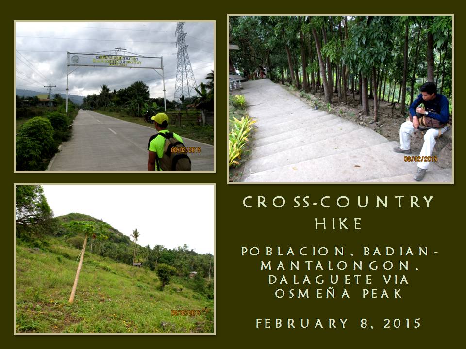
Highlands Trail Project. Today, February 8, 2015, we will do a coast-to-coast hike and climb from the Municipality of Badian to the Municipality of Dalaguete with Osmeña Peak as the highlight of the route. It is 34 kilometers long according to a road marker on the junction of the highway in Badian.

We will be on Survival Hike Training. We will just subsist on bread and water. We will have to forego again lunch in between Point A and Point B, unlike that which I used to do with my other activities. During Segment III, time would be of essence since we would have to cover a lot of ground under daylight hours and we could have that deserved meal only during dinner and breakfast. We will also train on speed and endurance and, for me, getting used to the load I will carry during Segment III.


I am the project director of the Cebu Highlands Trail Project since this is my brainchild. It is a personal undertaking that is supported by both the Camp Red Bushcraft and Survival Guild and the Mountain Climbers Alliance of the Philippines. Sponsors who had contributed equipment and other logistics for this project are Silangan Outdoor Equipment, Mr. Jonathan Blanes, Mr. Glen Domingo, Mr. Aljew Frasco, Mr. Glen Pestaño, Titay’s Lilo-an Rosquillos and Tactical Security Agency.

I am also the team leader and navigator of the Exploration Team. The team is composed of Jonathan Apurado and Jovahn Ybañez with Justin Apurado as reserve. They are all here for today’s activity and they will face and brave the yet untried but intimidating route with me. It had rained when I am about to leave my house 03:00 and I liked the omen I received. I walk from home to the direction of the Cebu South Bus Terminal and take a short nap.

The bus leave Cebu City for Badian at 05:30. We cannot be at Badian at 07:00 since I miscalculated the departure time and I have to make do with a 08:00 arrival. We reach Badian at 08:15 and we start our foot journey at 08:35 after some personal necessities. We walk on the road for the village of Basak, which we reach at 09:40. At Basak, the trailhead to Southern Cebu Mountain Range is found and I retrieve my AJF Gahum knife and open carry it. Jonathan and Justin do likewise with their knives.

The weather is cloudy since we left the national highway and it augured well to our cause. I am most worried with the 10 kilo load in my Silangan Predator Z bag because I might bog down when the route would get difficult in very warm temperature. I follow the trail from memory over rocky terrain and small farms. We reach a small community of Malagaring and eat our first pieces of bread and drink water. It is good to take a rest, but not for long.

We meet the first party of overnight visitors of Osmeña Peak. They are poor creatures utilizing minors to carry the loads for them. Not a good idea. I decide to shift to a different route down a small valley which I have had the lust to explore. This is the best moment to undertake that and the best moment as well to evade the Malagaring Trail which would be crowded by the same people we had met earlier.


The path is good but there is less forest cover. It is used for farming. The route is also used by charcoal gatherers. Here and there and everywhere are spots of ground used in charcoal making and, on three occasions, smoke emit from mounds of earth indicating charcoal in the making. A very light shower fall from the skies and make limestones slippery. I have developed trust on my 5.11 Tactical Series Shoes and I am not worried.

The only worry from this pair is that the energy caused by the pounding of feet on ground are not absorbed well by the rubber soles but transferred directly instead to the feet soles as what happened the 
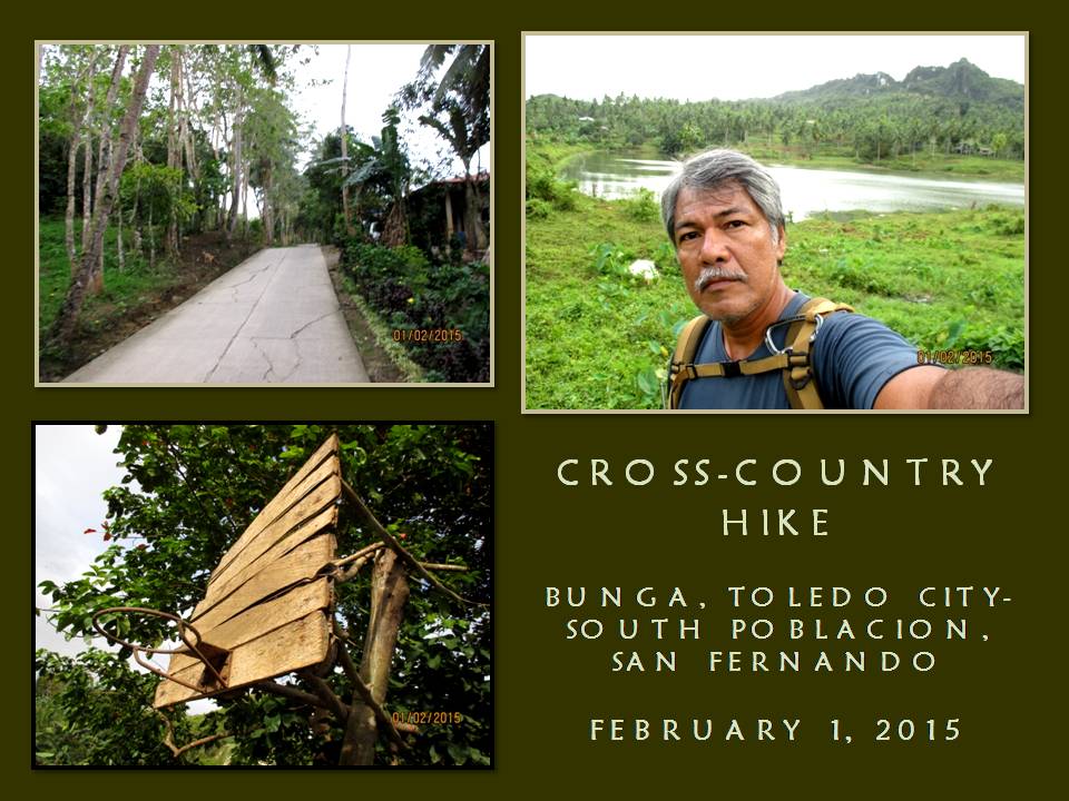
last time when we were on another training from Lutopan, Toledo City over the middle spine of Cebu and down the road to South Poblacion, San Fernando. My feet soles were in great pain after that and a skin on the tip of my left heel burst.

Today, I added rubber insoles to my shoes and added another layer of thin socks next to my skin apart from the Kailas hike socks I preferred using. The trail ascends in easy gradual stages but when the sun is out I begin to feel my energy sapping. We stop to rest near a smoking charcoal mound and eat our second pieces of bread and drink water. It is good to just sit and recover your breathing.

We continue on and the trail begins to go steep and pass by farms of taro and walls of limestone so close together. I see a lot of caves here and I like caves but not to the extent of using it as a venue for commercial and leisurely activities. This route is so “lonely” but I like it the way it is. It suits well to my interest of bushcraft and survival. I see water seep down from the rock wall and channeled to a plastic container with bamboo troughs.

We climb up to through many saddles and I now begin to feel fatigued. It begins to get worse when the sun comes out. From afar, I see a small community. It would be good to take rest there and ask for directions. I noticed that the farther we take the explored route, the farther we are from the village of Patong and of Osmeña Peak. I happily remove my backpack when we reach one house. We eat our third pieces of our bread and drink more water.


We ask of their coconuts and happily disgorge it of its precious liquid. I feel the energy coming back and I stare back at the steep trail that a local pointed to me that would lead me to Patong. It is very intimidating but I have to try. My stomach is full and it would add to the weight. Slowly, I ascend the path which leads to a high saddle and arrive at the top without stopping. We are now behind schedule when I followed the route in that small “lonely” valley but, nevertheless, we have to be at Patong and analyze our chances.

We reach Patong and take the opportunity of dousing thirsty throats with cold soft drinks. I believe we lost about two hours exploring a place and recovering my blunder. It is 13:00 now and I calculate in my mind the possible time we would be at the peak. I would like to be there by 14:00 so I could communicate with Chad Bacolod by radio using an assigned frequency. Chad is a member of the team as Base Support. He does not go with us but updates us of weather at assigned hours. Likewise, we update him of our progress.

Osmeña Peak (1,015 MASL) would be the last obstacle to overcome and it divides Badian from Dalaguete and, slowly, we begin our ascent. For some time, fogs would hug us then the sun blast us and then it go cloudy and sunny again. We reach the peak at 13:58 with a good clearing. Remnants of weekend visitors are enjoying the view that OPeak offer. I shake hands with Jovahn, Jonathan and Justin to congratulate them for climbing OPeak the hard way. I use the radio on the assigned frequencies and inform Chad of our position.

We go down the peak for the village of Mantalongon, Dalaguete through the old route. A lot of houses had sprouted on the upper valley that disoriented me during the last few recent times I was here but I am reunited today through the effort of Jovahn. He lead us through a trail that cuts across the wide Mantalongon Valley instead of following the meandering road which cut short our travel time. We reach the village at 15:18 and douse our thirst with cold drinks along with eating the fourth pieces of our bread.
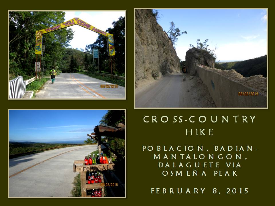
From here, it is all the way down the coast of Dalaguete. It is all concrete except at a part where there is an ongoing road clearing. I never liked concrete pavements because it is not kind to the feet, especially when it goes downhill. It is still a long way to go and it is now 13:30 and then I chance upon a road marker after hiking half a kilometer. It says we are still 12 kilometers away!


My worst fears are relived. Now, as I steadily walked down the road, I could now feel excruciating pain under my feet. Worse, the rubber insoles do not work well outside my hike socks and liner socks do not work well inside on the same socks. My feet feels like it is floating inside their shoes and my toes bump against the insides. When my toes curl to lessen pain the collision brought, it puts pressure on the upper part of the toes, where the the thin socks fills the creases and gaps and rubs the skin.

I transfer to the part of the road where there is dirt or where there are grasses. The reprieve is only temporary until you step on a small pebble and you wince in pain and it slows my walk. I need to be on the coastal highway before 19:00 and resting is out of my thoughts. I did not blink at pain but my eyes betray. The concrete markers says 10 kilometers...9...8... Each time I see one, it gives me hope, but the farther I walk, the pain becomes great.

7...6...5..., I could see the coast now and I overtake Jonathan and Justin take rest. Adding to my misery is the weight of the backpack which starts to dig deep on the flesh of my shoulders. I just transfer the bag – and the weight – infront. Meanwhile, motorcycles whizz by with many people on board unable to comprehend our activity. Sometimes, the drivers offer us rides for free but we softly decline.

Farther ahead and beyond my sight is Jovahn. Four kilometers to go and I could achieve my goal in a few hours, with or without all these pain. Then comes 3...2...and I could see the grade of the road more to my liking now but, still, I choose the greener sidewalks and trot slow until I see the last of the marker which says it is the last kilometer. I reach the junction at 18:10, just as Jovahn had predicted we would, and seconds after me are Jonathan and Justin.

We had just accomplished our last training session in preparation for Segment III, which we will undertake on February 19-22 from Mantalongon, Barili to Mantalongon, Dalaguete over the middle mountain ranges and, I fully believe, we are ready for that challenge. We also had just accomplished the first-ever reverse cross-island hike in contemporary times from Badian to Dalaguete in under 10 hours despite being delayed.

Our hike was done by traditional means, although we may have achieved this rare distinction, but it was just a means to a bigger picture. The Exploration Team’s focus is on Segment III and this achievement was done only for the fun of it. It was sweet for Jonathan and Jovahn for they had not ascended Osmeña Peak from a reverse route and then doing the long extra distances but it was most sweet for Justin for it is his first. At his young age, he had already accomplished much today what most of us have done at a later age.


Nevertheless, we celebrate our coup by finishing the last pieces of bread before limping to the bus stop across the road. As I have said before in a previous article, that finding a half-empty bus to ride is much easier here than on the other side which the majority of weekend hikers go. The first bus arrive with many vacant seats to choose from and I sit nearest to the door and enjoyed the stress-free ride.


Document done in LibreOffice 3.3 Writer

Wednesday, September 16, 2015

MAN-SIZED HIKE XII: Lutopan to Taiheiyo Cement

THE PREPARATION FOR the Cebu Highlands Trail Project goes on high gear today, February 1, 2015, with a Survival Hike Training from Lutopan, Toledo City to Tubod, San Fernando then going down to South Poblacion, where Taiheiyo Cement Corporation is located. I have tried this route last August 17, 2013 but it was a leisurely activity which took me and those with me more than 12 hours to finish.

Today I am with my chosen Exploration Team composed of Jonathan Apurado and Jovahn Ybañez. I woke up at 02:00 and walked my way 30 minutes later from residence to the Cebu South Bus Terminal. I buy five pieces of bread to be consumed later during the hike and take time to nap on an empty chair. By 04:30, I transfer to the 7Eleven Convenience Store and wait for Jonathan and Jovahn.

Jovahn did not arrive but Jonathan and I leave, nevertheless, at exactly 05:00 from Cebu City on board a bus for Toledo City. I do not want again to make my activity to be held hostage by people who are not punctual. We arrive at Lutopan at 06:55 and walk to a waiting shed that marks the start of our route. The village of Bunga will be the jump-off point for this training hike and the early morning clime is cold but, otherwise, fine.


I grab my new Canon IXUS 145 Camera, provided for by Tactical Security Agency by special arrangement, from inside my Silangan Predator Z Tactical Backpack. The camera will be used for documentation of the whole project as well as for this occasion. I also make ready my Cignus V85 VHF radio and set a frequency where another cog of the team – Chad Cordova – will be monitoring as Base Support Crew.

I will open carry my AJF Gahum Heavy-duty Knife inside its PVC sheath. The knife is made by Aljew Frasco, a fellow bushman and one of my benefactors. One of the reasons why I will open carry a knife on this route is to facilitate familiarity to the locals of a different lifestyle that bushcraft will undertake. To recall, inhabitants on this route are suspicious of outsiders and they do not see hikers often and, much more so, from a knife-carrying urbanite. It is time to break that taboo.

At 07:00, me and Jonathan follow the road to the community of Bunga. We are still on the jurisdiction of Toledo City and, soon, we will be in Lamac, a mountain village of Pinamungahan town. We pass by a small lake and go down the road into its shore. Across us are people fishing using lines while nearby the lake is a poultry farm. It is a small lake alright and we know its name by the time we go back to the road. It is called Po-og Lake.

Today I am blessed with the finest weather. It is supposed to be a rainy morning and that would not have bothered me except the new camera. The camera kept blazing at its target seen in the viewfinder. Some parts of the road were cleared recently of earth caused by Typhoon Seniang. The walk becomes fast-paced as the grade of the road goes down into Lamac. We reach the village at 09:00 and eat rice cakes without stopping.

Without stopping really meant without stopping for a short respite even the chance to rehydrate. We do stop beyond the village of Sibago, still a part of Pinamungahan, but on the foothill of a trail that led to a ridge to drink water. This ascending trail leads to a road that is the boundary between Pinamungahan and San Fernando. The trail had been washed by rain runoffs and by small landslides yet we reach the road at 10:00.


We reward ourselves with cold bottles each of soda drinks and, at the same time, eat our first pieces of bread. After about five minutes, we proceed on with the training. We follow a path that had been widened and dug in deep by the sleds pulled by the many generations of swamp buffaloes. I call this the “Carabao Highway” and it would lead to the village of Tubod, in San Fernando, and, perhaps, would go all the way to Mantalongon, Barili in the old days.

The animal path is wet but there are parallel paths for humans to walk on, like a street sidewalk, and we shift often to one or the other whenever it suits us. We pass by an old concrete marker on top of a ridge that divide San Fernando and Pinamungahan and a couple of albino carabaos grazing. Since we left Bunga, I gave my best courtesy to the locals, giving greetings with a smile to arrest their instinctive suspicions of our presence. Sometimes they may ask what we are doing but I gave them honest answers.

It is not strange if they would ask us if we are doing a survey. That is the strategy that some groups with ulterior motives had been using to cover their real purpose but they get, instead, our honest answers. One local even asked us if we are treasure hunters. It elicit me a smile when I remembered that this was the prevalent question which the mountain inhabitants of Carmen had been asking of me and my previous group when I was there in 2009.

We reach the village of Tubod at 12:00 and it looks empty. On the communal water source, women are crowding around a concrete basin filled with water from a natural spring. They are doing laundry. We asked for a piece of their clean water and filled up our water bottles. We do not tarry and again we found ourselves walking on the road. This is the second half of our training and may well be the hardest.


Tubod is found exactly in the middle of Cebu between San Fernando and Pinamungahan and it could be 15 to 16 kilometers, when a bird flies, to either shores. It is located on a mountain ridge but on its east and west are other mountain ranges. Your view of the sea are blocked because of these mountains! We happily go down the road and reach a bridge after 30 minutes and, slowly, our torture begins when the road goes up. Ahead of us is a mountain range.

The bad thing about walking on mountain roads, especially if it is paved with concrete, is it is torture on the feet soles. Another thing is its monotony which bleeds away your expectations of a reprieve. I had been tempted many times to end this walking by accepting an offer of a free ride from drivers but I politely declined. During four days of Segment III (Mantalongon, Barili to Mantalongon, Dalaguete), which would be in about three weeks from now, it would all be mountain roads.

I face the ascending road with dread as it evolve into unending rises which would be broken by just a handful of level grades for just a few meters only. I would want to take a brief rest but the breaking of a momentum would be hard to recover. I would get that rest, however, if I am assured of a cold drink from a small store, which is rare. I need to replenish my spent energy and the best answer is sugar from soda drinks.

When I found a store in Bugho, we stop and drink the cold contents of a bottle and eat our second pieces of bread. After that, we bravely face again the endless rises of the road. We pass by the village of Magsico and further on would be the village of Tabionan which we reach at 14:00. My feet are now complaining as it is now swelling at the heels and the ankles are a bit stiff. I have found the 5.11 Tactical Series Shoes unfit for long walks on concrete roads. I don’t know why? But it must be the great care I treat the pair by changing my gait so soles would not drag on concrete.

We stop at Tabionan for one final drink of cold drinks. This is where the end of endless rises and the start of an unending downhill walk of asphalt and concrete pavement. Asphalt are missing on some parts of the road and I chose to walk on where it is unpaved. The soft ground would have been a reprieve but the feet have suffered so much and can only feel a little comfort. Worse, the weight of my backpack’s contents are beginning to be felt on the flesh of my shoulder as well as on the back of my waistline.

I walk slow to diminish the impact of feet on the ground and to lessen the bounce of the bag on the shoulders. I see a different ridge from my angle that would have lessened the travel on the road and I could have dared to explore it today if I only knew of its existence. The road I am on wind on a very long horseshoe curve and I am appalled at this torture. I have seen no local walking on the road like we do and they might have thought us as foolish for declining a ride.


Our hopes begin to soar as we see from afar the shoreline and the tall exhaust tube of the Taiheiyo Cement plant. I am hoping we would reach the cement factory by 16:00 but, at my controlled pace, I doubt it. I am not worried because we have a lot of daylight to spare. Steadily, the slow and controlled downhill walk diminish away the distance and my expectations that I would reach the highway at 16:00 becomes achievable.

I reach the plant at 16:00 and the highway five minutes later. We crossed the road half limping and sit on the waiting shed. Sitting still had never been so wonderful as is felt now. I congratulated Jonathan for surviving this test. We have accomplished our Survival Hike Training in nine hours of an almost non-stop walk without a solid meal in between. My experiments on just bread and water gained success once more with this long hike.

Today’s preparation would be tested on Segment III. The monotony of the roads and the different attitude of locals upon strangers would be our big obstacles. The pains felt on our feet and our shoulders can be remedied by adjusting the loads to the most basic of essentials like simple shelters, extra clothes and dried food. Navigating by traditional means would still be our main strategy in dealing with distance and objectives.

Apparently my feet took a beating and I wince in pain as I try to stand up from where I sat. I sit down again and, silently, I begin to return the camera, the AJF Gahum and the 5.11 operator belt inside the backpack while changing to a dry t-shirt. I have learned a lot from this day’s activity and I will make a big adjustment on the care of my feet since Segment III will be 4 days. I would need pain killers and some balms for that or even change my shoes.

It would be noted that on Segment III our loads would be heavy considering that we will be carrying our food. My own load would be very heavy and I begin to doubt the externally-expandable 32-liter Silangan Predator Z could carry all my needs. But it does not faze me at all. Today’s activity had prepared me and my team what to expect.


Document done in LibreOffice 3.3 Writer

Wednesday, September 9, 2015

CEBU HIGHLANDS TRAIL LAND NAVIGATION TRAINING

THE CEBU HIGHLANDS TRAIL Project is an exploration activity. Its main purpose is to find a route and would ultimately link the northern tip of Cebu with its southern tip or vice versa through a trail or a route which would traverse axially on and among the island’s rugged and middlemost mountains and hills. It is an ambitious undertaking considering that it is a personal crusade pursued by this blogger almost without sponsorships and support.

Cebu is about 260 kilometers in length, more or less, in a straight line and, presently, it can be traveled north and south and all around through the coastal highways. A route blazed by the Exploration Team of the Cebu Highlands Trail Project would someday make Cebu a very tantalizing magnet for backpackers, both here and from abroad, since the idea itself is lent from the Appalachian Trail and by the Pacific Crest Trail of the USA.

The Exploration Team which this blogger will lead will identify and document the possible river crossings, water sources, campsites, entry and exit points, evacuation areas, escape routes, bivouac sites, meal stops and communities, along with its peace and order situations, which the chosen route will pass. The team will rely more on traditional land navigation like terrain and shadow analysis, local knowledge and location of celestial bodies.


The Global Positioning System which everyone favors because of its real-time information is not, and will never be, part of the team’s equipment. On the other hand, each member of the Exploration Team, to include the Base Support Team, will be taught and will learn the basics of map information, knowing how to read a bearing, use protractors to get back azimuths, understand grid coordinates and ascertain locations basing on this time-tested and fail-proof methods.

For this occasion, this blogger is inviting the members of the Exploration Team and the support group to a free Map Reading lecture. I have taught many times practical map reading to a number of outdoorsmen in the past, especially to my adherents belonging to the Camp Red Bushcraft and Survival Guild, and, I believe, it creates better outdoorsmen of everyone. GPS can fail you anytime but the map, the compass and the protractor would not.


From the team are Jonathan Apurado, Jovahn Ybañez, Justin Apurado and Chad Bacolod. A few of those whom I have invited also came like Aljew Frasco, Bona Canga, Jerome Tibon, Nelson Orozco and Jon Daniel Apurado. I seldom teach technical sessions because it wracks my brain but, just the same, I am glad to share this valuable knowledge to the team members and to the rest.

It is a rainy Sunday morning of January 25, 2015 yet it does not matter. I will do the theories under the wide front awning of the Cebu Cultural Center in Lahug, Cebu City. Everyone are here, except two or three, and I use an unused plywood to act as a “blackboard” and, at the same time, to attach different maps. Of course, there are many kinds of maps but, in land navigation, the topographical map is preferred.

The topo map has all the important ingredients which you could use for navigation. It has contour lines, different shades for elevations and vegetation, bar scales, a declination diagram and, most of all, it can be improved further by drawing intersecting grid lines across it. What this blogger did was photocopying a part of the map and draw grid lines and reproduce it as test maps. The test maps would then be used by the participants during the practical phase of the lecture.


The contour lines are those very thin crooked lines colored brown. Contour lines interpret the different elevations of land as seen on a map and are sometimes seen as eccentric circles. Interpreting actual elevations based on a map are quite catchy and, sometimes, are confusing. For this occasion, this blogger gave the participants a written exercise in profiling a mountain range based on a sample set of contour lines.

After getting familiar with the choice of a map, the choice of a compass is next. While all compasses are made to be dependable, one compass that stands out from the rest because of its design is the one with a base plate. This compass has a transparent plastic rectangular base that functions as a short ruler with measuring units in metric and in English. It has a small magnifying glass that lets you read small details on the map. It is lightweight and very simple to use.

A stand-alone compass is already enough to get the cardinal directions but, paired with a map, it can locate your exact location. How to do that? First, you have to orient the map with the compass. You have to find true north. Your map has a grid north while your compass points to the magnetic north but you have to adjust both map and compass according to the declination diagram and, after doing that, you now have the true north.


Here in Cebu, where we are ten-degrees above the tropics, adjusting the map based on the declination diagram is not necessary. What matters instead is where would you use the compass. The compass needle is subject to magnetic interference and you must avoid, as much as possible, steel towers and metal you wear. Yes, your ring, necklace and your electronic gadget would create a false direction on the needle.

When you have oriented your map and compass, you only need two prominent landmarks to sight your compass at before determining your location thru the dissecting back azimuths as in the method called Resection. On the other hand, Modified Resection uses an already identified feature on a map (like a road or a river) where you assumed you are on and sight only one landmark. The back azimuth dissecting that location on the map determines then your exact position.

Giving a demonstration on the open grounds across the University of the Philippines is quite difficult for these two methods since tall buildings obstruct all view of mountains, leaving me no recourse but to apply dead reckoning on our present location, which is easy anyway, for the features on the map are second-nature for a Cebu native to guess at correctly. Anyway, I proceed to teach them about how to read grid coordinates.


We transfer to higher ground which is near the GMA TV Station on the hills above the Mahiga Creek Watershed. Rain make our map reading difficult to execute since the maps get soaked. Besides that, thick fogs befell on the mountain range where our precious landmarks are and on the very places where we are. We need to find a much suitable place and much much higher than this place.

We found it near where Mr. A Restaurant is located. This time we got what we wanted – mountain peaks, islands, shorelines and man-made landmarks. The guys practice their skills on the compass and the map doing the two methods – Resection and Modified Resection - and converting it into grid coordinates. I am satisfied that I had imparted this valuable skill and my XTeam comes equipped now with this.

For that matter, the Xteam of the Cebu Highlands Trail Project would now be ready to take on Segment III next month and the rest of the segments.  


Document done in LibreOffice 3.3 Writer

Tuesday, September 1, 2015

NAPO TO BABAG TALES LC: The Team Finals

FROM NINE PEOPLE WHOM I had invited to join my selection in establishing a team to explore the route for Segment III of my Cebu Highlands Trail Project, five made themselves available for the challenge last January 4, 2015. It was a tryout of sort and I was considering the five to be on the team, in one way or another, but I need only two slots.

It was a moderate route that tackled Tagaytay Ridge head on from Sapangdaku Creek and then taking a long loop, tiptoeing over Babag Ridge and down again to Sapangdaku Creek until we ended the day at the trailhead in Napo. The rain that had caused trails to go muddy, soft and slippery, made it more hard. All persevered and made my selection for the team difficult and complicated.

Today, January 11, 2015, however, will be different. I would be expecting four of the five to be at the meeting place in Tisa. The fifth candidate would be in a foot race and would not be available at Tisa but I considered the absence justifiable. On the other hand, only two candidates physically came. Well and good! That would make my selection easier now. Even before this day’s hike would commence, the two had comfortably snared the slots. Congratulations! Although, it would still be the manner of how both will finish this hike.


So, after a light breakfast at Mang Tinapay, we leave Tisa at 07:00 for the trailhead over Riva Ridge Subdivision. We will be following the complete route of Freedom Trail, a route that I had last walked on June 11, 2010. I do not know if some stretches of the route are still existing but I do know that this is the mother of all travails that I had concocted on the Babag Mountain Range.

Fortunately, the climate played into my expectations. There is a thick cloud blocking the rays of the sun as I gaze from the trail on Tisa Hills. At this hour, the sun will start to scorch you senseless on the bare slopes. It was smooth sailing for us that I have given in to the temptation of exploring another route that would bring me closer to Kilat Spring.

My 5.11 Tactical Series Shoes played true to its billing and had never given me problems on water-polished limestones which my other shoes had. I cross a cleavage and go on up Banawa Hills, passing by parched farms and stopping to examine a small chapel with a small statue of the Holy Child. The ground underneath a mango tree is swept clean, indicating that there is a thriving community on these forgotten places.

In a week, the whole of Cebu will celebrate the feast of the Señor Santo Niño de Cebu and the chapel is being readied as well and, I believe, the common people living here would celebrate with the rest. Their faith keeps them going and they persevered on these unkind slopes but it is their home and that is where they get their strength to survive. I am just amazed at these poor simple folks, toiling under the sun on soil as hard as rocks.

We move on and cross another cleavage into a rare flat land that is home to stunted rows of horseradish. Grassland pitas (Local name: maya) swarm the air when it notice our presence. I enjoyed the spectacle that I kept them flying with a loud clap of the hands. I pursue Freedom Trail into the higher elevations and then I switch to a path that led to Kilat Spring.

I meet an old woman with a bundle of long sticks above her head. I presume, she came from Buhisan and she carried that uphill for, maybe, about 30 minutes. Oh God, she is strong but coughing bouts showed weakness in her health. Tears well on my eyes that she still had to do this labor so late at her age when she is supposed to be resting and taken cared of by her relatives. I know that life is sometimes unfair but God will never turn a blind eye on her. I am sure of that.

I walk on and somewhat assured that I would be walking down the lee side of Banawa Hills. The natural spring is devoid of people. We took the occasion to fill our bottles full with its pure water. After that, we proceed for the Portal at 09:00 and, I believe, it would be a short walk to there. By 09:30, we are passing by the place, intending to reach our next stop in another 30 minutes.

I reach Baksan Road and walk the concrete pavement uphill in warm sunshine. I need to reach a forgotten trailhead at 10:00 and I am beginning to doubt it because of my sudden exposure to sunrays which slowly demoralizes me. But, as I was recovering from the heat under a mango shade, the clouds again interfered. I hasten my pace and reach the trailhead.

I finally sat down on a knee-high concrete that marked the presence of a drainage culvert underneath and the trail just across. We took the opportunity to munch on a piece of bread. Yes, we are training in survival hiking. We will not cook a meal like I used to do with the rest of the Camp Red Bushcraft and Survival Guild because, during Segment III, daylight hours would be precious and we need to cover a lot of ground.


I am applying to the candidates what I had experimented many times: bread and water. One bread if bloated with water afterwards, would give you enough energy for a good two hours to tackle difficult terrain. For moderate terrain, about 3-4 hours. This is the first of our rest stops. I had bought six cinnamon bread and I eat only one. Sweet, yes, and overindulgence of which would not be good for your health but I need glucose to give me that energy boost.

I face the path that lead to Arcos Ridge with dread because I do not know anymore the condition of the trail. I discovered this trail in 2009 and incorporated this into that Freedom Trail that I had talked about. I notice smoke ahead – charcoal makers! Walking on slowly, I see a man helped by his two little kids arranging wood in a hole. They did not notice my coming and were startled by my presence. To diffuse their anxiety, I gave six little cupcakes to the two children and I am rewarded with smiles.

We proceed on and I face now a wall of thick vegetation where, before, was a path with strips of little corn plots beside it. Arcos Ridge is a thin piece of ground that starts from Baksan going down into Napo. About a kilometer long, more or less. It is very steep on the whole side facing the Sapangdaku Creek and on some sides towards a part of the Lanipao Valley.

I always open carry a big knife in all my outdoor pursuits and, today, the AJF Gahum heavy-duty knife claimed that honor of worthiness. I hacked a path through thickets and vines which hinder our passage. I did not do this blindly because you would veer away from your intended route. I checked out the landmarks to guide my progress else I would fall on those steep slopes. This is traditional land navigation at its best and I was slashing for about 40 minutes.


The work with the knife would have tire me out were it not for the cloudy skies shutting away the sun. I got a firm hold of the path I made and I am rewarded with the first of the several tamarind trees which I remembered shaded me during my previous visits here. The trees became my guide posts until the first signs of a trail appeared as the terrain cant down. It is steep but it is the trail. Slowly and methodically, I reach Arcos Creek. It will drain into the bigger Sapangdaku Creek somewhere near Napo.

I cross the Sapangdaku and intentionally immerse my shoes in the water to get rid of the caked mud which it got during last week’s initial training. Then I climb over the riverbank and into the campus of the Napo Elementary School. It is 11:30 and we buy cold soda drinks to pair it with our bread. I eat two pieces. I begin to feel better now but, I think, we need to spend a brief but well-deserved siesta in the school.

By 13:00, we continue on. After crossing a footbridge, we follow the trail to Lower Kahugan Spring, reach it after 30 minutes, and then refilled my bottle. I look at the skies and it begins to darken. Rain is threatening our hike. I pushed myself harder because of that when I made my move towards the Roble homestead and suffered for it by resting often on the trail.

At 14:30, I reach the house. I could not believe it that I am able to reach it in less than 30 minutes. Probably some 25-26 minutes because we rested at the natural spring for a refill and lots of breathers for me. The fastest I did was 28 minutes but it was done downhill! I take a seat on the bamboo bench and close my eyes to keep my body still for it was shaking like an overworked engine.

I plead from Fele Roble three pieces of green coconuts for the three of us. I drank the refreshing liquid of the fruit and opened it with the AJF Gahum to retrieve the meat with one hand for my nourishment because I needed it most for the hardest part of the journey. For insurance, I eat my fourth bread and washed it with water. It is still a long way and a lot of it are uphill.

I walk slowly, not forcing this time, even though I am pressured by time. I rest to take breathers when I need to and I could not count of how many times. It was torture and I begin to entertain thoughts to end this hike if I reach Mount Babag and hire a motorcycle to whisk me down to JY Square and sanity. To reach the topmost ridge, 45 minutes is unrealistic although I have done it long ago.


This time it is different. It brings back memories of that 2010 Freedom Climb starting on the same place at Tisa. I was carrying a big Habagat Venado II then, which contained all the items of my house. This time I am carrying a smaller Silangan Predator Z that contained the things that I would need during Segment III. By 15:30, I reach Babag Ridge. I blinked at the feat I just made. I think I am crazy and I need a break!

I would have taken a shortcut on the shoulder of Mt. Babag but it had been smothered by a construction work. I may be crazy but crazier still are people who bulldozed mountains when they begin to think a piece of the mountain as their property. This land belongs to the government and is considered timberland. The most you could do is just possess a title declaration or a timber lease agreement but you could not develop and construct a permanent structure on it. Period!

I walk on and grumble on the way until I reach a small store. We stop to buy cold softdrinks and eat our bread. (I ate my fifth.) I am refreshed and I now believe that I could finish this circuit and begins to disregard that exit plan to JY Square. For almost an hour we walk the road until I reach the trailhead of the No-Santol-Tree Trail which would lead me to Kalunasan.

Thank God, this is all downhill. The bad news is it is already late afternoon and soon it will be dark. The trail had improved a bit, I suppose. The last time I passed by here was on the dawn of Black Saturday 2013. It is also very slippery here but my new shoes keep my footing stable. This is really a good pair. I make good progress and come upon familiar landmarks which says I am in the right way.

As I was traversing the rest of the trail, I am tempted to explore a trail that Ernie Salomon had wanted to try. I begin to follow that path but, contrary to what Ernie had believed, it went instead to the direction of Napo. I looked for an alternative route to find a short cut that would intersect back to my own NST Trail. It goes down to a flower farm and then a dead end. I saw a glimpse of a path far down and I studied the terrain carefully.

I thought I saw an easy way to get there but I misjudge it. It was not easy but I chose a Hail Mary chance and it brought me to a steep gully. Debris are choking it but you have to be careful where you step. The rocks are slippery since it is wet but you have no choice but down. It is already gloomy as the last hours of the day are sinking. Going down I see bamboos and bamboos meant people. People always gather bamboos for housing materials.


My hunch was correct. Bamboo poles were harvested recently and left all around. I used the long poles as a bridge to transfer to another spot. I crawled, balanced, slid and even squeezed painfully my holy balls to initiate a good progress. I finally found the headwaters of Lahug Creek by accident and this is no mean feat in an unholy hour. The waters are clear but I remembered the flower farms were using pesticides. Blue traces stuck on their leaves.

The light of the setting day is getting dimmer now but I am walking downstream over boulders and then I saw a path going up. This is the trail I saw earlier from the flower farm, I reckon, and my heart beats faster with excitement and so are the footsteps behind me. We ready our LED lights but we did not use it. In the dim light the path is very clear like a ribbon of creamed coffee. I use this opportunity for night navigation training instead for the duo.

We reach Kalunasan Road at 18:00 and there is nothing more to do but eat my sixth bread and walk its long length to Guadalupe. We arrive at 19:15 and conclude our journey at Bikeyard Coffee where Aljew Frasco, Bona Canga and Christopher Maru joined us. The remaining two candidates with me are now officially part of the Segment III Exploration Team, along with another, who excused himself because of a commitment, and two others as Base Support Crew.

That was a blockbuster of a route and it was long and hard. We all deserve the slots for we persevered and survived on bread, water, coconut and soda drinks. This was just the start. We will be doing this same routine for four days of February as we walk Segment III and – soon - from Segment IV to Segment VIII. The Cebu Highlands Trail is a demanding route and no one had taken it yet but me and my team are undaunted. I will walk into the sunset with my team and we will leave a legacy.


Document done LibreOffice 3.3 Writer