Showing posts with label Malagaring Trail. Show all posts
Wednesday, September 23, 2015
MAN-SIZED HIKE XIII: Badian Coast to Dalaguete Coast
THIS
WOULD BE THE last Sunday of training for the intrepid individuals who
will compose the Exploration Team of Segment III of the Cebu
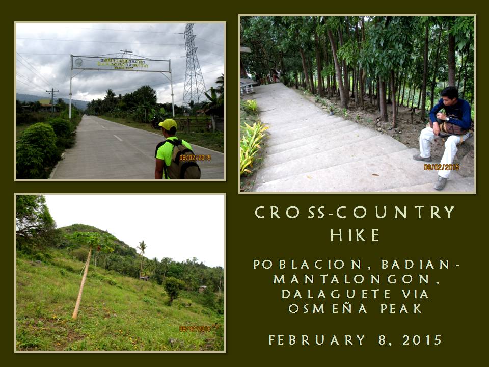
Highlands Trail Project. Today, February 8, 2015, we will do a
coast-to-coast hike and climb from the Municipality of Badian to the
Municipality of Dalaguete with Osmeña Peak as the highlight of the
route. It is 34 kilometers long according to a road marker on the
junction of the highway in Badian.
We
will be on Survival Hike Training. We will just subsist on bread and
water. We will have to forego again lunch in between Point A and
Point B, unlike that which I used to do with my other activities.
During Segment III, time would be of essence since we would have to
cover a lot of ground under daylight hours and we could have that
deserved meal only during dinner and breakfast. We will also train
on speed and endurance and, for me, getting used to the load I will
carry during Segment III.
I
am the project director of the Cebu Highlands Trail Project since
this is my brainchild. It is a personal undertaking that is
supported by both the Camp Red Bushcraft and Survival Guild and the
Mountain Climbers Alliance of the Philippines. Sponsors who had
contributed equipment and other logistics for this project are
Silangan Outdoor Equipment, Mr. Jonathan Blanes, Mr. Glen Domingo,
Mr. Aljew Frasco, Mr. Glen Pestaño, Titay’s Lilo-an Rosquillos and
Tactical Security Agency.
I
am also the team leader and navigator of the Exploration Team. The
team is composed of Jonathan Apurado and Jovahn Ybañez with Justin
Apurado as reserve. They are all here for today’s activity and
they will face and brave the yet untried but intimidating route with
me. It had rained when I am about to leave my house 03:00 and I
liked the omen I received. I walk from home to the direction of the
Cebu South Bus Terminal and take a short nap.
The
bus leave Cebu City for Badian at 05:30. We cannot be at Badian at
07:00 since I miscalculated the departure time and I have to make do
with a 08:00 arrival. We reach Badian at 08:15 and we start our foot
journey at 08:35 after some personal necessities. We walk on the
road for the village of Basak, which we reach at 09:40. At Basak,
the trailhead to Southern Cebu Mountain Range is found and I retrieve
my AJF Gahum knife and open carry it. Jonathan and Justin do
likewise with their knives.
The
weather is cloudy since we left the national highway and it augured
well to our cause. I am most worried with the 10 kilo load in my
Silangan Predator Z bag because I might bog down when the route would
get difficult in very warm temperature. I follow the trail from
memory over rocky terrain and small farms. We reach a small
community of Malagaring and eat our first pieces of bread and drink
water. It is good to take a rest, but not for long.
We
meet the first party of overnight visitors of Osmeña Peak. They are
poor creatures utilizing minors to carry the loads for them. Not a
good idea. I decide to shift to a different route down a small
valley which I have had the lust to explore. This is the best moment
to undertake that and the best moment as well to evade the Malagaring
Trail which would be crowded by the same people we had met earlier.
The
path is good but there is less forest cover. It is used for farming.
The route is also used by charcoal gatherers. Here and there and
everywhere are spots of ground used in charcoal making and, on three
occasions, smoke emit from mounds of earth indicating charcoal in the
making. A very light shower fall from the skies and make limestones
slippery. I have developed trust on my 5.11 Tactical Series Shoes
and I am not worried.
The
only worry from this pair is that the energy caused by the pounding
of feet on ground are not absorbed well by the rubber soles but
transferred directly instead to the feet soles as what happened the
last time when we were on another training from Lutopan, Toledo City
over the middle spine of Cebu and down the road to South Poblacion,
San Fernando. My feet soles were in great pain after that and a skin
on the tip of my left heel burst.
Today,
I added rubber insoles to my shoes and added another layer of thin
socks next to my skin apart from the Kailas hike socks I preferred
using. The trail ascends in easy gradual stages but when the sun is
out I begin to feel my energy sapping. We stop to rest near a
smoking charcoal mound and eat our second pieces of bread and drink
water. It is good to just sit and recover your breathing.
We
continue on and the trail begins to go steep and pass by farms of
taro and walls of limestone so close together. I see a lot of caves
here and I like caves but not to the extent of using it as a venue
for commercial and leisurely activities. This route is so “lonely”
but I like it the way it is. It suits well to my interest of
bushcraft and survival. I see water seep down from the rock wall and
channeled to a plastic container with bamboo troughs.
We
climb up to through many saddles and I now begin to feel fatigued.
It begins to get worse when the sun comes out. From afar, I see a
small community. It would be good to take rest there and ask for
directions. I noticed that the farther we take the explored route,
the farther we are from the village of Patong and of Osmeña Peak. I
happily remove my backpack when we reach one house. We eat our third
pieces of our bread and drink more water.
We
ask of their coconuts and happily disgorge it of its precious liquid.
I feel the energy coming back and I stare back at the steep trail
that a local pointed to me that would lead me to Patong. It is very
intimidating but I have to try. My stomach is full and it would add
to the weight. Slowly, I ascend the path which leads to a high
saddle and arrive at the top without stopping. We are now behind
schedule when I followed the route in that small “lonely” valley
but, nevertheless, we have to be at Patong and analyze our chances.
We
reach Patong and take the opportunity of dousing thirsty throats with
cold soft drinks. I believe we lost about two hours exploring a
place and recovering my blunder. It is 13:00 now and I calculate in
my mind the possible time we would be at the peak. I would like to
be there by 14:00 so I could communicate with Chad Bacolod by radio
using an assigned frequency. Chad is a member of the team as Base
Support. He does not go with us but updates us of weather at
assigned hours. Likewise, we update him of our progress.
Osmeña
Peak (1,015 MASL) would be the last obstacle to overcome and it
divides Badian from Dalaguete and, slowly, we begin our ascent. For
some time, fogs would hug us then the sun blast us and then it go
cloudy and sunny again. We reach the peak at 13:58 with a good
clearing. Remnants of weekend visitors are enjoying the view that
OPeak offer. I shake hands with Jovahn, Jonathan and Justin to
congratulate them for climbing OPeak the hard way. I use the radio
on the assigned frequencies and inform Chad of our position.
We
go down the peak for the village of Mantalongon, Dalaguete through
the old route. A lot of houses had sprouted on the upper valley that
disoriented me during the last few recent times I was here but I am
reunited today through the effort of Jovahn. He lead us through a
trail that cuts across the wide Mantalongon Valley instead of
following the meandering road which cut short our travel time. We
reach the village at 15:18 and douse our thirst with cold drinks
along with eating the fourth pieces of our bread.
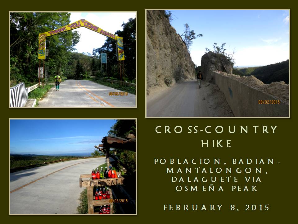
From
here, it is all the way down the coast of Dalaguete. It is all
concrete except at a part where there is an ongoing road clearing. I
never liked concrete pavements because it is not kind to the feet,
especially when it goes downhill. It is still a long way to go and
it is now 13:30 and then I chance upon a road marker after hiking
half a kilometer. It says we are still 12 kilometers away!
My
worst fears are relived. Now, as I steadily walked down the road, I
could now feel excruciating pain under my feet. Worse, the rubber
insoles do not work well outside my hike socks and liner socks do not
work well inside on the same socks. My feet feels like it is
floating inside their shoes and my toes bump against the insides.
When my toes curl to lessen pain the collision brought, it puts
pressure on the upper part of the toes, where the the thin socks
fills the creases and gaps and rubs the skin.
I
transfer to the part of the road where there is dirt or where there
are grasses. The reprieve is only temporary until you step on a
small pebble and you wince in pain and it slows my walk. I need to
be on the coastal highway before 19:00 and resting is out of my
thoughts. I did not blink at pain but my eyes betray. The concrete
markers says 10 kilometers...9...8... Each time I see one, it gives
me hope, but the farther I walk, the pain becomes great.
7...6...5...,
I could see the coast now and I overtake Jonathan and Justin take
rest. Adding to my misery is the weight of the backpack which starts
to dig deep on the flesh of my shoulders. I just transfer the bag –
and the weight – infront. Meanwhile, motorcycles whizz by with
many people on board unable to comprehend our activity. Sometimes,
the drivers offer us rides for free but we softly decline.
Farther
ahead and beyond my sight is Jovahn. Four kilometers to go and I
could achieve my goal in a few hours, with or without all these pain.
Then comes 3...2...and I could see the grade of the road more to my
liking now but, still, I choose the greener sidewalks and trot slow
until I see the last of the marker which says it is the last
kilometer. I reach the junction at 18:10, just as Jovahn had
predicted we would, and seconds after me are Jonathan and Justin.
We
had just accomplished our last training session in preparation for
Segment III, which we will undertake on February 19-22 from
Mantalongon, Barili to Mantalongon, Dalaguete over the middle
mountain ranges and, I fully believe, we are ready for that
challenge. We also had just accomplished the first-ever reverse
cross-island hike in contemporary times from Badian to Dalaguete in
under 10 hours despite being delayed.
Our
hike was done by traditional means, although we may have achieved
this rare distinction, but it was just a means to a bigger picture.
The Exploration Team’s focus is on Segment III and this achievement
was done only for the fun of it. It was sweet for Jonathan and
Jovahn for they had not ascended Osmeña Peak from a reverse route
and then doing the long extra distances but it was most sweet for
Justin for it is his first. At his young age, he had already
accomplished much today what most of us have done at a later age.
Nevertheless,
we celebrate our coup by finishing the last pieces of bread before
limping to the bus stop across the road. As I have said before in a
previous article, that finding a half-empty bus to ride is much
easier here than on the other side which the majority of weekend
hikers go. The first bus arrive with many vacant seats to choose
from and I sit nearest to the door and enjoyed the stress-free ride.
Document
done in LibreOffice 3.3 Writer
Posted by
PinoyApache
at
10:00
0
comments
Labels: Badian, Cebu Highlands Trail, Dalaguete, Malagaring Trail, Osmeña Peak, training
Monday, September 1, 2014
ALLIANCE MATTERS IV: An Osmeña Peak Reverse by Team Tamad
WHEN I POSTED AN ARTICLE about
the seldom-taken reverse route to Osmeña Peak which I hiked last August 2013 (Reversing
the Trend), three mountaineers from the Mountain Climbers Alliance of the
Philippines, Inc. (MCAP) took this as a challenge and contacted me to engage in
it. I then requested Maria Mahinay to
create an itinerary for this so as to accommodate the wishes of the trio from
Team TAMAD: Kris Shiela Mingi, Gene
Arceno and Julius Roman.
Osmeña Peak is named after from
the most illustrious son of Cebu – President Sergio Osmeña Sr. - because of its
lofty location, being the highest point of the island province at 1,015
meters. It is located within the
Southern Cebu Mountain Range and, contrary to the common perception, is really
part of the Municipality of Badian.
Local mountaineers used to approach it from Mantalongon, which is on the
Dalaguete side, and is just a stroll in the park. The peak is, thus, relegated as just another
leisurely picnic area which I do not like.
Almost everyone thought that it
is unthinkable to hike Osmeña Peak from Basak, Badian and all would rather take
the easy route from Mantalongon and then take their chances downhill to
Badian. Daunting as it may seem, a few
intrepid hikers had successfully tackled this reverse route and had given
meaning to the climbing of O-Peak and of the totality of their journey. It is best to start the climb early morning
during warm days and, if it could not be avoided, is totally safe during rainy
days as there are no streams to cross to.
Today, January 11, 2014, I will
again return to the Southern Cebu Mountain Range to accompany my guests from
Luzon. Local MCAP members Maria and
Barry Paracuelles are also coming in.
Barry is with his wife, Eva Marie.
We start at 4:00 AM from the Cebu South Bus Terminal on board a Ceres
Bus bound for Badian. It had been
raining since last night caused by a Low Pressure Area approaching Mindanao and
a lull had been experienced during travel until we reach Barili when it rained
again.
After taking a light breakfast
at the public market in Badian, Sien Alfanta, Ed Dablo and Neil Mabini arrive
to boost our number. Then comes Jodel
Seville and Charito Matollama and that makes us twelve. Although this is a dayhike, most of the
participants will spend a night in Oslob and so have brought with them bulkier
gears like tents and sleeping bags and some extra cargo. We leave the market for the trailhead in
Basak and start our hike at exactly 8:00 AM.
I travel light today and just brought my EDC
kit, a trauma kit, a dry shirt, a rather heavy LED torch, a Cignus V85
UHF-VHF radio and a liter of water.
Going along is my Nessmuk trio: a William Rodgers bushcraft
knife, an AJF Gahum heavy-duty knife and a Victorinox SAK Trailmaster. I do not open carry a knife today because
this is an entirely different activity.
My Kodak EasyShare digital camera is in the pocket of my Silangan
Outdoors hiking pants. A Buck 112
folding knife is kept in the beltline behind a Victorinox operator
belt.
Sien, Ed and Neil will
spearhead the trek while I backstop the rear.
That relieves me of pressure and would extricate me of possible
accidents as I chose the wrong pair of shoes for this occasion. Anyway, as last man, I could take it easy on
my pace and I could focus more on documentation and taking pictures freely,
although sparingly, as I would not want to ruin my camera under the threat of
this light downpour.
Neil and company started from
the Basak communal well and climbed up a steep snaky route that pass by small
plots of spring onions, corn and cabbages gouged out of rocky terrain. The rain kept up a steady torrent but all
burst with a high spirit of excitement and adventure and shut away the
discomforts of cold and muddy trails.
Walking in foul weather are for the stoutest of hearts only and the
people I am with did not waver from this hardship and that satisfies my
expectations.
When you would want to develop
your stamina and your resistance to the elements, you would need to keep only
the bare comforts and become used to it.
Then you complement it with a good elevation gain which this route will
provide. You start low at Basak at 235
meters and gain 780 meters upon reaching the crown of Osmeña Peak which you
cannot achieve if coming in from Mantalongon.
Aside that, you walk a steep incline of about four kilometers in length
which is also impossible to get from Mantalongon.
We reach the small village of
Malagaring at 8:55 AM and a local offer us free cups of coffee. He is very happy that some of whom who went
with me today sponsored a Christmas party for the children last December. Nobody could beat charity and goodwill. It would always open doors and windows and,
here in the mountains, it will open wide as I have had done so in my own Babag
Mountain Range. If only more outdoorsmen
would include charity works in their activities, trails that had lain invisible
to outsiders would be happily given.
Neil and company follow a
different route than what I took last November 17, 2013 and then it arrive to a
point where the route they had chosen is the same as mine for about a hundred
meters until it crossed a farm and it became totally different again. This time it is more muddy and slippery and
our footfalls are now forceful to get a good grip. It is quite taxing to gain a foothold
especially if you are wearing an old pair whose soles had seen better days and
water ooze in among the hairline cracks.
What I lacked in good footwear
I compensate with less of LNT. Yes, I am
no fool to just walk in the middle of the trail that is muddy where puddles of
torpid water are present just because it is stated so in the Leave No
Trace. Forgive me but my common sense is
better than that foreign ideology which was designed for terrain in temperate
zones. This is the tropics and our two
seasons are conducive to speedy regeneration of vegetation. I deliberately stepped on a lot of vegetation
because I know better.
We keep up a steady ascent and
the guests from Manila were up to the challenge. Gene would take short rests but I keep my
distance so he would spend a lot of it without worrying about the next person
coming, which is me. The route goes in a
small patch of forest and, as it thinned, farms. We reach the small village of Patong at 10:45
AM and it is a chance to quench thirst with soda drinks. I opt to drink my supply of water instead and
eat sweet buns which I bought at a bakery in Badian.
Although we started an hour
late, we compensate for that by pacing fast and reached our rest stops with
more than an hour to spare; muddy trails were not a hindrance though. From what I ascertained, most likely we would
be at the peak before noon. We leave
Patong at 11:10 AM for the last push for the top. The rain had stopped but it is replaced by
strong gusts of wind. Wind chill factor
is high but the guys had taken food and had a drink to replenish spent reserves
of energy exerted in going up here.
The trail is decked now with
broken lime stones, foreboding a great concrete coverup in the future. This route would lead to the saddle where a
concrete road had stopped. We took a
different trail that branched out from this route and it is muddy again. It pass by hilly farms of spring onions,
cabbages and vegetable pears until the trail weave out along the contours of
roundish hills which gave a false impression that you are in the vicinity of
O-Peak. The pace became hurried but I
keep to my own comfortable speed, taking on the scenery with my camera.
After a final turn below a
false peak, the Grandfather Mountain of the South stood in mute silence without
its shroud of mists. We reach the top at
exactly 11:30 AM and, by God, we were fast.
The cold winds are not hospitable in this exposed spot but we held onto
dear ground by putting weight were wind is most felt. I test my portable radio on an arranged
frequency but the reception is not good although I could pick up very clear
signals from harbor traffic and from a weather station.
I congratulated Shie, Gene and
Julius for snaring Osmeña Peak the hard way and, probably, would be the first
done by Luzon-based mountaineers coming in by way of Basak. It is a textbook reverse traverse hike that
will soon terminate in Mantalongon. When
the guests had their fill and had fixed the apex of their quest with photos, we
slowly go down the hill into the breadbasket of Cebu – the high valley of
Mantalongon.
It is raining hard now and the
trail is very slippery, especially at the lower approaches, but when we had
reached the road, we begin to feel that we are now in home territory. We reach the public market at 1:00 PM and
take a deserved lunch at a local restaurant.
It is still raining outside and windy and the inside of the restaurant
is comfortable but we have to leave for lower ground to talk about the Oslob
trip. Six motorcycles accommodated us
all and we go down the main highway located at sea level.
Shie, Gene and Julius had to
shelve their Oslob trip as the waves spun by the inclement weather are not
encouraging for whale watching. We stay
for a while at Dalaguete’s waterfront park for four big bottles of cold beer to
fill up lost electrolytes. We go back to
the highway when we think that the rain would not stop for a bus back to Cebu
City. What people do not understand is
that you get a good chance to ride on a half-empty bus in Dalaguete than that
in Badian. We just did that and we reach
the big city at 7:30 PM.
Document done in LibreOffice
3.3 Writer
Posted by
PinoyApache
at
10:00
3
comments
Labels: Badian, Cebu, Dalaguete, Malagaring Trail, MCAP, Osmeña Peak
Tuesday, July 1, 2014
MALAGARING TRAIL
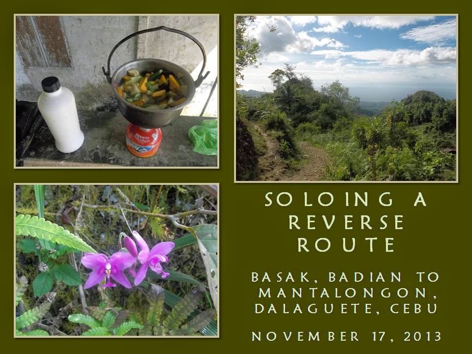
I HAD BEEN MULLING for quite a while to walk alone the trail to that range of mountains where Osmeña Peak belong. Although I have been doing some solo walks to the peak in the past by way of Dalaguete, but I never have done so from Badian. I almost got there solo last August but two people got wind of my plan and scuttled it. However, today, November 17, 2013, that wish would come true.
Basak, a village in Badian, is an exit point whenever people visit Osmeña Peak (1,015 meters above sea level) from Mantalongon. In going down to Basak, people take the Malagaring Trail. This trail is torture to the knees and the shoes. It is rocky. Some sharp, some sloping and very slippery when wet. Although quite formidable, it is really a beautiful trail offering a breathtaking panorama of the narrow valley, of the coastline and of Badian Island.
I know this route very well but it is strangely unfamiliar when you do a reverse. Only fools would walk it from Basak. I am one of these then for insisting to do this for a second time and, for this occasion, under the unyielding torment of the sun. Why start from Basak when you could cruise easily from Mantalongon? The answer to that, my dear Pedro, are 780 meters worth of elevation gain. If you insist to be called a mountain climber, this is significant in your physical preparations.
I am a bushcrafter but, in the course of my outdoor activities, I climb mountains. Not because it is there but because it is just an obstacle to my route. My walk is the complete opposite of conventional backpackers’ route and my terminus would be at Mantalongon. I may not be the first one to do this alone but I may be the first one to blog this worthy activity and convert it into a trend. It should be documented and shared to all and, hopefully, would bring satisfaction to those who will try.
When I left the terminal bound for Badian at 7:00 AM, this quest is already half done. Even without breakfast, much less a cup of coffee. You know, I harbor grief and pain about the succeeding disasters that have struck our nation and I have gone to the very places where earthquake and storm came to give comfort to the affected. This walk is my way of releasing this melancholic stress; my own defense mechanism. This walk is dedicated to the survivors amongst us.
I am a survivor myself and the chance of being outdoors alone will solidify my existence and my link with Mother Earth. The bus arrive at 10:00 AM and, instantly, I procure the ingredients for my noontime meal at Badian market which I intend to cook along the route. More weight were added to my backpack but it is an essential weight. Before I leave town, I eat a piece of bread. This is my breakfast and I am experimenting how one bread, if bloated with water, would carry me through this journey.
I start my walk at about 10:30 AM after stretching my muscles at the very foot of the flight of stairs going to the Basak Elementary School. I am well-stocked with water this time – 2 liters or 2 kilos – and I am not known to use water excessively just to quench thirst. I know this would be a hot day since I start late but I have no misgivings. This walk is all about me and for the survivors of the recent disasters.
Once I am out of the settlements, I stop underneath a mango tree and retrieved my Puffin Magnum knife and sheath from the bag. I place it beside me hanging from my operator belt. I now carry my knife openly when I am outdoors and it is for a lot of reasons. Long ago, my old club used to discourage us about bringing a knife when climbing mountains yet I always had a small one stashed inside my backpack. I now defy that logic and today I spawned a breed of bladekeepers known as the Camp Red Bushcraft and Survival Guild.
I carried another blade – a very rare William Rodgers. It is also sheathed and the wooden handle is prominently jutting out from a hole where bag and shoulder strap meet for easy retrieval. A classic Buck 112 folding knife is safely tucked inside my beltline while another classic folder – a Case XX – is inside one pocket. Last, but not the least, is a Victorinox SAK Trailmaster placed inside the zipped pocket of the 40-liter Sandugo Khumbu bag.
I carried a lot, didn’t I? I can afford to carry that weight and these, too, are essential weights. All are given by my benefactors, except for the Buck and the Case which I got from trades. They are all handsome tools and it takes a special kind of person to understand blades and handle it correctly. You should know your knife rights too and, conversely, know the laws that govern the carrying of knives which I teach everytime I convene a bushcraft camp.
The limestone formation gave the Malagaring Trail a character all of its own. The narrow valley floors are tamed by man but the edges are teeming with wild vegetation eager to reclaim what was theirs. Many deep valleys are choked with hardwood trees and bamboos. Although the day is very hot as it is near noon, the shades afforded by trees are very welcome. I follow a beaten trail and onto the heels of two locals with big but empty baskets carried on a trumpline from their foreheads.
I come upon a narrow pass where the two locals rested and they, with due courtesy reserved for visitors, immediately leave and give me space when I take my turn to rest. The view below is just too enchanting; the azure sea of Tañon Strait so inviting. I am thirsty from the initial exertions so I take a sip and let water stay long in my mouth before swallowing.
My camera is busy taking all what I perceive as very significant like landmarks, hardwood trees, rare plants, etc. It is placed inside one of my pant’s pocket for quick retrieval. My dark blue Rohan hiking pants are a sturdy pair, quick drying, with thick fabric but very light. This pair had not failed me in all my outdoor activities. I also wear my old Rivers 3514M hike boots since there are not too many long descents but I am too careful with foot placements since soles are not that thick anymore.
I just follow the trail, guided by memory, onto enchanting places. I say enchanting because I am alone and my thoughts are not disturbed by a company of chatting people and that kept me away of worries by their presence. I am excited to see many bamboos in places where there are no human activity and I entertain the idea at sitting out the rest of the day cutting one pole and prepare my food on bamboo but it is still a long way so I disregard that.
I push on my ascent skirting farms onto long ridges wishing when this would end. Within the forest, I saw the stinging tree (Local name: alingatong). It had not been cut by people even if it is beside the route although its neighbors are slowly felled dramatically widening the trail. I first saw this tree during my first visit in August 1992 coming from an overnight at Osmeña Peak with my old club. It is like seeing an old friend again.
In my relaxed pace I reach the village of Patong at 1:00 PM. I boil water for coffee first before starting to prepare my meal. I cook the milled corn then the viand. It is a concoction of mushroom and mixed vegetables, fried first before turning it into a soup. No MSG. As I am in the middle of this, two locals join me and befriended me. I am offered a glass of fermented coconut wine which I accepted. The single glass became a repetition and my tongue is loosened.
I told them the tale of my experiences shuttling relief goods to Bohol during the aftermath of the 7.2 earthquake and to Northern Cebu days after Super Typhoon Yolanda left. They were greatly affected upon hearing of the plight of their fellow Cebuanos and would have helped if they would have the resources. Although they had not suffered much but they had felt the unusual aftershocks. I shared my meal to them before I left at 2:30 PM.
I pick my way among farms of cabbage, spring onion and vegetable pear which are hacked from rocky terrain. The soil is good with fine climate associated with high elevations. It is now colder but I have just taken a meal even as I am not wearing layers of clothe. As I near the ridge, I meet people going the opposite way. They came from the market in Mantalongon and they are carrying goods which they could not produce from their own farms.
The ridge bless me a view of the high valley of Mantalongon which is Cebu’s former breadbasket. In the old days, all the vegetables that the markets of Carbon and Taboan in Cebu City used to come from here until other places, much nearer to the city, produce their own. I slowly follow the route to the market and I pass by indigenous hardwood species, still untouched and in its blooming splendor like the yakal (English: golden mahogany), the bagras (English: Mindanao gum) and the bagawak (English: starburst).
The afternoon shadows begin to creep but I am on the way to the market which I reach at exactly 5:00 PM. Mantalongon is known for its men who carry their blades openly in public. I keep mine and walked proudly with it. I get a lot of stares for I am different. Not because I am a stranger but because they are not used to seeing city people with backpacks carrying knives openly. I dare to be different and they better get used to it.
I stay for a while to return my Puffin Magnum and sheath and belt back to my backpack while the William Rodgers stay as its place. It is placed so for quick retrieval should I need it pronto. When I think that I have not sweated much, I replace my shirt with a dry one. I eat one bread from a mobile stall before hiring a motorcycle to take me down the main highway.
The road is good and wide but up ahead are recent landslides caused by the earthquake of October 15, 2013. Rocks of all sizes and dirt would have been all over the road but it was recently cleared. The motorcycle run with a dead engine as it negotiate the descent at moderate speed. When I landed at the highway, a Rough Riders bus came half empty and I can rest now - - - easy.
Document done in LibreOffice 3.3 Writer
Posted by
PinoyApache
at
10:00
1 comments
Labels: Badian, Cebu, Dalaguete, Malagaring Trail, nutrition, solo hike, solo trek, soloing
Subscribe to:
Posts (Atom)