Showing posts with label soloing. Show all posts

Saturday, September 15, 2018

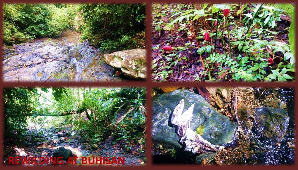
BUSHCRAFT BUHISAN XLV: Rewilding

REWILDING IS THE RETURN of habitats to its original state, to include the re-introduction of wild animals that were once native there before its disappearance. My version of rewilding is the return of the wilderness into my system. Immersion in a jungle environment, on a place or a camp all to myself, far away from any human company, is my idea of rewilding and I have the perfect place for it – Creek Charlie.

I need to return to the wild alone today, October 27, 2017, and there is no other day. In a few days, I will be sailing to Mindanao so I could teach and share bushcraft skills for the very first time there. Whenever I do that, I always retrieve the essence of the forests, the jungles, the mountains, the streams and all that is in the outdoors for connection, inner strength and a renewed knowledge in woodlore.

I cannot explain that to someone who has a mindset that is so different from mine. I may dress and behave like anyone else but I am not what you think. I am now carrying thoughts borne out of my native origins which I have rediscovered and embraced long ago yet modern enough to write something complex as this article. Yes, Virginia, my philosophy of the world around me is in all my writings.

You know, I have been assimilated unawares to conventional ways but I cannot undo it. I do not hate myself for that nor feel uneasy of all these people around me whose mindsets are mechanically trained since childhood to think and act in a manner and behavior tailored-fit for Western culture. I could do nothing about it and I can live with that but it does not carry an obligation to explain everything to someone who is of not my kind.

However, you may understand me if you follow the gist of this article. So, rewilding is a sort of ritual that I have done countless times, before I proceed to do big tasks ahead. It had helped me release stress while I was in a corporate prison, working my ass off for my masters. Rewilding had enriched my spirit and my life, and lets me retrieve wisdom that are not available in conventional channels. 

Personally, I love solo walks into the mountains. The silence is something that I would not trade for a lively company or the spattering of friendly conversations. My kind of silence is the whisper of wind among leaves, bird songs, the frolic of water in a stream, the buzz of a fleeting bee, even the crackling of dry tinder before a robust flame. I longed for these kind of sounds. Primeval and distant. In silence, these are so sweet to the soul.
I followed a path that I know very well and the chance to tread on bare ground immediately connects me to sacred grounds. I became one with the forest. Unobtrusive in movement and clothes. Silent like a cat. No hurried steps, no pressure of time. Not even the presence of dark clouds overhead could alter my pace. I am that rare someone who found enjoyment in what I do – alone – even walking on the same trails and places.

My Silangan Predator bag swayed as I struggled for balance when a shoe failed to grip softer ground downhill, exposing my presence to whoever may walk this path. But I doubt that. I have still to meet someone who is brave enough to walk trails on a weekday. Alone. Too bad, everyone is a slave to the system and their time is programmed on weekends only. Cannot blame them. Better that way. I can have all the spaces without them. 

The sun warmed up the forest and steam begins to rise. I am sweating even when I am under shady trees. Wild gingers are flowering everywhere, even within the unwelcoming presence of a Burma teak forest. Long ago, our forest managers eat anything fed to them, planting exotic species, never knowing the troubles it brought to native species, insects, birds and soil. This man-made forest is a failed experiment even if the trees grew healthy. 

Creek Alpha is before me and the stream is full and merry. I followed it downstream, careful this time not to leave any trace. Common sense tells me to evade streams but I find good sense of forest people using part of the stream as a route. They know their own places and I am learning from them. I see where they placed foot on rocks and know what are they wearing for their feet. Because of them, Creek Alpha now has a name: Banauan.

I am leaving Banauan Creek and the phony forest and I am now on a trail in an environment that is much wilder. Presence of spiny rattan competes for your special attention apart from the softened trail. This path is one of the wonders of local knowledge. It simply followed a certain contour instead of cutting across a mountain. It benefits well my walk, rising gently to cross a saddle and going down gently to Creek Bravo.

Just like the first stream, Creek Bravo is also energetic and loaded. On a rock is a carcass of a juvenile monitor lizard which died several weeks ago. This particular stream is teeming with rocks of all ages and sizes, broken up by the force of water. Across me are the groves of water bamboos, fully recovering from wanton destruction five years ago. I have planned of reintroducing fresh-water shrimps here but I just could not source live specimen.

After that brief rest, I passed through an alley where “skin snatchers” abound. This trail is thick with rattan palms and their spiny tendrils, slender and barely noticeable, suddenly catches skin or fabric and you have to respect that. You take a few steps back and slowly remove the spiny whip. My copy of the Puffin Magnum knife becomes useful as it cleared a safe path for me.

The trail climbs up towards a ridge, leaving the marshy areas behind for stable ground. The ridge goes up gently but it is blocked by more rattan palms and by the equally thorny vines of the Asiatic bitter yam (kobong), which got cleared by my open-carried knife. At this instance, I carved a digging stick to extract from the ground a rootcrop from the wild yam which I intend to bring home. The thorny vines make a good hedge against intruders.

The trail led to a very beautiful forest. Both sides are steep but it is much vegetated. It goes up and up, but gently. I arrive a small clearing which I know as my dear Camp Damazo. It hosted recently the 7th edition of the Philippine Independence Bushcraft Camp last June. Twenty-six participants came to learn basic bushcraft here which I first organized in 2011. The PIBC returned here after three years in Sibonga and Liloan.

Settling myself on a cheap laminated nylon sheet, I prepared my Swiss Army wood burner. I intend to boil water for coffee for it is 10:45 anyway. Found dry twigs which I break into short lengths and started a fire by a gas lighter. Placed a cup of water over the rim of the burner and feed more fuel into the burner. Water finally boiled after five minutes and I poured instant coffee. Paired the coffee with bread and enjoyed the moment of silence.   

Camp Damazo has recovered in so short a time, thanks to the rainy season. The campfire area marked by a cairn has settled well and new growths of vegetation begin to reclaim around it. A remnant of a bamboo pot with its lid lies nearby a Moluccan ironwood (ipil) and the stinging tree (alingatong) where a mass of dirt are left by the now missing army of ants after gnawing off clean the leftover rice many months ago.

I looked around the camp area. Madras ginger (galangal) bears little round fruits at the tips of its stems, ripe and drooping to the ground. The yellowish-green fruit became a diet of a passing palm civet (singalong) and left black round scats over a tree root. Tall arbor trees provide second-tier shade and jungle fowls loved to forage there when caterpillars infest the leaves. Much more so with raptors and lesser avian.  

I rest for more than an hour at Camp Damazo. I would have loved to stay here but there is something wilder somewhere over there. I pack my things back inside my bag and proceed to Creek Charlie. It is now 13:00 and, to my estimates, too late to explore more places. But there is a place that I once visited four years ago. I marked that trail but I was wondering what happened of that?

I followed the trail going to Creek Charlie, passing by where an unusually-shaped tree that looked like a brontosaurus, complete with feet, a tail and a long neck. This tree I also discovered four years ago but did not have the courage to approach and take a photo of it. I respect the presence of something other than it. Through the years, I was able to take photos from afar, then point-blank, when I think it is now used to my presence.

I am not superstitious and do not believe in those “third eye” tales, but I am convinced of the presence of these rarely-seen elements. I have seen and encountered many of these kind, even at closer range possible, yet I do not show fear and I let them be as they are. When you are a renewed Roman Catholic you would understand and be aware of their presence but it does not mean that you are impervious from harm.

Vegetation near it was being cleared and a hunter’s shed is being built near the trail, already shriveled, exposing horizontal wood beams that had once supported a roof of abaca leaves and walls of galangal leaves. I looked around where the hunter might have set his sights and I settled on thick debris that was supported by tree branches of the brontosaur tree and its neighbors. It could host a nest, an arboreal hiding place of wildlife.

I could only shake my head. Why would I trouble myself waiting for a prey in an uncomfortable location so I could get off a shot when I could do better with indigenous methods, with myself comfortably waiting in the confines of my home? I would not have to alter the surroundings. The only alteration I make is introducing a cord and using a young sprout to bend to my whim. 

Creek Charlie, I discovered, is part of the right fork of the bigger Lensa Creek that supplied water to the catchment basins, marshes, the man-made lake and, ultimately, to the MCWD consumers. This is a stream of primeval proportions. The rocks are bigger, water fall in cascades. You get caught in a flashflood here and you are dead. It is never a good idea to use this as a route but I know of a trail across me.

It is steep and follow a very narrow ridge, steep on both sides with one side on a deep ravine. The soil on this ridge is soft and it is not good to bring a lot of people here, especially people who do not carry the same mindset as mine. I crossed over another ridge, which can be reached by a short leap. The trail suddenly dies out and I am facing three possibilities, once upon a time paths before these were choked by vegetation.

I choose the marked trail and passed by a hole filled with very clear water coming from a spring. I did not see this before. The jungle is unfolding and showing me things that were denied to me last time. Must be because I am very patient or was it my awe and reverence for this place? I passed by the first of two bamboo groves. Poles are left by a forest dweller on the ground but I place it standing up beside a trunk. I might use this someday.

I am going to my sacred place in a jungle where it faced a distant lone mountain and the rising of the sun. I have bamboos to make a shelter – a sweat lodge – where I can do meditations in the future and be away from the complexities of urban living. It is there among giant figs (tibig and talo-ot) with buttress roots as tall as a man. Then I saw movement. Timid, confident and unafraid. Brown fur and a thick tail. Squirrel?

The Philippine squirrel (kangsi) is a very elusive rodent that is common in Palawan. But on my visit to Mount Pangasugan in Leyte last March 2014, my guide showed me a live one staying inert on a branch from a distance of about 50 meters. I could only see a brown smudge among the greens but its shrill whistle pierced the early morning air. You would think that the noise they made were done by birds.

I believed Cebu was part of its habitat when it was still all forest and too few people claiming farm patches. In case you do not know, there is a place in Sapangdaku Creek and everywhere in Cebu that are called Kangsi or Kansi. Nobody remembers why it is called that but I know why? The creature I saw disappeared among the roots and I found holes underneath it, the entrances are well used, indicating a healthy family.

Yes the forest is unfolding and showing me its hidden features. I am quite satisfied of my finds that I did not tarry long. I found my sacred place and the second bamboo is still untouched by humans. I go back to where I came from and crossed Creek Charlie once more. I take another trail to drink from a natural spring called Karamon. I crossed the headwaters of Creek Bravo and Banauan Creek towards a mountain road.

Across me is a trail that goes to Lanipao. It goes lazily downhill to the Lanipao Rainforest Spring Resort, Cabins Resort and a store that sells cold soft drinks. Walking on, I found another recreation center – Motmot Spring Resort – that was not here last June. Not only was the forest unfolding its secrets to me, it also include this road to Napo. So much for mysteries. Ha!

Document done in LibreOffice 5.3 Writer

Sunday, August 21, 2016

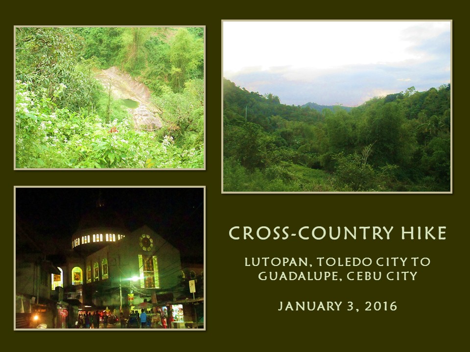
MAN-SIZED HIKE XVIII: Lutopan to Guadalupe

THE FIRST HALF OF Segment I that I have begun for the Cebu Highlands Trail Project, which is from Lutopan, Toledo City to Guadalupe, Cebu City, would be totally unusable when the projected Mananga Dam would be constructed and operational in the near future. A big chunk of that route would be inundated under a man-made lake since it cross many times the Bonbon River and downstream to the Mananga River and I am planning to revise this route.

So today, January 3, 2016, would be a good time to make this plan a reality. Also, today would be the most perfect day to start my training in preparation for a lot of activities for Year 2016, especially for the last three segments of the Cebu Highlands Trail Project, which I aim to finish this year. I know that many people are following my progress for this particular exploration and it would make them happy if I am in the best of health so I could accomplish more.

My body system has gotten used to treating myself to a hike in the woods every Sunday and I missed three sessions last December due, in part, to a vacation to some place in Mindanao. I also have gotten fat, unable to resist the extravagantly-rich food that the Christmas season usually brought on the tables of many homes and corporate offices. I have gained weight and my body squirmed at the uncomforts it gave of even simple tasks that I usually found easy to accomplish with a leaner body.

When you are fatter than usual, you tend to get lazy. That was what happened when I shook off my pre-set alarm of 04:15 to snooze mode in favor of longer time on the bed which led me to wake up instead at 06:00, quite late already and I will have to suffer for that later. Besides, the wife does not like it at all for all the noise it created every five minutes!


I purposely deny myself of company for this day and I will be in solo flight. I am happy with a crowd and I am most happy if I am alone. You know me, I am unconventional. I am a realist and I do not subscribe of your idea of enjoying the outdoors. There is so much I could accomplish if I am by myself. If I get struck by lightning or by any other means in my wanderings on the mountains, then, so be it, I die a perfect death the outdoorsman's way. Fatalistic, is it not? Maybe. But, remember this, you could even die drowning in a bowl of steaming soup in the comforts of your home.

Anyway, I made it to Lutopan at 08:00 and I am now in the process of looking for a bakeshop to buy bread. I will be on survival hike. My fare would be bread and water. I am bringing my small Lifeguard USA rucksack with the survival kit and a Trangia alcohol burner set - coffee is lovely when outdoors. I have my blades also like the Victorinox SAK Trailmaster, a vintage deer-antler handled Fame knife and the Puffin Magnum spinoff in its handsome leather sheath which I will open carry later.

I start the hike at 08:15 passing by Cantabaco, Camp 8 and Camp 7 (Minglanilla) before taking rest at a store on the corner of Manipis Road and Sinsin-Cantipla Road. It is exactly 10:15, and I just hiked for two hours from Lutopan to here. I may take the opportunity of eating a light brunch instead as the weather is already warm. When I am done, I buy two sachets of brown Kopiko. At 10:30, I start off again. I will be at a cross road going to a place somewhere in Buot-Taup in 45 minutes.

I am testing a TNF trail-running shoes provided for by my sponsor based in the United States, Harold Butanas, as his contribution for the Cebu Highlands Trail Project. It is very light and fits like a glove. Insides are soft but tight for my toes. I would manage the uncomforts, if ever there would be, later on. Breaking this pair for the very first time in a long hike, much of it on unknown territory to me, is essential.

When I reach Odlom, I jog very slowly and very carefully, not to be tempted by gravity. I know that overexertion would take a toll on my physical condition and my stamina later on which I would need very badly since I am an in an exploration. It means that the chances of taking wrong routes and backtracking would be many. I am overweight and I do not want to bring stress to my lower body joints like the ankles, knees and the pelvic area.

The rugged road is now concrete and it goes downhill winding about along solitary houses, which are few and far between. It helped to my cause that the skies darkened and wisps of moisture fell. I reach the crossroad to a gamefowl farm at 11:30 and eat my first bread. It is a nice feeling to just sit again and enjoy the silence and be cooled by a passing breeze.

After rehydrating, I proceed to the bank of the Bonbon River, passing by the said farm. I am facing the southernmost edge of the Babag Mountain Range and I aim to find a route over the back of its ridge. It looks formidable because it is noontime and I am washed in the full warmth of the sun. I cross the wide stream on barefoot to look for that tempting route and go to a community to ask for directions.


I go back crossing again the same stream and return the TNF pair onto my bare feet. I walk a little and then I feel exhaustion at the extreme warmth of walking along the bare river bank that bounced sunlight. I found a shady spot where there are grass and take rest. I am thirsty. I take my sips carefully, not to be tempted by thirst. I decide to eat two pieces of bread and wash it with water to bloat it inside. By 12:30, I go to the direction of the village of Buot-Taup.

In the village is a hanging bridge, recently constructed, which would cross over the Bonbon River to the other side of the riverbank. There is a dirt road that is ascending. This place is called Samboryo. Why is it called that I may have to know later on? A few locals I asked, shudder at the thought of walking it. There are a few houses along this route and there is a Suzuki Scrum going carefully down the road.

The driver notices my open carried Puffin Magnum and asks me what I am doing here but the difficult road takes back his attention instead. If he was persistent, I would have asked him of the 25 sacks of charcoal on the back of his light pickup. I am on a lawful activity but the driver was not. I presume he is one of those village aldermen trying to exercise their authority over a lone wanderer. Such kind of men discourages local tourism. Ignorance and arrogance are the dumbest mix, don't you think?

The rugged road vanishes when I reach a small community. I refill my water bottle after asking directions. I take a trail that goes up and up. A group of five youths overtake me. They are going to Cabatbatan which I also am going. The old route of Segment I-A passes by Cabatbatan, right after crossing the rivers Bonbon and Mananga twenty-one times. In a post-Mananga Dam scenario that would be impossible. I follow them for as long as I am able and take rest at 13:40 when I could no longer bear it. One piece of bread again washed with water.

So I am onto the best option available when I discovered this route which I would officially name as the Samboryo Trail. I do not have to cross streams from now on except at the Bonbon River by bridge and the Bocawe Creek and Sapangdaku Creek, later on, also by bridge. That means, exposure to sudden flash floods would be removed. And no more wet shoes, socks and feet.

The trail has many branches and I have to be sure which. I used my tracking skills to follow the wake of the five youths. It is difficult as the surfaces are dry and hard packed. Almost always, a fresh dent would emerge from spots where it is partly wet. Besides, upturned pebbles gave me hints and some disturbed vegetation above the ankles kept me updated of their diminishing presence.

I come upon a spot near a farm where the trail vanish and I was already exhausted by the heat, by my weight and by the steep trail, now almost to the brink of becoming drowsy, which is not a good sign. It is 14:00. I may need coffee to pep me up so I could continue on my lone quest. Fighting against fatigue, I am able to set up my Trangia alcohol burner and make it work. The blue flame boils water in my stainless-steel cup quickly and I slurp my coffee like it is the last precious thing in this world.


Getting my act together after a 20-minute rest, I look for the rest of the trail and found that it traverses the middle of the farm. Going past it, takes some amount of strength considering I am utterly exhausted. The coffee and the brief rest gave only a fleeting optimism, my legendary strength seems to have caused little dent whatsoever on the mind partly playing it safe against my wishes.

Closing my eyes as I try to stabilize my breathing, I willed myself to carry myself to that high peak that has been imposing its existence on me as well as on locals. Now I know why they called this place Samboryo? The peak, of course. Mount Samboryo. I follow a path and then I come upon two forks. Which one? I remembered the local whom I conversed earlier along the route who said that once I reach the topmost it would all be easy to Cabatbatan. I choose the leftmost.

I am happy with my progress without anybody from behind me giving pressure or a paper that says where should I be on the dot. Just when I am about to reach the peak, I meet a local who was carrying a rolled rusty roofsheet. I was sitting at that time with my back towards him and who could not be happy at this opportunity? Immediately, I asked him if this was the path to Cabatbatan? No, he says, it is on the other branch. The trail I am on leads to Bocawe.

I am tempted on the prospect of going directly to Bocawe instead of passing by Cabatbatan first but my urge gets blunted when I learned from him that there is no store nor houses along the route. Well, why not take this path on another time where conditions are far more favorable to my liking? Why not indeed? So I follow the advice of the local and walk behind him back to where I was in the middle of regaining my composure.

Thanking the local, I proceed onto the right fork of the trail. There are no more ascents and I could see the Manipis Road on my right just across the chasm. Almost immediately, I could hear voice on a sound system announcing the progress of a basketball game. I look down on my left and I see a deep valley where there is a community. That must be Cabatbatan, I am sure. I slowly follow the steep path down, taking my time as I did when I climbed up to here.

I reach Cabatbatan (and the ongoing basketball game) at 15:30 but I need to pass time to a store that sells cold refreshments to me and my party for so many times in the past. The location of the store had been crucial to the old route since it afforded us something like you would like on a quest at the end of a rainbow. Its location on the new route is still very relevant if I were to choose since it can guarantee us cold refreshments all the time and the old lady there even offers her dirty kitchen and firewood for use during cooking.

I sit down again and, this time, it would be longer because I am buying a big cold bottle of San Miguel Beer. When I got tipsy, I simply munch one bread and it is gone. Had a long chat with the store owner and she happily welcomed recently one group of hikers on their way to Camp 4, Talisay City a few times. No wonder I get so many readers on this blog. They liked to share in the joys of the places that I wrote about. It is like a quest for them too.


I continue on at 16:20 after paying for my beer and saying goodbye to the old lady. I would be walking again on paved concrete. I cross the Bocawe Creek by bridge. This would be the last half of the journey. The endless rises of the road would sap your hopes should you wish to hurry. It is better to take your time since it is now almost dusk and cooler. I reach Bocawe at 17:15 and stop at a store for cold refreshment.

I have to tackle one last stretch of endless rises and, after that, rolling terrain towards Pamutan Junction which I reach at 18:15. By the way, I also carried my Cignus V85 radio and I shoot message over the frequency of Ham Radio Cebu but I got no reply. Checked my Cherry U2 phone but no message either. It would all be downhill from here and I choose to hike on the road without a light. The only time I use a light is when I signal a few motorcycles using the same road.

My plan was to go direct to Guadalupe by trail from Baksan but I am miserable tonight. My toes are in pain. Blisters are starting to develop the insides between toes. My knees ached while my right thigh starts to feel the tell-tale sign of a fledgling cramp. All these pain are but a part of a realm of nerves that the mind is gracious to accept and process. All you need to do is flip a switch and it becomes bearable. So I remained on the road.

Finally, at 19:30, I reach the Our Lady of Guadalupe Parish. Limping to find privacy in the crowded parking lot, I find one at the new but still unopened convent. I sat and do nothing but close my eyes and whisper a prayer of thanks. I could not believe I am here. I count the time I started since morning up to here and it totalled 11 hours and 15 minutes and this was an exploration where I waste time taking wrong routes and retracing paths to start again. Opened my phone and I got a message this time.

Document done in LibreOffice 4.4 Writer

Friday, July 8, 2016

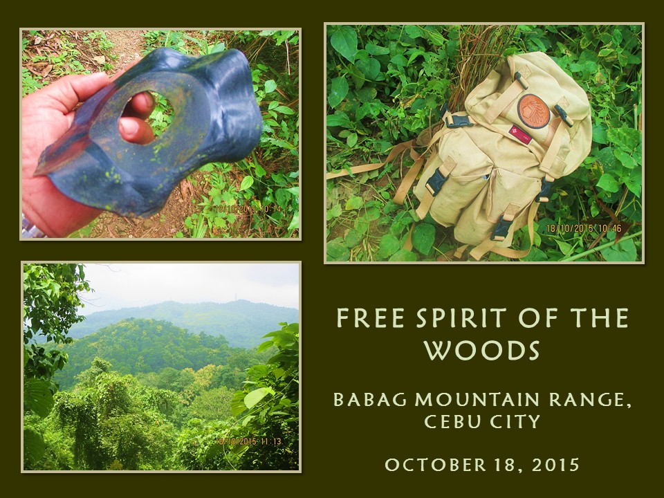
BUSHCRAFT BUHISAN XXXVI: A Happy Free Spirit of the Woodlands

I AM SUPPOSED TO be in Bohol today, October 18, 2015, but a strong typhoon battered the north of the country and the Coast Guard has released a stern advisory on sea travel. My wife thought it not wise to proceed on and so she had all our tickets refunded against my wishes. That would also confine me to an inactivity on a Sunday which I find so alien now in my system.

I always go out to the backcountry every Sunday be it in the best or under inclement weather or be it with companions or alone. Every Sunday is allotted for a walk with nature and I have good reasons for that to the dismay of the wife, who understood and allowed me despite her protestations. If she would have not, the bed would have claimed me as an everyday companion and I would be a medical case.


The moment that I learned of the shelved trip, I absently assemble all the things inside my Lifeguard USA rucksack. Included are two small pots and one-fourth of a kilo of milled corn, small plastic bottles of cooking oil and salt, an AJF folding trivet and a plastic chopping board. I will go to Buhisan alone to look for a good place to train ladies for the audition of “Expedition Philippines” and to look for things to help in their training.

Yeah, I am carrying a heavy load for such a trifle activity. Even my wife noticed that. She reminded me about my load which is unusual for just a day hike. It is already late and I do not have time to disassemble the contents of the bag. I would have to carry this load instead as a training load in preparation for Segment IV of the Cebu Highlands Trail Project which is just four days away.

By the way, Segment IV is an exploration hike that starts from Mount Manunggal, Balamban and ends at Caurasan, Carmen. It will be on the dates of October 22 to 25, 2015. It is more than fifty kilometers long but the very rugged terrain, the total lack of knowledge of its trails, absence of information and guide and the inherent risks to personal safety make this my most challenging journey for the Cebu Highlands Trail Project.


I will be alone today and I commute to Guadalupe. I will forego about the cooking and proceed instead to the business of survival hiking fare: bread and water. I fill my water bottle full and stash just two pieces of bread. My mind is still unclear. Yes, I will go to Buhisan but which route? I settled for the longest. Okay, even if it is already very late – 08:45 – the cool weather is stacked in favor of me. I will pass Heartbreak Ridge.

I climb the flight of stone stairs to the ridge and stop by the last store to buy a single sachet of 3-in-1 coffee. I get my AJF Gahum knife from the bag and hang it from my 5.11 belt while stripping the Canon IXUS camera off of its pouch and slide it inside the right pocket of my khaki Blackhawk pants. The long pants is heavy but I am unfazed. In fact, it gives me confidence to prowl the bushes.

For the fifth time, I am using my new Merrell Geomorph shoes. This would be the final break-in test before bringing it to the Segment IV hike. I will not be in a hurry today. The ground is wet and limestones are slippery. I am still very careful even with good shoes. I may trust my equipment but I always respect nature first. You cannot be too sure. Never underestimate a wet trail.


I pass by the steel tower and go on the tunnel vent and beyond without stopping. I am sweating even if the skies are cloudy and the winds blow constantly at 18 kilometers per hour. This is the good thing when you hike in the Visayas in the worst weather affecting the north. But when we get one bad typhoon, expect our brothers in Luzon to enjoy favorable weather too. Tit for tat.

One of the things why I am out of the comforts that my home would have provided me on a Sunday is that I also want to field test a portable iCOM VHF radio with an extendable Skyprobe antenna. Communications is an important part in explorations and the radio equipment would be very vital in my day-to-day progress, as well as receiving weather updates. I stop for a while to communicate with my Base Support Team – the Eagle Base – using the station frequency of Ham Radio Cebu.

Some of the weeds are in bloom and I captured this in camera. There is so much to learn in local vegetation. I may know some but 99-percent of these remain incognito. My thirst for more knowledge about plants is an ongoing process. Because I do not walk on mountains just to benefit my health and my self-confidence, I stop often to enjoy nature's beauty at closer range possible and I appreciate it when these are in good health.


I am very fortunate to walk on a trail where nobody knows except locals. I am also very fortunate to pursue on a journey without companions for human noise drown out natural sounds. Few people would engage on lone hikes and these few people have found harmony in themselves and with nature. I prefer being alone not because I want to but because I owe my existence to my close links with the natural world.

One of the privileges why walking alone is beneficial for me is I could act like a fool without causing anyone to worry or laugh at me. It seems crazy but I have some good reasons like testing my new Merrells. A wet trail is a hazard in itself if taken downhill and this is terrain where shoe reputations are made or unmade. Well-worn limestones too. I deliberately step on one and my shoe lose traction and I fall on the side of the trail.

Been expecting that slip. I shrug off the leaves that stuck to my clothes and went on my way. Picked up dried wiry vines that had already been neatly rolled by a farmer and tuck it securely on the side of my bag. My tummy is acting strangely and immediately my eyes scanned a big-leafed shrub and an animal trail. You know how it goes when no one is with you. Come on, use your imagination. I picked up a warped old 45 polyvinyl disc and keep it in my bag after I have finished my nature call.

I met a local with a heavy sack over his head and I gave the privilege of the trail to him. Despite gaining little in his progress by the heavy weight, the man took time to ask me why I am alone today? I answered him honestly and he went on his way grinning. I saw a woman splitting firewood with a bolo from a distance and she smiled when I gave her morning greetings. I talked to another local with a sack of coconuts over his head and asking me the same question. He gave his name as Ronald.


I reach the place called the Portal at 10:45 and I savor my first sips of my water. Meanwhile, my mind is working which of the seven routes would I take. I chose one that goes deep into jungle which leads to a stream. The trail is beginning to vanish as the vegetation claimed the bare grounds. Some parts have been washed away by water making my walk quite dangerous. The Merrells never failed me here but my sense of balance begins to irritate me.

It could be caused by different factors: 1) Lack of breakfast, 2) overweight or a 3) shifting backpack. I considered all three but I suspect the bag. It is overloaded by useless weights and the insides shift when I move. The bag is of old-school design and does not have a waist belt to hold the bag still. I use my hands when I need to as I weave along a tiny ribbon of ground which sometimes went missing for a time.

The last time I passed by here was in December 2014. That time I was leading people into the streams but the path that provided me through there had been missing or that the vegetation had really gobbled it up for good. I am now in a quandary if the other trail that would lead to Starbucks Hill would not be found also. I changed plans and take another trail but it led me to a familiar hill and to a community which I want to sidestep at.

I am back to square one and I start from there to Creek Alpha instead. A great transformation from the original plan. Reaching the community took a lot of my energy which no bread could compensate. I can now feel the burning hunger. I can never discipline a brain that automatically sends signal from the stomach. Well, it can wait for I intend to go slow to keep the mind from dictating its wishes on me.

I reach Creek Alpha at my own pace at 12:25 and I would go downstream to where a trail would lead me to another stream. The water is clear and briskly running in the fulness of its existence in a rainy season. Ahead are footprints of children and adult alike, distinguishable by bare and sandaled feet on sand. My senses peaked up a notch upon learning of people ahead of me. The sensation of hunger is now totally gone.

Meanwhile, my close observations on plants have led me to an exposed rootcrop of an Asiatic bitter yam (Local name: kobong) and I plucked a piece intending to propagate it on my backyard. The thorny vines make a good obstacle for burglars and strays. As I proceed on, I saw a small stream that connects to the bigger Creek Alpha. It looks good even if going above it takes a little climbing. I found a small pool and, above it, more climbing.


I go back to the main stream and found the trail. I reach Creek Bravo at 13:20 and take a short rest. I see the groves of water bamboos (botong) above me are recovering from its desecration of two years ago and, I believe, a single pole is ripe for the taking for another bushcraft camp should I host it back here. I take another trail bound for Camp Damazo taking dry twigs for firewood along the way. I may have to boil water at the campsite to dump the contents of my only sachet of coffee into it.

I reach the camp at 14:20 and begin a fire between a trio of stones. Camp Damazo is still the best place to do these trainings for the ladies, even of the auditions itself, because it has a clean source of water nearby. Likewise, it could now host another episode of the Philippine Independence Bushcraft Camp since the vegetation had already stabilized. It could host more people this time since there is a wide level ground a few meters away from camp.

After I had my coffee, I continue my hike at 15:20. The natural spring which had provided the camp with reliable water had become a small stream. Strong rains had caused the enlargement of the hole and washed away the bamboo trough that I had placed there in 2013. Its source came from another stream some 300 meters away, which I called Creek Charlie, whose water passes through permeable rock, sand and clay.

I push on and cross two more small streams, the upper parts of Alpha and Bravo, and climb up a steep trail that passes by healthy stands of stinging trees (alingatong) beside a stream. I reach Baksan Road and cross it to view a firewood gatherer’s version of a Nessmuk triumvirate. It is a heavy US-made axehead with a thick GI pipe for a haft; a local blade – 20 inches long – whose handle is bound by strips of rubber; and a stainless kitchen knife whose blade had metamorphosed into a mere sliver due to constant sharpening.

I take an easy stroll down to Lanipao enjoying the full bloom of the plants until I reach it at 16:50 and down some more to Napo which I found at 17:30. I got a motorcycle ride back to Guadalupe and changed to dry clothes while at the parking area of the Catholic church. I spend the rest of my day for a couple of cold San Miguel Beer bottles at a watering hole frequented by expats. Cheers! Mission accomplished.


Document done in LibreOffice 3.4 Writer

Sunday, December 20, 2015

DAYHAGON CANAL ADVENTURE TRAIL

I DO NOT KNOW WHAT lay awaits me. I only know that I must be brave...” This line from the theme song of the movie High Noon kept ringing in my head as I begin to start on my solo exploration from Hagnaya Bay to Bogo Bay on this 28th day of April 2015. I just checked out from the San Remigio Cultural Center and Leisure at 04:00 and I am walking down the road to Hagnaya Port in darkness.


I had arrived at the Municipality of San Remigio yesterday morning and I had met Mr. Niño Ybañez, the town’s public information officer. We discussed about my Dayhagon Canal Adventure and I promised him that there would be good publicity afterwards when I post this in Facebook and here in Warrior Pilgrimage. It may be not much but, just the same, it would generate interest on the Dayhagon Canal and people would use San Remigio as the jump-off point.

Hagnaya Port, the gateway to Bantayan Island and the Province of Masbate, had expanded its size since I visited it the first time in 1983. That time, it was just a finger of concrete over shallow waters. Now the port had reclaimed water east of it and will do so in the coming years. I stood on its farthest edge and gazed at the shoreline from where I plan to walk. A local instructed me to walk an unpaved road following the shoreline to a place before the village of Argawanon and start my journey instead from there.

I followed the instructions to the letter wearing a bright-orange PAC Outdoor Gear float vest. I may have looked like a Martian with a Petzl Elite headlamp ringed on my forehead while a desert camo hat sits uneasily over my head. I am carrying my Sandugo Khumbu 40L backpack with a 30-liter Triton dry bag hiding a Silangan hammock, an extra shirt, a medical kit, a 10-meter 7mm paracord, a Leatherman S2 Juice, a Victorinox SAK Trailmaster and a LuminAid inflatable solar-powered emergency lantern fully inflated.

I am ready for sloshing in waist-high water and have worn my black Mammut Schoeller quick-dry hike pants and my sturdy Columbia Coremic Ridge 2 shoes. In the front pocket of the float vest is my Cherry Mobile U2 phone, a whistle, an ID card and my Canon IXUS camera. Hanging from my neck is my Suuntu A-30 compass. My general direction would be east. The sun and the shore would guide me, the compass just a fail-proof back-up.


I reach the spot and I follow a path lined by mahogany trees which goes down to the shore of Hagnaya Bay. Healthy mangroves are growing thick and wild and, where land meets sea, swampy. I step only on hard surface like stones, wood and on thins trips of sandy ground. It is a tiny wilderness frequented only by fishermen, whose small boats are secured safely within the small forest to shelter it from inclement weather.

The swamp floor are littered by debris carried by high tides and by wind and by another debris dumped by humans. I followed the coastline and sometimes wished that I chose higher ground for parts of the route I had chosen are difficult to navigate. My bag gets snagged by branches, I have to select the ground where I would tread and I have to watch out for those harmful plants.

Almost always, I retreat to the safety of higher ground when progress is hampered by impenetrable vegetation. Mangrove roots make foot space rare and travelling through it is quite tricky. When I unknowingly disturbed a wasp’s nest, I decide that plunging into thick vegetation is not practical and exposes me to more danger. I did not know of the hive’s presence until one stung my left bicep. I froze and backtracked very very slow to keep me off their radar.

I cross the first of the many water channels found between fish ponds, salt plains, islands of mangroves and mud flats. The play of tides caused these channels as it penetrates into lower inland plains and created a delta. My shoes sink deep into mud in midstream as I cross the channel but my eight-foot walking stick is a welcome ally. It helped me probe the depth of water as well as a reliable aid for balance.


I climb up and walk on the first of the many dirt embankments protecting fish ponds from high tide and surf. I walk on the narrow dirt causeways with the bay water on my left and the ponds on my right. Right where there are sluice gates, I would go down the pond and cross to the other side. Then another water channel and on to another fish pond.

I had calculated my exploration would time with a very low water rise during tides. Low tide was 0.33 meter at 01:16 and high tide would be 0.76 meter at 08:56 and I would just have to contend with a rise of just 0.43 meter in between the hours. It is a good window of opportunity to tackle this route, especially at the channels and the mud flats, for this would be inundated with water if ever high tide would reach by even just a meter.

I meet only a few people to ask directions on this intricate maze of mud-lined channels and steep dikes. One of those whom I met are a couple of old women. They gather shellfish for a living. They offered me a ride on their old canoe but it defeats my purpose and I politely declined it. I would rather be wet and struggling on my own accord and this lent my unusual journey a color all its own. However, they point to a place where there is shallow water to cross.

I follow a narrow finger of land going to a forest of breast-high mangroves. The leaves part to reveal more muddy floors. I changed routes as often as I can to take on firmer ground. I am successful until I come upon another finger of land that led me to nowhere but deeper channels. I tried to brave the divide but once I sank deeper up to my waist I gave up that idea. These are the very places where quicksands are possible. I backtracked and tried other routes until I am on to another embankment.


This time I am gazing down on a salt plain. I could hear the faint sounds of running motorcycles. About a kilometer away are two radio transmitter towers. A message alert tone from my mobile phone halt me in my dizzying task of gaining on the Dayhagon Bridge, a significant feature of the route that would mark the halfway point of this adventure. It is a message from Johnas Obinas. I replied that I would be approaching the Dayhagon Bridge at any moment.

I re-assess my position and plan a better route by referring to my compass. I got past the salt plains and I see a glimpse of solid concrete washed in sunshine a half kilometer away, perhaps it is the bridge. By now the body of water is narrowing and the coastal side of Medellin are no more than a slingshot throw away from me. I am now on the Dayhagon Canal proper and I see two elder women crossing the canal up to their knees and a dog after them up to its flanks.

I walk the bank of the Dayhagon until I can see Johnas standing and weaving his arms at me on the middle of the bridge. I reach the span at 07:53 and maneuver myself to climb up on it. It is good to see Johnas again. He is one of the few who learned bushcraft from me and he is assigned in Medellin as a jail officer. I think I need a break as he is bent on treating me to a free breakfast. He whisk me away to Don Pedro Rodriguez on his Skygo motorcycle.


For a good 30 minutes I get to relax and eat inside a local restaurant. We go back to the bridge and we parted. It is now 08:35 and still is the best time to resume a journey. I will now be walking on the side of Bogo City. I retrieve my walking stick and go down the bridge into a tree-lined path. I go down a channel and cross it and then cross another waterway after climbing up a small island in between.

After that, I begin to traverse the first of the many private properties. I had completely evaded private lands while walking the shorelines of San Remigio but, here, I have almost no options. Fences above fishpond dikes keep away people but there are gaps where one could pass. Strips of mangroves lined the dikes and most of the dikes are built right up to the water’s edge.


I walk above the dikes and it is easy navigating the Dayhagon Canal here than the ones at San Remigio. I met some fishermen sitting on the embankments with fishing rods pointing on the canal while one guy took chances on ankle-high waters of a fish pond. Muddied people work on the dikes plugging holes and they ignored me. It is a big fishpond and I enjoy the walk even though the heat of the sun begins to make its presence felt.

I have thought long ago that the Dayhagon Canal was a fresh-water creek whose source I could not determine everytime I go north passing by the Dayhagon Bridge. I did not even know that it is called Dayhagon until I studied Cebu using Google Map. I found something unusual on the land feature between Hagnaya Bay and Bogo Bay. There is a very narrow body of water traversing on the narrowest part of a neck of land that made the northernmost part of Cebu look like an island.

The creek that I once had thought is a canal after all. It crossed from one body of sea to another and had separated the land north where Medellin and Daanbantayan are found from the rest of Cebu. In fact, the man-made canal looks like a neckline. Who were the people who built this canal? Why? When?

I do not know the history and the reason why the Spaniards built this canal. From what I perceived, the Dayhagon used to be an isthmus connecting the northernmost part of Cebu to the rest of the island. Economic considerations when demand for sugar became high in the middle to the later years of the 19th century might have been the prime reason why this canal was built.


Sugar canes from the haciendas of Bogo, Tabogon, Borbon and Sogod may have found its way to the then town of Bogo. The lack of a deep-water port forced it to travel by land to Hagnaya Port which would had been time-consuming considering that there were no developed horizontal infrastructures at that time. The isthmus might had been so low at some places that it is cheaper to build a canal than building a road.

The canal might have made possible the transporting of sugar canes easily to Hagnaya from the depots as Hagnaya is much convenient for a boat to dock coming in by way of or out towards Negros where the much bigger plantations of sugar canes are found. That was before the Industrial Revolution, the steam engine and the locomotive found its way to Asia and las islas Filipinas.

I have come upon to the endmost part of the big fishpond and gaze across an estuary to an open field that had recently been harvested of sugar canes. I walk along the dike looking for a good place to cross this small stream. Children had just came out of that stream with a good number of catch. I cross on the other side and squeeze into a barbed wire fence.

The wide plain had been burned off to prepare for another cycle of planting sugar canes. The fire had reached a buffer zone of wild vegetation growing between the farm and the mangroves. I walk along the edges of this narrow wilderness, my observation is at a peak since this is a favorite hunting ground for all kinds of snakes and I do not want to be surprised. I open carry a Mora Companion knife though and it satisfies my requirement of security.


The path weave along the edges of another farm located on a gentle hill where there are dried cogon grass. A quail flew away upon my coming and a lot of flying it did to keep its distance. Typhoon Haiyan had left many scars on the land and felled many big trees, the spread roots providing sturdy windbreaks for the next storms. The canal begins to widen and I am now gazing at the waters of Bogo Bay.

I walk an open field of scorched grass, cracked soil, termite mounds and an abandoned house. Not far is a small community on a finger of land reaching out to the sea. It is a fishing community and a lot of small boats are kept on dry land. Strong breeze are all over here and it cooled my now very warm body. Across the bay is Medellin where there is a golf course.

I follow the shore southeast to a thick forest of mangrove where there is a tiny stream. I can see the Polambato Wharf a kilometer away but going directly by shore is impossible now as a cock farm nearby is fencing off access to the sea with high nets. I cannot pass by but have to take another route out instead into dry ground, farms and more felled trees that became shelters for cows and swamp buffaloes.

I reach an unpaved road and leave my walking stick among bundled firewood of same size and height. It is now 10:00 and it is very warm. I am not surprised by people raising an eyebrow when they see me passing by. Do not I look like a Martian? Anyway, I reach a small store on the Bogo-Polambato Wharf Road to take cold refreshment and eat a banana I saved for this occasion.

After having an amusing conversation with three elderly women, I rode a tricycle bound for the bus terminal of Bogo City. It is almost 11:00 and I might as well eat lunch on one of the small restaurants in the terminal. I would have wanted to make a courtesy call to the city’s tourism officer and its police station but I looked like a muddy Martian even without the float vest. I am not appropriately dressed and nobody would take me seriously.


I do not profess to be the first person to have walked through the Dayhagon Canal from Hagnaya Bay to Bogo Bay. There may have been older adventurers before me and, of course, fishermen and seasonal workers of sugar farms, who might have traversed it on foot in the course of their finding a living and were not known for those efforts for it could not have been part of their priorities and plans or that they do not have the means to “broadcast” it in popular media as I do presently with Facebook.

Only the Municipality of Medellin had included the Dayhagon Canal on their tourism program but it is done with kayaks and native canoes. See their website here. My visit of the whole length of the Dayhagon Canal, to include parts of Hagnaya Bay and Bogo Bay, is a testament that it could be done by foot, provided that it is timed at low seawater levels. Since it passes through a lot of water, however low it may be, flotation devices and safety equipment are a must.

For sure, there would be others after me and will make San Remigio as a springboard of their own adventures. The Cebu Highlands Trail, which I am in the midst of establishing a route from northern tip to southern tip or vice versa, will be passing by the Dayhagon Bridge, without a doubt. Because of this, the Dayhagon Canal would be an ideal side trip, as well as other nearby places that will surely attract local and international visitors.

My solo traverse of the Dayhagon Canal would not had been possible of the following whom I owed a great debt of gratitude. The Municipality of San Remigio, thru its Public Information Officer, Mr. Niño Ybañez, for providing me free overnight accommodation at their San Remigio Cultural Center and Recreation. Likewise, the staff of their hotel for providing me excellent service.

The police stations of Bogo City, Medellin and San Remigio for ensuring security of the route incognito. JO1 Johnas Obinas, the Community Relations Officer of the Medellin Municipal Jail, for that well-deserved breakfast and it came at the right time and place. PAC Outdoor Gear and their great guys – Mr. Anthony Espinosa and Mr. Carlo Genova, for loaning me one of their reliable float vest from their shop.

Mr. Glen Domingo of Portland, Oregon, USA, for providing me an excellent compass – a Suuntu A-30. It is a fail-proof piece of navigational equipment that had been handy during the most difficult part of the hike. Finally, to the warm people of San Remigio and Bogo City whom I have met and conversed with – THANK YOU!


Document done LibreOffice 4.3 Writer

Sunday, November 1, 2015

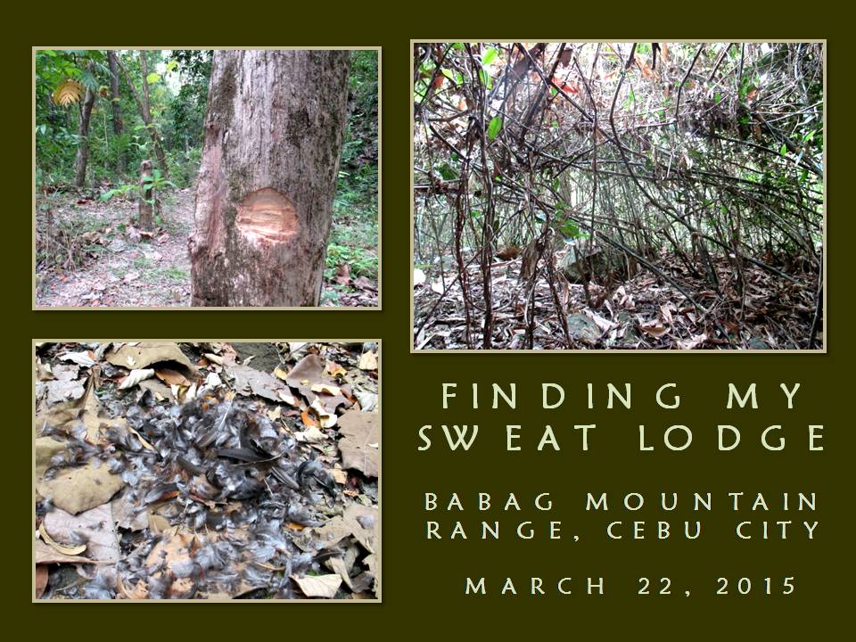
BUSHCRAFT BUHISAN XXXIII: The Search is Over

I HAVE TO FIND MY INDIAN-style camp today, March 22, 2015, which I failed to locate seven days ago. I would use the same route as was the last time but, this time, I will cross Creek Charlie and walk that steep trail that I have noticed many months ago. This time also, I have to be early so I could cover more ground and not compromise my health by eating a late lunch.

After procuring the food ingredients for my meal at Guadalupe, I proceed to the trailhead at Baksan. I go down to the reclining mango tree and prepare the Chipaway Cutlery fighting bowie knife that I aim to carry openly for today. I also brought an Albay-made native blade (Local name: ginunting) with its wooden sheath as a back-up tool should I need it for hard chopping work.


A Mora Companion knife is safely slipped inside the pivot place of the right shoulder strap of my backpack while a Victorinox SAK Trailmaster is inside the bag’s front pocket. I get ready my Canon IXUS 145 camera and my Cherry Mobile U2 phone, then I sent off text messages to Jhurds and Ernie about my solo hike. The sky is partly cloudy but it is warm. I place my meshed shawl on my neck should I use it to cover my head if I am exposed to the sun. Once again, I pick up a short stick which I could use as a tool or a weapon.

It is 08:00 when I begin my walk. I found the new route that I had chosen and explored last week very favorable compared to the old route of interconnecting ridges. My water bottle is full compared to the last time and it gave me confidence. It is getting warm as clouds begins to disperse. The teak forest does not help me a bit as it is now almost bald of leaves. The path led to a dry stream called Creek Alpha.

I stop where another dry stream join and see drops of liquid on a stone. It is sticky. It comes from a high part of a live tree. I put a finger on my tongue and it is sweet. Another overflowing honeycomb but there is no hive. This is a different colony of stingless bee (kiyot). I found one last week near Camp Damazo and I am quite surprised that nobody had harvested these.


I see a path beside the dry stream and I might as well explore this since I have the luxury of time. This path goes on a small saddle to another foothill. My right foot snagged on a root and I dive forward landing on the right side of my body. Fortunately for me, the trail is full of dry mahogany leaves and it cushioned my fall. I stood up and continue. I notice my right small finger acting queerly.

I cross a dry gully and walk among tall mahogany trees whose foliage are now enveloped by leaves of crawling bamboos (bokawe). I find this place remote with a small clearing to set up a tepee but I see a debris shelter used by a hunter and, coupled by lack of a water source, I decide that this is not the place I am looking for. This is the first of the many places I am exploring and I have a full day to find that perfect place.

I go back to Creek Alpha and walk downstream. I pass by the slow seeps occurring on the dry stream and studied it for some time and quite convinced that the source is not near here. It could be from the other side of the mountain. I walk on and visit my old campsite which I yielded to the holding of the first Philippine Independence Bushcraft Camp in 2011. People had spent a night here recently. They had a dry camp. Were they had dug a hole, they could have water.


They had used big chunks of wood for their campfire. I never taught people Western-style camping. I always taught the conscientious use of forest resources, including firewood. I do not like bonfires because it is unnecessary. I see the flattened vegetation caused by tents – which is okay - and I see a tree trunk chopped so a rope of a hammock would not slide down – not a good idea.

I leave the camp and Creek Alpha for the next destination – Camp Damazo. The dead teak leaves which had carpeted the trail last week had disintegrated, caused by several pairs of hiking shoes passing by here. I am walking comfortably now without those “popcorn” sounds. After the teak comes dry mahogany leaves. The leaves had either frayed or crumbled and I do not feel like “floating” today.

I arrive at another dry streambed called Creek Bravo. It would be good to explore the part of the creek up ahead. I notice small spurts of running water and pools of clear ones when I walked a considerable distance. I had also observed a smaller branch of a creek contain much water than the bigger one. Nevertheless, I explored the farthest reach of Creek Bravo until I could get no further. Besides that, I have no appetite to use a stream, even how dry, as a route.


Creek Bravo would have been an ideal location for a campsite since it could provide me adequate water but its banks are just too steep. I go back to where I came from and start exploring the small stream that joined Creek Bravo. Somebody had cooked something here and that somebody had dug two water holes. Aside that, this somebody had placed a zingiber leaf underneath a rock and water flowed on it like a trough. It is just less than a day old.

I walk on upstream over several clear pools of water and I discover (and assume) that this small unnamed stream is the source of those slow seeps occurring at Creek Alpha! The streambed is easy to walk although it steep gently and I begin to like it here. I could go on walking up to its source which I believe could just be up ahead. I look for level areas along its banks but all are steep.

I see something unnatural. In the middle of a dry part of the creek is a clump of feathers. That somebody had caught a live wild fowl and dressed it here. There is no sign of blood, so the fowl must had been caught with a snare or it could be brought here. What caught me by surprise is the fowl was very fat judging by the texture of its feathers. I collect nine feathers and carefully stow it.


I go back to the bigger stream and decide to prepare my lunch. It is now 10:20 and, besides that, I had not taken anything solid since the time I woke up. I will make my fire over the ones that I have found somebody cooking. I collect dry firewood. I have no problem with dry wood since it is totally very warm for the past four weeks. I choose twigs and small branches and break it into short pieces.

I brought with me my AJF Folding Trivet, place a pot above it and I start to boil water. I need to enjoy coffee first before I start my cooking. Milled corn came next and then I start to slice pork meat, onions, garlic and green pepper with my Morakniv over my extra-thin PVC chopping board. When the milled corn got cooked, I place the second pot with oil over the fire.

I scatter crushed garlic first until it begins to go brown then I drop sliced onions. Next comes the chopped green pepper. Finally, the meat. I stir it all briskly, reduce the flame, and return the lid. After about five minutes, I stir it again before I pour soy sauce. Feed the fire with more wood and start to relax. After another 10 minutes, I take a peek at my pork. It looks perfectly cooked and it smells spicy. Now, I am hungry.


At exactly 12:00, I eat lunch. In silence, I enjoyed the meal. It is very spicy without any artificial flavourings. It is cooked with the right frame of my mind. I eat all the pork adobao but I am not able to eat the rest of the milled corn. I leave the rest instead on top of a big stone which is exposed to the sun. The oil from the adobao, I pour over the milled corn. It would make a nice meal to this forest’s wildlife.

I start packing my things and continue on at 13:00, going up to Camp Damazo. The honey I discovered last week is still oozing in slow motion from its perch to the ground and nobody had disturbed it as well as the Asiatic bitter yam (kobong) that I dug also last week. Eventually, I reach Camp Damazo but I walk past it towards Creek Charlie. Plants always attract me and I take it seriously by taking pictures of that which I need to learn or to teach people.

I have always seen this strangely-shaped tree which looked like either a giraffe or a brontosaurus but have not dared to come close and shoot it. Was it fear of the unknown or is it just that I would not want people know of its existence? Both. I may be a modern savage but I believe in the spirit world that I always give it a sense of respect. Today, I felt something that this whole forest had accepted me so I go near the tree and take pictures.

Having done that, I go down the stream and study the banks for any human or animal activity. I found none so I watch the water cascade down slowly on rocks coming from upstream. I see a long pole of bamboo arching down to the other bank which I have not noticed in my previous visits. A smile crossed my face in the discovery of another rare bamboo grove. The forest is slowly revealing its secrets to me and I take it as a sign that the search for my camp would not take long.

Across me is a trail which I had noticed for sometime but lacked the time to explore it. I am not in a hurry. Perhaps, it would be wise if I lay down first on a rock big enough to fit me and close my eyes to rest for a while. The stream is very humid, the early afternoon sun drains me of my strength. I would summon my energy back first and, when I am ready, I would continue my search for that elusive camp which I plan to make as a sweat lodge. Just a little while.


By 14:00, I am up and begin engaging the path that lead up to a steep mountain. This is a seldom-used trail and I use my tracking skills to follow the scant path which goes up a ground which has a steep gully that is 20 feet deep. The path crosses to a part where it is not deep enough and continue on precipitously to the other side. It is a dangerous choice of a trail but I soon sense that there is no better way to cross over the other side except through here although walking here sends you shivers.

I climb up and the trail vanishes before a conglomeration of naturally-felled trees and debris caused by recent typhoons. I veer left over easier slopes and face another sheer slope. I catch a glimpse of level ground, which is quite rare in a place where I am now. I scan the place all around. Trees are everywhere but not on the place where I stood at a radius of five meters! A rare pocket of open ground in a forest and the only piece of level ground on a rugged mountain slope.

The forest had been kind in giving me this place as a gift for my future sweat lodge. Somehow, I cannot explain how it had known my heart, my mind and my purpose. The place is a place of power. It faces east where the sun rises. Across me is a distant mountain and, behind it, is a small mountain range. With so much dead wood near here, I could make either a teepee or a hogan. I am quite happy at this discovery.

I make more explorations and I discovered two more bamboo groves, one of which had not shown signs of human activity. There are a lot of bamboo poles that I could use in the construction of a shelter. There are also a lot of wild edible plants that I could cook but I could introduce vegetables and fruiting trees here in the future. The place is awesome but very remote and quite hidden.

After I had finished my business here, I returned to the path I took. Before leaving, I left a mark on a tree and a trailsign on another tree. It is necessary since what looks familiar today would look strange in a different season. I go down Creek Charlie then up towards Camp Damazo but veer left instead to the exit route. I reach the road but cross over to a trail that leads to Lanipao.

I will be back for sure. I believe it would be after the Philippine Independence Bushcraft Camp or later.


Document done in LibreOffice 3.3 Writer