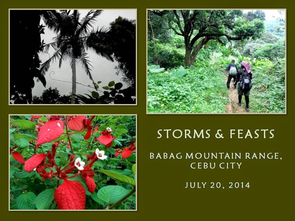
Saturday, April 25, 2015

BUSHCRAFT BUHISAN XXVIII: Deadfall

WE KEEP THIS ACTIVITY a hush-hush so we contacted just a few individuals. Jhurds Neo, Dominik Sepe, Ernie Salomon, Boy Olmedo and a rough cut, Mark Lepon, came today, September 7, 2014, at the parking lot of the Our Lady of Guadalupe Parish. When we had secured the ingredients for our noontime meal, we left Guadalupe at 07:00, taking the route to “heartbreak ridge”.

It is a warm early morning and I begin to feel the heat by the time I hit Bebut’s Trail. My legs begins to work as my lungs suck in air as the terrain inclined. It is a cloudless day but I do not discount rain. It would probably come late in the day or early evening. I walk in a hastened pace, a pace that is forced upon me by the bareness of the ridge. A slight breeze gave me slight comfort but I need shade which you could indulge only behind this long hill which could be reached at the top.

By the time I reach a steel tower, I just stop to take a selfie and then go on my way to the top. I reach the tunnel vent and I looked behind and saw Boy walking past the tower. The rest are struggling behind him. Yonder me are bushes and farms and a few stunted trees. Beyond that are tall trees and thick vegetation. I reach the periphery of a farm and there is shade. I take my first drink of water but I inadvertently swallowed it instead of taking a small sip.


I waited for the rest near an abandoned hut and noted the minutes. I saw a wild basil plant (Local: sangig) and I cut off a branch, intending to add this as another ingredient for our meal. Boy arrived three minutes after me and he is winded. The group of Jhurds, Ernie, Dominik and Mark arrived seven minutes later. I see Jhurds and Mark suffering from the exertion of walking up the ridge. That is why I call it “heartbreak” because it had broke the hearts of many individuals.

I have led people here and I could count seven people giving up without mentioning their names. Likewise, another five were on the verge of collapse but have recovered to reach the top and finished the journey. As I was recollecting that, I sharpened a short stick with my AJF Gahum heavy-duty knife and throw it like a knife to a trunk of a banana at a distance of three meters but I missed the target. The stick pierced instead a papaya leaf behind the banana.

We proceed with our journey. Tree cover is good and I relish at the shade and the sounds of different birds. Soon we will reach the Portal. I notice many trail signs which I gave close attention to by stooping to get different angles of view or to touch the texture of leaves and stones. I would have explained my actions should one behind me asked what I was doing but all were only concerned of their own dispositions, unable to go beyond what they perceived.


Moments like these are the best time to learn nature. You just have to shed off your conventional nature learned in university classrooms and corporate environments and become entwined with Mother Earth. You have to change your mindset so you could adapt quickly and understand more about mountains, trees, wildlife, birds, streams, even the thread of ants that cross the trail. All of this tell their own story.

I reach a high point on a trail and take rest near a grove of spiny bamboos (kagingkingon). I noticed that the trail had recently been given a good “makeup”. It is widened. The grass and brush on both sides had been sheared but this is a route that only few people use and nothing special. There is, however, a scheduled foot race that will use this route. Not a good idea. We proceed on after foraging sand bamboo poles (bagakay) left by a local on the ground. I think I may need this to where we are going.

We did reach the Portal but we only pass it and continue on to another trail which goes on toward the road at Baksan. The promise of rest only tempt me to drink more water than I should normally take. I broke my simple rule on water discipline a while ago and now I am beginning to feel the backlash. The concrete road had recently been cleared of debris and soil brought by excessive rain the past few days. We will only follow this road for a few meters before burying ourselves again into the forest.

I gladly transfer into another trail, dipping into a forest of Burmese teak where Lensa Trail treads. The trail had been parted wide by great volumes of water during heavy rains. The path took us to high ground and veered right to another path that follow a low ridge which goes to a saddle and onto another ridge which steadily climb up a hill, which I tagged as Boy T’s Hell. We take a short rest while I take another swig from my bottle. From there we follow a path blocked by several fallen trees until I found my trail sign.

I have created a path here for the 2013 edition of the Philippine Independence Bushcraft Camp and this path had stayed. The vegetation changed as we go down a stream which I named as Creek Alpha, for want of a name. The air is humid but cool. The stream is brisk and full. I step on stones so I would not leave footprints on sand and on the banks. Dominik saw animal droppings on sand and, instantly, I recognize those as belonging to a Malayan palm civet (maral).


We move on from the stream into the rest of the trail. I thought I heard the sound of flapping wings associated with birds being surprised but it stopped abruptly instead, the rest of its sound, like that of a long burst of its flight, totally missing. How strange? Then I heard something falling on the ground. Might be a broken branch. The first sound is heard again and, a moment, a thing falling. Slingshots!

People with slingshots on higher ground, unseen from view, had been shooting at an unknown target among trees, the trajectory of their pebbles arching down towards me and my companions. I shout at them of our presence and it stopped. A dog barked. We hurriedly left the place and wind into a lot of bending paths with lush vegetation. A lot of recent trail signs are left by locals and by a canine.

We reach the second stream, which I named as Creek Bravo. This stream seldom has running water but today it is singing its heart out because it is full. Jhurds had been asking for coffee but I suggest we have it at Camp Damazo instead, where we will also have our lunch later. It is now 09:40. Camp Damazo hosted the PIBC 2011, 2012 and 2013 here except this year to give way to the coffee seedlings planted there. We will go there today because the place is special.

We climbed up a low ridge where there is a beautiful path. I saw a mummified human dropping, a month old, smacking right on the middle of a big dried leaf as I ascend on the last few meters. The absence of flies indicate that it had exhausted all its organic odor unless you deliberately step on it. Everyone gave it a wide berth but rattan tendrils abound here. It grabs your shirt, bag and skin just like it did to my Silangan hike pants.

I drank water again and I notice the bottle beginning to go light and noisy when shaken. I could not believe it that I “waste” a lot of water. I see a lot of debris and felled branches but I am only interested with dry firewood, which I would forage up ahead. Most of the coffee seedlings planted are not healthy despite being maintained by a group of farmers. I believed the ground is just too dense and too rocky with a fully-grown forest to compete with ground water and sunlight.


I reach Camp Damazo with an armful of firewood and I see the middle of the fire ring planted now with a single young coffee. The place is shrouded with a vapor-like mist or could it be a remnant of a very early morning smoke? I just cannot give up this place for it is a perfect campsite with water sources not far away. Thinking of water, I drank generously my diminishing supply knowing I could have my bottle refilled later. I sat exhausted on a root of a Moluccan ironwood tree (ipil) waiting for the rest.

Boy came first, then Jhurds with another armful of firewood and then Ernie, Dom and Mark. All open-carried a knife except Boy. The knives are then used to break and split firewood. Ernie used his Mora knife to slice vegetables and meat as he begins to work on our meal. Two AJF Trivets are set up to stabilize pots above a fledgling flame. I retrieved my foraged basil leaf and gave the leaves to Ernie while I plant the stalk on a spot where water would accumulate should it rain.

Within the camp is a debris shelter which is less than a day old. It is made of zingiber stalks and leaves, which are abundant in the Buhisan Watershed Area. The inside is spacious and can accommodate three sitting people. Hot coffee are now distributed. Coffee, oh coffee. It always tastes good in the outdoors, even on a hot day, especially for someone who is thirsty and tired.
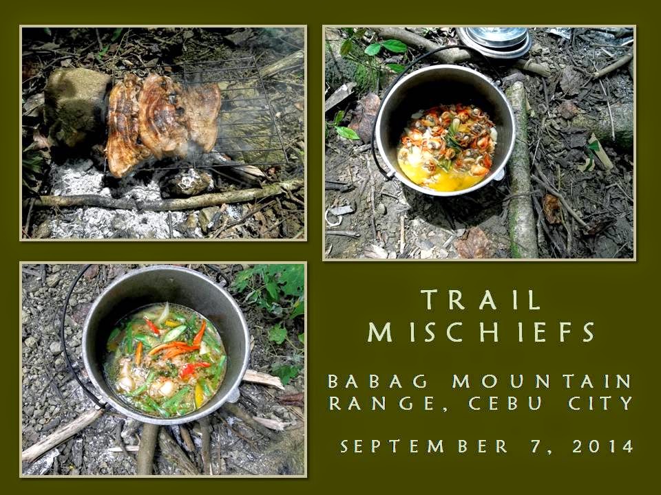
Jhurds had always been generous when it comes to food. Today, he brought raw blood clams (litob) and marinated pork. Ernie knows how to cook the clams in his own special way while Dominik will take care of the pork. A second fire is started by Dom where an iron grille is placed above it. Mark and Boy helped Ernie with the vegetables as I begin to search the camp for a spot to make a boar trap.

Laying a trap is without purpose if you cannot lure prey into it. A few good reasons why a boar will approach a place near where your trap is, are food, water or the opportunity to find a mate. Absence of all will make your trap useless unless you drive a boar to flight. When it runs it always follow a path of least resistance, like a trail, and would use the slope to hasten its escape. Man smell will prevent a boar from approaching your lure or it may stimulate its flight.

The trap should make it appear that it follows the trail, then diverted to a different path by blocking it with a very gentle arc of obstacles towards the hole. The boar, when stressed by pursuers, would follow that diverted route and into the trap. I have seen a perfect place (and the route) where a boar would be lured to run. This will start from Creek Charlie, follow the trail to Camp Damazo, then diverted downhill to a narrow ridge. Side trails should be blocked. Water of the stream and some wild yams (bulot) could provide impetus why a boar should follow your plan.

Unfortunately, the small ridge I choose does not allow me to create a hole large enough to accommodate a boar for the ground is dense and rocky. Although I have bamboo stakes, leaves, twigs and things nature could provide to make a boar trap, I do not have modern tools to make such a hole on a hard-packed ground. And I do not have the luxury of time. Making a boar trap is labor intensive and can be done in two to five days! I may have to make an alternative instead. Why not make a deadfall?


I go back to the campsite. Jhurds is squeezing the juice out of a grated coconut and would be mixed with a vegetable soup that Ernie is starting to finish. Dom had done with the first side of the pork and now had just flipped the other side facing the embers. I went past them, going to the rest of the camp. As I was walking, I noticed a flat ground below the trail I am on. I looked for a path and found it near a debris shelter that we found earlier.

Slowly, I tread among bushes, palms, zingibers and thick vines and come upon an almost flat ground. There is an abandoned makeshift shelter where there is a stock of firewood, a plastic gallon of water and empty flat bottles. The awning is made of abaca leaves, now frayed, supported by sticks laid horizontally that are propped by forked wood dug on the ground. This piece of flat ground could support five shelters but it is best with hammocks.

Walking back, I saw another bigger ground blocked from view by thick vines and zingibers. I have ascertained that it could accommodate seven shelters and more with hammocks. I begun to entertain in my mind that Camp Damazo could again host more PIBCs in the future. Besides that, this one is hidden from view if local people pass by because it is very secluded. Perhaps also, this one is nearer to Creek Charlie.

I return to the campfire and I see the pot of rice being cooked. Jhurds and Mark volunteered to fill our empty bottles with water to a natural spring. I decide to look for a tree that might had been cut by a local. I found one on a steep terrain just below the trail that we had passed more than an hour ago. I go down to pull the dead tree but it is heavy. I decide to separate the lower trunk by chopping it from the rest. I dragged it to the trail and it would do as a deadfall, it being about four feet long.

Exhausted, I go back to the group to drink water. Fortunately, my bottle is full as it was filled at a natural spring by Jhurds and Mark. Dominik had already sliced into bite sizes the last of the grilled pork. The rice is transferred to an abaca leaf to make it easy for all to reach and take refills. Lunch begins. I fished the blood clam first and ate it, then I take a refill of rice and poured the mixed-vegetable soup into it and eat contentedly. Another refill of rice, I paired it with grilled pork. It was another feast for Camp Red.

After I had eaten lunch, I immediately go back to the place where I left the trunk. Jhurds and Mark came with me to observe and, later, to help me set up the deadfall. I carried a coil of nylon rope and a plastic bag of cords. I make a notch on one end of the trunk so rope would not slip when I tie and suspend it high while Mark lent another length of nylon rope to reach the high branches.

The deadfall is placed above the trail and would swing towards an intended target once it is released by a system of spring mechanisms and triggering devices initiated by the target. The trigger cord is placed on the trail where it would be accurately stepped on by the right foot. I demonstrated its efficacy upon a wooden dummy and the deadfall barreled it away, scattering it six feet from where it was placed.

Sharpened wooden stakes buried on the trunk would make it more deadly. Not only that, the action of the swinging trunk would also open up many possibilities like activating peripheral “offensive” systems which would chuck several targets after the first one. It was very tempting to set this all up but, again, I do not have the luxury of time. I decide we go back to the campsite since it is almost 16:00. After disposing our garbage and packing up our things, we put out the fire thoroughly and leave.

We pass by the natural spring and two streams before climbing out of the jungle towards Baksan Road. Ernie suggested that we take the road instead going to the spillway at Sapangdaku. It was a tiring walk although it was downhill but a concrete pavement is never kind to the feet. We arrive exhausted at 18:00 at Guadalupe where Jhurds and Boy left immediately. As predicted, rain fell that early evening and I have to wait out the storm with bottles of cold beer that Boy Toledo had provided free for me, Dominik, Ernie and Mark.


Document done in LibreOffice 3.3 Writer

Sunday, April 19, 2015

NAPO TO BABAG TALES LXXXII: Over and Beyond the Ridge

IT IS A WARM SUNNY SUNDAY today, August 24, 2014. The fog of the early morning blended with the reddish-brown smoke of burning wood made into charcoal creating an unworldly haze skimming above the Sapangdaku Creek. We just left Napo at 07:45 and I am leading thirteen others on a hard-packed trail that follow the stream.

Feathery clouds displayed a rainbowish spectre in the east. It tells something but I am not a weather forecaster and I focus my observations on the ground and the moisture on the leaves instead. The vegetation are in bloom and the stream is laughing at the fulness of its racing water. I have a plan today. I will go to the Babag Mountain Range, climb Tagaytay Ridge, cross a saddle and explore a route to Lanipao. In one day.


My chest, which had been injured recently, begins to suck in oxygen full as my exertions begins to go full tilt as the terrain starts to get rolling. I felt that walking was not enough. I decide to run on short stretches of ascending trail. My burst of speed had widened the distance between me and my five guests.

Behind them, also in a widening distance, are the stripe of tigers of the Camp Red Bushcraft and Survival Guild like Jhurds, Jerome, Nelson, Ernie, Dominik, Eli, Justin and Boy O. The first rest stop is at the Lower Kahugan Spring. I begin to top off my bottle from the natural spring when I arrived and only saw Mark, Marisol, Marimar, Junrick and Jayr coming after me.

I begin to worry on the rest. They might break off the main route and assume that I am taking Manggapares Trail directly. Immediately, I set out from Lower Kahugan Spring and sprinted uphill to intercept them. Good thing that they were walking as if they were “strolling in Plaza Independencia under a pale moonlight”. Feeling safe with that, we resumed our foot journey.

The running had expanded my lungs back and the pain had gone away. I am beginning to feel better. I do not even notice anymore the weight of the Silangan Predator Z on my back although the AJF Gahum heavy-duty knife craved for my attention as the PVC sheath slaps, time and time again, against my left leg. I rub and cajole the knife handle when I feel I like it.


I put on my camouflaged mesh shawl when the sun begins to go high as I start the ascending hike of Kahugan Trail. I just walk slow to accommodate the pace of my trail companions. The long line lengthened. The heat of the day and the weight of the backpacks begins to be felt on the rest. The stoutest walkers begins to lag.

This would be the perfect time to show people of the hidden waterfalls of Kahugan. The first group, which consists of the guests and Justin, arrive first at where I stood and I showed them the path down to Busay Lut-od Falls. They could take their fill of the beauty of nature down there while I would wait for the rest of the Camp Red bushmen from above.

Just when the first group climbed up from the waterfalls, the second group arrived winded. The next rest stop would not be far ahead and we will arrive there soon. By now, the route is quite shady and breezy and everybody’s facial appearance returned almost to normal. We arrive at 09:20 and take a rest among bamboo benches. It is a good time to drink water and to open up spirited conversations, lifting up morale.

We go down a forested enclave and cross a crystal-clear stream. We are now near the headwaters of the Sapangdaku Creek but we opt to take a branch of a trail and start to climb Tagaytay Ridge. This is a reverse route of the one I have taken last July 13, 2014 (NBT 81: Exploration Gallery) and would be slightly steep but the shady trees are very welcome since it will shield us from the heat of the day. As we ascend, Jhurds and I forage tinder.


We reach our meal stop at 10:35 and, immediately, the minions at Camp Red began to work on the fire, the coffee, the meat and the rest of the food ingredients. The guests observe first and, when they begin to feel the hang of things, by initiative and with willingness to learn, joined in the fray. Justin worked on a fire with a ferro rod after considering several tinder while Dom and Nelson do the same thing on another fire. A pot of water is boiled and another pot of rice is cooked using the AJF Trivets.

Ernie, Jhurds and Boy O begins to slice the meat and vegetables as the first cups of steaming coffee are being sipped of their goodness. Hot coffee is always superb and had always been a bushman’s companion, no matter what form it is served. Eli, Nelson and I scour for firewood as the famous Camp Red blades begins to appear. The guests eagerly chop firewood with the knives under tests like the prototype Seseblades Combat Bushcraft and the AJF Puygo.

I take time to test the Trailhawk Cleaver that I designed and which was commissioned at the Knifemaker of Mandaue City under the sponsorship of Jerome. The cleaver is made from a 1095 steel with a striped ebony handle and a matching wooden sheath. I am satisfied of the result and I am greatly indebted to Jerome for this. He is a good benefactor, not just to me, but also to everyone else at Camp Red.


When Camp Red prepares its food, it is always a feast. Trust that to Ernie, Jhurds and Dominik. Today we have Bicol Express (a pepper-based soup cooked in coconut milk), pork kilawin (medium rare grilled pork sliced and mixed with spiced vinegar and soy sauce) and sweetened raw cucumber. We finally have our lunch after a prayer before meals lead by Marisol. We shared the meal to our host, Vicente Bonghanoy, and to his nephews.

It was a very filling meal worthy of mention in successive gatherings in the future. Then the young coconuts came, carried by Vicente’s nephews. Everyone is advised to open their own coconuts, self-service, with the knives offered for use. To provide quality time, Justin and Eli demonstrated to the guests, fire-making with ferro rods and flint and steel on different tinder like natural fiber, chaga, cotton gel and charclothe.

When my AJF Gahum, the Trailhawk Cleaver and my William Rodgers bushcraft knife are pierced on a log, everyone with worthy and helpful knives, take the cue. Suddenly a spine of knives erupted from the back of the log in less than 30 seconds. Another great knife porn of local, branded and unusual blades are on display, which is now part and parcel of every Camp Red activity. When you are part of this, your warrior pride just whips off from your breast.

When 13:35 came, we ask leave from our host and tackle the trail towards the top of Tagaytay Ridge. The route is surprisingly easy, following along the contours instead of engaging it. It is also very shady, the noontime sun did not bother us below the foliage. I arrive at a saddle and walk a few meters to find the trail which I had noted in the past with several passing through here.


I stood before it and it looked very formidable. The route curved and curled along the side of the mountain until it buried itself into the forest below. I may need a walking staff for this stretch. My feet are now beginning to suffer inside the close confines of my shoes. Pain would intensify when it is downhill. On this downhill route, hell would surely be felt by the toes. The stick will lessen the pain when I grip onto it to stave off gravity.

It is an unknown route to me, a route used by locals, but I will try to unlock the secrets of its existence. I believe the route would sire many branches the moment I reach the lower levels. I will again test my traditional navigation skills for this afternoon of shifting surprises. Everyone knows that we are now in exploration mode and they saw a good challenge coming but very wary of the unknown.

Some terrain (and plants) are slightly similar to those of the No-Santol-Tree Trail in Kalunasan, marked by some very narrow paths, almost obscured by grass, and soft loamy ground that gave in to weight. The upper levels are used for pasture lands as evidenced by cattle droppings and places where cattle are kept during night, especially underneath an old mango tree, of which trunk cannot be hugged by four people.

Blending in amongst vegetation is an abandoned shed. The cant of the trail is tremendous and puts pressure on my toes as I try to get a good grip on the ground aided with the staff. The staff is most helpful as it would arrest my downward acceleration, preventing misplacement of a foot and untoward injury. Behind me are the rest who are in a more difficult bind than me, grabbing handholds, trying to defeat gravity.

I wait for them on a rare flat ground where there is a cornerstone beneath a Java plum tree (Local name: lomboy, duhat). There are also three mango trees that grow in a line and a grove of Chinese bamboos. I noticed tamarind trees along the way. Tamarind trees are used by the older ones to mark a route and I used the trees as landmarks during my past explorations of Baksan, Buhisan, Kalunasan, Arkos, Banika and Patay’ng Yuta.


I push on until I reach a pygmy forest of indigenous trees. This forest is still young. It may be on private land since I do not see evidence of indiscriminate cutting. The path is now pronounced and hard packed, indicating that it had been used extensively, perhaps by cattle and by farmers. I finally met the first of the many branches of the trail that had worried me back on the ridge. Time to do some reconnoitering.

I place my staff to block the left branch of the trail and slip off my backpack. I take the right fork and half-trot downward. The path is in excellent condition but it goes abruptly down to lower ground, most probably to Lanipao Creek. I backtrack and engage the other fork. The route is on rolling terrain. It follows a long ridge. I choose this route over the other and double back to tell the others of my discovery.

We proceed on and pass by a goat shed. There are no goats kept yet but the maker of this shed uses the fork of branches to secure the awning to the mango tree. Quite brainy. A good chap. A sample of local bushcraft which I showed to the guests and to the bushmen. The principles of “blend, adapt and improvise” are used to the hilt. It is woodlore at its best!

I am faced again by three trails: left, middle and right. I opt to scout the right first and, just like the previous search, it probably will go down to Lanipao Creek, although the trail is very inviting. I did not consider the left branch and I push on in the middle but I left three knife hacks on a tree should I tackle this route from the ground up.

The trail pass by a goat shed which has goats in it. I cross the small open ground and proceed down to the rest of the trail. I ignored trails left and right and follow the contour of the ridge until I met a dead end. The trail is blocked by tree nurseries. Although the owners are kind enough to allow us to pass through their properties but that only meant we cannot proceed on our own at another point in time at this same route.

It is an easy invitation and would end our activity in a much easier way but I have other things in mind. I wanted to go back to this beautiful route and I want to go back unimpeded without passing through public properties. I explained my intent to my companions and thanked the owners of their kind gestures. I backtracked instead to higher ground while I keep the rest to stay until I gave a signal.

I found the place where there is a fork. I take off my backpack and I began exploring an almost unused path. Paths like these are hard to find without a trained eye. The path followed the contours easily until I reach a ground blackened by charcoal. The ground begins to go downward but there is a slight parting among thick vegetation and, beyond the greens, I see a glimpse of the presence of a wide hard-packed trail!

I hurriedly returned for my backpack on the trail fork and told them of my find. Again, I am onto the trail leading them until I reach a wide path. From hereon, the stream would just be up ahead. At least, I have the freedom to go as I wish without having to secure permission from people to pass through their properties. Today, I had accomplished a lot. I could return again here in another time and I would now know where I am going.

Besides, there are trails worth looking into. But, honestly, the route from Lanipao to Tagaytay Ridge would be very challenging and difficult which I do not have the temerity to tackle yet. Yes, the reverse might still be out of the question but, if the time is right, I would do that. Even alone.

The trail was unnamed and there was no one to ask from, for I saw no people on our downward walk. For purposes of documentation, being the one who initiated this exploratory hike, this privilege of naming places should be mine alone and, placing this in a proper perspective, I hereby name this as the Lanipao Ridge Trail.

Finally, we reach the community of Lanipao after crossing the stream and reward ourselves with cold soda drinks from a small store. It is 16:10. Napo is just a kilometer ahead but we would be walking on a road and, after that, more cold drinks at Red Hours.


Document done in LibreOffice 3.3 Writer.

Monday, April 13, 2015

COMPLEAT BUSHCRAFT XVII: Prospecting a Campsite

I AM PUSHING FOR the transfer and the holding of the Philippine Independence Bushcraft Camp for 2015 in another place and I am eyeing the Municipality of Lilo-an. This town is located 22 kilometers north of Cebu City and is known for its rosquillos biscuit, a lighthouse in Bagacay Point and the whirlpools of Catarman, from which Lilo-an is named after.

Travelling north, your senses are accustomed only to the tame but narrow strips of plain which the Hagnaya Road traverses. Inland is different, especially into its hilly barrios, where the rugged landscape prevent the development of a reliable public transportation on those almost-forgotten roads less travelled. I need to see what secrets lie there and try to get the answers that I had been seeking.

Today, August 10, 2014, I am with my fellow outdoorsmen of the Camp Red Bushcraft and Survival Guild. By the time I arrive at the meeting place on AS Fortuna Street, Mandaue City, Jhurds Neo, Glenn Pestaño, Eli Bryn Tambiga, Justin Abella, Faith Tannen, Nyor Pino and Mark Lepon are already there. We immediately commute to Lilo-an where Christopher Maru meet us at Titay’s Lilo-an Rosquillos.


Inside a gated compound, Aljew Frasco is waiting and smiling. Beside him is a Frost River rucksack with the black rubber grip of a Sycko 911 knife protruding from the inside pocket. Between him and us is a stainless-steel ewer of hot steaming coffee flavored from the guts of a palm civet, freshly brewed, a prime item for immediate taking. Coffee like this make the most feral creature behave like a kindergarten kid. Sweet!

We leave the town center into the interior of Lilo-an. All ten of us, plus four local guys, ride on a maroon Toyota 2003 double cab pickup, driven by Aljew. We follow a thin ribbon of concrete until an unpaved stretch begins to unravel for the rest of the way. Four-wheeled traffic is a rarity in these parts with occasional motorcycles. It is a warm Sunday morning and everyone are excited of the prospect of an exploration.

We finally reach the jump-off point somewhere in the hinterlands of Kanagahan. There is a chapel and a grassroots volleyball court, some houses and a few ceiba trees. Aljew parked the Toyota and we hefted all our bags onto our backs. Faith, Jhurds and me brought our Silangan Predator trizip bags. I open carry an AJF Gahum knife, Aljew with his Sykco 911, Jhurds with a Spyderco Forester bolo and Nyor his Seseblades NCO knife.

We walk the rest of the road that wind above a peak, which Eli read from his GPS at 237 meters, and down into a saddle where a path turn left. One of the locals who are with us, Titing, lead the way into private land. It is steep, the topsoil dry and loose. We pass by mango trees down ravines and into a patch of healthy corn, from which we wind among our way following a narrow path and finally going down into a stream.


The stream – Mantalogo Creek – is at the base of Mount Laniguid, Liloan’s highest peak at around 500 MASL. Titing cross the stream and showed me a shallow water well on the lowest shoulder of the mountain. Titing says that he dug the well over forty years ago. It is supplied by a seep which Titing says had not been affected by drought or by typhoon. It is the source of drinking water for families living near the stream. Amazing!

I drink the water after gasping hard from that very short but very fast climb. I have not yet fully recovered from that motorcycle crash thirteen days ago and my breathing is stiff and painful caused by a slipped cartilage on my left chest. I should have taken it easy and slow knowing that I am nursing an injury. The water is good but I have reservations about it since it is not covered. Anyway, we could improve about its quality later on.

We go back to the stream and Titing led Aljew and all the rest upstream. Mantalogo Creek is clogged up by huge boulders. Running water led to clear pools and stagnant ones, which usually are choked with thick algae, indicating indiscriminate use of fungicide and other chemicals which usually are sprayed on mango trees. I did not see a high water line which normally shows after a flood. As I walk, I scan the river bank for a hint of a good campsite.

I found one as I was walking on a wide sandy area. It is not wide but it is level and long. It could accommodate, at the most, ten tents placed in one row and another three tents on the second row. Buri palms and mango trees are ideal anchor points for hammock shelters. I am quite satisfied of this discovery and I confer with Aljew about this. Well, it would help very much if we could determine the owner of the lot so we could have a permission to use this during the next PIBC.


We walk a little upstream and halt under a very shady mango tree. We stop. This would be a perfect place to rest from the heat of the late morning and a good place to prepare our meal and to talk. Immediately we forage dry firewood and a fire is beginning to take shape. Fabricated pot stands designed by Aljew are being distributed to each of us. I call this the AJF Trivet in reference to the owner.

It is just a simple construction of two flat iron bars – bent at three right angles – and fastened by a thumb screw. When used, the bent bars would act as “legs” and would support a cook pot or a frying pan. The legs are six inches high and gives enough space between ground and the bottom of a pot for firewood to burn. When storing, you just have to cool it down and fold it. It weighs about 150 grams.

Christopher cook the mixed vegetable soup and boiled water for coffee while I take care of the rice on the fire irons. Veteran pots, blackened and dented, are used. We had ditched the immaculate ones long ago. Nyor and Jhurds watch over the pork meat being grilled over glowing coals. Justin, Faith, Glenn and Mark make themselves comfortable under the shade. Aljew is doing a sightseeing with the local guides upstream.

When Aljew came back, we start our meal in “boodle-fight” fashion. The rice are spread over banana leaves while the grilled pork are chopped in bite sizes. The vegetable soup is confined to the pot and everyone is encouraged to pick as many food as he could. Fourteen of us line the edges of the banana leaves but it is best to spot your own place farther from the crowd.

After the meal, I asked Aljew and Jhurds to go with me to take a survey of that possible campsite that we passed by hours ago. The area is covered by grasses and stones littered the ground. Cleaning and levelling it would be done weeks before the PIBC and it is best to stay here overnight to get the feel of the place. The wide sandy riverbank below the proposed campsite would be perfect for the lecture site since it is shaded and there are a lot of rocks which you could use as seats.


But the most valuable assets which lead me to choose a good bushcraft campsite is its proximity to water sources and bamboos. I have seen separate sources for drinking and for washing on the stream. Rain and flood would up the ante of adventure for the participants if ever it would contaminate the stream. On the other hand, the Philippines is bamboo country and it is that which makes us develop different methods for survival.

It is now 14:30 and we have decided to leave the stream and go back to where we came from. Titing lead us to another path, which is a better one. It follows a small stream and it passes by a small waterfall. We cross the stream where there is a saddle and hike up a beaten trail until we reach the dirt road. We pass by communities and the afternoon was very warm that we stop by a small store that sells cold soda drinks.

People here are engaged in manufacturing of bamboo skewers. Their blades are so sharp and they are so adept at using it, regardless if it is a small cutter or a long bolo. I begin to admire of the system they used in the manufacture of skewers. I collect the bamboo shavings because these are good fire kindling and it would be good to add these to my fire kit.

From Kanagahan, we proceed to a secluded farm in San Vicente and spend the rest of the afternoon there preparing our dinner. While doing nothing, the guys start a blade porn and opened up another round of good conversations amidst the presence of very cold bottles of beer which made the talks more enticing and the guts craving for food. Christopher delivered a really spicy hot chicken cooked with a kilo of chili pepper. True. With that, the cold beer came in very handy.


Document done in LibreOffice 3.3 Writer

Tuesday, April 7, 2015

ALLIANCE MATTERS V: Sibonga BMC

I AM STILL NURSING a fever borne out of a motorcycle accident that I got into on the night of July 29, 2014. My left chest is in pain, probably a slipped cartilage, and breathing is quite stiff. I also have a pulsating headache, a runny nose and an itchy throat. Yet, despite those, I am game enough to lend my presence, my time and my knowledge before outdoors enthusiasts today, August 2, 2014, at the Green Habitat Resort in the hills of Sibonga, Cebu.

When I gave my commitment to Barry Paracuelles a week ago, I will pursue it, no matter what. Like today. I was even getting too restless to look forward to this day that I am deprived of a good sleep the night before. I am excited to work with my local peers of the Mountain Climbers Alliance of the Philippines Inc. (MCAP), who included me as resource person for a Basic Mountaineering Course. Barry had designed the program of this BMC and this is, I think, a different kind of BMC.

I woke up at 04:15 and out of my home after a cold shower. The participants will converge at the 7Eleven across the Cebu South Bus Terminal while Barry had designated the office of Primary Structures Corp. in V. Rama Avenue as the meeting place for the organizers. By 05:00, I am already at the place. Since Barry had not arrived yet, I decide to enjoy coffee and bread at Pan de Manila at the nearby M. Velez Street and buy ingredients for my meal at the Guadalupe Public Market.


We leave at 07:00 for Sibonga. Primary Structures, where Barry worked, provided us free transportation. Some of those that will take the BMC are employees of Primary Structures. Got to hand it to Barry for organizing this event more than what I had expected it to be even to the extent of involving the company where he is working along with his co-workers. I believe that the main body of participants had left the assembly area as well in a bus.

When we arrive at the Green Habitat Resort, some of the participants were already there. I examined the place and it is a resort alright with five pools, a camping ground, a stage, several cottages while a creek runs beside it. The ground had been leveled off including the part where it once was a slope. I take a seat at the farthest kiosk where I am joined by Neil Mabini, Chad Bacolod and Xerxes Alcordo.

Barry immediately led the setting up of the sound system and the projector on the stage. I offered my Apexus tarpaulin sheet as an improvised projector screen. As everyone settled in among the PVC chairs, Barry started the BMC. The projector throw images from the laptop to the tarp sheet but daylight defeated the purpose. Nevertheless, Barry explained every detail of each chapter until such time when lunch break came.


After the meal, the lecture transferred to one of the cottages and the discussion of the BMC by Barry continues. By 15:00, my turn came. My topics are The Survival Kit, Water and Cold-Weather Survival. Some of the participants are a bit bored and sleepy so I decide to let them stand up and asked them to give 15 seconds of silence to the memory of Aldrin Cerba, who died during a canyoning accident at Canlaob Canyon in Alegria.

The first topic, The Survival Kit, cannot be discussed without a real survival kit. Of course. It is a very complex subject that would involve the exhibition of all the items found in a survival kit plus the WHYS and the HOWS of why it is part of the kit. The delivery of the lecture fluctuate between the hilarious, the serious, the scientific and the interesting. At least, I get the attention of the participants, most of whom are still new to the outdoors.

The survival kit, I explained to all, also consists of the different sub-kits like the first aid kit, the repair kit and the replenishment pouch plus a good knife. The knife could either be a fixed blade but very light like the Mora or the different versions of the Swiss Army Knife, especially with one that has a folding saw. One of the very important components of your survival kit is the thermal blanket, which you should have since you tend to visit higher altitudes, and fire tools, the redundancy of which ensures your overall security.


My next subject matter is Water. Water, I inform to all, are very abundant here in the tropics but is a commodity that had caused conflict in other places. Outdoor activities like those done in mountains demand water so much because dehydration is a natural process of the human body. You cannot remedy loss of body moisture except rehydrating several times as you can and filling up bottles whenever you can. Taught them of the places where to source water and what methods of treating water before drinking.

Last is Cold-Weather Survival. Since mountaineering is a high-altitude activity where exposure to cold is high, the best way to prevent hypothermia is to know the five mechanisms that steal heat away from your body: Respiration, Conduction, Convection, Evaporation and Radiation. For every natural heat-loss process, there are remedies for that which I clearly explained. When I thought I have reached the end of my lecture, I let them examine all the items of my survival kit.

Neil came in next with Technical Climbing. He discussed about the different ropes, its usage, care and storage. Apart from that, he showed and discussed the safety gears that are used with the rope during technical climbing like the harness, carabiners, descenders, flat webbing and cords, mechanical ascenders, chocks, etc. Other accessories like the safety helmet, rock shoes and chalk bag are properly explained according to its purpose.

When ropes and cords are involved, surely there would always be knots. Lots and lots of tying around. Ropesmanship is another topic that Neil is discussing to all participants for the rest of the afternoon. He taught the basics of knot-tying and the most common knots used in mountaineering like the square knot, the bowline, the figure-of-eight, the double bowline, the double figure 8, the Prussik knot, the munter hitch, the Kleimheist, etc.


The knots and all the equipment are then used for the Single-Rope Technique, a method of traversing up and down vertical places using the rope instead of a ladder. Neil showed everyone how to use the ascender and how to devise the cord to work with the ascender and your harness to gain altitude. He shows the technique in how to uncouple the ascender and transfer to a descender when he needs to go down. A belay is used to increase safety for the first timers.

When dusk came, everyone settled to their respective groups. There are several informal outdoor groups which carry funny names like Tribu Batig Nawong (literally, ugly faces), Yabag (unmelodious voice) and Orcs (they are not from the Lords of the Ring); and the serious ones like the Enthusiasts of Cebu Outdoors, Visayan Trekkers Forum and RECON MACE 7.

When I had ended my lectures, I set up my Silangan “stealth hammock” between two midget coconut palms. Overhead cover is my Apexus sheet which is anchored at its edges by sharpened wooden stakes. That would be my resting place for the night which, I believed, would be long. When fixing my shelter was finished, I start preparing my dinner. For this occasion, I brought my almost-forgotten butane stove.

After the SRT session, everybody gets busy preparing their own food. Each group has its own concoction and I thought I saw a bottle of hard spirits but I declined an offer of a drink. I believe the gut needs a filling first and it is still too early. A spoon rapped on a pot lid signaled the start of dinner. In a flurry of refills after refills, the food gets decimated and everyone are too bloated to make crazy somersaults on the swimming pools.

The groups are to each his own now and I carefully evaded the attention of the ones holding the bottles until I get to enter an open cottage and I got trapped with a group who knows my son very well as they are working in the same company. They are with a little-known business process outsourcing company located at the Cebu IT Park called Microsourcing.


They are now serious outdoorsmen and they asked me everything about “Mag-ne” and why I hid my face with different books on my Facebook profiles? I give them funny answers that tickled them to the bones especially now that the spirits in the glass begins to work on all of us. The rounds of the glass becomes tighter and faster and the laughter begins to get boisterous. Outside is pandemonium as some of the participants begins to make the pools work for their enjoyment.

When I thought I have enough, I work my way into my sleeping quarter. Fortunately, it is empty of stragglers. This would be my first night on my Silangan hammock and I am trying this for the very first time as a half-conscious occupant of a few hours. A built-in mosquito net protects me from those noisy insects and that gives me an assurance of a good night’s sleep, a peace of mind. The hammock is quite spacious which I had not experienced with old hammocks that I used before.

Indeed, the hammock worked wonders as I see daylight of the next day, August 3. Coffee are available everywhere but I kept to myself with my own supply which I get to share when someone overshoots his orbit. The rappel session starts early under the direction of Neil while I assist him with the belays. When it was over, the whole BMC class with their certificates takes a pose for the cameras. After that, everyone gets to relax and takes another dip in the pool as the bags are packed ready for departure.

BMC classes are now very common that it is now given free. This BMC, to keep abreast of the times, is given en gratis and would be a first in the annals of MCAP to be held outside of Luzon. However, Barry choose to involve topics which had not been discussed before in any level of any BMC to equip better the participants by its practical applications in the enjoyment of their interests among our mountains.

Because of that, I was moved, at the instance of Barry, to make better mountaineers and better individuals of the participants. I could not have been more happy than to become a catalyst of increasing their safety in the outdoors and of their survivability as well.


Document done in LibreOffice 3.3 Writer

Wednesday, April 1, 2015

BUSHCRAFT BUHISAN XXVII: “Riders” of the Storm

THERE IS ANOTHER WEATHER disturbance named “Henry”. It is not a hindrance to me on my outdoor sojourns. It may be a nuisance to others but it would never ever be a reason to postpone an outdoors activity just because it caused one a not-so-perfect day. A wet disposition, a cold atmosphere or a muddy trail are the least of my concerns. I just focus on the totality of the journey and bad weather can only lend a color to it. Nothing bad.

It had been raining since last night and this morning of July 20, 2014 is a bit cold. I will have to “ride” out the storm then. I am leading five others cheerily up “heartbreak ridge”. Rainclouds are a blessing up here on this exposed ridge of Banawa Hills whose features imitate the back of a giant lizard if you see it from Mandaue. The power pylon now sports a signage with a smiling skull which seemed to relish at the word “DANGER”.


Behind me are Jhurds Neo, Jingaling Campomanes, Nelson Orozco, Ernie Salomon and Nyor Pino. The bottom of the ridge where there used to be a cairn are now behind us and so is the Our Lady of Guadalupe Parish which we had left at 07:15. We got past the tower and the World War II tunnel vent and met three perspiring youths with firewood on their shoulders going to where we came from.

We are now among farms of cassava, lemon grass, horse radish, corn and sweet potato but the hard packed trail cant downward and I take it slow as it is slippery. Ripe fruits from a Chinese laurel tree (Local name: bugnay) provide us something to relish. Old fruit trees populate the path but it is not the season for mangoes, tamarinds, star apples, breadfruits and Spanish plums. Met a man carrying a sack of avocados on his head. The route goes into different saddles until we reach the place called “the Portal”.

It is 08:30 and I need to reach our destination, which is Camp Damazo, before 11:00 but, infront of me, is the old trail that lead to it. Ernie insists on using it. It is long, difficult, gloomy, wild and it is a trail that I had last walked in 2012. Sounds foolish when I had already been using a shorter route. Well, I do not have to switch to “Plan B”. We take a muddy detour for Baksan Road. All of us are wet and I am happy to see that no one is wearing a rain coat.

Rain coats, for me, are for school children, for higher altitudes and for corporate people. Bushmen do not wear such, not in a tropical jungle, and they improve their resistance by adapting to the elements of nature. Exposure to rain and cold prime up my senses and I do not want it in another way. If you want comfort, then do not go out of your house on a rainy day. Watch TV on your warm sofa and drink hot milk.


We go down the trailhead where it led to a dry stream then go up a ridge. We are now at the teak forests of Baksan. I follow another ridge going down a low saddle and then into another ridge that climb up a hill which I liked to call as “Boy T’s Hell”. Ernie takes a dig at Boy Toledo, who is not present, as he recalled the latter’s dark skin turning white after climbing this low hill from another very difficult route. Very amusing story since I was there and it is worth telling. With a laugh!

We cut straight branches from teak trees so we could use it as walking sticks. This type of teak planted here is not an indigenous species but originally are from Burma and are not very receptive with birds and insects. It is a boon instead of a blessing. It does not make the soil fertile and does not like to share space with native tree species. Even with that, we carefully choose which branches to cut that would result to an even healthier tree.

We go down the hill and I looked for my trail sign. Found it and I see the route I took last July 5. I was alone then engaging on “Survival Day”. Three teak trees growing in between, I used as springboards to aid people during descent, after which it cross two small gullies and weave in and among low trees and shrubs until you reach a trail beside a stream which I designate as Creek Alpha for want of a name. Vegetation are now wilder here with different varieties of indigenous plants and trees.


I cross the stream and I see a single footprint on the sand. It belonged to a small man. Beside it is a paw print of a dog. It is a couple of hours old. I am now on the other side of the stream bank and I follow a path. I go down a branch of the trail which lead to the same stream. I need to check on the old location of Camp Damazo. I see a deep imprint of a paw, most probably of that same dog. I do not see traces of the man. Perhaps it is a dog trained to hunt. Dogs like that move a lot without waiting for a signal from its master.

The old campsite is just a small tongue of even ground between the confluence of two small streams. It could accommodate about five tents but during the first Philippine Independence Bushcraft Camp of 2011, it was filled with nine tents housing fourteen participants, which Ernie and Boy T were part of. Water source then came from water holes dug beside the stream.

I do not like crowded campsites, that is why I transferred Camp Damazo to a better but safer location and that is where I am going to now. We leave the old campsite and go back our way but I change direction. The ground and foliage are so moist that we found it hard to look for dry dead leaves. I found dead branches with dead leaves hanging onto it. I select dried ones and we fill up a small plastic bag.

I follow the trail as it wind along the contours of the terrain and I see the same footprints. The hunter placed overturned rattan leaves on the ground. It is purposely done that way so he could find his way back and the lighter shade of the leaf’s underside could be seen better in dim-light conditions. It reflects light better when probed with a LED torch. The man used his head well or it could be that he learned it from others.


Blocking the path before me are two slender branches of a teak tree bent towards the other side. I thought it at first as a spring mechanism for a snare but I do not think so. Teak wood are not stiff and would easily bend but does not snap back when released. I looked closely and I see no cords but he placed crawling ferns over it. A debris shelter! So he must have waited for a prey and, that means, he is armed with a hunting rifle. So that is why his footprints have deep imprints?

I looked all around to guess where would he aimed his rifle sight? Surely it would be high on a tree but which tree? I see traces of somebody sliding down a steep hillside. So he must have hit his prey, probably a jungle fowl. No fool would go down that steep ground where I stood at without something to gain from. As I see all these series of events reading the tracks, I expound it to my companions, including a trail sign commonly used by “other people”.

We reach the second stream which I named as Creek Bravo. Somebody just harvested three bamboo sprouts (dabong) here where it is peeled on the creek bed. It came from the groves of water bamboo (botong) located just above us. There is no visible water on the stream but there is one underneath. Growing and clinging on a mossy stone are two young plants with glossy leaves which I suspect to be Philippine ginseng. Strangely unbelievable but I based on the peculiar design of the leaf edges but I could be wrong.


Nevertheless, we have to go. It is now 09:25 and the sky starts to open up with a slight sunshine touching the tips of leaves on the highest elevations. The path is muddy but all behind me knows how to deal with it. The Leave No Trace teaches people to “walk single file even if it is muddy”. We do not do that because we always think, we improvise and we adjust well to a situation. Common sense is much better than following a foreign ideology that had been ruthlessly made a rule by corporate outdoor clubs instead of as a guide.

I saw many muddy paths turned into “water slides” when people without real-world skills follow that dictum and gave locals a hard time to travel from their farms to the market and back and also for the children from their homes to their schools and back. That is really careless and downright aloof without regard and respect for the locals living on the mountains just because you want to portray yourself as a champion of the environment. Remember, they had been content of their lives for years until you came one day and made it miserable.

Anyway, we follow the path ascend to a ridge. In a short while we would be at Camp Damazo. My wet Silangan Greyman pants snagged on a rattan tendril and I slowly remove it. Steadily, we hike uphill and come upon a reddish cuckoo dove (tubaon) foraging on the ground. The small dove had not noticed our coming until we are near and it flew. We collect firewood as we walk until I see the “gate” of Camp Damazo. PIBC products - Ernie, Jhurds and Nelson, had learned well and all used their wits.


Dry firewood are hard to find, especially during rainy days, and it is rather difficult for people without basic survival know-how. I taught people how and why everytime I convene the PIBC or you may study my trail habits and be attentive when I am on a day hike. I am very generous when it comes to sharing knowledge and I always explain when I think there is an importance or I may find you very interested in what I do.

This campsite had been found and chosen during PIBC 2012 and revisited in PIBC 2013. Outdoorsmen from Luzon came here to learn bushcraft and survival on those two occasions and this place had produced the finest products yet of the PIBC. When coffee seedlings were planted here, I decide to respect the locals who nurtured these and transferred the 2014 edition in Sibonga. Besides, the campsite had widened during brush clearing by locals for their coffee seedlings.

As I meticulously break off dry twigs in pencil-lead sizes, pencil sizes and thumb sizes, Jhurds chopped small branches with his Spyderco Forester bolo. Nelson and Nyor make a “bird’s nest” of dry tinder and kindling. With a spark from a ferro rod, the tinder emit smoke and Nelson blow it to life. I placed my smallest twigs over it as the smoke thickened. Fingers of flame sprouted and it blazed more when bigger twigs are placed over it. Ernie automatically work on the food ingredients while I produce blackened pots.

We boil water for coffee first for hot coffee gives you heat, quenches thirst, makes you think better and unload a lot of tales. Nelson provide a small fire placed on a different location. Its purpose is just to provide thick smoke so mosquitoes and ants do not torment us. A pot hang suspended from a tripod and over a fire. In it is a kilo of rice. We will be having another “feast”, especially with Ernie around. Cooking on a dayhike is a trademark activity of the Camp Red Bushcraft and Survival Guild.

We do this because we do not hurry. Haste creates waste of quality time and energy and exposes you to accidents. Quality time is learning new ideas and knowledge from people and learning to appreciate nature better. Ernie cook a mixed-vegetable soup and blood clam (litob). Jhurds provide entertainment. Jingaling takes care preparing raw cucumber in vinegar while local sausage (chorizo) is grilled over coals. We eat lunch at 13:30 under a very breezy condition.

We leave after storing back our things to our backpacks. Oh, yes, I carried the Silangan Predator Z today and so is Jhurds with his Predator Alpha. We reach Baksan Road at 15:15 but we continue on to Lanipao and take refreshments. We proceed to Napo where we end our walk by riding motorcycles-for-hire for Guadalupe. We did not tarry long and we all decide to omit the post-event discussions as everyone are exhausted.

Although doing an outdoors activity during bad weather is not advisable, but you would have to do it sometimes. You have to prepare yourself physically and psychologically by training in a real-world situation because the really bad ones are those that hit you where you least expected it. “Murphy’s Law” is a demanding adversary which nobody had gained advantage of yet. But a prepared mind knows how.


Document done in LibreOffice 3.3 Writer