
I
JUST HAD A VISIT to the Babag Mountain Range yesterday, but, here I
am again today, January 4, 2015, traipsing almost on the same route.
I have no reservations about the idea of making this range as my
playground. The mountain range IS my second home. I have no reason
to go tramping elsewhere for Babag is big enough to satisfy my spirit
of adventure and for training purposes.
Besides,
I am on an urgent mission to select my team for Segment III of the
Cebu Highlands Trail Project. Segment III will start on February 19
at Mantalongon, Barili and will end on February 22 at Mantalongon,
Dalaguete. The route will pass by the mountain highlands between
them. On the other hand, the Cebu Highlands Trail is the bigger
scale. It will encompass eight parts – or segments – from north
to south or reverse.
I
offered only two slots for Segment III aside from mine being the
project organizer and the team leader for that exploration. Five
people of nine whom I invited came on this day at the parking lot of
the Our Lady of Guadalupe Parish. The other four automatically
forfeits their right to be selected. Good. The lesser people, the
better will I manage and instruct them and the faster will our pace
be.

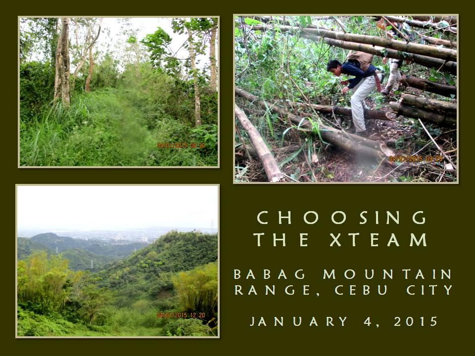
We
leave Guadalupe at 07:00 for Napo by motorcycles. Once we cross the
foot bridge, we engage on the trail immediately. It is not the Napo
Trail but the full route of Manggapares Trail. It starts where the
Sapangdaku Creek and Tagaytay Ridge meet. It is an old route which
had been forgotten by the present leisure hikers after an easier
route to Mount Babag had been discovered. I talk when I walk and I
do that when I need to.
This
is a trail which I could have walked in the early ‘90s but, through
my persistence to discover places here, re-discovered it in January
2013. The path led us abruptly to elevated portions which needs some
very brief rests from time to time. We took our real rest when we
reach a tamarind tree to rehydrate. From there, it is all walk until
we reach our first steel tower and we rest again.
I
used the steel power pylons as landmarks everytime I walk Manggapares
Trail and I would know which tower has side trails and which one has
not. The walk continues on until after the fifth tower, where a path
cut down to a low ridge but, midway, I shift to a very scant path
that I called Liboron Trail. It is a short cut but it is very
difficult when it is wet. The ground is very soft since it had been
raining almost uninterruptedly for the past months brought on by
storms.
My
new 5.11 Tactical Series Shoes gets its real baptism of mud. I fight
off gravity by changing steps as long as the shoe held its grip but,
on a few occasions, I am unsuccessful and I have to start another
strategy. My shoes are wet as well as my new Kailas hiker socks
inside. Pressing on, we reach a saddle and it is another rest that
is very well deserved after that nightmare of a trail.
Facing
us is a low hill and we climb it. I point the grassy place where I
saw a grass owl. I begin breaking off dead twigs that are not
touching ground. Everybody do likewise, looking for dry kindling as
we walk down into another saddle where bamboo poles blocked the path.
We crawl below it and walk on towards a small house on the hill. A
dog’s bark greeted us and I look for the owner, Julian Caburnay.
Found
him walking behind us and he is glad to have company. I ask
permission to use a part of his place to prepare our food. It is
still 09:30 and, by God, we are very fast. Immediately, I retrieve
my AJF Folding Trivet and gave the task of boiling water for coffee
to one of the guys. I have to slice the pork meat, onions and pepper
and crush the garlic.
Wet
conditions kept the guys from starting separate fires immediately
but, after two or three tries, they got success. Two other AFJ
Folding Trivets appear and three fires are now burning underneath a
big pot reserved for the milled corn, a small pot for coffee and
another pot for the cooking oil which the sliced ingredients would be
dumped upon soon. We have to feed the fire from time to time with
thin pieces of firewood.
While
doing that, Julian gave us ripe bananas, papayas and a sliced
jackfruit. The fruits are organically grown and the banana is
uncannily sweet. Then it rained. Good thing one of the guys has a
tarp sheet and we were able to rig it up to cover our fireplace. At
this juncture, Julian lent us his big laminated-nylon sheet and the
cover provided us and our things from rain.
The
food would be a very spicy pork adobao. I place basil leaves for
garnishment. A guy produced a banana leaf and frayed it over the
fire before resting it above a table. Then the steaming milled corn
are spread over the leaf, then the pork adobao with its spicy sauce.
After a prayer, the hungry bunch picked and eat to their heart’s
content at 12:10. I reserved a portion for Julian which I gave after
the “boodle fight”.
We
leave the place cleaned and resume our training at 12:45, hiking over
the rest of the trail to Babag Ridge. I use my open-carried AJF
Gahum heavy-duty knife to slash at the thick vegetation that had been
blocking the path. Notable among the vegetation were the devil’s
coach whip (Local name: kanding-kanding) and the rattan vine
(Local: uway). Both are harmful to the skin and would snag on
fabric.
We
pass by two hunters with “alcohol rifles” sneaking on some birds.
Walking further on the path, it is blocked by falling debris caused
by Typhoon Ruby and then by Typhoon Seniang and we have to go around
it. Up ahead the path is blocked again by wooden fences which was
not there the last time I passed by here in November 2014. We just
climb over it and go on the other side.
We
reach the Babag Ridge trail and it is squishy. All sort of debris
are on the path, big ones blocking it while big rattan vines snag and
make walking a delirious undertaking. I liked the way how the trail
looked for it makes life miserable for those weekend Enduro bike
riders. I have seen them only once but I could hear their presence
on some occasion when the weather is right. Today they won’t dare.
We
follow the path and I show them the old war-time campsite. I notice
some fresh earth nearby had been disturbed, dug and moved. Treasure
hunters! I have heard of a recent story of how some Japanese
nationals and their local counterparts were able to locate a hoard of
gold bars from there. Speculations are always ripe but greed only
begets more greed which some people would capitalize on.

The
guys gazed at the twin peaks across us, divided by the Bonbon River
Valley. They asked me the name of the place. It is Barangay Pung-ol
Sibugay, said I. I point at the peaks and that is how the village
got its name. Mount Pung-ol is on the left and Mount Sibugay on the
right. It is my self-appointed mission to inform people of the
correct names of places and the origins behind its meanings.
The
top of Mt. Pung-ol looked like it had been chopped and that is where
it got its name. Mt. Sibugay got its name because it moves towards
the sea away from Mt. Pung-ol. The frequent cracks on the
Transcentral Highway fronting Ayala Heights is a testament to the
peak’s migration. Most of the time, the latter is referred to by
people as either “Mount Kan-irag” or “Sirao Peak”. Now they
know better.
I
show them how my trailsign looks. More knowledge about my ways equip
the guys better how to navigate in woodlands and mountains. We
follow a long path with a fence to the right of us which goes down
and then up to a road. This road used to be a trail and this trail
once trod on high ground – at the ridges – but it was fenced off
by people who believed they have the right to own a piece of a
mountain which actually is timberland and, therefore, owned by the
government.
We
rest and rehydrate on a bench before pursuing the route to Mount
Babag. Along the way I see children making the most of a narrow
strip of concrete and a few scraps of plastic. They were so happy
sliding down that concrete on plastic. What gave me joy is that they
were not “wired” to the electrical outlet, the Internet and
Facebook. Simple joys from unstructured outdoor games are vital in
the child’s development and of their creativity.
I
look down at the path from where I stood. It is muddy and it looks
like it is going to be slippery. At least, for this occasion, it
does not look like a water slide yet. Slowly, I test my 5.11s on the
middle of the but it is just too slippery. I changed to the sides
and I got good progress but slipped when I turned to look back to see
how the rest are doing. Blag!
Smiling
to myself for my own boo-boo, I continue down on this long slippery
but narrow descending trail. Not trusting to the change in texture
of the ground, I walked on the green side, making use of the
vegetation for balance. Some parts of the trail needs maintenance
and widening since these are crumbling or are very threatening. I
would rather take this route uphill than going downhill in rain.

Finally,
after almost an hour of working our brains to solve the slippery
ribbon of ground, we reach friendly territory - the Roble homestead.
It is 14:45 and we are just too fast. We sat exhausted but
undefeated. The candidates had been patient with the weather and the
terrain and are now rewarded with water from young coconuts, a
natural electrolyte. We leave after 30 minutes and continue on the
last phase.
We
cross Sapangdaku Creek and doubled our pace, sometimes trotting when
the path is easy enough. We pass by the trailhead where we started
in the morning and I am just amazed at our pace. We reach Napo at
16:00 with enough light for another round. That would be crazy but
feasible. Anyway we ride on individual motorcycles-for-hire for
Guadalupe. We found solace at the Bikeyard Cafe and rehydrate cold
beer to our heart’s delight. All passed the selection. Round Two
coming.
Document
done in LibreOffice 3.3 Writer


1 comment:
You can get A .925 Silver Chain online at an excellent deal.
Post a Comment