
DAY
TWENTY-TWO ::::: THE COPS FROM THE Tabogon Police Station have left. We appreciate very much of their presence last
night watching over us. We were able to thank them. Today, is February 9, 2017
and this will be Day Twenty-two of the Thruhike. We just had a breakfast of
bitter gourd mixed with egg, rice, coffee and bread. We have another fresh
supply brought by the supply team yesterday.
Leomil
Pino would be joining with me and Jonathaniel Apurado today as a guest hiker.
He chose the most difficult time over the most brutal route. He would be with
us for as long as his time allowed him to. What he would worry is just today
and tomorrow because he is on his own where food is concerned. After this, food
could be had along the way because it would all be lowlands and highways.
The
supply team brought my Jack Wolfskin trail shoes yesterday and it shall be
tested against the unforgiving terrain of the Doce Cuartos Mountain Range. I
changed into a clean pair of Lorpen hiking socks that were provided by Viajero
Outdoor Centre at a special price. I also changed into a clean pair of Accel
elastic undershorts. I carried all my dirty socks and undershorts with me
north, as well as the everyday sleepwear – a cotton t-shirt and a long-sleeved
PDRRMO jersey.

After
drinking in capsules of Enervon Multivitamin and Herbalife Natural Raw Guarana
and an amount of Yakult Cultured Milk, I gave my thanks and appreciation to
Hon. Leonilo Peligrin and wife of Labangon, Tabogon. I left a loaf of Park N Go
bread and their baked products as my appreciation. Breathing on air near the
national highways gave me opportunities of good cellular phone signals and
allowed me to update the Thruhike to my sponsors, family, followers and friends
in a social networking site.
The
Lenovo A7000 smart phone floated out unsent photos of ten days while the Cherry
Mobile U2 basic phone tackled text messages. After that, I switched off power
on the Lenovo to save the battery for more picture taking up ahead for it
devours battery life quickly. It was cold last night even though we were in
lower elevations but I had a good night’s sleep. I am ready today for the
hardships ahead. We left Labangon at 07:40 which is not good. Forty minutes of
delay is a big difference.
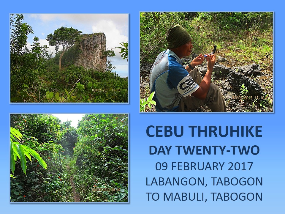
The
Doce Cuartos Mountain Range is the last obstacle and is also the most
challenging. Rising to not more than 270 meters and a length of about 4-5
kilometers, it is partly wilderness. Few locals go there as there are almost no
trails and there are no known water sources. There is a forest of stunted trees
which just barely grew above your head. It is made of limestone, with loose
outer surface and treacherous sinkholes. Less foliage contribute exposure to
the sun while rocky surfaces bounce off heat.
I
had tried exploring this twice during the Segment VII Exploration Hike last
April 2016 where I did a solo and again in August 2016 with four others. The
first time was almost a success but lack of water and suspicious locals forced
me to abort it. I followed my route on the second attempt but I lost the trail,
going in circles until I found it, then I let another from my team to find a
route during the most trying times which led us farther away from engaging on a
northerly direction.

This
time we followed a wide trail until we reach an open well. Across us is a trail
to the southern part of this mountain range. We hiked slowly, conserving energy
as much as possible for it would be extremely warm up there even when there is
a very generous presence of breeze. The route I chose is the same as the last
two episode. When the trail disappeared, I embarked on guessworks, to determine
where the rest of the trail would be?
I
had learned from the last time and able to distinguish some familiar features.
I did a lot of trial and error of possible routes and followed a few ghost
trails until I found a real trail. When you are into that, you do not
compromise your companions to hardships. They stay in one place while you do
the reconnaissance yourself. Besides, it is easier and faster if you do it
alone instead of a line of people going back and forth all the time.
I
found the small patch of corn field. Someone comes here all the time. That
someone may have a source of water nearby or he depends on rain. There is a
wild dragonfruit growing near and I cut four members to propagate it or maybe
borrow my idea of “pepper diplomacy” which I used to great efficacy during the
southern leg of the Cebu Highlands Trail. How did it get there? Anyway, I
discovered that this small field is watered through a ditch which came from a
natural drainage during rain and rainwater stayed for a while here.
First
time I was here, I came from a trail from below. These last two were from a
trail from above which, in my first visit, I used in leaving from here. I need
to explore more of this place. It may have another trail. I got to exert more
effort. I found it finally. I followed this. It afford me a good view of the
sugar cane fields in between Ilihan and Labangon. I passed by a hole on the
ground where there was water recently. The trail led me to a thin copse of
mahogany trees. My older route passes by this place and it goes to a small
house.
I
had befriended the occupant. His name is Vicente. Today, I have real gifts for
him aside from a combination of numbers for a numbers game. He is here
gathering charcoal. The place has shade. Perfect for a noon break. It is still
11:08 but it is so warm. I opened my High Sierra Titan bag and dug my hand at
its deepest quarters, producing a box of ten Marlboro packs. Vicente was
smiling now and I thought I heard an old woman from inside the house. I added
two packs of Knorr instant soup, 200 grams of rice, a loaf of bread and baked
products. We lunched on Fitbars and stayed until 12:00.
I
followed the trail uphill into a forest of stunted hardwood. The vegetation
changed as we penetrate its most remote parts. Trees were now tall with bi-is
palms growing among them. Some parts had been cleared for firewood and I see
many abandoned holes that were used to make charcoals. The trail goes down and
I know where it goes so I tried again the trail that branched off it. This was
the ones I used during my two visits here and it would lead me to a place where
there are gaping sinkholes and where there is a standing rock called Tindog
Bato. From a gap on a rock, I finally glimpsed the sea to the east.
The
trail disappears because it was overgrown by grassland. I would not chance
clearing a path here. It is too dangerous. There may be more sinkholes. Tremors
and aftershocks caused edges of some sinkholes to collapse and enlarge. The
last trail that I followed passed in between two sinkholes and it just stayed
at the edge of a cliff. I consult my clock, it is 14:00. Too few daylight hours
left. We stopped and rest for a while and thought out another strategy. The
warmth, the thirst and the fatigue factor are just too much.
We
would follow the route I took the last time. I will go down and look for that
dry watercourse. I will travel down following the contour, gently and slowly.
The vegetation is so thick, made up of thin wiry vines running everywhere,
elongated branches trying to reach for sunlight, shrubs and palm leaves. There
are trees and thick branches but it is best that I move like water instead of
acting like an irresistible force slashing indiscriminately on anything that
blocked.
I
forgot to bring out my Camp Red Limited Edition Balaraw during the lull and it
was so cumbersome to unload and load my heavy backpack. I need not waste
strength to untangle myself. I borrowed instead Leomil’s Seseblade NCO knife. I
do not need a big blade to work my way through this jungle tangle. The very
light Seseblade is enough and I do not have to use brute strength. All I have
to do is flick a wrist and – voila – I am moving forward. It was hard going but
it would be harder still heaving a bigger knife and getting entangled. This is
no cinema. This is the real world.
I
found the dry watercourse. The last time, we followed it downstream, blinded by
the rush of adrenaline. Today, I will follow it upstream, just like the ones I
have wanted last time, but I will be facing an obstacle of chest-high grasses.
You cannot slash it with a knife, you have to part a path through it with a
stick. I cut a slender branch for this purpose. I need to make a lot of noise
with the stick to scare away what is hiding beneath. Good thing we do not have
big cats here else we are meat salad.
As
I navigate through all these unwelcoming territory, my eyes cast left and right
for any signs of a way out of these suffocating place. I must have walked
slowly and surely for about 800 meters when I caught something that elicited me
approval. A trail. I transferred to there. Leomil was in a state of semi-shock
and speechless while Jon already on the brink of exhaustion. It was very humid
and draining. The air was thick. Breathing took an effort. Resting above the
grassland valley gave us more room to recover strength.

We
go up and up into a high valley. I could see from a gap the reservoir tanks of
Libjo, Tabogon. It was one of my reference points and it showed we had not
travelled far although I thought we did a lot of walking. The gap offered a way
out of the Doce Cuartos Mountain Range for there is a trail. I opt for another
branch that goes into uncharted territory for me. I had spied an abandoned hut
last time and I aim to reach that today before dusk sets in.
I
found the hut and there is a tinaja just near it. There is water. I even
scared a rail which had been quenching its thirst from there. The trail passed
beside the natural reservoir and goes up to a ridge. I followed it to a rocky
promontory where there are steps hacked on the rocks. Beyond it is a small
plateau and is the jewel this mountain range have kept hidden from me for some
time. The place is flat but it is ringed by hardwood trees. Unfortunately,
locals are starting to deforest it. We will set up camp here for it is now
16:00.
The
hammocks are strung up between trees along with their overhead canopies.
Firewood are plenty and we will have a small campfire after supper. Jon and
Leomil have recovered and are now laughing as they gave life to the three
alcohol burners. Water is boiled and I deserve a cup of coffee. We have enough
water for dinner and breakfast plus a small washing for the pots in between. I
think we would be left a liter of water tomorrow to share among us. Let
tomorrow worry itself then.
We
got a nice meal of thick Japanese spicy noodles, rice, plus pork and beans. The
full moon hung over the sky casting an eerie glow over the rugged landscape
below. Leomil has his MP3 music going. The spirits of the mountain have favored
us today and showed me to this place. Warm breeze from the sea blew over the
fire that flickered and danced, enjoying its existence with its earliest companions,
who fed it with more fuel. I felt like being transported to a place when the
earth was still young.
Distance
Walked: 4.35 kilometers
Elevation
Gained: 254 meters and a low of 106 meters
DAY
TWENTY-THREE ::::: I EXPERIENCED THE BEST sleep ever last night even if I was
partly exposed. The combination of a cool night, warm breeze from the sea, well
fed, silver light from a full moon and that floating feeling of a hammock could
best any night spent in a 5-star hotel on any day. Unfortunately that beautiful
feeling do not last with the approach of daylight. A sea of clouds enveloped
the lower places blocking the sun.
Today,
is February 10, 2017 and it is the birthday of Mrs. PinoyApache. I reached for
my Cherry Mobile U2 basic phone and sent out a birthday greetings to her. She
has been very worried about me, especially when she saw photos I posted with
blistered feet and blackened shoulders during the southern leg of the Thruhike.
She has to accept my stubbornness. She thought I am half-mad for engaging in an
activity where I am not paid.

I
woke up late but Jonathaniel Apurado and Leomil Pino were still in their dreamy
moments. I noticed Leomil sleeping on his ground sheet. Did he not slept in his
hammock last night? I noticed his hammock opened up at the bottom and it had
dumped him to the ground. It had a torn fabric. Anyway the perfect condition
last night placed him in a good advantage as if he was sleeping in a hammock.
The
fire had burned to ashes. There is still heat as I placed a hand inches above
it. A live ember. I gathered the unburnt ends over the small ember and, moments
later, smoke appeared. Oh sweet woodsmoke. Even the mountain spirits loved it.
I filled a pot with water just enough for me. With my Trangia, I flicked a
lighter and blue flame shoots up from its small reservoir. Smell of coffee and
woodsmoke go together.
Leomil
and Jon woke up. Either the smoke or my noise or the light piercing the eyelids
may have something have to do with that. Jon, still sitting on his hammock,
fried the rice from last night and fried also the thin slices of Bilbao
chorizo. The smell of a different food other than the Knorr soups shook my
appetite alive. We eat our breakfast and left little to throw away. We could
not spare water for washing and we hoped we have that on Day Twenty-three of
the Cebu Highlands Trail.
We
break camp at 08:30 and go down the mountain. We passed by the hut of yesterday
and saw a trail that goes down. We met a local. We talked about the abandoned
hut. It is an urban legend. The previous occupant had been possessed by an
unnatural power. He had the power to walk on the tops of coconuts and bamboos.
He could slip in and out unseen even when he was cornered in several police
dragnets. He was impervious to bullets but died when his underling stabbed him
on account of loot spoils.

That
was why there was something in that campsite of ours last night. I just ignored
it but it was there, watching us. It could have played a prank on Leomil. But I
was sleeping with my Camp Red Special Edition Balaraw and I can not miss at
close distance. Anyway, the trail goes down into dangerous places as it pass by
deep sinkholes. Staying late at dusk on the trails here is not advisable. I
trust my Jack Wolfskin shoes but, even so, we were careful.
We
touched bottom and there are trails everywhere. Took out my Suuntu M30 compass
and followed one trail that goes north. There is a stream that divides us from
the rest of the field. Beyond us is a field of sugar canes. Where we were are
meadows. We followed the path that goes on its wavy progress, passing by
marshland, forest, crossing streams, until we have to stop at the edge of a
community to gather our breathing.
I
got the feeling that I am going to the village of Mabuli, Tabogon. I sent a
text message to the Tabogon Police Station to inform them that we are now
approaching that place. I simply had an unpleasant experience here last April
2016, during the first day of the Segment VII Exploration Hike. I was alone
then. I was not welcomed to stay in their village when I did a courtesy call.
They were concerned of their safety. What could one man, burdened with a heavy
bag and almost died of thirst, do to their peace and order?
I
was suspected by local officials as someone working for an opposing political
party even when I have a letter received by the Office of the Governor and
another from the Cebu Police Provincial Office. That is the problem with
half-literate people is they do not understand what is stated in the paper.
People from the municipal mayor’s office arrived to interrogate me but found
nothing wrong. They called the police to escort me out of this place for my
safety. That was the time I aborted my exploration.
I
am going back to Mabuli. There is the small store where I took refreshment and
there is the public school. I see their village hall as we walked on the dirt
road. This village is a beautiful place but the more I am out of here, the
better. The people are just too suspicious, even now. I have been into the most
notorious places of the CHT but I was not subjected to disgrace and distrust. I
would not have come down here again where it not for water. I simply do not
want a hiker passing by here in the future. I may have to refine the route of
Segment VII later.

This
village is simply big. I thought I have gone past Mabuli after walking for two
hours and crossing two streams where I thought it as boundary with Bogo City.
But when I met a local and asked, they would say I am still in Mabuli. This
stretch would have been perfect as it is all trail. I cast a glance at giant
power pylons crossing my path and I remembered that these are omnipresent in
Bogo City. I met another local and I got an answer that satisfied my wish. I am
in Bogo City. At that moment, I sent a text message to the Bogo City Police
Station informing them of our presence and our Thruhike.
The
trail could not go past anymore on our northerly progress as fields are now
fenced. Private lands. We followed a miserable looking dirt road that exits to
the national highway, which was known in the old days as the Cebu Hagnaya Road
but is now part of the Central Philippines Nautical Highway. We walked beside
the pavement amidst the blur of buses and cargo trucks. It is warm and sunny and
shades are less when you are on highways. We have to find a place to take a
noon break and a meal.
We
found one at 12:15 in a place somewhere between La Paz and Anonang Norte, Bogo
City. It is a small store but it sells food. The owner is Mercury Las Doce. She
was curious of our big bags and a conversation began. She was amazed at our
journey that started in Liloan, Santander last January 17. Her husband, Martin,
joined her. He, in all his years living in this place have never been to the
Doce Cuartos Mountain Range. Martin gave Jon a machete which are commonly used
to cut sugar canes. Jon, on the other hand, replicates the gesture to Martin
with a Swiss Army Knife Camper.
After
an hour of rest, we continued on. We switched on the other side of the road,
which is now more shady, and passed by La Paz. We walked on and reached the
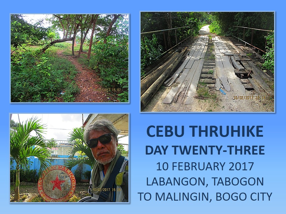
boundary with Dakit, Bogo City. It is here that we exit from the road and
transfer to a trail that cross 600 meters over an unused lot and it joins with
an unpaved road. It leads to the interior and followed it until we crossed a
slowly disintegrating bridge. We are now in the village Malingin, Bogo City.
Just 300 meters more and we will arrive at their village hall.
By
15:30, we were now resting at a community stage. We were expected and the
village chair, Hon. Marilyn Calidguid, met us. We were welcomed to use their
new building but we insist to use the stage instead as our sleeping area.
Missing me by 30 minutes, Markus Immer arrived with Glyn Formentera. Markus and
Glyn would stay here and would walk north with us tomorrow. The Toyota Hi-Lux
pickup of Markus would be driven back to Cebu City by his driver.
It
seemed that something was taken off my back. For 23 days, we faced difficult obstacles,
bad weather, sudden and unexpected warmth, suspicious people, slippery trails,
heavy loads, monotonous menu and cold nights. I could not count the nights I
find myself chasing sleep. My appetite was strong but the last five days I
found my breakfast half-consumed where Knorr soup is present. The heat shrivels
the skin. Rain drains down in your socks causing you blisters. Bad shoulder
straps saps the life out of you but the most difficult of all are still people.
Distance
Walked: 13.99 kilometers
Elevation
Gained: 254 meters and a low of 45 meters
Document done in
LibreOffice 5.2 Writer


3 comments:
Sheila and I are faithfully following the CHT documentation. And reading your story definitely excites us more to try out the CHT.
Our sponsored trips and adventures hindered us from doing a CHT segment this year. But we'll plan it out next year; completing the CHT in 2018 will be one of our goals.
It is alright Gian. No need to be worried. Next year is okay. Enough time for me to prepare also.
Very nice poost
Post a Comment