Showing posts with label Mount Manunggal. Show all posts

Tuesday, January 1, 2019

ADRENALINE ADVENTURE HIKE: Segment I-A

THE CEBU HIGHLANDS TRAIL, is best appreciated in segments. But Gian Carlo and Sheila Mei of the Adrenaline Romance Blog, thought of it otherwise. Why not walk it in half-segments? Although I have tried it (and completely forgotten that I did) but, I believe, it is STILL a wonderful idea. Two weekend days. Overnight. Yeah, why not?

Segment I, the most intimidating of the eight segments, because it goes up and down through three separate mountain ranges, cross two major river systems, and break your will huffing and puffing while carrying your load for 4-5 days. I have walked it straight but once only last November 2017 and, if only it would be possible, I would not walk it again that way.

 
Why not break Segment I into two sub-segments like I used to during the exploration phase of the Cebu Highlands Trail and, unintentionally, during the Thruhike of January-February 2017? Why not indeed? Frankly speaking, it benefits me well. The two-day hike removes the stress that the third, the fourth and, maybe the fifth day would give to a person.

Why not? Why not? Oh, why not? Thank you Adrenaline Romance. You just gave me an idea how to safely proceed about the segment hikes of the CHT. This blogging couple, is one of my supporters during my 27-day Thruhike. They even provided me a replacement bag – a 50-liter High Sierra Titan – halfway in my Thruhike after a local bag created problems on my shoulders.

Gian Carlo and Sheila Mei, in one of their articles, choose the CHT as one of the seven destinations in their bucket list for 2018 but they do not want to hike it through for they simply do not have a generous time in their lives, they, being company employees. They fund their trips from their hard-earned salaries and write about it in Adrenaline Romance.

Their blog is what kept them going. The couple made mincemeat of any difficult challenges and obstacles and what becomes of it are well-written essays of their adventure experiences. They are into rock climbing, scuba diving, caving, mountaineering, snorkeling, canyoning and, of course, blogging. They walk the talk and, for that, they influence people about adventure destinations and activities and what gear and equipment you need.

Gian Carlo and Sheila Mei are product ambassadors of Deuter and Se7en Outdoors, a local apparel provider. Aside that, they are honorary members of Project Blue, an environmental advocacy organization. The couple, from to time, gets invited to cover events and services with their famous blog as medium like Bluewater Resorts, Trexplore, Bellevue Hotels, to name a few.

But, today – February 17, 2018 – their quest of the CHT starts on this early hour at Ayala Terminal, Cebu City. I would be their guide and we will be walking from Mount Manunggal, Balamban, to somewhere in the Transcentral Highway in Cebu City. Sounds easy but it is not. Not because it is difficult terrain, but because of my unreliable memory. The CHT is a product of traditional navigation. No GPS coordinates. Just memory only and it wreaks havoc on your itinerary!

The van-for-hire dropped us on a corner where there is a feeder road to Mt. Manunggal. Astride motorcycles-for-hire, we arrive at the famous parking lot of Manunggal. We checked our bags and retrieve items that we need for the hike. It is like a ritual. At 08:00, we go down a path that leads to the campsite where there are tents and people. We simply pass by going to a trail that these campers know not.

No, it is not a secret trail. Locals use this trail once in a while. Only a few hikers walk this trail. I am a regular here and I once walked it alone on a Good Friday. I talk as I walk and Gian Carlo and Sheila Mei were laughing as I told them my encounter of a big snake on this path. I jumped downhill out of fright, rolling and panting. Who would not? It travelled alongside you!

The path goes through second-growth forest and an original forest that clung to the steep rocks. The ground is muddy but we walk on firmer parts. As I walk I also talk about plants. An unusual vine bear oversized beans. I did not know matchbox bean vines (Local name: gogo, bayugo) grew here. It is so huge! Showed them rhododendrons (yagumyum) and Asiatic bitter yams (kobong) and explained what they for are.

Once we got past the forest I showed them a speck of white on a trough between two hills. It is a saddle, of course, and it is our next destination. It is called Inalad but it is pronounced as Ina-a-a-ad. The quirks of Cebuano vocabulary. We will arrive there at noon and we do not have to hurry. They were shocked at my casual disregard of distance.

I have to take it slow. I am nursing a fever. I have to honor a commitment and I must not let them down. Also, they must not know about my condition. Slow is better. We must not hurry or we get stressed out. It is a long day and tomorrow is another long one. I must conserve my strength for tomorrow for it is much different than today. Patience would win the day for me.

 
We go down into a grassy and open field and entered another forested but very tight path among rocks. Rock surfaces are well-polished by water and I take them so super slow here. I am wearing my Hi-Tec Altitude low-ankle shoes and I developed a certain level of trust on this pair. My High Sierra Titan bag looked heavy with a rolled Therm-a-Rest hitched underneath it.

On the other hand, the Adrenaline Romance pair wore their Deuters and the bags are almost like a part of their physical bodies. They move with it without any extra effort. They are good product ambassadors and Deuter did not err in choosing them. They looked also great with the CHT t-shirt made by Silangan Outdoor Equipment.

The trail goes into farms and we meet one family trying to wiggle themselves out of a path that was choked by a falling tree. Some of the higher branches and twigs have blocked the way and the children and women have to squeeze through with difficulty. The mature male among them, equipped with bolos, do nothing and just let the weaker ones manage themselves.

When they were gone, I break off the twigs and slimmer branches away from the trail. The bigger ones, I stepped on and put weight to break it in two. I am used to this work: Clearing debris in my playground at Camp Damazo and doing trail maintenance. Of course, I have with me bigger blades then. On this hike, I have only a Mora Companion, a Victorinox Trailmaster and a William Rodgers Bushlore, which I did not use.

We arrive at a homestead and rest for a while. It is 10:00 and we did good. We are now  halfway down the mountain and in about a half hour we would be on the shores of a stream. To celebrate that, I asked from Sheila Mei to part a chocolate bar to a shy small girl that had been spying us from a window. She goes to school far far away, up and down this mountain. They are deprived of little comforts which urban-bred ones take for granted.

After a rest of five minutes, we proceed down the trail, passing by little streams and more homesteads. Once, I stopped on the path to study a trail of a farm animal. It is the one made by a swamp buffalo and there is only a single line of hoof prints. I quizzed Sheila Mei about this anomaly. Actually, there is another set of hoof prints along the outer edges of the path and it could not be easily seen unless you study it at a different angle.

We arrive at the bank of the upper Lusaran River. This is one of the three major river systems of Central Cebu and it flows out of Balamban to the TaƱon Strait. We will cross this stream five times and will have to remove shoes and socks. Walking barefoot on the sandy bed and on sandy banks made a soothing effect that removed the kinks in our nerves. It is a wonderful feeling.

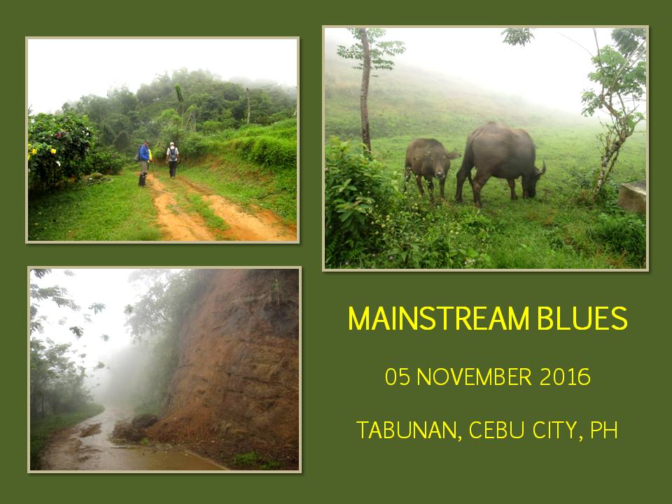
Walking on solid ground once more, we met the first of the many animal farms tethered on to trails, most of these have their young with them. We met two cow families while going to Inalad, where we arrived at 11:30. That is 30 minutes early despite the deliberate slow pace. Inalad is a marketplace and the boundaries of Balamban, Toledo City and Cebu City converge here. We took lunch on one family-run restaurant and enjoyed siesta.

The 30-minute nap was good enough for me. The fever is almost gone save for brief dizzy spells. At 13:00, we leave Inalad for a feeder road that goes all the way to Tongkay, Toledo City. The village is located on the bottom of the valley and Sheila Mei bought a few vegetables there but failed to find a common ingredient: lime (lemonsito). We also filled full our water containers, renewing the weight we lost to eaten food and to rehydration.

We cross the uppermost Hinulawan River where it drained to the man-made Malubog Lake. We follow up a path that rode the back of a ridge. It is very warm, the sun slaps hard at your right, the part where the mountain is almost bare. Gaining more elevation, we come face to face with a bull, standing over the path. I make grunting sounds and the bull gave me space but regained that space immediately after I passed.

It created a bit of a problem for me. The bull refused to vacate when Gian Carlo and Sheila Mei slowly approached. Both made a difficult detour on a very tight space where the ridge is narrowest. My heart trebled its beat when the bull approached the duo. Unexpectedly, the bull slurped Gian Carlo’s hand instead. What a close call.

Once I reach my old campsite, I break off the trail and follow a narrow path that led to a hillside farm. A slight drizzle begins to appear and it elicits a frown from me. I hope it does not rain hard. The path disappeared when I got past the plowed field and blazed across waist-high grass to reach a ridge, which led to the present campsite. We came 90 minutes earlier than what was indicated in the itinerary and we are just walking very slow.

The slight drizzle became light rain and I have to set up a shelter over a space reserved for cooking. My hammock can wait. Gian Carlo and Sheila Mei found the shelter convenient to set up their dome tent nearby. Pouring drops of rain fell from the shelter eaves and I have to wait when rain begins to disappear. Winds added chill to the situation.

At 16:30, the shower stopped and there is still a lot of daylight. I hastily set up my hammock between two trees. Then I transferred my sheet from the cooking area over my hammock. The campsite is on a cleared ridge where a forest claimed the other side. We eat our supper early, availing of daylight. The grounds and vegetation are wet and it begins to go cold. We turn in early at 18:00 and the hammock felt warm.

I awoke at 21:00 hearing great gusts of wind roaring from below the valley. It never affected us. In fact, warm air dislodged from the valley floor by colder wind made its way up to our camp, giving us a comfortable night. This micro climate will stay for a few hours and would soon dissipate. I have noticed this phenomenon in my older camp down the mountain.

I feel good rising early on the second day – February 18. The long comfortable sleep was most welcome for my body. I did not feel any effects of fever today and that is good news for me because it would be a challenging task for me later. After a very early breakfast, we break camp at 07:00. We follow the path up a peak and show Gian Carlo and Sheila Mei, a big hole on the very apex. I believe this was used as a mine vent.

Beyond the peak, we follow a very narrow ridge that led to another peak – Etwi. The landslide that blocked the trail below Etwi had been cleared and it led into another narrow ridge that led to Maraag, a part of the Sudlon Mountain Range. A concrete marker bears information that this is now part of the Central Cebu Protected Landscape.

At Maraag, we savor a bottle of softdrink each and munch a few stale bread. After ten minutes, we proceed to the “hog’s back” (buko-buko sa anay) on a paved road but switched to a feeder road for Panas. I surely marked the place of the trailhead I took last time in my mind so that I would not miss the route to Bonbon again.

The trail is well-beaten but once you get past homesteads it becomes narrow. Some of it pass by scrubby grass that grew persistently despite being trod by many feet everyday and you get the impression that a trail do not pass by here. We cross the headwaters of the Bonbon-Mananga River System several times and these are brisk clean brooks.

It always excites me to walk this stretch because it keeps my mind to work and think, to read the right track from the false ones, and to study the terrain with much concentration of thoughts. These things make up traditional navigation so honestly demanding from even the most trail-savvy traveller. The changing contours here are themselves very demanding.

After four hours of walking, I am rewarded of an arrival in the last homestead in Panas that was a half-hour early than that found on my itinerary. We were not hurrying. We were just in a strolling pace, most of the time stopping briefly to talk about a plant, an outstanding land feature, previous observations, local attitudes, scenery and landmarks or even the shape of a hut. There is a clean water source here and we take some.

We rest for about five minutes and then proceed on, following a trail downhill to a forested part. I try not to miss this trail this time and it is well-marked in my mind. The route inside the forest is steep and slippery. Too few hand holds and most of them were unreliable taro stems and abaca trunks and springy vines that break at the first sign of force.

We arrive at the rocky bank of Biasong Creek and follow it downstream. We walk for about a half hour when I found a perfect spot to stop and prepare our noontime meal. It is shady with a wide sandy beach. Sheila Mei cooked our food with the butane burner and we proceed with lunch and a few minutes of rest.

 
After an hour, we are now fully rejuvenated and proceed on with the last hours of our journey today. The couple was amazed at the clean water of the stream as well as beautiful spots good enough for river bathing. Ahead of us is the sound of rushing water falling in a high elevation but we are deprived of its presence since it is impassable from our location.

We go over dry ground, this time, skipping the sheer obstacle and, from our new location, caught limited glimpses of the not-so-known Bitlang Waterfall. The trail put us on the part of the stream where there is another branch whose mouth is choked with humongous rocks. May God bless those souls caught up in here during a flashflood. It is a meat grinder.

Downstream, Biasong Creek gets tamer and tamer as black PVC pipes competes space with rocks and debris. These pipes channel water to communities and a local resort. We arrive at the resort and outside it is another local unofficial resort. We cross the last of the stream and walked again on dry ground to a store in Biasong selling cold softdrinks. We deserve that.

After fifteen minutes of rest and snacks, I followed a different direction this time given by a local as shorter than that of going to Bonbon and we do not have to cross another stream. Okay. Goaded by local knowledge, we followed a paved road and it seemed to rise forever. It did go downhill going to the St. John Marie Vianney Parish in Maomawan, but it goes up again.

 
We finally reach a place named Tugop, which is a part of the village of Babag at 16:30 but there is something wrong with the new route I took. It is much tiresome compared to the older route and there is but little difference in distance. It was recommended by a local because they travel nowadays on motorcycles and it is very convenient for that kind of travel. But, for walking? Nah.

Well done Adrenaline Romance, you made it this far and, on many times, bettering the itinerary by 30 minutes to even 90 minutes. Amazing! You have proven your steadfastness and your commitment to the first of the many that you would soon impose on yourselves. This is no easy walk but you are rewarded with scenery that was denied to most people and the experience that you could better describe in your popular and highly-rated blog.

The mysteries and idiosyncrasies of the CHT would simply be laid before you once you set your sights on the rest of the paths. You are on the right track to that quest and there is no turning back. Happy trails...

Gian Carlo and Sheila Mei wrote about their Segment I-A experience on their Adrenaline Romance Blog under two installments:

 Cebu Highlands Trail Segment 1A: Mt. Manunggal to Mt. Tongkay
  Cebu Highlands Trail Segment 1A: Mt. Tongkay to Tugop
        

Document done in LibreOffice 5.3 Writer
Photos courtesy of Adrenaline Romance

Thursday, October 11, 2018

MAN-SIZED HIKE XXVII: Manunggal-Babag-Lutopan

THE CEBU HIGHLANDS TRAIL is a long trail comprising of roads, dirt paths, farm trails, highways, even an old railroad and a stretch of trackless wilderness from southern tip to northern tip. These were stitched together by this blogger for almost six years before being hiked through in 27 days last January-February 2017. You would marvel at its length and you would be amazed that this blogger walked it on sheer memory.

It is divided into eight segments, the author noting that a guided thruhike is a far possibility as of this time since the routes had not been documented by any radionavigation system, being the CHT is but a product of memory borne from the oddities of traditional navigation. In segments, the CHT is simply manageable and the chances of error are small which could be rectified by creative ways.

 
In segment hiking, you could either start from the heel of Cebu, going up north to the “finis de tierra”. Or you could do it in numerical order from Segment I to Segment VIII. Whichever, the author simply designed it for the convenience of travel, with easy access from start and finish. Segments vary from two days to as much as five days. Segments also make it easy to carry your load of gear, food, and fuel and other supplies.

I have not yet opened it for guided walks but I accommodated the request of the Bukal Outdoor Club, for them to try the CHT. I have complete trust in this group for they trained themselves in jungle survival and wilderness first aid. They choose Segment I, the route that would start from Mount Manunggal then to Mount Babag before it terminate at Lutopan, Toledo City. This could be a test hike and to test my memory.

Segment I is one of the most difficult hike of the CHT and could stretch from 56 to 60 kilometers in length. It pass and traverse over three major mountain ranges: the Central Cebu Mountain Range where Mt. Manunggal is located; the Sudlon Mountain Range; and the Babag Mountain Range where Mt. Babag is located. It also cross two major river systems of Cebu: the Lusaran River and the Mananga River.

 
After lunchtime of November 30, 2017, we left the terminal at Ayala Center. Thirteen members of Bukal Outdoor Club came and two from the Camp Red Bushcraft and Survival Guild. We have an itinerary to follow which is very important since it would determine the food we bring. Going up and down difficult terrain for five days hefting heavy loads is not easy, especially under a warm tropical sun.

We alighted at the Trans-Central Highway where there is a feeder road that lead to Mt. Manunggal. From there we follow this dirt road which pass by the village of Sunog, Balamban. The village now charge visitors eighty pesos each if you camp at Mt. Manunggal, which we will soon be, and at Mt. Mauyog. Personally, I do not have any qualms about this if it benefitted the folks and improved the services, then, so be it.

We arrive at 16:00 and set up our shelters. Part of the entrance fee is the use of the bathroom and piped water. Which is fair enough. I do not know about how the caretakers dispose of other people’s garbage. As far as I know, hikers and mountain climbers take care of their own garbage and bring it with them. I believed the bulk of the garbage are those that are brought by locals, especially during the annual March 17th revelry.

It was strangely warm in Mt. Manunggal where, in another time at that hour, it would have been already awfully cold. I expected a sleepless night since I would be laying down in a hammock under a simple shelter of taffeta sheet which are open on two sides. The ingredients for their first meal is now dispatched into a grand dinner. There was a glass of brandy doing the rounds and I stayed until about 20:00 when wind begun to chill a bit.

When it was still dark, and cold, hushed voices awakened me. In the clear air, the metal clank of pots are distinguishable and I could hear the hiss of a butane stove. Somebody woke up so early to prepare breakfast. I would want to rise but there is not much I could do except slurp coffee. I could do that later. The second day, December 1, is really the start of the Segment I hike. The start of their adventure.

After a filling breakfast, we break camp and started very early at 07:30. Our first destination would be Inalad Saddle, which the itinerary says we will reach at 12:00. We would be following a trail that only a few people use and it goes down the upper part of the Lusaran River. I know this path well, having passed by here on many occasions until someone closed that part which offered shorter route to Inalad.

 
We go down from Mt. Manunggal over a very beautiful trail, grassy and forested and squeezing among rocks in a tight cleavage until we rest by a place called Kapiyoan. Going with us is a dog from Sunog. It followed us because we have food to spare. From there, we go down some more among cleared patches, solitary houses and swidden farms and cross small tributary streams and landing on the sandy shore of the Upper Lusaran.

We cross the stream five times and climb up on the other side and follow a narrow trail that follow gently the lower contours of a mountain range of Cantipla. We ultimately reach Inalad at exactly 12:00 and buy prepared food from a local restaurant. One of the hikers  has to cut short participation because of prior commitment. Inalad is a marketplace and is the common boundary of Balamban, Cebu City and Toledo City. After lunch, we spend our deserved siesta. So is our guest dog.

At 13:00, we continue on our way by crossing the Trans-Central Highway into the side of Toledo City. There is another feeder road that would lead to the village of Tongkay. It snaked its way, gently meandering into a valley surrounded by mountains. When we reach the village, we registered our names into their visitor’s log after a courtesy call. We cross the Upper Hinulawan River, which drains to Malubog Lake, and climb Mount Tongkay. 

This is another good trail but you would not appreciate it since the warm early afternoon sun would be directly facing your right. Although it is well vegetated on both sides, the path is bare. The trail goes up and up until it becomes tricky. While the trail goes on its hog back, I prefer to cut across a hillside farm, oblique, right on the face of the mountain until I come upon low vegetation where I turn at a right angle towards the campsite uphill.
  
Before climbing Mt. Tongkay, everyone filled their water containers full at village since the nearest water source would be at Etwi, half a kilometer away. What weight they disposed to the two meals at Mt. Manunggal were replaced by water and everyone struggled the trail to this campsite, which we reach at 16:30. Tents are set up on the open ground while Jethro and I opt to sleep above ground in our respective hammocks.

Soon there would be a spectacular moonrise as the moon approaches its full waxing in two days. Across the campsite is the saddle of Inalad and the imposing height of Mount Gaas. Further away, lost in its mantle of clouds, is Mt. Manunggal. We are overlooking the valley and, soon, warm air from below would slowly rise, giving us a comfortable night with just the right temperatures. A forest rising from the other side protect us from the south wind.

Dinner is prepared hastily while there is still daylight and our adopted dog liked it very much. We made a campfire to celebrate the good hike for today. Another glass of rum make its round among the campers under the silvery light of the moon. Wind shrieked among the lower valley yet it never affected us. It was comfortably warm in our campsite. When the last of the fiery liquid were completely gone, we made for our waiting shelters.

The third day, December 2, made its presence known with the crowing of the cocks, tame and wild, and by the hiss of the butane burner. The camp becomes alive as daylight augured for another round of adventure. Segment I is divided into two sub-segments. The first installment, the ones we have walked yesterday and later for today, is unknown territory which this author and only a few has walked.

After breakfast, we break camp and kept to the trail to Mt. Tongkay. On its very summit is a deep vertical hole, perhaps the vent of a large copper mine and everybody carefully study its depths from the lip. Continuing on, we followed the path on a narrow ridge that connect to Etwi Peak. Landslides effected a difficult passing underneath the mountain but all made it safely. This ridge goes on to another ridge which becomes the Sudlon Mountain Range.

We arrive at Maraag, in the village of Sudlon I, and there is a store that sold cold soda drinks. We stayed here for about ten minutes. There is now a road here that connect to the Trans-Central Highway if you go north. We go north but we veer to a feeder road that goes to Panas. It is a dirt road with several trailheads, tempting you to take one. I have taken each and every trail in the past, borne out of confusion, stress and failing memory.

Never have I stuck to one path on those occasions and I was literally lost except for my first attempt. That path is the one I am looking for. I have to be accurate this time. I have fourteen people to take care of and our line would stretch long on “uncharted” territory. I found the trailhead and my confidence builds up. The trail lead us to solitary houses, farms, headwaters, forests and grassy meadows. It is a warm day and my memory begins to lose some.

I have to backtrack on one when I found going the wrong way and I have to reconnoiter on other times, the stress begins to build up on me and I have to call a time out at 11:00 as the sun bore its intensity on me. I begged for coffee underneath the shade of a big star apple tree. I have to rest else I would burn out. The rest for thirty minutes, coupled with coffee and powdered juice, have stabilized me and I took the trail once more with gusto.

The trail goes on its serpentine path, going up and down, mostly down, until I reached the home of Yolando Obong at 14:00, whose place I passed by in 2015 during a penitence hike. The house is abandoned yet there are fighting cocks leashed to the ground while hens and chicks rove around and everywhere. Mr. Obong would be back later to feed these fowls, I am sure of that, but I could not wait. We rest here for a while and fill our bottles from a spring.

We must go down to Biasong Creek then go to Mt. Babag and we have squandered a lot of time that we are now behind schedule. Once we reach safely the village of Bonbon at dusk, it would be alright to walk in darkness to our next campsite. We leave for the stream, following a trail which I thought was the one based on a two-year old memory. Although I passed by here in January during the Thruhike, it was done in reverse from Biasong Creek.

We go down a steep and difficult route inside a jungle. There were trails but it ended on holes where charcoals are made. I tried the gully but I stared on a very steep precipice as it is a dried up waterfall. My hair stood on its tiptoes as I realized we could all be swept away to kingdom come if ever there is a big downpour. I advised everybody to backtrack and go back to where we came from. My memory simply failed me again and I am tired.

It is now 15:30 and too few daylight hours to make another try to the stream. We have to go back to Mr. Obong’s place and set up our campsite. We have adequate water there. Defeated, I set up my hammock and shelter far from the rest. Dinner is prepared. There is another spectacular moonrise over the Babag Mountain Range, the place where we should have set up camp tonight.

Mr. Obong arrived at 22:00 and how I was glad to see him and talked to him about our earlier debacle. He is feeding his fowls in the dead of night for his late arrival and he promised me the correct path early morning. He also warned me that strange men not from his place pass by here at dawn. He just leave them alone. True enough, there was a man in a hurry passing by where I slept at around 02:00 and he was not carrying a torch.

The fourth day, December 3, saw us falling behind schedule by almost 24 hours. I have to remedy that and do some improvisation once we reach Biasong. We thanked Mr. Obong for his help and for accommodating us in his ground and bade goodbye. Refreshed from a good night’s sleep, I am now on the trail to Biasong Creek at 07:00. The ground is slippery as it is steep with very few good handholds to anchor since most plants here are spiny.   

 
After 45 minutes, we were on the stream. The water is at a moderate level. We followed an invisible path where we are able to keep our shoes dry. While trying to grip a steep rock face, one of my shoes slipped from a slippery toehold and I fell into a waist-high depth, totally incapacitating my use of my Lenovo A7000 smartphone and my Cherry Mobile U2 analog phone. Without these, I cannot give updates of our locations. 

We arrive at Biasong at 10:00 and sucked dry, bottle after bottle of cold soda drinks. We haggled with a Suzuki Multicab owner and we were transferred, all 15 of us and a dog, to the place where we were supposed to spend our campsite last night, disregarding the need to cross Bonbon River and walking the road to the Trans-Central Highway and to Mt. Babag. Even with that, we are still a full five hours late. It is almost 11:30 and we eat lunch brought by another Bukal Outdoor Club member who joined us.

Fully rested and full, we continue at 12:00, following the dirt road, passing by Mt. Babag, until it becomes a mere trail. The Babag Ridge Trail is a beautiful stretch of forested country unknown to a lot of people. Lately, new hikers begun to discover this and they failed to know the places where the old World War II trenches and tunnels were located. Everyone were aghast at this hidden gem and it goes through another forest, mostly of crawling bamboos (bokawe) and, facing before us is, Mount Bocaue.

We did not climb the peak as we were on a hurry. We are racing with time and there are too few daylight hours left. We need to be in the village of Buot, Cebu City before sundown and walking in darkness into our next campsite would be okay since we will be on roads. In the meantime, we are on a trail yet and following a wrong one would spell disaster to our itinerary. I concentrate on landmarks instead of being concerned with time and pace.

This is a long ridge. We are walking almost the entire length of the Babag Mountain Range. We reach Mount Samboryo and my worries of getting lost are losing its grip. The trail goes down but some people before us, on board dirt motorcycles, have ruined the path, loosening a lot of rocks and tearing soft spots which became difficult to tread on. These people simply do not respect the locals who used these trails for their livelihood and for their children going to school.

We cross a hanging steel bridge and arrive at Buot at 17:00. We douse another batch of cold soda drinks before going the long way to Odlom. This time, we would be walking uphill on a combination of paved and dirt road. It is a long uphill walk. The soles have seen its beating from four days walk and extended for another many hours of night walking. It begins to be painful as the leg joints begins to complain.

 
The pace becomes controlled and careful so as not to overburden the feet soles. We arrive at Odlom, a part of the village of Sinsin, Cebu City, at 19:00 and we have to walk another hour to the Manipis Road and then 30 minutes to Camp 7, in Minglanilla. It extended to two hours because of frequent rests. At 21:00, we finally arrive at the DENR’s Biodiversity, Coastal, Wetlands, Ecotourism Research Center for our day’s campsite.

Our stay at DENR-BCWERC was made possible through my request which was approved by Dr. Alicia Lustica, the center head. It is composed of the Cebu Experimental Forest, a nursery, caves, trails, a small waterfall and wildlife. Unknown to most people, the center accepts ecotourism tours as it has a 240-meter Kiddie Trail; a 1.3 kilometers EcoDiscovery and Heritage Trail; and a 1.2 kilometers Ecstacy Trail which include visiting two caves.

Dinner came at 23:00 and it was another grand meal worthy of remembrance. There was a bottle of brandy somewhere but I opt to chase sleep. I am really tired. I was using the wrong bag. It was the Mil-Tec rucksack whose waist belt was inadequate to transfer the weight to my hips from my shoulders. I was hefting all along for the past four days the whole load on my upper body. I was supposed to reserve this bag for overnight trips only. Memory fail again.

The fifth day, December 4, is just a stroll in the park. Our destination is Lutopan, a progressive mountain village of Toledo City. We left the DENR-BCWERC at 09:00. The road goes down but long and paved. We are nursing bruised soles. What more for our adopted canine who walked bare? We reach Lutopan at 12:00 and rode a bus bound for Cebu City. What a great canine migration and adventure.        

Document done in LibreOffice 5.4 Writer
Photo credits to Apol Antenor, Kier Mancao, Nyor Pino and Mariel Reyes

Sunday, July 9, 2017

THE THRUHIKE JOURNAL: Day 13 (Biasong Creek to Mount Manunggal)

I HEARD A SLIGHT SHOWER when I woke up early. The noise of the jungle filled my senses into a primeval state. Moisture dropping on my overhead canopy taught me to lay still. This is Day Thirteen, January 31, 2017 and it is 05:30. In the half light, I noticed my rump already kissing the ground. My mind tried hard to wiggle out the rest of me from its comfort zone, which it did, at around 06:00 only. The stream changed its color but it had not risen.

I look around to answer the call of nature. The vegetation is lush, moist and untouched. But there is a path. I noticed wild taro and wild cassava. This used to be farmed by man. Yes, the path. It goes up into more wild jungle and the path turned out to be a pathway, no less, made by water. This is not the one that I hope to find. Anyway, I enjoyed this solitary interlude with nature with so much gratitude. The feeling is most cherished. I believe you will agree.

When I returned, Jonathaniel Apurado had already cooked rice. I tried again to catch signals from my Cherry Mobile U2 basic phone and from the Versa Duo VHF radio transceiver. None. I was dismayed by the new SD card that I am using as a storage for pictures for the northern leg. It got corrupted yesterday, damaging the pictures I took with my Canon IXUS 145 camera at the start of Day Twelve. I noticed the harm only after lunch and was forced to change it with the one that I used during the southern leg of the Thruhike. Just like on the southern leg, I carry an extra battery for the camera.


We got our breakfast of Knorr soup, rice and coffee. Popped in a capsule of Enervon Multivitamin and a Herbalife Natural Raw Guarana. These food supplements were provided for us by our sponsors, Markus Immer and the couple Mark and Mirasol Lepon, respectively. I noticed it improved my performance as the Thruhike went from south to north, especially on the last five days of the southern leg. Power and increased stamina put us to where our itinerary would want us to be, except at Day Seven, which immensity and length was under-appreciated by me during the planning stage, just like yesterday’s.

Today, I will find that elusive trail which would have brought us to higher ground yesterday and on that place indicated on the itinerary as Maraag Ridge, which is part of Sudlon II, Cebu City. We are now at the edge of Sudlon I, another upland village of Cebu City. I look around again as Jon went on his business of boiling water taken from the stream for our supply of drinking water. I see another path but, this time, it is made by man. The path is now claimed by jungle but I know how to track people, or what seems to be the traces of humans made months ago.

I go back to our bivouac site and anxiety take hold of me again. I traced that former path I did minutes ago to commune with nature once more, this time with more feelings. It is ecstasy! After that sweet moment, it is time to break camp. We leave at 08:20 and follow that ghost of a trail that I believe would ensure our success. It goes up over very thick jungle, that I have to slash from time to time with my Camp Red Limited Edition Balaraw. At times, the ground is slippery, at stretches where it is most steep.

Persistence lead me to a mango tree, a sure sign of human habitation. I was utterly exhausted. It was hard going, just to gain 150 meters. My Silangan hiking pants was a patchwork of sticking parts of ladyfinger ferns and a hundred detached threads. Up ahead is an open field and grazing cows. I now know where I am going. I passed by here two years ago. There would be a small farming community up there but we have to walk up a hill and a hundred meters more to get there. The day gets to go warm.


The first rest for the day happened at a place called Panas, a part of Sudlon I, at 09:10. I have befriended a homesteading family here while I was on an annual penitence hike in April 2015. I am most grateful for Yolando Ubong and his family for providing us drinkable water today and acknowledged that kindness by leaving behind a couple of our powdered juice drinks and small packs of Titay’s Liloan Rosquillos. Sourcing clean water here is difficult and you have to walk far. There is phone signal but it left me as quickly as it appeared.

Far across a wide and rugged valley is Maraag Ridge. I could not go there direct. It looks too difficult. But a scenery could be deceiving. You would get there in time if you have patience. I am now on more gentle terrain and I am following a trail that goes in a wide arc, a long circuit. This trail is not the same one I took a couple of years ago. I am only walking on this because I listened to Yolando. I am going southwest, farther from Maraag. I thought I saw a familiar landmark but I succumbed to adrenaline rush offered by exploring a new route.

Passing by part wilderness and part farms, I come into more tamed places and bigger farming communities. Music, of the genre popularized by Eddie Peregrina and Victor Wood and the like, took my attention as it blared from one house to another. Mountain communities, I noticed, starting from the southern leg up to here, share the same taste in music. It is only broken sometimes by recent danceable tunes like those unpalatable bodut music. The farther I go away from that, another fresh song of the same kind would welcome me.

I am now walking into the navel of Sudlon I. Our own revolutionaries fighting Spanish and American occupations, made these mountains their redoubt. Nearby is a colony of descendants of these revolutionaries. It has its own brand of Christianity, are vegetarians and eat their food uncooked. Although the day was warm, cool breeze came in abundance maybe because we are in the highlands of Sudlon Mountain Range. By 11:45, we found a small store offering food at a place called Gabi, in Sudlon II. We need real food, if ever we want to reach Mount Manunggal before dusk.


We took short naps while in the store, taking advantage of the one hour allotted for noonbreak. We really need that. Before leaving, I sulk myself to another bottle of cold Sparkle after swallowing a capsule of Guarana extract. I need these for more energy for I will be racing with time the rest of the day. Ahead of me are gentle rolling terrain, paved in concrete, and it would lead me to Maraag. It is 13:00, but the skies seem to have cooperated with us as it gave us a very mild weather. Then I increased the pace, forgetting sometimes that I am walking with Jon.

The Sudlon Mountain Range is found in the middle of Cebu. It links with the Cantipla Ridge of the mountains of Tabunan in the north and goes on its way through its southern ridge at Sinsin, the same place where we passed by on Day Ten. The road that we are walking now follows a gentle course on easy rolling terrain where it afford us breathtaking landscapes. We reach Maraag after an hour of walking and proceed without stopping to the entry point at Cantipla where we availed of rest at 14:15, with bananas and cold Sprite.

I have to forego of my original plan of hiking through a part of Tongkay, Toledo City on mountain trails and unpaved road instead of here due to time constraints. I would have proceeded to Mt. Manunggal through there, following the Lusaran River from above. I have to modify the itinerary again. It is a mockery on that piece of paper but who else knows of what I am doing except Jon. I consult him whenever there is a change of plan. I simply underestimated the distance and the difficulties of Day Twelve. I hope I would not make the same mistake in the future.

After 30 minutes, the race is on. We cross the Transcentral Highway on to the other side and found ourselves walking another paved road down to the village of Tabunan, Cebu City. It is a long downhill walk that took most of the afternoon among stretches of beautiful scenery and the monolith that is the Central Cebu Mountain Range. We arrive at the bosom of Tabunan at 16:15 and availed another rest time, but it would be very brief, since we do not have the luxury of time. Soon it would be dusk and I do not want to navigate uphill in the dark in a spent state.

We cross the Lusaran River at 16:30 into Balamban. Yes we are leaving Cebu City and I immediately sent a text message to the Balamban Police Station to inform them of our presence and our Thruhike. I got a reply and that is reassuring. Slowly, we followed the trail up to Mt. Manunggal. I have been walking here many times and I am familiar without any guidance until I come at the point where there are two trails. One goes up, one goes down. I consult my compass. One going up goes north while one going down goes northwest. I opt for the former. It is 18:00.


I noticed that it took me a long time to work my way out of the forest and I begun to retrace back to where the two trails converge. My logic seems to have favored the same trail I took once I noticed yellow ribbons tied to trees which are used to mark routes of adventure races that are always held in Mt. Manunggal during the death anniversary celebrations of a president who died in a plane crash here. We follow a trail of yellow until I saw no more and by that time we had already covered a great distance that going back was out of the question.

Meanwhile, I have contact with a team of policemen sent by their station to provide us security. I saw the headlights of their motorcycles and, by God, they are faraway or that we strayed so far from our destination. In darkness I have to assess our location and terrain when I come upon a prominent spot and used the policemen’s location as my reference point. Years of studying traditional navigation come in handy during the most trying times.

At 19:15, we come upon a small house where the dog’s barking shook the owner awake and it helped to our cause when a woman pointed to a trail, which I thought, in half-darkness, as just a path to an animal watering hole. It is slippery but once I am on to the other side I saw a clear path that goes up. The trees parted and it revealed a road, near a junction between the one going to Mt. Manunggal and the other to Sunog, Balamban.

The messages from the policemen came and they are waiting for us at the camping ground, near where the monument of President Ramon Magsaysay is located. We were utterly exhausted and disoriented that we do not have the time to socialize and so choose our bivouac area at 19:30, at the nearest place possible to where we are now. That place is the building belonging to the village of Magsaysay. Inside we have space to lay down as well as protection from the elements. We found more comfort here.

Immediately, we work on our alcohol burners and start the boiling of water for coffee and the cooking of rice. While that was going on, I helped myself to a pot lid, for want of a cup, of Extra Joss powdered energy drink. Just like on the southern leg, I left my metal cup, preferring to use a second pot lid to drink liquid from to compensate its weight. The Therm-a-Rest provided by the Thruhike patron Michael Schwarz would be tested again in cold weather here in Mt. Manunggal.

Dinner came at 20:30 but it is never too late. We cherished the warmth of the extra spicy noodles and warm rice. We have company here. They are migrant workers earning their keep while working on the abaca fibers and they sleep here. They are using the structure as a storage place to keep the fibers from getting wet. They earn extra income when we request them to fill our water bottles and collapsible containers. The policemen are sending another message but I declined their offer of company. We need rest. It was a hard day. Climbing two major mountain ranges in one day was never easy.


Distance Walked: 23.6 kilometers
Elevation Gained: 973 meters and a low of 320 meters

Document done in LibreOffice 5.2 Writer
Some photos courtesy of Jonathaniel Apurado

Thursday, February 23, 2017

WALK LIKE AN EGYPTIAN

THEY SAY THAT WHEN YOU ARE IN ROME, you should wear what Romans wear. For that matter, you should walk like an Egyptian when you are in the Nile. To preclude any animosity between mainstream outdoor events and bushcraft, it is best that the latter dress or walk like the former when you are in their realm. I am like a chameleon. I could adapt and blend and walk with the Egyptians of the outdoors. It is still bushcraft to me!

Do not be misled by my analogy and do not interpret it word for word to suit your personal world. Just hang loose and get the feel of it. Anyway, I am in a different scene and I am with a different company. I am used to a cerebral activity but now I am zombie. It is a rainy morning of November 5, 2016 and I am with three other guys on a planned dayhike of Mount Manunggal. It is not a big deal. I have done that twice but today’s weather is a bit of a challenge.

Inviting me is Ramon Corro, the proponent of this activity and we will spend a night afterward at Cantipla. At this time of year, it will really be cold and the rains that had been falling since Wednesday is an inherent part of the activity. Going along also are Boy Olmedo and Roger Padriga. Racing to JY Square made me forgot my purse and the three of them pooled money for our food to cover up my missing part. Thank you guys and God knows what you did to a beggar.


Ramon is driving his Toyota Hilux pickup converted into a touring tenthouse. I have seen his rig exactly last year during an antenna-making workshop in Linao, Talisay City and just last April in Bakhawan Beach Home. His is glamorous camping and I am amorous of that if I have wonga. I did my best to fit in into this activity, so I brought my Silangan Rev 20 tent as well as my resurrected Korean-made sleeping bag that a cousin had given me years ago.

We arrive at Cantipla but the camp is much farther and there is a grassy backroad which only 4X4s could maneuver. It is a stress-free housewife’s paradise. Flowers great and small and ornamental curiosities are planted in such colorful splendor that it can instead leave you stressful, at least, on the part where you drive through a low “underpass” of Samson hair vines hanging on trellis above a ground where an invisible stream ran under you. You can even see the river plunge on a small gorge below.

The road goes in onto another property where there is a small meadow at the end. Ramon parked his Toyota here and we start to prepare for our dayhike. I moved my Nalgene bottle, my Petzl eLite head lamp and my Suuntu A-30 compass into a sling bag. I have in my pockets my Cherry Mobile U2 phone, my Canon IXUS camera and my new Victorinox Ranger Swiss Army knife. Breaking my rule on how an Egyptian walked, I slipped my sheathed William Rodgers knife into my belt in frontiersman carry. I do not care.

We retraced our route on foot and saw the “underpass” closer. The owner practically built this road over a cascade and rested all his trust to man’s engineering prowess to overcome a powerful force like a stream. It sent shivers down my spine as I walked over this part of the road where the roots of the vines touched down the ground. The low ceiling was placed on purpose. You have to creep through else the vibrations of a speeding SUV undermine the foundations where the culverts are built.


The paved road goes down to the main village of Tabunan. It is good to walk here now because the clime is mild and there is an overcast sky though you have to watch on some slippery part where moss are thick. We would be walking on this same road in the afternoon and it would be all uphill. It is winding and I do not have breakfast. I foraged for something to eat as I walked and found a lone ripe rambutan.

After 90 minutes of walking, we stop at the village to buy something to eat from a store. Bread paired with cans of sardines and corned beef. I use the can opener tool of my Ranger to open the canned goods and how I wished when would the Egyptians appreciate the knife? I have eaten two pieces of bread and now the storekeeper is working in his kitchen to prepare us something for lunch which we would consume at Mt. Manunggal later.

We cross a foot bridge over a swollen river that made our first trail of choice inconceivable to walk. We proceed on our second option which is longer and is the one favored by hikers. The path is muddy and slippery and difficult to walk on. I just cannot imagine how we would fare when going downhill on this same route. We meet locals in rubber boots going down nimbly even with heavy loads above their heads or on their shoulders.

Going up the trail would have been more difficult if we were carrying a full load. The lighter weight made it easier to move though and where foot hold is secure we move about consistently and rest at a place where there is a chapel. Rain came while we were already in the middle of the mountain. There were fogs but it never blocked visibility from as far as 50 meters. It is cold but I am moving. The rest have their rain jackets.


Ramon is our lead guy while I took the rear. Roger is in a quandary. His eyeglasses fogged and he makes mistakes. Everybody is Egyptian except me. I do not own an alpine cane and I do not want one. I would rather have a wooden staff and I would have that during descent only. The trail is steep and we were afforded the view of the river valley and the verdant mountains across draped in fog.

All people appreciate scenery and most people are so ecstatic about it that they would go to such extent talking their hearts out like a child. To me it is nothing. It does not change anything except your mood. That is why I carry a camera. You ask that to a local of how they feel of what you just have seen? It is nothing and it cannot change their situation of living. What they are concerned of is when would they have that next meal?

Rain is pouring harder as we climbed more elevation. Fogs are thicker but not that thick. I do not feel cold even though wind chill struck at times. The trail is not that steep anymore and the scenery departed. We are now among the shoulders of Mt. Manunggal. We arrive on a dirt road and follow it to an abandoned concrete edifice that used to be a rest house of a local politician. Hikers were already there under the protection of the roof, otherwise, the structure is devoid of walls.


They are a mixed group with females accounting the most number. They are having lunch on their packed meals. We too will consume our prepared meal here. What was warm is now cold but it is nourishment just the same and I would need it badly to stave off the cold staying in a high place in stormy weather. After a few minutes, the hikers went back the road to where they first came from – the Transcentral Highway. It is not good to stay here long in this weather.

We left a few minutes later, going down the trail that we just have climbed in the morning. I could not imagine myself slipping in the presence of Egyptians so I foraged a wooden staff from a green branch of a madre de cacao (English: Mexican lilac) shrub. It is crooked but it functions better than those short aluminum poles that everyone loved to carry even if it is out of place.

Boy and me changed places and I see Roger having a difficult time slipping often. Even Boy and Ramon saw their butts kissing the ground once. I slipped once but I was able to use a tree to stop my careening by bumping it with my shoulder and so saved my butt getting muddy. Nobody can be a “last man standing” on this kind of trail in this kind of weather, with or without walking aids. It is a long way but we arrived at the footbridge sooner than expected.

We stop for warm coffee in Tabunan and a full 15-minute rest. Then we begin the arduous task of walking that paved road up to Cantipla. It is now 15:00 and it would be three to four hours to reach it from the bottom. It is still raining and it helped to our cause as it gave us a clear mindset. Most people abhor walking under the rain even if they were already wet. Me, I just love to walk in its protective mantle.


We arrive at a place where another dirt road joins the paved one at 17:30 and everyone stopped to gather their lights before proceeding on. We were fast for old guys. Ramon led us to a copse of pine trees and where there was no trail at all. He was making time by cutting on across grass and he knows this place very well since this is his playground. At exactly 18:00, we were on our campsite but rain had not stopped its chase on us.

The ground is squishy and mud mixed in with carabao grass. Ramon opened his Toyota and, at least, we can have a brief respite from the elements. The vehicle becomes an instant refuge with a kitchen to boot. Roger volunteered to cook our dinner on two butane burners that Ramon had stashed inside the numerous compartments at the back of the pickup. Rice, meat, vegetables and spice are now up for the test in Roger’s hands.

Boy and I helped in setting up a large white canopy sheet that became our center of camp socials later on. I looked around for a suitable site for a tent and both me and Boy found one where it is most appreciated: at the lawn of Ramon’s sister. It is off limits! I will have to look elsewhere. It is dark and that would make the quest even dimmer. I changed into a dry t-shirt, removing my hiking pants but retained the elastic undershorts. Now I feel warm.

There is warm chicken soup and warm rice to make us warmer. Dinner comes and it goes quickly when you are hungry and cold. A bluetooth-powered small boombox blared its ‘70s themes and what more to toast its remembrance is a bottle of a fine Spanish rioja wine and a sangria to blunt the edges of the former. The bottles have ran out of its course and I still do not have a good ground to pitch my tent. Roger had with his Rev 20 and I helped him set it up.


Boy opt to sleep on the reclining front seat inside the pickup while Ramon is high on his cabin on top of the roof and there is only one space left on the Toyota that is available for me. It is on a wooden deck reserved for placing things that do not fit inside the passenger cab. Ramon had it designed so a part of that could recline at certain angles which a person could rest comfortably. Brought my sleeping bag there instead and I will make it a home.

It is open on all sides but I could roll down the leatherette side covers. The open rear hatch door I could do nothing about except dry my feet and keep it confined in the sleeping bag later. It is cold. For want of a wool hat, I used a plastic bag instead over my head. Then I make sure my body heat would not be carried away every breathing action by placing an extra t-shirt in between nostrils and cold air.

I woke up the next day. I did not feel problems during the night and I slept well. My hair is wet. Moisture coming from my head condensed upon contact with cold surface from outside like a tent. I just wished there is sunrise. Time to pack my things into a Mil-Tec backpack that I am testing for the benefit of a friend. We will have to cook breakfast before moving out.

As was last night, my knife is on service for the kitchen. But this time Roger used my William Rodgers knife to stir boiling rice and, quickly, I gave him the proper tool – my wooden crooked spoon – to do that. I retrieve my knife and wiped it of rice grits and grease before returning it in its sheath and into the bag. It is fun to be an Egyptian.

Document done in LibreOffice 5.2 Writer