Showing posts with label Kilat Trail. Show all posts

Saturday, November 26, 2016

BEBUT’S TRAIL XIV: The Italian-Sounding Abomination

WE AT THE CAMP RED BUSHCRAFT and Survival Guild begun to love Baksan when we discovered its secrets that we decide to transfer our “dirt times” there. At Baksan, we do not meet anymore colorful corporate hikers. Of course, they know where it is because it can be searched in Google Earth but going there is still a puzzle for them. Even if they will accidentally find it, they cannot fit in because there is nothing spectacular to talk about.

In the old Roble Homestead, we frequently meet them there. Meetings are mutual and friendly but we know that they talk behind us because we are different. We do not worship Leave No Trace, like they do in such vociferous manners on other people, yet they cannot impose it on us. We have our own set of values when it comes to enjoying the outdoors and LNT is not one of those.

We carry knives and we know most of them cringe at the sight of even the smallest Swiss Army Knife. We regard our knives as mere tools and we know the value of this simple tool in simple outdoor functions or, worse, during SHTF. Our difference from them stood out glaringly with our joyous attachment to our unique tradition of the blade porn. We delight at our “wrong turns” and it is the best thing in the world.


We blend well with the landscape by just being there and not mere passersby. We can sit idly by a campfire and enjoy its companionship of warm food and steaming coffee while some of these colorful hikers would be busy spying on other campers of their misplaced garbage. While some of them pounce people in Facebook by posting pictures that hurt their make-believe LNT sensibilities, we dare them with ours that totally ground against their beliefs.

We are now at Baksan always to save them of their frustrations of seeing us doing many things that ran contrary to their Western-inspired outdoor principles. We regret to inform them that we never camp on bald peaks nor make campfires there. These are the very places we evade for it ran counter to our adherence of Blend, Adapt and Improvise. On the other hand, we do not stay a minute and we had rather be on our way quick.
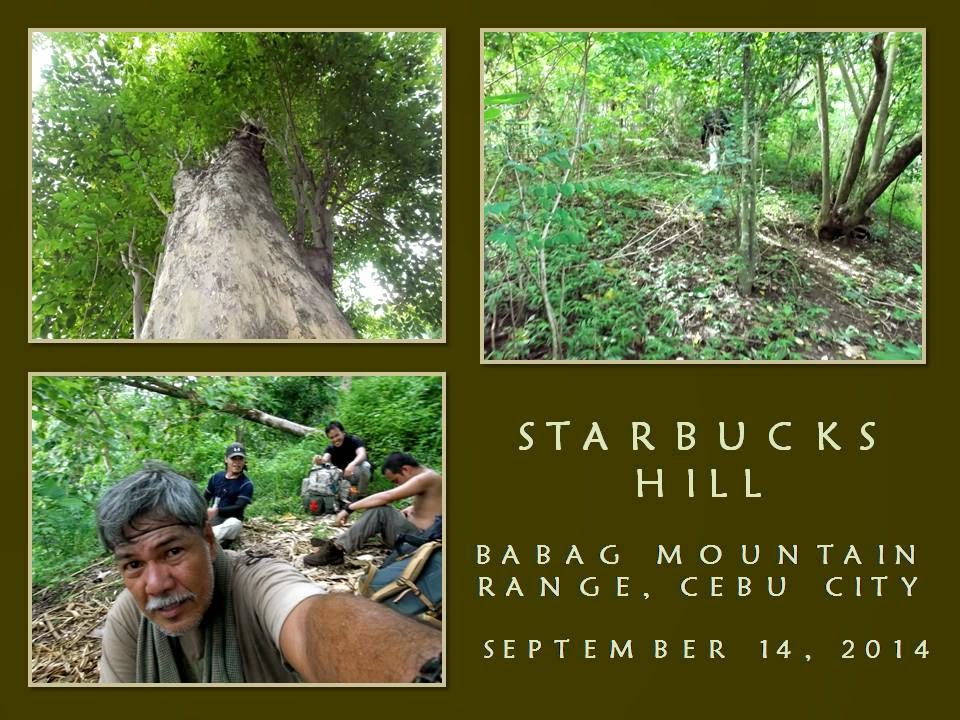
This day – August 14, 2016 – I am with these crazy bushcrafters. Two male guests came along upon the invite of one. Our plan would be to test the route between Tisa and Kilat Spring for we heard rumors of this greedy Italian-sounding abomination called the Monterazzas de Cebu trying to gobble up the whole of Banawa Hills and part of Tisa Hills, thereby, close access to a valuable water source at Kilat forever.


Although it is still 07:30, by my own experience walking both Tisa and Banawa Hills at this hour, it should already be warm. The hills are grassy but devoid of trees. It is rare to find a copse of different trees, most of it among deeper cleaves and on a few ridge tops. A power pylon stood guard on the trail. Its presence a hint that a corridor underneath it and its cables are government property. Why would this Italian-sounding housing development pursue its project?

Behind this low mountain range facing Cebu City is a watershed where Kilat Spring is found and the imaginary boundary is just a couple of steps away. Do not the Metro Cebu Water District find this position irregular? Is it okay to supply water to the metropolitan area whose source partly comes from the Buhisan Watershed Area which is now a close-door neighbor of this Italian-sounding residential area?

Did they check where their drainage flowed this time because there had been silence lately of places which had been inundated with water and mud coming from them in the past? I am just curious because one small stream in the Buhisan showed brown and silty effluents during a downpour. I understand it has been issued an Environment Compliance Certificate by the DENR because you cannot proceed with earth-moving activities without one? Is this ECC acquired with all the proper requirements? Is it above board?


Is it not a part of this Italian-sounding residential area transgressed by a corridor of high-voltage power lines supported by two steel towers on two separate points can be a risk to life and property? Can City Hall just allow and provide them building and land development permits without closely scrutinizing its close location to a watershed and a power corridor? Would City Hall not consider preserving a historical landmark that is now being trampled underneath this Italian-sounding abomination? It is a kilometer-long Japanese tunnel.

I waited for the others as they slowly negotiate the trail. I found a branch of a trail that would lead us to Kilat Spring. I know most of them have exhausted their water bottles but, over that ridge where there is an old mango tree, a path goes down into the Buhisan Watershed Area and abundant water. It did not take long and we reach Kilat Spring. We have all the water in the world. We celebrate by boiling water for coffee.

Water from Kilat Spring, according to an old-timer that I met some years back, burst forth after the ground was hit by lightning. A stump of a burnt tipolo tree is a testament to this incident which happened many many years ago. The water is now caught inside a concrete box and is diverted to the dam structure to serve as water supply for the MCWD engineers while the rest just flows freely thru a tap. Above the spring is a talo-ot tree, which nurtures the fine quality of the spring.

After 45 minutes we proceed to the Portal. We are now traversing thick jungle on a path that had not been used frequently by many people as before. Some parts of the trail are beginning to be overrun by weeds and it came at a point where there is a spot that had, so many times, led me to walk in circles and I am doing it again. I finally caught the true path and it relieved all the stress that I am now beginning to accumulate.


We pass by a forest of mixed sugar palms (Local name: idyok) and upland marsh palms (saksak). There has been an attempt to burn down these and a few of the palms are molested and cut without meaning. How could anyone be so vicious on these palms? I carefully pull the hair-like fibers of a sugar palm and the others did so. We collect this for our fire-making needs as it is a good tinder. I stuffed mine inside a small plastic bag where it will be transferred to my fire kit soon.

We reach the Portal but we continue until we reach Sibalas, the “Navel of Baksan”. There is also a natural spring here which is now housed inside a concrete box. Nearby, is the resting hut of the old steward of the water source and of the big swath of the place itself – Luceno Laborte or Noy Ceno. He is around and Jhurds Neo, the head shed of the Camp Red Bushcraft and Survival Guild, gave him two brand-new stainless-steel cups which elicit a very happy smile from him.

Everybody settled down and proceed to the foraging of dry firewood, which are few. Nevertheless, we have ways to make it fire-ready. The sound of wood being split by knives echoes down to where I sat talking to Noy Ceno and Jhurds. I watch the two guests, both wearing red t-shirts, watching silently the show the guys are now running. It would be their first time to see “dirt time” and they are glued to the spot where they are crouched.


Ernie Salomon, the camp fixer, is busy preparing the food while the rest are keeping him company in the slicing business. Fires are lit on two hearths. A pot for coffee is now above one while another pot of rice claims the other. Ernie’s home-made hobo stove spews out a smoke and a tin cup for coffee is placed over it. I was tired of the hike. Maybe I am just too busy. I was guiding people yesterday. Or maybe I am getting old.

I drank coffee again and I tinker with my Cignus V85 VHF radio. I am able to contact amateur station DV7FAL of Linao, Talisay City from my hidden location in Baksan, bouncing my signal to a steep flank of Banawa Hills which then makes a ping-pong to a repeater in Busay. Ingenious maneuver. When you are into ham radio, you tend to experiment and that is what I just did with an inferior made-in-China equipment. Think of what I could do with a Japan-branded radio?

Immediately after that, I caught the attention and interest of Christopher Ngosiok, Nelson Tan and the two guests about ham radio. We talked about licensing, acquisition of radios, review classes and preparing for that written examination administered by the National Telecommunications Commission. I am a licensed ham operator for three years now and I carry a callsign of DW7EUV. Many of the guys from the Camp Red Bushcraft and Survival Guild are licensed hams.

Radio equipment is always part of mine and someone else’s gear. Radio communications is essential when SHTF sets in. I have personally witnessed cellular signals fail in the aftermath of a 7.2 earthquake in Bohol and in places in the path of Typhoon Haiyan. Only radio signals were able to provide a link between the distressed communities and relief agencies. It happened in 2013 in many places of Bohol, Leyte, Samar and Northern Cebu.


Spoon is rapped on a pot lid, signalling the start of our late lunch. Ernie did wonders with chicken meat with an estofado dish. For a dayhike, we at the Camp Red Bushcraft and Survival Guild are pampered to feast like kings! How could we reduce our weight with food like that? More servings please! We gave a share of the meal to Noy Ceno and his family and our bellies bloat like that of Jhurds’. Hahaha…

When dark clouds begun to appear in the middle of the afternoon, we decide to pack our things back into our bags, including the blackened pots. We will be exiting to Guadalupe this time but, first, we will have to pass Enas. I lost the trail to there and I decide to explore the many strange trails that crisscross Lower Baksan until I call it quits and followed a trail that led to high ground. So familiar. So, Bebut’s Trail it is.

We go down that dreaded place called “Heartbreak Ridge”. We walk on the fringes of that Italian-sounding abomination and I see they are now starting to fence off the poorer quarters. How can you fence off a fault line? It is recently discovered in Buhisan, just at their back. I wished the new homeowners well.


Document done in LibreOffice 5.2 Writer

Tuesday, May 5, 2015

BUSHCRAFT BUHISAN XXIX: The Last Visit

TROPICAL STORM LUIS is hitting landfall today, September 14, 2014, in Luzon, and it had brought great volumes of rain for the past days here in Cebu. It had rained at dawn and I do not mind if it will also rain on my scheduled activity this early morning. I am at Tisa eating bread with coffee and I wait for Bogs Belga, Dominik Sepe and Mark Lepon to arrive. All came early. Very good!

When we had secured ingredients for our noontime meal, we left Katipunan Street and proceed to Riva Ridge Subdivision where there is a road that led to the trailhead of Freedom Trail. Freedom Trail is the route which I had pioneered in 2009 that traverse Tisa Hills, Banawa Hills, some fringes of the Buhisan Watershed Area, Baksan, Arcos Hills, Sapangdaku with terminus at Mount Babag. It was used during Freedom Climb 2009 and again in FC 2010.


I had last used this route in April 2011 (BUSHCRAFT BUHISAN 7: Training the Pulag-bound) during an endurance training for members of Tribu Dumagsa Mountaineers who were preparing for a climb to Mount Pulag. In that hike, we passed by Kilat Spring and Starbucks Hill, before finishing it at Napo. Today, I will follow that route and, hopefully, scale again the fabled Starbucks Hill.

We reach the trailhead. The ground is wet, dews adhered to the blades of strikingly-green green grasses. Overhead are rainclouds while a strong breeze blew in from the southwest. Rain is ominous but I do not mind. In fact, I welcome it. I reach a sentry post and I retrieve my Chipaway Cutlery Bowie knife from my Silangan Predator Z bag so I could open carry it below my waist.

When you are with a Camp Red Bushcraft and Survival Guild activity you can relish that freedom of carrying a knife openly. It is a privilege that might had been denied to you when you are with another set of people but, here in Camp Red, we ensure you that you will enjoy that right. Along the way you will learn what is the wisdom behind the carrying of knives. For that matter, outdoorsmen of tougher character begins to seek our company.

When we had crossed a cleavage, I begin a practical lecture about tracking while walking along the trail. Since we are on hard ground, tracks are invisible and impossible to read but by touching the surfaces of stones, you will know if people pass by here recently or not. There are two different techniques for that: one for the dry season and another one for a rainy day.


I intentionally brought them to a different trail and, forced to find the correct trail, we took an animal trail, hoping we could find a perfect footprint, which we did, on a farm. Seeing a deep imprint, I touched the ground if it is soft or hard. When I found that it is neither, I explained to them about the gender of the foot that made it; the rough estimate of time that the footprint was made; approximate build and height of the owner; and the possibility that the owner is carrying a heavy load or not.

We cross an open field until we come upon Freedom Trail again. Rainclouds are a blessing when taking this trail since it is really warm and sunny here. Then I thought of the many who have planned an activity for today at any place outdoors but decided not to push through because of Typhoon Luis, of this inclement weather, of muddy trails and of getting wet. I sneered at that attitude. Most of these people loved to use the word “adventure”.

I reach the mango tree on a high saddle and I shift to Kilat Trail. I will again be reunited with the natural spring of Kilat. I found this place while hiking and exploring alone in September 2010. Although locals visit here often to source their water needs, it was unknown to conventional hikers until I brought a few here but these returned and brought more of their kind. The natural spring gave them an option to rehydrate and replenish.


Water poured out of the ground when lightning struck the place many years ago. A burnt stump of an antipolo tree (sp. Artocarpus blancoi L.) stands as a mute reminder while a fig tree growing over the hole nurture its sweetness. Today, I met a man while going down there. We exchanged conversations and I was alarmed when he told me that people from the nearby abomination called Monterazzas de Cebu, conducted a survey there.

That could only mean that they aimed to claim the rest of the Banawa Hills and deny people access to Kilat Spring or, for that matter, claim Kilat Spring for themselves. Behind their palaces and mansions is a watershed area that had provided drinking water to the poorest quarters of Metro Cebu. The government should know that developments adjacent to watersheds are regulated, even prohibited, depending upon its vulnerability. I believed I smelled dead rats somewhere in the offices of the DENR and the Cebu City Government.

I reach Kilat Spring and I see people washing their clothes while the children help their parents with the laundry. I gave away my sweet buns to the children while we stayed for a while to boil water for coffee. Dom and I forage dry firewood and natural tinder, which are rare because everything is wet. It does not matter but we have to try and we did make a small fire just enough to boil water good for four people.

Satisfied with our coffee and after filling up our extra bottles, we left the place going by way to the Portal. The trail is excellent and it is thick with vegetation. Beside the trail is a path hacked for a tree planting project. Each stick marks where a young tree is planted. I reach a point on the trail that I came to get lost often. Today I know where I am going. The sticks told me so. Easy!

When I got past that, I pass by the section where upland marsh palms (saksak) grew abundantly. The palms are flowering and in bloom and nobody had harnessed their saps, which would usually pour out from a flower petiole when cut, that can be used as a strong drink (tapuy) or into vinegar. It only shows that some essential primitive-living skills are not anymore available to the present generation. Why not do the harvesting myself? Hmm...why not?


When we reach the Portal, we rest. It is 10:30. I am eyeing Lensa Trail today and it would lead me to Starbucks Hill. I hope. Last time, after I scaled the small peak (BUSHCRAFT BUHISAN 12: Circles), I got lost when I followed a wrong ridge for an exit route and dumped me and the rest instead on a small but suffocatingly-hot valley. Ultimately, I was able to extricate my companions from that place by following a set of scant tracks on a trail-less terrain. That was in April 2012.

Abundance of rain for several months have thickened the vegetation and the trail looks gloomy. I do not fear snakes for snakes are lazy creatures themselves during a cold rainy day. My worry is the soft ground and the harmful plants that grow along the route. The ground is almost covered by thick bushes and long grasses now and I have to pay attention closely of deceiving paths that led you to nowhere but disappointments.

I do not want to waste time going back and forth borne out of overconfidence and reading the wrong path. I need to be sure where I am going. Somewhere along the path is a small palm that marked a fork of a trail. The left branch would lead to Banica Creek while the other would follow the contour of the terrain. I would make it sure that I will not miss the plant. I follow the right route going into a very long bend until I see a mango tree.

Mango trees are quite rare in Buhisan, especially at its wildest parts. We may have to stay here for a while since it is already 11:00, just about right to prepare a meal. Underneath is a rare clearing and almost flat. It had been visited recently by people. I retrieve the pork, my AJF Folding Trivet and my sooth-blackened pots from my bag. Dominik and I forage again dry firewood. We got only a few dry ones.

Dominik begins to slice the pork with his Hemvarnet knife. Bogs and Mark helped him by slicing the other ingredients with their Mora and Seseblades, respectively. I explore the place and some bushes had recently been cut. I secured three long sticks and a vine and brought it back to the resting place. Dom had already started a fire. A pot is placed over the fire iron. It will be used to cook braised pork.


I prop a tripod over it where the bigger pot containing rice would be hanged beside the first. Only one fire will cook our food inside the two pots simultaneously since we do not have plenty of dry firewood. One pot is placed directly above the flame while the heat carried by the breeze will do the cooking of the second pot that is hanged. Bushcraft is like that. Full of improvisations. Quick to adapt to any situation.

We had our lunch at 12:30. Bogs had added a dish of sliced raw cucumber in vinegar to the fray. It is a simple meal. The braised pork is excellently prepared. I believed we had taken many refills that the bottoms of the pots are scraped clean. We have extra water to clean the pots and to boil some for tea. We revived the fire and burn small scraps of garbage and, when finished with that, we thoroughly put it out.

After repacking our things, we resume at 13:20. The trail really is difficult to follow since the time we left the Portal hours ago. It is now covered with so much vegetation. I arrive at another trail fork. One goes down while the other goes up. I remembered I had taken an ascending trail and so I took this trail. A small snake instantly move away upon noticing my presence. I advised everyone to be a alert.

It is a long ascent and I could not believe, after that, I come upon a house with barking dogs. It is not supposed be there or I may have missed a trail again. I see clusters of houses below us and I take a trail instead leading to a nearby ridge. That ridge is good and well covered. One could camp here without being noticed and would have been a perfect place were it not for the nearness of houses. The trail ended abruptly. I look for other paths but found none so I go back to the lone house and then down to the community.

It is a very secluded community and it is the first time I have visited this place. I asked a man for the name of this place and he said it belonged to Baksan. He pointed me to a route going to the road but I have other things in mind. I need to visit again Starbucks Hill and I asked instead another route to the Buhisan, apart from the route that we had just came from. He pointed a path. I gave thanks and we are still in the game.

When I arrive at the branch of a trail, I followed it and it goes on a long stretch of soft ground. I remembered this route now. It pass by a huge rosewood tree, standing straight to the sky, and everyone are amazed when all see it. The soft ground gave us difficult footing. We rely on our hands, grabbing at anything to keep our balance and to keep us from slipping down. We pass by a patch of broken rocks. Loosening one might trigger the whole hillside to slide down so we chose where we step.

It is silent save for the singing of the cicadas. It never rained but drops of moisture from leaves fall from time to time. Our clothes are wet because of that. The path is wet. The ground gave in to weight. It is a very tiring walk. Mark found a rusting empty shell of a Garand rifle and kept it as a souvenir. We persevered until we reach a ridge. The ridge goes down to a saddle. I stood looking at the familiar back of another ridge – Starbucks Hill.


The rest are exhausted and all sat on dead poles like I did. Infront of them is the fabled peak! It is still 14:30. Is this really Starbucks Hill? Dominik, who was in that hike of April 2011 (BUSHCRAFT BUHISAN 7: Training the Pulag-bound), remembered. I do not know, but there is something amiss. I looked around the saddle, at the tamarind trees and at the peak. There is something that I have noticed as odd but I cannot recall what is that.

Anyway, I urge the rest to move because, after that, it would all be ridges that end near a road. I had never expected that there is now a well-used trail leading to the peak nor I had expected to move easily upward. This is something new on Starbucks Hill. I reach the top in less time than I had expected it to be. The breeze is always cool here. It cooled my superheated body and so for the rest.

I need to find that huge tamarind tree where the “coffee bar” is located. When I had visited here the first time (BEBUT’S TRAIL 5: Starbucks Point), I was with Ernie Salomon, Boy Toledo and Glenn Domingo. We brewed coffee here – under that big tamarind tree – and that is why this place is called Starbucks Hill. It is a special place. A good place to rest from the noontime sun for breeze coming in from the sea are plentiful here.

I am very careful now, intending not to be misled just like the last time. My mind says “RIGHT” all the time, always keeping to the rightmost path if ever there are trail forks. I saw none, much more so the “coffee bar”. Strange. I am now following a descending trail and re-tracing it back to the ridge is now daunting since I covered a lot of ground already. I looked for signs. Somebody just left a bundle of freshly-cut fish-tail palm leaves.

I see black seeds of a zingiber plant on the ground. It is not scattered but grouped like a mound. A Malayan palm civet left it long ago as its dropping but it is now very dry and very light. I thought I heard a rustling of dry leaves on the ground. Might be the rest of the guys coming down after me. As I walk down a few meters, something moved far from my right and it created a lot of ruckus. A sizable snake is fleeing away in a frenzy.

The path I took led me to a stream. It is Lensa Creek all right. The one that supplies water to the catchment basin and then to the dam of Buhisan. We have walked very far and I cannot explain why I am again dumped on another exit. I will have to follow the course of the creek upstream instead, intending to reach Camp Damazo thence to Lanipao and Napo, but it is still a long way. It is now 15:15 and too few hours of daylight. Then I saw a shoeprint on a sandbar.

The shoe is threaded. This is interesting. I called everyone to study the print and asked of their opinions. Dom says it is a hiking shoe and it is going upstream. Very well. Let us see if the rest of the tracks just ahead weave a different tale. A woman may have left this considering that it is a narrow shoe and small. About size 7. We found the same tracks but I found one unusual print. The heel dug in deep. It is made by a rubber boot. It is not made by a hiker but by a local and it has a dog for its companion.

While doing all this walking on the streambed, I chose to step on boulders. When we walk on forested ground, I chose the stones and roots instead of stepping on the wet path. I deliberately show them my walking habits even to the extent of going back to a shoeprint I intentionally left and wiping it away. This is done to leave no trace of my passing and from being observed by another person. It is not related to the Leave No Trace, but a skill taught to me by grandpa when I was a kid. Ages before LNT was born.

The stream gave in to forest then stream again. Another set of shoeprints – I mean, bootprints – are discovered by us. It goes downstream. Why? Because a pebble was dislodged from its hole when the foot stepped above it and moved an inch downstream. It belonged to a man. Why? Because it is size 9 and the imprint is deeper than the first set of tracks we saw. Up ahead, I saw the twin logs and I am near. We walk on until we reach Creek Bravo.

Mark and Bogs are now suffering from cramps. Walking on a streambed is very taxing and would stretch some of your leg muscles because you will be using a different set of muscle tissues that is different from those you normally use on a trail. Camp Damazo is on a high ground and it would be difficult for them. We may have to rest more often and they would have to rehydrate more often. It is a slow process going to Camp Damazo and daylight is losing its brightness.

We reach Camp Damazo. We rest again. It is 16:15. Just a little more and we will be on Baksan Road. I walked with Bogs while Dominik accompanied Mark. Our distances lengthened. I reach the road at 17:00 and waited for Dominik and Mark. They came at 17:20. The trail to Lanipao is now easy as it is all downhill. We use LED torches when darkness overtook us. We took cold refreshments at Lanipao at 18:30.

Our last engagement is Napo. We reach it at 19:00. Motorcycles-for-hire whisk us one by one to Guadalupe. Lessons were learned during the hike and these hardy individuals that I am with had came out of that difficulties smarter and better. For me, it was my last tryst into Starbucks Hill by way of Lensa Trail. From hereon, it shall be a “Holy Grail” to any bushman worth his salt who seeks it.

Note: For a purpose, I never document some of my routes with GPS or given grid coordinates and, lacking that, it ups the ante for adventure.


Document done in LibreOffice 3.3 Writer
Some photos courtesy of Mark Lepon

Saturday, December 1, 2012

BUSHCRAFT BUHISAN XVII: Environmental Advocacy & LNT

INDUCED BY THE BRAZEN cutting of trees by mindless zombies with chainsaws inside of the Buhisan Watershed Area two Sundays ago, I decided to re-visit the place today, September 9, 2012. Coming with me again are Silver Cueva, Jhurds Neo, Ernie Salomon, Dominikus Sepe, Edwina Marie Intud, Eli Bryn Tambiga and Nyor Pino. They were with me on the date of August 26, 2012 when we saw NINETEEN, repeat NINETEEN, stumps of recently cut mahogany trees and two teak trees. We were going to Kilat Spring then for a grassroots bushcraft activity about Trailsigns and Stalking.


Adding to our number today are Randell Savior, Glenn Abapo and Mr. Bogs. We are the core group of Camp Red and I will discuss a non-bushcraft topic about Environmental Advocacy. In addition, I will also do a discourse of the Leave No Trace outdoor ethics. We all meet at the front court of the Our Lady of Guadalupe Parish in Guadalupe, Cebu City except Randell who will be late and would go directly to a place called the Portal.


The Portal is the hub of seven trails located somewhere along the edge of the Buhisan. Buhisan is where the Metro Cebu Water District source part of their water in providing services to about 15-20 percent of the city’s households. It is a protected area and is covered by a national law known as the Central Cebu Protected Landscape Act. Buhisan is one of the playgrounds of Camp Red and is the only and last place in Metro Cebu that still host a a large forested area.


Few people go to its wildest side and Camp Red happens to carry that honor and reputation of being the only outdoors group who have penetrated its thickest jungles and leave almost no traces of their visits. It is terra incognita to the rest of the other outdoor clubs and rightly so for this place is not designed for ordinary outdoors recreation like camping lest presence of many people and their refuse would threaten water source quality which is not what protected-area administrators wanted.

It rained the whole night but I am not worried because the weather pattern is very predictable like sunny mornings and late afternoon showers. Anyway, it had always been my manner to proceed in all kinds of weather and the weather had never given me any disappointment like postponing an activity on the mere excuse of muddy trails. Rain clouds of last night’s dissipated quickly as the sun emerge from its slumber and it is mildly hot when we finally move up for Bebut’s Trail at 8:00 AM.

Dews adhering to blades of grass at this hour only suggests that “heartbreak ridge” will not be tormenting. When we arrive at the Portal at 9:00 AM, Randell is already there. I show to the newcomers the stumps of mahogany and that most hated sound of a chainsaw from a distance and unseen from our point. After rehydrating, we take Kilat Trail and I notice two new stumps of mahogany and their respective upper trunks already cut into pieces. The illegal tree-cutting activity have caused so much disturbance among vegetation and wildlife. I could hear no birds nor other creature sounds in the vicinity of the newly-cut trees.


My heart sank into despair and dejection of seeing and knowing that the government cannot do something to protect the trees and the environment in a place that is just about six kilometers from City Hall and their bureaucrats utterly inutile and incompetent to monitor a protected area. This gave me the vigor to commit Camp Red to an active role in protecting the very places we choose as our playground. When these places are destroyed and become off-limits we may be ultimately forced to transfer our bushcraft camps to faraway places and that will entail us more transportation expenses and several days travel which is very impractical.

When we arrive at Kilat Spring, I start my discussion on the good cause of advocating for the protection of the environment. I would have understood the cutting of trees done by farmers during the hot summer months and during a drought season when their crop yield could not support their families but during the middle of the rainy season it invites suspicion. The use of chainsaws only supports my hunch that it is done in commercial quantities instead of by subsistence.

I enjoin all not to be antagonistic against these people but to use social media instead to create awareness among the rest of the populace. Facebook and Twitter are good vehicles to spread information fast and course it amongst politicians, environmentalists and other well-meaning citizens who, in the course of their works and causes, created accounts for themselves to make them relevant before the mainstream public. Everyone now has access to the Internet and information can be accessed and distributed from the tips of your fingers in almost real time.


When all have understood that protection of the environment can be done with the use of social media, all heave a sigh of relief. Then I proceed to the next topic which had been causing a slight strain among a number of outdoor groups against Camp Red. Camp Red, by the very nature of its niche which is bushcraft and survival, do not follow LNT as a rule. Still, I entertain the idea of educating Camp Red bushmen about LNT to let them understand better about its principles and to be informed.

I explain to all the very reasons why LNT is formulated by its original authors and its seven guiding principles based upon my knowledge, understanding and experience. This is my first time to teach the whole of LNT yet I state each and every sentence and line while giving certain examples to make it more understandable and illuminating to my audience. Furthermore, I sift every information to distinguish which are useful and applicable and which are not.


LNT is good and knowledge of it will guide you to conduct yourself properly in the outdoors in the barest impact possible. Making it as a rule though makes it counter-productive. I have known certain outdoor clubs and their individual members who insist that LNT should be strictly followed and use this as basis to reprimand or boot out their own. Such skewed interpretations of LNT defeats the very purpose and the intent of the originators. LNT, just like religion, is harmony and not foment discord.

Exactly as I have anticipated at the end my discussion, Ernie finished his cooking. Lunch consists of vegetable soup, pork adobao, raw cucumber in vinegar and milled corn. Aside those, Silver shared his gourmet beans. All take several turns to relish the excellent food. Water is very abundant and flowing from the concrete spring box of Kilat. I narrate to everyone why this place is called Kilat and how the spring came to be. Above us is a fig tree that nurtures the quality of the natural spring.


After an hour of socializing and exchange of conversations we take off at 1:00 PM for the lone mango tree which serve as my landmark on the other side of the high ridge. We reach the tree after twenty minutes of uphill climb and the shade of the mango is the last cool place after this if ever we decide to go either to Tisa or to Banawa. I let them choose which trail they would want to take and they opt for the latter so I target the Celestial Gardens of Gochan Hills.

It is all downhill now except when crossing between clefts of hills and we arrive and follow the Way of the Cross, a series of life-sized figures depicting the route and agony of Jesus Christ carrying his cross on his way to Calvary Hill. We arrive below the entrance arc of the Celestial Gardens at 2:30 PM and we take rest at a nearby store and rehydrate ourselves with soda drinks to pep up lost energy. We walk the private road down to Duterte Street so we could transfer to M. Velez Street.

Final destination is at the Red Hours Convenience Store and it is a good place to exchange conversations and observations regarding the day’s activity. We arrive there at 3:15 PM while Guns Pestaño make himself available in a short while to join us in our gathering. All are in high spirits and that is a healthy omen that Camp Red will be here for good.


Document done in LibreOffice 3.3 Writer


Thursday, November 1, 2012

BUSHCRAFT BUHISAN XVI: Trailsigns & Stalking

READING A TRAIL SIGN is one of the skills that a plain outdoorsman should recognize and develop. Comprehension and common sense are the only tools by which to successfully interpret a sign left behind either by an animal or by a human. Likewise, stalking is another ability that is perfected by a hunter but can be used almost effectively by a common drifter in his search for food.

These two compliment each other and so, this blogger organized another free outdoor activity which discuss about Basic Trailsigns and Stalking on August 26, 2012. This is a series of teach-ins under the Grassroots Bushcraft Teaching Series of the Warrior Pilgrimage Blog. Attending are Silver Cueva, Jhurds Neo, Dominikus Sepe, Eli Bryn Tambiga and Edwina Marie Intud. Also around are Ernie Salomon, Nyor Pino, Anthony Espinosa and the father-and-daughter team of Benjie and Jerii Echavez.


As usual, everything has its beginning at the parking area of the Our Lady of Guadalupe Parish where we assemble, take breakfast and buy food provisions for our lunch, which we will later prepare inside the wilderness of the Babag Mountain Range. We follow Bebut’s Trail and we leave at 8:45 AM. We climb Heartbreak Ridge very late already and I fear that the sun and the heat will torment us.

I intentionally slowed my pace so Benjie and Jerii will not be stressed and get fatigued so early in our hike. I just need to get all out of this stretch and go straight into the cool refuge of the tree cover which is about five hundred meters up the trail. I notice the blades of grasses still retain moisture and dew at this late hour where, I know, the sun would have scorched the leaves dry and cause disappointment to a lot of hikers. The sun did come out but, surprisingly, it is a degree cooler.

We reach the Portal and my original itinerary will have to be altered because I found it too demanding for the new attendees. So, we will go instead to Kilat Spring to cook our food there and, at the same time, do my lecture. I notice four fully-grown and one juvenile mahogany trees were brazenly cut by cockroaches with chainsaws. Hidden from my view but very audible is the hum of chainsaw. Oh God, I hate that sound!

I document the stumps with my Samsung camera and proceed to Kilat Spring with a heavy heart. There is a path through there and it is called Kilat Trail. It is a wild trail that I discovered in September 2010 while contemplating of exploring another part of the Buhisan. Few locals go there and the trail then teem with a thousand butterflies, some snakes and lizards and a Malayan palm civet.

Today, it is now used by cockroaches with chainsaws and they leave trail signs like tree stumps, felled trees, cut branches and dried leaves. I have counted NINETEEN stumps of mahogany trees and TWO stumps of teak trees. They trample everywhere and alter the trail that leave me and my party getting lost. I walk in circles and use a compass to no avail until I have to use the high ground to analyze better the location of the natural spring.


How could people cut trees so easily inside of a protected area? How could people that were supposed to protect these trees are not around to enforce environmental laws? The Buhisan is the last one wild place of Metro Cebu that is wide and is thick enough to shelter wildlife and endemic plants and it is already threatened by the near location of an upscale housing project known as the Monterazzas de Cebu. Now, cockroaches with chainsaws pierce this piece of wilderness with a lot of trees cut down and getting away with it.

I hear a kukuk1 calling and I answer it with a poor – nay, throaty - imitation of its birdcall. Then I thought I hear a monkey screaming somewhere deep in the jungle. I dismiss it yet Anthony heard it also and he told me that he and some friends once released seven Philippine macaques into the Buhisan a few years ago. Wow, I didn’t know that and that answered my curiosity of hearing a mammal-like cry in a different part of Buhisan last May.

I expect sunbathing reptiles along the trail but they are not there anymore. Too many people, I mean cockroaches, might have disturbed their habitat with all those sounds they make or they may have been hunted down for food by these same folks during their illegal logging operations. Small clearings made by these cockroaches have disoriented me no end and contributed to my boiling agitation.

I reach the high ground and walk towards a faraway mango tree that marked the trail to Kilat so we could take rest under its shady branches. I am stressed but I insist that I will go to the natural spring to fetch water for our cooking for everyone have used up their water reserves during the search for the true trail to Kilat. Silver, Dom and Eli volunteer to go down with me. The hard part will be bringing all that water up.

When everyone got settled with plenty of drinking water, I start the informal lecture. I start with trail signs and “trailsigns” over a cup of coffee. I let them recall of what unusual items they have seen along the trails that we have passed. All agreed that it was caused by humans. Of course, it could not be denied that humans alter and disturb the trails like those resulting from cutting of trees and those telltale signs of plastic waste strewn all along the length of the route.


There are, however, small things that you see which are ordinary and do not demand your keen attention while there are those invisible to the sight which only the trained eye could only notice. Everything you see, smell, feel, taste and hear that is not in its natural state should be analyzed and studied. It could be a disturbed pebble, a bent grass, an offensive smell, a dent in the ground, a coarse texture on a smooth rock, a cotton fiber caught by a thorn, etc. All these things tell a story.

Animals leave their signs unintentionally and by instinct. Usual places where animals leave their signs are at water sources when foraging for food and on boulders and trunks to mark their territory. Humans leave signs unintentionally and by purpose. The aim of leaving a sign is to mark a trail for directions and to leave a clue such as that made by signatures. Signatures tell something genuine or just ego-releasing graffiti.

Trailsigns can be made from simple items like stones or sticks or hash marks on trunks. The latter is considered by others as graffiti and cruelty to trees. Hack marks could also be left on rocks, especially on limestone, to aid local travellers at night and outdoor ethics are out of the question. Just the same, all these processes tell a story.

On the other hand, there are certain procedures for stalking either an animal or a human being in the wilderness. The most basic rule is to never let yourself get skylined. You have to use cover and land contours to your advantage. Camouflage is essential here and, where there is none, stick to the shadows or keep yourself as small as possible from observation.


Another important technique is to use the wind as your ally. The wind drowns out your movement sounds and blow away your odor, provided you are facing the wind. If you’re in the other direction, your stalking is no good and useless for surely the wind will carry sound and smell to your prey. The rain also aids your stalking for it covers the sounds you make and neutralizes any man-smell you emit.

Stalking also demands certain rules when observing a prey. Avoid standing. Stalked animals and people instinctively use their field of vision at a level where big predators like humans are most likely to be seen. Watch your prey instead with chin very close to the ground to prevent yourself getting silhouetted. Avoid exposing straight-line patterns and man-made items. Cover these or leave it behind.

Follow movements with peripheral vision. In much the same way, do not get caught by the peripheral vision of your prey. Lessen your movements by approaching cautiously. When prey turns head at your direction, do not move jerkily as if to hide from detection. Freeze and move in slow motion. Imitate the dance of the chameleon and the measured crawl of a cat. Jerky moves catch attention and make lots of noise.

Lastly, do not fight nature. Let nature do the work for you. Consider all the natural elements as your ally and brother. If prey follows a certain pattern, use common sense to get to the place first before your prey does. That way, you make yourself unexpected as the prey is preoccupied with its backtrail.

By the time I finish my short instructions, Ernie snuff out the flame of the last stove that simmered the last pot of milled corn. Ernie has a certain flair when preparing and cooking food in the outdoors which make him valuable. Such skills are hard to master in an outdoors setting with few resources like my proclivity to exclude MSG in all my activities.

Ernie, by his own power and creativity, is able to cook mixed-vegetable soup and pork adobao with a side dish of raw cucumber-and-tomato-in-vinegar in masterful fashion. All take several digs at the delicious food and are quite refreshed after that. Their morale and their strength soon returned to replace the wrinkles on their faces.


We wrap up the session by going down to Kilat Spring. The going is easy and all are now in a relaxed mood compared to the agitated tense they have felt in the morning. From the spring box, the trail is now easy to follow and we reach the Portal in no time. We did not rest and we pursue Bebut’s Trail back to Guadalupe where we arrive at 3:45 PM. Everyone transfer to the Red Hours Convenience Store for the Camp Red ritual of post-activity discussions over ice-cold beer and Glenn Pestaño is already there to enjoy the company.

Document done in LibreOffice 3.3 Writer


1Philippine coucal. Sp. Centropus viridis.

Friday, July 8, 2011

KILAT SPRING

A PROMISE OF A fine sunny weather came to present me in the early morning of January 9, 2011. A little window of just a day is what I need right now from a week of a monotonous drizzle that bring cold temperatures during late afternoons and nighttime. Boy Toledo is so restless today and he fetched me near my home in his car and off we go to Guadalupe.

We found the assembly area empty and, after almost an hour of waiting, we decide to take breakfast at the back of the church. Then we buy just a little provision for lunch for just the two of us when Tonton Bathan of Tribu Dumagsa came just in time when we were about to depart. Tonton, by the way, came with us during a cold-weather training in Mount Babag a week ago and began to like our cheap-budget outdoor exercise. His mindset meshed with ours and so we are now a crowd.

I will be bringing Boy T to Kilat Spring today. But first we will have to tackle Bebut's Trail which will pass by the dreaded Heartbreak Ridge. This ridge is the backbone of Guadalupe Hills and it is most harsh at nine in the morning, like we are doing now, because it is a bald hill devoid of tree cover. I know of four people who backtrack from here and another four who almost gave up.

Sadly, this place became a convenient garbage dumpsite for an informal settlers' colony nearby and some structures are beginning to encroach upon this route. Amidst all that, the ridge is shrouded with short green grass and groups of common-floss flower weed. A switchback route will shield you though from the hot probing rays of the sun and passes nearby a wartime tunnel entrance.

The humble abode of Ricky Flores and his family are now abandoned and left to the elements. I am just saddened about the fate of the children. I just brought bread for them. Meanwhile, we pass by a another small hut and part the bread to another family where there are small children. This is the beauty of each and every journey I take in the hills: to make people forget hardship for a while and elicit a smile.

We start to climb up the apex of a hill and found rest under a tipolo1 tree where we were in good company with four farmers who took a moment's time to converse with us. One farmer narrated of a now-dead coconut tree that was struck by lightning a month ago and how he survived a minor burn after being thrown meters away. Nevertheless, it is always a good opportunity to talk with simple folks.

The trail is slippery because it had rained last night. Exposed roots are sure ankle breakers if you step along the grain and that elicit caution from me and the others. Never be in a hurry unless you are very flexible motor-wise. Eye-to-muscle connection is most important if you know your body very well and, if not, be slow. Nothing is lost with being last. Bush hiking is not a race but a battle of wits.

By 9:45 AM, we were at the Portal. Referred to by the locals as “puertahan” or “pultahan”, this is a crossroad of seven trails. This is the hub, so to speak, and the trails are the spokes. This is also where we took rest and make coffee. I retrieved my hidden bagakay2 cane from under a mango trunk which is very lethal against snakes. The trail to Kilat are full of surprises. I encountered two snakes, a monitor lizard and a palm civet the last time I explored the route.

Kilat Trail is now thick with weeds and bushes due to the recent rains. Few people pass by here and so few disturbances are felt except around a felled tree. Boy T counted twelve stumps of fully-grown tree, whose felled trunks are either left to rot or to be retrieved later in small parts by illegal loggers. It follow the fringes of the Buhisan Watershed Area and is so dense of vegetation.

We arrive at Kilat Spring at 10:30 AM. A half-hour too early. Water gush forth from a tap which comes from a concrete spring box and a mother and her two children are washing clothes. We decide to prepare lunch. I do the cooking of the milled corn while Tonton helped Boy T with the cooking of the seaweeds and pork. As we were in the middle of our cooking, the heavens begin to growl and dark clouds accumulate overhead.

It rained when we start our lunch. It is eleven o'clock. Boy T cursed me for not bringing a bottle of our favorite alcoholic drink after eating our meal because we have a surplus of time. Poor Boy T. Somebody should tell him that drinking liquor is banned inside and within a protected area. I am not a lover of rules but, at least, I have an excuse of not having to carry unwanted weight. There you go.

There are too many seaweeds and milled corn left and we gave it to the woman who is still washing laundry and her two children who both were now taking a bath. Two men arrive from below and another from above. The last man have two dogs with him and one dog instinctively climb a high stump of a burnt-out tree. A good dog. It perched above and stood as sentry for his master.

Meanwhile, I watch at my sorry pair of McKinley hike boots. This will be its last trip. It had served me well despite its imperfections. It got mangled during a cold-weather climb to Mount Babag last week by way of Ernie's Trail. It lost two studs for the shoelaces and the thin leather uppers bristle out and the original owner – Boy T – gave a nod of approval. It had been given to me by him in Olango Island in May 2008 but it had outlived three pairs of branded shoes during the same period!

After washing our cook sets and utensils, we slowly retrace our route and came upon a deceptive clearing where you would lost your way. I forgot to mark our way and so suffered the fate of walking around in circles. The third trail I tried took me to the true path. During my wayward traipse, I notice a lot of traps placed along the trails, perhaps, to snare small mammals and monitors.

We found the Portal after that and rested for a very brief period to sip water then we go right back to Bebut's Trail for Heartbreak Ridge. Along the way, I slip on smooth limestone and almost fell on the tunnel vent. Fortunately for me, nobody have seen this awkward spill but I was shaken by the fact that it would have been a sure embarrassment if my fat butt got stuck in that hole. I sit for a long minute until Boy T arrive.

The upper ridge offer a good view. Not steep, but I did not pursue my habit of running downhill this time. A spill near that vent gave me a lesson to watch my step. After pursuing rest at Guadalupe, we three decide to spend time at Summer Kyla, the new Camp Red watering hole, to talk of the just-concluded activity and to rehydrate lost energy and body electrolytes.

Ernie Salomon joined us and I am glad that he was able to borrow me a spare pair of sandals. Most appreciated. After downing six big bottles of Red Horse beer, Tonton parted company while the three of us joined a meeting of the Cebu Mountaineering Society somewhere in F. Ramos Street. This time, we behaved like schoolboys.

Document done in OpenOffice 2.1 Writer


1Artocarpus blancoi. A tree related to breadfruit, jackfruit and breadnut.
2Schizostacyum lima. A kind of bamboo.

Monday, February 7, 2011

KILAT TRAIL

FOR FIVE STRAIGHT weekends, I was frozen in my workplace and family. My mind is somewhere else but my butt is glued to my office chair and the living room couch until a slight breakthrough came in on September 19, 2010. Previous to those weeks, I thought I need to explore a trail I found somewhere in the fringes of the Buhisan Watershed Area.

Two presets of alarm went past unnoticed. And as the heat of the day became an inconvenience, I woke up grudgingly and tried to convince myself that it is okay to go hiking in the woods in an unholy hour past seven in the morning.

In slow motion, I dress up for the outdoors and collected all my gears and went out without any fanfare. I arrive at 8:10 AM in Guadalupe and took breakfast there. My unpreparedness took a toll on me as I took so long in deciding what to buy for my meal up there. I decided, anyway, to buy a kilo of fine-milled corn and a can of corned beef plus fifty-pesos worth of bread for Ricky Flores and his family.

It is already 9:11 AM by the time I start from the trailhead of Bebut's Trail. Along the way, I saw men making a small coffin. A four-year old child succumbed to dengue fever, they averred, and I am saddened. I parted half of my stash of bread to the surviving children and gave away some money as alms to the grieving parents.

I move on with a heavy heart along “Heartbreak Ridge”. Reality comes when you walk late in the day on this exposed part of the route because it is very hot! The saddle is now thick with grasses whose tops reach my thighs. I smooth the grass tops with my palms as I walk along the trail and I thought I am in another place. But it is just a daydream.

Then I saw the ugly garbage dumps beginning to take shape on this place and bamboo poles being planted into the ground to mark somebody claiming a territory for his new home. A fence is already started and it sucks!!! I wished I have with me my camera! Credit that again to my ill preparation.

I reach Ricky's house but it seemed abandoned. I left the foodstuffs hanging at the back of his door and I place packs of different seeds on his floor. Took a sip of water from my bottle and gurgled it before swallowing. That way it saves me water drinking and cooling my tongue and gums at the same time. My backpack is now a kilo-and-a-half less in weight and that is better for I have a long way to go, most of it on unfamiliar ground.

I reach the Portal at 10:21 AM and took another sip-and-gurgle and rested for thirty minutes. I took two more sips of water before my exploration began to roll. Destination will be the spring in a place called Kilat. According to a local old timer, a lightning struck the place a long time ago and water gushed forth from the ground and it has been called Kilat ever since, the word “kilat” being the equivalent of lightning in vernacular.

Along the way, I picked up a discarded bamboo cane that is sharpened on one end and heavy on another. It is the bagakay1 variety and very lethal against snakes. A good weapon to complement my tomahawk and jungle knife. I started very slow, absorbing the features and landmarks of the trail and, along the way, I saw old and recent stumps of trees. The recent ones have their trunks felled on the side and might be left there to be chopped up in small pieces later. I just wished I have my camera. Grrrr!

The Buhisan Watershed Area is a protected enclave and I could only shake at the inutile attitude of the DENR2, the MCWD3 or the Cebu City government of their neglect to enforce environmental laws. It is high time that the city police department should create a detachment to oversee the watershed, its trees and its wildlife.

This route is better than Freedom Trail which I help explore on June 7, 2009. Spider webs are crossing all over the route hinting that nobody had passed over here since yesterday or days before that. The butterflies are so amazing. They swarm you all over from different directions in ambivalent colors and variety. The birds glide by to and fro and the forest comes alive with their songs.

At exactly eleven, I reach the spring area. The water is collected inside a concrete spring box from whence it is funneled to a 2-inch lead pipe which lead to an unknown destination. A high faucet, propped up by a dead branch, is erected for use to people fetching water for drinking, washing and bathing. I tasted the natural water and it is very refreshing after a long hike on a hot day.

The spring lies at the bosom of a rare banyan tree which I call as the “mother tree” because it is the one nurturing and sweetening the water. For its age, the tree is quite small yet, for want of its size, it has huge roots. The spring area is a natural clearing rimmed by a man-made forest of mahogany, gmelina and teak; trees that are not endemic and are huge drinkers of water.

An old stump, burnt and decayed, stood below the spring box and, beside it, is a young tipolo4 tree. Beyond the clearing is a boggy area where a clump of badiang5 tubers, with the most mature found in the middle bearing several flowers. There used to be a stream here and it followed the contour of the place into a ravine below where thick vegetations abound.

I prepared my lunch here and cooked fine-milled corn, just enough for me, inside of a small stainless-steel pot over my equally small camping stove powered by butane gas. I stirred the grain, after it boiled, with my wooden ladle, carved many months ago in Mount Babag. I could have cooked and enhanced my tinned sardine were it not for the absence of another cooking utensil – a plate – inadvertently left out due to my half-hearted attitude a while ago.

I eat my meal at twelve. Afterwards, I washed my pot, spoon, ladle and knife. To while away the rest of my siesta time, I practice my knife-throwing skill at a gmelina trunk at different distances and force. Satisfied with the work, I slowly packed up my gears to resume my exploration of the whole route. I need to know the extent of this trail keeping an eye on important side trails especially above Kilat Spring.

I leave at 12:30 noon. The trail is more of the same, but wilder. Thousands of butterflies are fluttering by and there still are these spider webs, almost invisible, that you will notice only at the last minute and, by that time, your hair get snagged or, worse, your eyes. Among some copse of teak trees are long grasses that tilt to cover the trail. This is snake country and I made sure I have the bamboo cane preceding my foot. Somehow, I hadn't encountered one yet. 
 
Then the forest is thinning until I get to see a glimpse of the South Road Properties in between two high hills. I also saw my first house after several hours of walking inside the forest. As I walked by, I hear several gunshots on the watershed basin itself, about two kilometers below me.

Anyway, I arrived at an upland community of Puti, which is a part of Buhisan. I asked directions for the exit of this route and I followed it but decided not to continue at the halfway mark when I derive at the place where it will end. A very valuable information that will be of use to me in the near future.

I backtrack and rested often. The trail is steep and I get to sip water again and again knowing that a water source is available to where I'm going and this is a luxury. It is upward trail until I reach the forest cover again. The branch trails are an enticing bonus. I will explore useful trails but I would lay emphasis today only of exit points and alternative routes. Tried one and another. For each route, I turned around, partly exploring after deducing the general directions not of my advantage.

Meanwhile, a shoelace is loose but I leave it untied until I reach Kilat Spring to save time. I reach Kilat and refilled my bottle. My eyes were now following the direction of a steep trail. A small snake lurked along the trail and it scampered once it notice my coming. My cane chased it and it disappeared below the path, scared out of its wits.

I have a hunch that this route lead somewhere to another upland community as it is easy to follow. I reach a ridge and a flat terrain where there is a lone mango tree standing. The trail slowly went down among thick cogon grass that obscure my vision until it forked into two trails. I partly follow the leftmost path and saw the familiar route of Freedom Trail and Banawa. I tried the other trail until it lead me almost to Tabay Lawom in Tisa.

I retraced my route and went back to Kilat Spring and rested myself where I refilled once again my bottle. I am very tired already due to my exploring several side trails and I could have just finished the day in Buhisan, in Banawa or in Tisa, but I did not. I will finish this day back to Guadalupe by retracing Kilat Trail and Bebut's Trail. Besides, I need to experience the effects of an afternoon sun along Bebut's Trail.

During the last stretch of Kilat Trail, an animal scampered away and climbed a palm frond. It took a quick glance at me before disappearing into the thick vegetation. I believed I just saw a palm civet and it warmed my heart to know that they are surviving. I arrive at the Portal at 2:42 PM and rested for about ten minutes. I cached my bamboo cane before proceeding for Guadalupe.

It is hot and I am in the last reserves of my strength but I arrive at 3:38 PM, twenty-four minutes faster than in my coming in the morning. I craved for a cold drink and instantly doused my thirst with one. Bought a set of ampalaya6 and patola right across the street for my wife and changed my wet shirt with a dry one.

I went to the office of Jungle Wild Adventures in Mango Square Mall to be with Ernie Salomon, who is manning the reception table there. Nonoy Edillor is there and, later, Nigel Wenceslao joined our company. A garage sale of the Primer Group is winding its last day and both Nonoy and Nigel went home with a prized find. Ernie and I left the office at 7:30 PM and took dinner at Apurado's in nearby Fuente Osmeña.

I parted ways with Ernie and I am glad to reach home and everybody were still awake. I took the time to enjoy an hour of bonding time with the boys until my eyes feel like it is rolling a dozen pebbles inside and I surrendered to the comfort of a hard, but cold, floor after a day's strenuous walk. A smile crossed my face as I heard the soothing laughter of little Gabriel...

Document done in OpenOffice 2.1 Writer

1Schizostacyum lima.
2Department of the Environment and Natural Resources. The main government agency tasked to enforce environmental laws.
3Metropolitan Cebu Water District. The MCWD operates the Buhisan Dam where the watershed provides water for its existence.
4Artucarpus blancoi.
5Wild giant taro.
6Bitter gourd.