
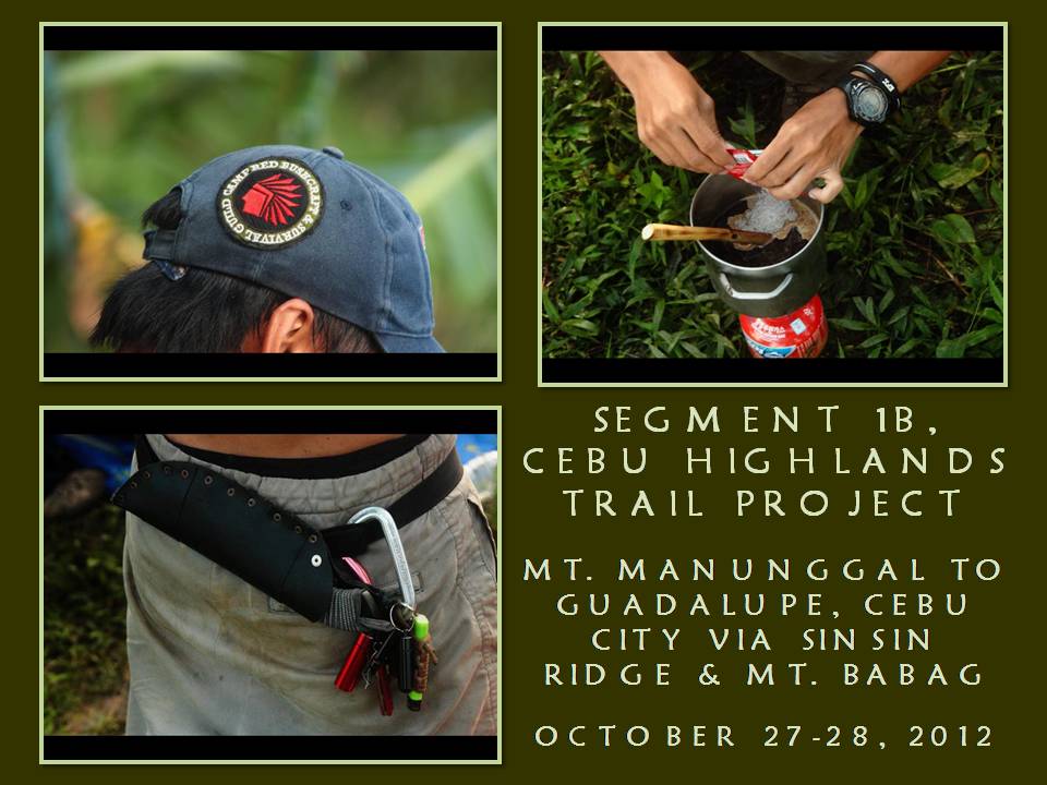
I
AM WITH SIX OTHER people going to Mount Manunggal, Balamban this day,
October 27, 2012. There is a mountaineering event there but I don’t
want to be part of that. My friends are not mountaineers and we are
just passing through. We are with the Camp Red Bushcraft and
Survival Guild.
I
have a goal to seek and I am going to walk from Mt. Manunggal to
Mount Babag in Cebu City with my party then go down to Napo and
Guadalupe the following day. A distance of 28 to 30 kilometers of
two days walk. It had never been done before but it is possible and
quite achievable. This is the other half of Segment One of the Cebu
Highlands Trail Project which the latter I aim to complete in 2015.

The
Cebu Highlands Trail is a very ambitious project that I am
undertaking on my own under my Warrior Pilgrimage blog. I will look
for and establish routes in segments from north to south of Cebu
Island and link these as one whole route that would be patterned
after the Appalachian Trail and the Pacific Rim Trail of the United
States. Once done, Cebu would attract multi-day backpackers,
thruhikers and segment walkers from all over the world.
The
Mt. Manunggal to Guadalupe cross-country hike would complete Segment
One which start (and was done four times) from Lutopan, Toledo City
to Guadalupe. Segment Two had already been accomplished last March
2012 that brought me and my team from Lutopan to Campangga, Barili.
Segment 1 would link with Segment 2 and would accumulate between 100
to 110 kilometers distance in six to seven days walk.
The
Cebu Highlands Trail Project is in need of donations from
kind-hearted donors and sponsors to outfit the expedition teams that
I am organizing. The present expedition team for this traverse hike
are Raymund Panganiban – photographer; Ernie Salomon – cook; Eli
Bryn Tambiga – medic; and members James Cabajar, Nyor Pino and John
Sevilla. Another member – Dominikus Sepe – will act as base
support and would update the rest of Camp Red at Facebook through
live SMS feeds.

We
all meet at JY Square in Lahug in the early morning of October 27 and
proceed to Mt. Manunggal at 6:45 AM through the Transcentral Highway
on board a hired public jitney after procuring our ingredients for
lunch. Going to Mt. Manunggal entail a huge budget for
transportation back and forth. The motorcycle drivers bleed you dry
when they think they could gain more from what you usually pay them.
I will solve half of that predicament by walking back to Cebu City
instead.
I
am the organizer, expedition leader, guide, safety officer and
navigator of this man-sized hike and I will make this as simple as
possible. We arrive at Mt. Manunggal at 8:00 AM and leave the
mountain thirty minutes later after giving last-minute briefing and
instructions to my team. I found a mass of people on the mountain
where an LNT signage is found. Quite interesting.
I
lead and we go down the trail that goes to a saddle where the
Transcentral Highway pass. That place is called Inalad. The weather
is hot and humid and so perfect. That usually happens after a
passing of a tropical typhoon. The ground is wet caused by
high-altitude moisture but it does not bother our pace. We cross
brooklets and open spaces; cleaves and ridges; and the Bangbang
River.

John
and Raymund suffered leg cramps. I administer emergency relief
techniques to loosen the muscles. At this instance, I slow down my
walk to allow John and Raymund to recover. Eli and James share a
cacao fruit to all while I steal a ripe guava along a route. The
rest of the team keep an eye on John and Raymund as I concentrate in
understanding the details of the trail and the terrain.
I
passed by this trail only once in March 2009 and this is a beautiful
path; long and winding. I see a sign left by a monkey and yonder,
beyond my sight, is a sound of a boar burrowing rootcrops. Wildlife
still abound in the Central Cebu Mountain Range. There are a lot of
them monkeys hidden from sight and you may catch one if you are
persistent. Cebu’s last wild boar was reported caught in 2000 but
I don’t believe that it was the last one. Overhead me, a hawk
glide by and disappear as it cross my path into a hill.
We
reach Inalad at 12:30 noon and we immediately unpack our food
ingredients from our backpacks. I cook a kilo of milled corn on
conventional camp stove while Ernie make himself busy slicing the
pork meat and cooking it adobao-style. Side dish is raw cucumber
mixed with tomatoes, all sliced and dipped in spiced vinegar. Nyor
added dried fish fried in oil. We take our lunch at 2:00 PM.

It
is 2:45 PM by the time we leave Inalad and I cross over the
Transcentral Highway into the other side. Now, we’re on the
territory of Toledo City. I follow a trail that vanish as soon as I
begin to climb a knoll. A hundred meters below me is a stream and
some 300 meters away is a dirt road that had just been opened and
graded. Need to follow it so I go down to the stream and climb over
a farm to reach it.
The
road lead to Tongkay, a mountain hamlet nestled in a valley within
mountain ranges all around. I did not explore further the place and,
I think, the road ends in a cul-de-sac after reaching it at 4:00 PM.
We cross a river and climb up a steep trail to an unnamed high
mountain. I name it Mount Tongkay and it could be above 750 meters
above sea level.
It
is almost dusk and I am still nowhere of my objective which is the
halfway point on Sinsin Ridge. We lost a lot of time to rests and it
is pointless to go on at dusk in unfamiliar territory. We set up
camp instead on a good piece of flat ground that is very vegetated.
It is a very good campsite, not exposed to the elements yet it could
catch warm air as it rise up from the valley floor.
Four
tents were set up while three use tarpaulin shelters. Of this three,
Raymund and Nyor hitch their hammocks underneath while I chose to
sleep on the ground. Mine is an Apexus tarp given to me by Pastor
Reynold Boringot during the MCAP Bushcraft Camp at Mt. Balagbag in
Rodriguez, Rizal early this month. It is the first time that I am
using this and I will give a product review of this camping gear
later.
We
ration our water to focus only on cooking and drinking. We have
brought some Indian rhododendron leaves from Mt. Manunggal and we
used this to wipe clean the insides of our cooking pots and spoons
from grease. We cook a half-kilo of milled corn, a soup of mixed
vegetables and pork adobao. The hot food is reassuring and it gives
back our depleted strength and provide us body warmth.

I
sleep early as I was tired of doing a lot of reconnoitering during
the daylight hours. The moon is full and it is bright. At around
2:00 AM, it started to rain and I wake up and listen to the night
sounds. I hear a roosting wild cock being disturbed by something.
Later, I hear a creature making a slight sound as it pass by near my
shelter. By now, the warm air had been displaced by rain and I find
myself trying hard to sleep back. I wait for light.
I
did sleep and got startled to find the sky showing traces of light.
I decide to explore the bushes around the camp. The early hours of
morning are the best time to commune with nature. I remember grandpa
teaching me the ways of the forest when I was small and it is
wonderful to be still and listen to the birds and unseen creatures
thanking the Creator.
We
break camp at 8:00 AM after a dry breakfast. The trail of yesterday
which went missing is still missing today. But this is what I love
best, reading terrain by traditional means. The early morning sun is
a blessing and I follow where the path ended and guessed the route
where it would likely pass or go. I was not disappointed and caught
it again on a wide ridge where there is a treeline.

I
decide we stay for a quick moment so the rest could recover their
breathing while I could test the folding saw of my Victorinox Swiss
Army Knife. This black tactical-looking SAK was given to me by Jay Z
Jorge during the same MCAP Bushcraft Camp in Luzon. I have owned
SAKs before but it never stayed more than a week in my hands. But
this one is different. I begin to love it. I cut a half-dry guava
branch so easily and I now have a slingshot fork!
Time
to climb up the ridge where the peak is found and reach it at 8:45
AM. I found a sinkhole at the top of Mt. Tongkay and it looks like a
small volcano minus the sulfur fumes. The mountain is linked to
Sinsin Ridge by another ridge which passes by Mt. Marag. Marag is
much higher and I decide to evade the peak by following a downward
trail which led to a small community which the locals called Itwe.
The
boys are happy to replenish their dwindling supply of drinking water
provided by a cool spring below. After a brief rest, we follow a
moderately rolling path amidst farms and reach the Sinsin-Cantipla
Road at 9:45 AM, which is actually our halfway point. Yesterday’s
cramps that hounded the expedition crew and late starts cost us
precious time and denied us to camp on this place last night.

Anyway,
the guys love to see a road and some small stores selling cold soda
drinks. Going north would be Cantipla and the Transcentral Highway
and south would be Sudlon II, Sudlon I, Sinsin and Manipis Road. I
choose the south way to Sudlon II and I believe there is a road there
that goes to Bonbon. I have not been to Sudlon II but I have been to
Bonbon some years back and I hope to fill the blank spaces in
between.
At
11:00 AM, I see a barrio eatery. At the back of it are two locals
butchering a pig. I insist that we stay at the place and take
advantage of that by ordering a kilo of pork. We will cook our meal
there on an open fire. We could also procure milled corn and cook it
on the same fire pit. I reward myself by taking off my shoes and
socks and dry it. After an hour we partake of lunch.
We
resume our journey at 12:35 noon. I have found the road to Bonbon
and I follow it winding down among hills into a wide valley. It is
very hot and concrete pavement is unkind to the feet. I now begin to
feel the tell-tale sign of a muscle cramp on my upper thigh. Keeping
a tight ration of water on myself, I decide to take good swallows of
it and some quick rests too, to overcome the nagging pain.

I
reach Bonbon at 3:30 PM and waited for the others at the bridge. We
will cross this bridge all at the same time. I avail myself of cold
soda drink when the others arrive and drown out their thirst with it.
We cross Bonbon River and follow the road upward to the Transcentral
Highway. We reach the road at 5:15 PM but leave it at once for Babag
Ridge.
Dusk
have overtaken me as I climb on the darkened road for the ridge that
have blocked my view of Metro Cebu and the sea. I reach Babag Ridge
at 6:30 PM and I go to a store that had been my watering hole in past
hikes and, immediately, we prepare our last meal with whatever we
have carried. I opt to drink a bottle of cold beer while the rest
sipped noodles bought from this store.
The
moon wax its full shine and I believe I don’t need my flashlight to
walk the trail down to Napo. I will use my night vision instead as I
leave the ridge at 8:00 PM. Others follow with their headlights but
I leave them a distance away so my eyesight, now accustomed to the
dark, will not be irritated by all those shifting shadows caused by
the lights of their moving heads.

I
pass by the Roble homestead at 9:30 PM and I decide we take another
brief rest here. Manwel, my young friend, is having a fever and so
is his sister, Juliet. Eli and Raymund provide analgesic tablets to
keep them in good health. After that, we continue on through the
rest of the night and finally reach Napo at 11:11 PM.
This
route had never been taken by a group of present-day recreation
hikers. This may have been a regular path in the past of several
groups of people when the Transcentral Highway have not yet been
constructed like upland dwellers who take their farm produce to
Carbon Market; by local Katipuneros during the last years of the
Spanish regime and the early years of American colonization; by
guerillas of the Cebu Area Command during World War II; and, perhaps,
by members of a local liberation front.
Segment
One is thus completed but the real route will be determined and
finalized by this writer upon after a Trail Assessment Report. When
we all reach Guadalupe, I personally congratulated each and every one
for their achievement. They have all been very patient with my
unrelenting pace and very persistent to reach and finish our
objective. All told of the great deprivation and pain they have
during the trek yet they were made of stern stuff that only a badass
could accomplish.
Document
done in LibreOffice 3.3 Writer
Some photos courtesy of Raymund Panganiban


1 comment:
Nice hike sir. Too bad we did not reach the summit of Mt Manunggal.
Post a Comment